


Socially vulnerable groups are significantly over-represented in high wildfire-risk areas across the United States and should be prioritized for targeted mitigation measures, research has found.
A study in the International Journal of Wildland Fire identified census tracts across the US where high wildfire risk and high social vulnerability intersect – and found that American Indian/Alaska Native communities, Hispanic/Latino residents, and mobile home residents are disproportionately concentrated in these areas.
Most of these tracts are located in less populated areas of western and southern states, and concentrated mainly in California, Texas, and Florida.

With nearly 21 million people living in these high-risk, high-vulnerability zones, this research has implications for wildfire mitigation and disaster preparedness, particularly for communities that have historically been underserved.
This is not the first study to make the connection – lead author Professor Jayajit Chakraborty from the University of California, Santa Barbara, explains that we have known for a while that vulnerable communities bear a disproportionate burden from wildfires.
“What we are doing differently is asking where exactly does this happen and using rigorous spatial statistics to answer that,” said Prof Chakraborty.
The study overlaid a number of databases and analytical tools to get the result – mainly, the bivariate Local Indicators of Spatial Associations (LISA), and the Social Vulnerability Index (SVI) that was developed by the Center for Disease Control and Prevention (CDC) to map areas of vulnerability for public health and emergency planners.
The use of LISA at a national scale provided spatial precision. “Previous studies have documented the relationship but had not really pinned down the specific neighborhoods where high wildfire risk and high social vulnerability coincide spatially. That’s the gap we were trying to fill”
So, what does a more precise approach for these communities actually look like? It really depends on the community, Prof Chakraborty says.
“For Indigenous communities, for example, it’s not just about dropping fire mitigation resources in – it’s about meaningful consultation, respecting tribal governance, and supporting things like culturally grounded prescribed burn programs that many tribes have practiced for generations.
“For Hispanic communities, a lot of it comes down to language access and trust issues. Evacuation notices that only exist in English, or disaster relief programs that exclude undocumented residents – these are fixable barriers.
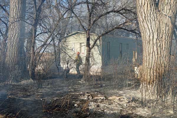
“For mobile home residents, the needs are more physical – these homes are genuinely more fire-vulnerable, and their residents often don’t have the financial resources to make improvements on their own, so you are looking at approaches like subsidized retrofitting or community-level preparedness programs.
“The broader point here is that the High–High tracts identified in this study essentially provide a spatial targeting layer — agencies and decisionmakers can overlay this map with existing program boundaries identify gaps and prioritize investments in overburdened communities.
But how do we explain the LA fires of 2025 that burnt into some of the most expensive real estate in the country?
“The rich can be exposed to wildfire, but they are not socially vulnerable to it in the same way. The findings from our IJWF article show it is American Indian, Hispanic, and mobile home communities – disproportionately in rural western and southern areas – who face the combined burden of high risk and low adaptive capacity,” said Prof Chakraborty.
“The LA fires were a high-visibility event in an economically affluent area; the communities our research identifies face similar or greater physical risk with far fewer resources to prepare, respond, or recover.”
Read the full research paper by Professor Jayajit Chakraborty and Masters Student Sara Soroka in the International Journal of Wildland Fire.




No comment yet, add your voice below!