


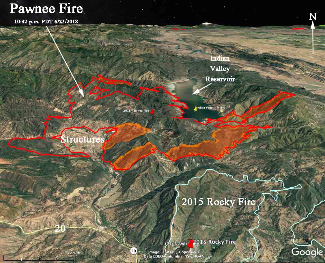
Above: 3-D Map of the Pawnee Fire looking north at 10:43 p.m. PDT June 25, 2018. The shaded areas indicate where the fire was very active.
(Originally published at 8:52 a.m. PDT June 26, 2018
(UPDATED at 1:27 p.m. PDT June 26, 2018)
The Pawnee Fire in Lake County, California continued to spread actively south and east Monday. It has not spotted across Indian Valley Reservoir, but burned around the south end of it in a long finger that ran uphill for 2.5 miles and kept going when it crossed Bartlett Springs Road at the top of a ridge. Additional spread to the east beyond that point should be slower on the downhill slope to the valley below.
The Governor’s office has declared a state of emergency for Lake County. According to CAL FIRE the Pawnee Fire has destroyed 22 structures and 600 others remained threatened. Mandatory evacuation orders are in effect for the entire Spring Valley community which is now virtually surrounded by blackened hills. The Lake County Sheriff’s Office has more information about evacuations.
Monday afternoon CAL FIRE reported that the fire had burned 10,500 acres, and Tuesday morning updated it to 11,500 — which is a very conservative number.
The weather forecast for the rest of this week for the fire area does not predict any extreme fire weather, with highs around 90, wind less than 10 mph, and relative humidity in the teens or low 20s. However, these conditions will not cause the fire to lie down. Firefighters will still have their hands full.
During the previous three years residents of Lake County have been seriously threatened by three other fires, the Rocky and Valley Fires of 2015 and the Clayton Fire of 2016. It is possible that the Pawnee Fire could burn into the footprint of the Rocky Fire, slowing its spread to the southeast.
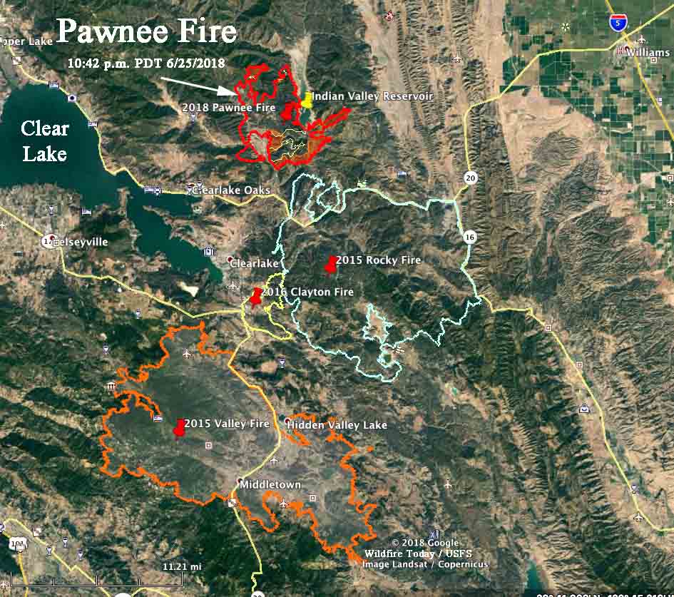
Resources assigned to the fire include:
- 110 Engines
- 35 Hand crews
- 15 Helicopters
- 58 Dozers
- 10 Water tenders
- 1,422 personnel, total
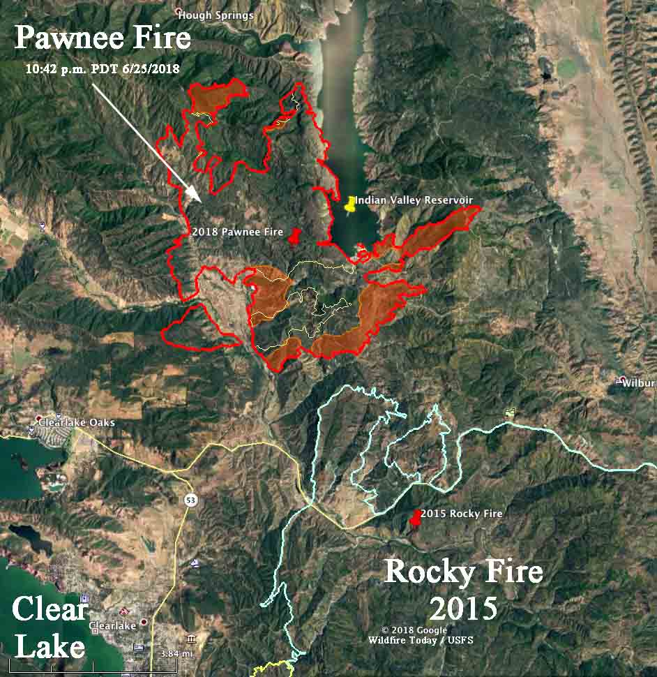
.@CalFire stating that the #PawneeFire has grown to over 11,500 acres and is 5% contained. WorldView-3 Color, Infrared, and SWIR images taken June 25, 2018. #lakecounty #wildfire https://t.co/aWYyH247HS pic.twitter.com/D1wE8eUGRq
— DigitalGlobe (@DigitalGlobe) June 26, 2018


