Above: Mt. Laguna Observatory in Eastern San Diego County at 8 a.m. PST November 21, 2019. HPWREN.
On Tuesday the remnants of tropical storm Raymond hit Southern California and the next day merged with a cold storm that formed in the Gulf of Alaska. The result was two waves of rain, lightning, wind, and in the higher elevations, snow.
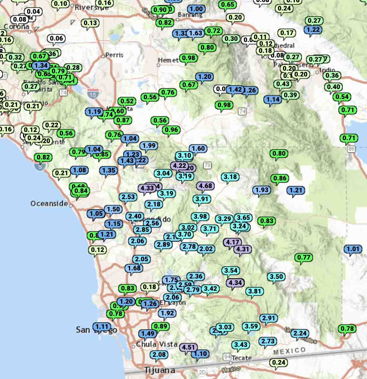
Nine weather stations in San Diego County recorded more than 4 inches of precipitation. The highest total was at Lake Henshaw with 4.68 inches. Some of the moisture became snow at Mount Laguna 6,100 feet above sea level.

Many other locations in San Diego County received more than an inch, but farther north Riverside, San Bernardino, and Los Angeles Counties had less.
This of course will pause the fire season in these areas and may be the season-ending weather event in the locations that were dumped on with multiple inches of precipitation.
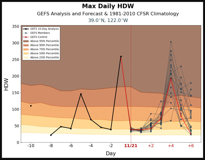
Meanwhile in Northern California it was dry and very windy Tuesday and Wednesday. On Monday in the Sacramento area the Hot Dry Windy Index is predicted to be above the 95th percentile again but there is a chance of rain in the area the next day, November 26.