“You sing the country before you burn it,” an Aboriginal fire-lighter in Australia told the author. “In your mind, you see the fire, you know where it is going, and you know where it will stop. Only then do you light the fire.”
Ignition: Lighting Fires in a Burning World, by MR O’Connor
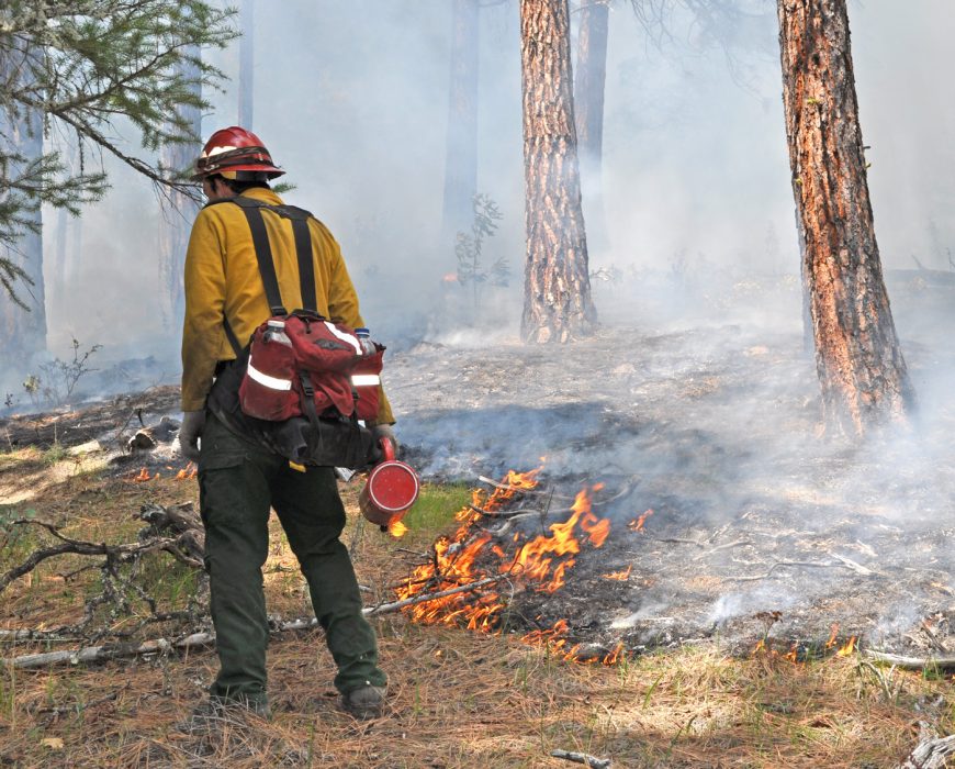
Close your eyes the next time you are preparing to start a prescribed fire project and visualize its beginning and end. Where will you paint the ground with brushstrokes of fire? What is the wind saying? What tricks does Mother Fire have up her sleeve?
And, importantly, how will the day end? In calm twilight laced with thin smoke and the soft sound of dying, crackling fires? Or in a cacophony of bulldozers and bombers and the sight of your prescribed fire project racing over a far ridge?
“Ignition: Lighting Fires in a Burning World” chronicles author M.R. O’Connor’s deep dive into the world of prescribed fire, mostly in the United States but occasionally elsewhere. She embeds herself with state, federal and private crews as they conduct prescribed burns — taking the training, wearing the clothes, learning the terms and the lingo — and finds it deeply fascinating and occasionally quite frightening.
There is a rush these days to return fire to the land, a belated response to a few decades of staggeringly large wildfires that could have — should have — been tempered by prescribed fire. She talked with many firefighters and fire-lighters and “began to deduce how complex working with fire could be.”
Using fire as a tool is an art people are still grappling with. “Fire-lighters seemed to carry with them a dream of a place where fire was stripped of safety regulations, government qualifications, diesel fuel, and engines. In this pyro-Eden, fire was so benign that lighting one was like watering a garden.”
It’s dizzying to think that something as simple as returning fire to the land could, and likely would, avert highly aggressive wildfire behavior. Could pre-treatment have kept 2018’s Carr Fire from spawning a fire “burning so hot and generating such intense winds that a whirl of fire with winds of 143 miles per hour … slammed into Redding. It picked up a truck and threw it a quarter of a mile down the road, killing the firefighter inside. It was the equivalent of a category 3 tornado.”
Indeed, the fire environment had become so dangerous that firefighters had begun experiencing post-trauma health problems at an unprecedented level. One firefighter O’Connor discussed this with “made me consider that confronting a monster — what you saw out there, the feelings you experienced and things and people you lost — could exact a mental and spiritual cost.”
“I thought about the dragon-fighting analogy a lot,” wrote O’Connor, digesting what she had been told by firefighters coping with wildfire-induced PTSD. “It conveyed something of the monstrous qualities of the wildfires themselves and hinted at the quixotic nature of fighting them.”
After years of fighting wildfires, some “began to see suppression as a lost cause.” One said, “If a fire was close to any type of community, it never crossed my mind that we shouldn’t go put the thing out. [But] I was on a lot of fires way out in the wilderness where I thought, Well, if somebody gets hurt or killed out here, this is really dumb. This is kind of for nothing, this is a lightning fire. This area needs to burn.”
With so much land needing a fire, and wildfires increasingly getting larger and more dangerous, agencies have embraced programs like TREX, in which fire-lighting skills are taught and tested. However, actual prescribed fires have moved forward slowly due to the fear of losing control of the burn, destroying private land and homes, even though this has rarely occurred.
“Of the roughly forty-five hundred fires [the Forest Service] ignited each year,” writes O’Connor, “fewer than 1 percent of them escaped control. The ones that did, however, were often emblazoned in collective memory and cited for decades. People didn’t forget, let along forgive, when the government intentionally lit fires that ended up burning down homes.”
A 2012 prescribed burn in Ashland, Oregon: Brian Ballou.
Nearing the conclusion of her book, O’Connor highlights the Washburn Fire that burned in 2022 within Yosemite National Park. The news media homed in on whether the fire would consume the Mariposa Grove of giant sequoias. “The Washburn Fire and so many others became apocalypse clickbait.” The news media nearly completely ignored the fact that areas that had been treated with prescribed fire burned with much lower intensity, if at all.
“Ignition: Lighting Fires in a Burning World” is a fine read, and I find it particularly impressive that it was written by someone who knew next to nothing about prescribed fire. Perhaps that was best.
She asked wildland firefighters whether the current fire environment was too dangerous — an interesting question for people who sorta kinda really really like having a bit of danger in their day — and learned that maybe, yes, it was getting a bit too hairy out there.
O’Connor never provides a succinct message at the end of the book. I rather like that. But the alignment of the various segments of the book make it clear: The time for prescribed fire is today, yesterday and tomorrow. No, it won’t always be pretty.
Brian Ballou retired from the Oregon Dept. of Forestry where he was a fire prevention specialist and public information officer. In the 1970s and ‘80s he was a firefighter with the US Forest Service. He lives in Medford, Oregon.
Ignition: Lighting Fires in a Burning World
By M.R. O’Connor
Bold Type Books
Copyright 2023
Nonfiction
Hardbound, 372 pages, $30 (also available from Amazon and Apple in ebook format)
Wind turbulence is a well-known factor in the complex wildland fire environment. Sometimes it is the wind shear over vegetation, buildings, or terrain, and other times it’s the buoyant forces from solar surface heating or thermal plume injections from the fire itself.
Smokejumpers approaching landing zone in 2011. Photo: Mike McMillan
For a smokejumper, parachuting from a low-flying aircraft in a remote and rugged landscape, turbulence near the ground at the atmospheric boundary layer (ABL) is of particular concern.
Scientists at the Rocky Mountain Research Station have published a study on how to better predict terrain-induced turbulence to assist smokejumper operations.
Smokejumpers are employed by the United States Department of Agriculture Forest Service and the Department of Interior Bureau of Land Management throughout the western US and Alaska. These smokejumpers use Ram-Air style parachutes, which require forward speed to maintain lift (USFS 2018). Small wind fluctuations can drastically impact parachute aerodynamics. Existing protocols to assess ABL turbulence during jump operations include the release of weighted streamers to visually assess the winds and turbulence. Numerous hard landings, serious accidents, and fatalities have been attributed to unexpected near-surface turbulence during training and operational jumps. Searching “Smokejumper Accident” on the Wildland Fire Lessons Learned Center’s website shows an average of four serious jump injuries per year between 2015–2023 in which turbulence potentially played a factor.
Wind flow over ridges can create large wake zones with increased turbulence that extend far downwind. This phenomenon likely contributed to the hard landing that resulted in a smokejumper fatality during a jump on the Eicks Fire in New Mexico in 2021 The research team used WindNinja, the high-resolution diagnostic wind model for wildland fire applications, to investigate surface winds and turbulence during the jump operation on the Eicks Fire. The findings indicate that the jump took place in the wake of a tall upwind ridge that created a large re-circulation zone with areas of turbulence.
WindNinja is routinely used by fire managers in the US and around the world and can drive operational fire spread models such as FlamMap and Prometheus. These uses take wind speed and direction predictions from WindNinja, however, the research notes that WindNinja can also generate information about the near-surface atmosphere, such as turbulence and shear. The researchers say these capabilities, to date, have not been made accessible to end users or formally assessed for accuracy by the development team. WindNinja has been evaluated in the field but not in the really rugged terrain where smokejumper operations often occur. Here, wind modeling is far more complex and challenging.
This study concluded that WindNinja’s lesser-known ability to simulate wind turbulence could be of use for assessing smokejumper operations under moderate to high wind conditions.
They also suggest that although this work focused on smoke jumping, real-time turbulence predictions from WindNinja could be useful for other near-surface firefighting aerial operations.
BOISE, Idaho — As Sean Peterson took his seat Friday morning in the nation’s nerve center for fighting wildfires, 104 large fires raged uncontained across the United States.
The federal government’s firefighting resources were already fully committed, but requests from regional coordination centers kept pouring in.
The day before, his office had turned away requests for 37 aircraft, 40 engines, and hundreds of specialists from dispatchers to heavy equipment bosses. Six hundred more requests had landed that morning. The Park Fire in northern California was exploding at a pace that horrified and amazed even the hardened veterans here. A firefighter injured by a tree had been evacuated to an Idaho hospital. And an aircraft had gone missing overnight amid the smoke billowing from Oregon’s Malheur National Forest.
Peterson, with his can of Liquid Death on the conference table, scanned the room before the morning briefing.
“Ready to rock and roll?” he asked.
When all the West is on fire at once, this is who deals with it.
Peterson manages the 32 employees at the National Interagency Coordination Center (NICC), a key part of the National Interagency Fire Center (NIFC) on the fenced-in federal government campus abutting the Boise Airport. The staff, including personnel with the U.S. Forest Service, Bureau of Land Management, Bureau of Indian Affairs, and other agencies, must constantly weigh the threats of multiple rapidly changing fires and deploy their limited resources where they can do the most good.
After weeks of extreme heat and waves of lightning storms, there is so much fire burning now that the U.S. has reached Preparedness Level 5 (PL5), something that has happened this early in the summer only four times in the past 20 years, according to staff here.
At times like this, there’s never enough help.
“No fires are going to get everything that they want,” Peterson said.
The vibe here is not Situation Room suits and ties. It’s looser and more outdoorsy: short sleeves and jeans, sandals and tattoos. But it’s serious work.
On the video conference, Jeff Walther, a representativefrom the Pacific Northwest region, informed the group that a single-engine airtanker had gone down the night before while fighting a new blaze near the Falls Fire on the Malheur National Forest.
“Ground crews are out there this morning trying to locate,” Walther said. “Pretty difficult terrain. Smoke’s still hampering the area.”
“Thanks Jeff, and definitely, our thoughts from here, along with everyone in the dispatch coordination community, hoping for the best,” Derrek Hartman, the center’s deputy manager, told him. “I feel terrible for the situation going on.”
The Forest Service and the Grant County Sheriff’s office later confirmed that the pilot had died.
The staff at the coordination center are familiar with these risks.Nearly all of them worked as firefighters. And many have worked together for years or decades, building a camaraderie and rapport that helps them navigate the logistical maelstrom on any given day.
Peterson, a third-generation firefighter with a scar on his right cheek from one of his close calls, grew up in California and took his first firefighting job two weeks out of high school. He was raised partially in Paradise, the mountain town that was demolished by the 2018 Camp Fire, one of the deadliest fires in U.S. history. Both of his childhood homes there went up in flames.
Over his three-decade career, he has watched as fires have grown in scope and intensity. He’s lived to see a winter fire that burned more than 1,000 homes. Forests hit by repeated fires that have transformed into quick-burning grasslands. When he started, he said, a 50,000-acre fire was a very rare occurrence.
“Now that’s the norm,” he said. “Right now we have six fires burning over 100,000 acres. And we haven’t even got to August yet.”
Peterson acknowledges that warming temperatures from climate change are part of the story but he also believes the decline of the logging industry — including clearcuts that helped thin the forest and gave firefighters anchor points from which to work — is to blame for the country’s worsening fire problem.
This summer’s quick explosion has followed two relatively light fire years, as abundant winter rain and snow has nourished the West. To fire experts, wet winters mean more grass, which eventually dries out and turns to kindling when the heat cranks up.
“We can turn good news into bad news like nobody’s business here,” said Steve Larrabee, a Bureau of Indian Affairs official who is thecenter’s fire and fuels analyst.
This year got off to an ominous start when wildfires in Texas and Oklahoma burned more than a million acres. “We just don’t get million-acre fires in February,” Larrabee said. In the past several weeks, there have been many major fires in the Pacific Northwest and California. Now, the Great Basin and Northern Rockies are lighting up, too. About 3.8 million acres have burned in the U.S. so far this year, above the average over the past 10 years of 3.4 million acres.
Larrabee tracks metrics of the dryness of dead trees and vegetation. He is concerned that the numbers seem okay but aren’t really corresponding with the “spectacular fire behavior” now showing up in parts of the West.
“These things that are usually fire barriers, like green vegetation, they’re not working like fire barriers like they normally do,” he said.
The biggest crisis right now is northern California’s Park Fire, near Chico, which has burned more than 300,000 acres in less than three days. Officials suspect an arsonist started the inferno that now threatens thousands of homes. Evacuation orders are in place for several communities, including what’s rebuilt of Peterson’s hometown of Paradise.
“It will be one of the largest — if not the largest — and one of the most devastating fires on record in the country when it is all said and done in the fall,” Peterson said on Saturday.
Amid all of this, the coordination center must steer desperately needed firefighting resources around a constantly shifting map.
On Friday, fire managers from the Great Basin, with 26 new fires ignited the day before, said they needed all types of crews and aviation support. Meanwhile, the Northern Rockies, battling 77 new fires, wanted smokejumpers and rappellers.
Shortages at such a time become more glaring. All 27 contracted caterers who feed fire camps have already been committed, so beyond that, teams will have to buy meals from whatever local providers they can find.
The day before had reached a high-water mark for demand this year for infrared flights to map fire perimeters and work new fires, with 81 requests. And the federal government’s 91 single-engine airtankers were also all spoken for, staff here reported.
There are 26,020 firefighters deployed just on large fires, the most this year. More help is needed.
Peterson met on Thursday with officials from Australia and New Zealand, longtime firefighting partners of the United States. Those countries agreed to send 80 people, including personnel in sorely needed middle management positions such as division supervisors and task force leaders. The most critical shortage, Peterson said, was in local fire dispatch centers, where there are more than 100 vacancies. People in these grueling jobs field 911 calls and coordinate the response to new and growing fires.
“Nobody wants to do it anymore because they’re just burned out,” he said. “It never stops.”
And there’s no respite ahead. Red flag warnings were peppered across the West with wind gusts expected up to 45 mph. Smoke from Canada’s fires, also raging, had finally reached Europe, one staffer noted, just as the Olympics were starting. Outside the nation’s firefighting command center, yellow smoke hung low over Boise.
At the end of the morning briefing, Peterson reminded his staff to take care of themselves.
The peatland ecosystems of Central Kalimantan are transitioning from wildfire resistant to wildfire prone; with the potential huge release of carbon from burning peat stocks, it’s time for local and global actions to better protect these lands and communities.
As someone who has visited and observed wildfires in Indonesia for more than 20 years, I’ve witnessed the increasing loss of forest ecosystems and I recognize the potential for constructive international assistance.
Sebangau National Park firefighters moving fire equipment on the fire ground. Photos courtesy of Sebangau National Park
In the Indonesian language, Kalimantan refers to the whole island of Borneo (the third largest in the world), while in English it describes just the 73 percent of the land mass located in Indonesia, containing about 70 percent of the island’s population.
Kalimantan covers 554,150 kilometers divided into five provinces and the non-Indonesian territories of Borneo, Brunei, and East Malaysia.
The meaning of the name Kalimantan — originally Kalamanthana — is burning weather island, referring to the very hot and humid climate.
Kalimantan is home to many cultures; the Dayak, or people of the interior, are Indigenous and have long used landscape fire in their agricultural practices to clean up land for slash-and-burn farming.
The smoke produced by burning peat is particularly hazardous. Besides its climate-warming carbon content, peat smoke contains toxins and other particulate matter, and in Indonesia, it is now being measured during times of wildfires as air pollution.
A volunteer firefighter with firefighting patrol boats on a fire in the Sebangau National Park, Central Kalimantan, Indonesia. District level volunteer firefighting brigades in Central Kalimantan are locally known as Masyarakat Peduli Api, or MPA firefighters.
This system of using fire to clear farming plots in the rotating system of land use allows for conservation; preselected areas or fields are used for a predetermined number of years before they’re allowed to go back to nature to recover fertility, while another field is cleared by cutting and burning to be ready for planting until its fertile cycle is complete. Then another field is cleared, and the small scale of slash-and-burn continues as the land recovers after farming.
This system of rotating agriculture and wildfires to clear land has been culturally important. The Dayak use of fire for cleaning and clearing was extremely controlled historically, with organized groups using pre-constructed fire breaks and advance planning to consider predicted winds and fuel conditions.
The Dayak have been masters of using fire as their tool to clear their forest lands. However, cultural, modernizing, and competitive economic forces have brought changes which, during a severe dry season, can quickly transform some areas of the Indonesian part of this island into a thick smoke-filled hazard, lasting months and impacting the surrounding islands and even the cities of Indonesia, Singapore, and Malaysia.
Recent changes in vegetation and culture have swung the Dayaks’ historic mastery of fire in Kalimantan out of balance. The Dayak people are no longer the only Indonesians who live in the interior of Kalimantan, where the rainforests long acted as a moist blanket to keep out fires or retard fire growth. Also, within Dayak culture, changes are taking place as the people join the wave of progress brought by globalism sweeping the world which, as a byproduct, disconnects us from the natural world and our hands-on, sustainable practices. The landscape is being modified and fire use has fallen outside of its traditional Dayak checks and balances.
While most of the fires in Kalimantan are human-caused, the fire origins are complex. Many past fires arose from the fact that land ownership claims in Kalimantan historically have been legally proven with the use of applying fire to land for clearing, thus establishing legal usage. Other blazes are ignited by accident — or by fishermen to attract more fish or drive away mosquitos — or fires are lit by hunters to attract wildlife, and myriad other reasons.
Sebangau National Park firefighter moving hose across fire ground. Photos courtesy of Sebangau National Park
But in recent years, during extra hot and dry seasons, when fires do get started in what may now be often lighter fuels, they can spread quicker and carry flames into forest areas, or even into the swamp peat forests. And once the peat layer below ground is lit, it will burn underground down to the water table and then move laterally beneath the surface, consuming important thick layers of organic decaying peat matter.
These burns can become huge subsurface peat fires with their flames not visible until they occasionally climb up to the surface to consume vegetation. But the heavy smoke from these peat fires, referred to locally as smog/haze, will have local, regional, and global impacts. The Dayak historically did not apply fire to the forest where there were peat layers beneath it, as they were burning for their agricultural fields and they knew their crops would not grow in the peat region.
Peat swamp fires on Borneo are unique for wildfires because the peat itself, created from countless generations of falling and then decaying organic forest matter, has been built up into massive locked-up carbon stores — and these peat stores burn underground as a slow smolder, releasing heat and smoke to the surface. The thick carbon stockpiles begin to release their carbon when the peat swamplands they are part of are dried by drainage canals created to open lands for timber harvest, home building, and other uses. If this dried peat is then consumed by fires, the huge pool of stored carbon that had been safely locked away will be released into the atmosphere, causing global concerns for air pollution and climate change.
The smoke produced by burning peat is particularly hazardous. Besides its climate-warming carbon content, peat smoke contains toxins and other particulate matter, and in Indonesia, it is now being measured as air pollution during times of wildfires.
Kalimantan fires became an international concern in 1997 when a massive man-made ecological disaster burned in the peat forests, and since then, because of that disaster’s compounding effects, additional new dryseason peat fires have created an accelerating cycle of fires, peat loss, and flooding.
Peat’s organic matter, lying below the surface in a swamp forest, has long functioned as a natural sponge; the small percent of its decaying matter is able to soak up as much as nine times its volume in water. This layer of peat acts as an absorber to dampen the effects of seasonal flooding river systems. However, now with large areas of peat lost to wildfire seasons in 1997, 2015 and 2019, the summer dry seasons are followed by rainy seasons and large flows of water are draining from the burned peat lands into Borneo’s river systems and to the sea, leading to much human property loss and misery along the way.
Protecting the remaining peat beneath the swamp forests has become a priority in Central Kalimantan for those understanding the issue, and over the last 20 years, people have been adapting to the situation. Groups of people in Central Kalimantan have been organizing into both volunteer fire militia and paid fire forces, ready during dry seasons to fight fire. With the help of Japanese, Indonesian, and English scientists, new tactics and techniques are explored, and in 2015, there arose an international effort to assist in fighting wildfires. Indonesian law enforcement has also been activated to target illegal burners with stiff penalties of up to 15 years in prison and 15 million Indonesian Rupiah (about $930 USD) in fines.
Internationally, an agreement among Southeast Asian nations has been developed to assist during times of high fire activity, though there are still very real needs for which international assistance would be greatly appreciated and valued globally — by reducing the peat fires and their massive carbon releases.
Indonesia is still adapting to the emerging wildfire issues in Kalimantan, and as such, has so far developed only limited capabilities, with a particular need for shared technology in fire detection and wildfire response equipment. Many other fire-prone areas of the world have developed and routinely share these types of technologies, and Indonesia should be added to this group. Indonesia has unique firefighting technology advances to share, such as locally developed fire response systems and cloud seeding.
Aircraft dropping water on vegetation has been found to have limited effectiveness on peat fires, and therefore the fires are fought from beneath the ground. The priority is to find a water source on a peat bed nearby; this water source must be safely away from the fire to prevent its burning, and it’s usually found by drilling down as if through the ice on a frozen lake.
Using an augur to bore beneath the peat to find the water table, crews will tap into the water with a firefighting water pump and install a series of pipes and hose to carry water to firefighters, who spray it where needed to cool the flames. These firefighting pumps and their draft drill holes are strategically laid out and are manned with crews across the path of wildfire or in its wake, depending on the responding agency to act as anchor points, working outward with the cooling water while supporting each other. This is hard work, Kalimantan style, but necessary.
Indonesians are also experimenting with Japanese-developed soap agents that can be injected underground into the peat to extinguish flames, and the Air Force is using weather modification by cloud seeding to create rain. It is truly a fascinating time of change and adaptation for wildfires in Kalimantan.
While these changes are internal, the funding and support for Indonesia’s efforts can come from beyond the region’s borders. Indonesia’s emerging wildfire issues are global issues, considering the potential climate impacts of the massive carbon releases from the peat.
Better protection of the peat reserves could be accomplished by a change of local land ownership laws to allow for proof of ownership to be legally established in new ways, thereby supporting long-term management, conservation, and restoration. Instead of the historic local use of fire to clean property, incentives could be created toward fire prevention. Tree planting instead of clearing could be transformed into legal proof of land ownership. Indonesia has huge stockpiles of reforestation funds at the government level, and some of these funds could be invested into bank loans to assist in these efforts and for program development (and local hiring and training for landowners).
Water-canal damming is undertaken to allow the saturation of dried-out peat soils; these efforts could be greatly assisted by the international community, and as an essential byproduct of healing these soils could begin to return more of Kalimantan’s fire-resistant blanket of forest with the added benefit of assisting in the fire protection of its peat lands.
The damage to the peat lands over the past 20-some years is immense; however, to protect the remaining peat lands and their carbon sinks would require only strategic forest replanting above the damaged areas, such as along waterways after the area’s water levels are again raised from canal damming.
Kalimantan’s El Niño dry season fires, especially in the peat swamp areas, have the potential to affect the world’s climate with their associated huge carbon releases. For this reason alone, Kalimantan and Indonesia should be offered more support internationally in their efforts to help to protect the remaining peat swamp forests.
Kalimantan may be an island that seems isolated and far away, yet when the peat fires burn they impact us all with carbon releases, whether we can see the smog or not.
Learn more about Kalimantan’s wildfires, nature, and the Dayak culture on Michael Hill’s YouTube channel, Talking Wildfires with Michael Hill.
Michael Hill began this journey in the 1980s as an American wildland firefighter, and across his career worked as a hotshot and smokejumper. For many years Hill has been, and still is, deeply interested in Indonesia’s and Australia’s wildfires. He serves as an associate editor for Wildfire magazine.
A little note and a little request — by Patrick Carnahan
~~ July 5, 2014
Still can’t believe we are only hours away from marking the 20-year anniversary of the fire on Storm King Mountain. I’m now 12 miles away from the parking lot I was in when Paul Harvey told us we’d just lost 14 firefighters on the mountain.
Our strike team had orders to go to that fire and we got stopped leaving camp and re-routed to another fire. We drove 3 times as long to fight another fire as it would’ve taken us to be on the South Canyon Fire. We reached our assignment just as the flames were crossing the road into a remote community and we fought fire for the next 14 hours. Lost a wooden deck but no structures.
I remember everything in sight that night was on fire; it looked like hell, and there was no place else any of us would choose to be. Had about 4 hours of sleep and the first hot meal in 6 days when we got the news. Nobody really said anything at the time. We all understood we should’ve been on that mountain. Spent the next 5 days in a haze of smoke and flames before we were demobed. I have lost a couple of friends since then and many more I never had the opportunity to share the line with. Glad that the ignorance of youth was not wasted on me and I’m still here.
Asking that you all take a moment out of your day tomorrow and recognize those who never came off the line. Fire will always be a part of our reality and it will never be a job free of risk. When the next report hits the news about a wildland firefighter losing his or her life on a fire, please go here and make a difference: The Wildland Firefighter Foundation.
Keep one foot in the black and stay safe out there. For those who have gone on, save me some line to work when the time comes.
P.C.
And a revisit from a few years ago of one of Bill Gabbert’s best pieces:
Registration is open for the 2024 Wildland Fire Canada Conference, a biennial conference scheduled for October 28 to November 1 in Fredericton, New Brunswick, Canada. It will bring together wildland fire management agencies, indigenous fire experts, scientists, and collaborators from across Canada and other countries.
The theme of this year’s conference is Transforming Wildland Fire Management, i.e. taking a collective and inclusive approach to wildland fire management in which Canadians at all levels of government work together to co-exist with wildland fire — including prevention, preparedness, response, and recovery.
In-person registration: This includes access to all sessions and social activities. Registrants can access to the virtual conference platform to watch recorded presentations and network with remote attendees.
Virtual registration: This includes access to all sessions and online networking activities. Sessions will be recorded and made available for at least 6 months after the conference. You will receive access details about a week before the conference.
Join us in late October either in New Brunswick or online — or both — for this exciting collaboration with Canadian professionals and other international wildland fire experts!
The IAWF will hold its annual national Cohesive Wildland Fire Management Strategy Workshop in Atlantic City, New Jersey from September 16 – 19. Before that, the IAWF (in partnership with the Wildland Fire Leadership Council — WFLC) is asking people to submit recipes for the upcoming “Cohesive Strategy Cookbook” that will be ready in time for the workshop.
But hurry up! Deadline is June 7 and those who submit recipes should provide the following:
Name of recipe
Ingredients with measurements
Step-by-step directions
Prep time, cook time, and total time
Number of servings
Photo of the prepared dish
The association also asks contributors to share the source of recipes if they aren’t original, e.g. Betty Crocker recipes.
Anyone who has been in a fire camp knows firefighters don’t have the privilege of gourmet-level meals. On the contrary, the USFS has received numerous requests to update and elevate firefighters’ food supply. University of Idaho researchers, for example, analyzed standard USFS food vendor menus for fire camps and found that most did not meet firefighters’ nutritional needs, including deficits of micro-nutrients, meals lacking electrolyte balances, and only minimal variety.
“We expect vendors to provide a variety of healthy options during fire season, but along with that firefighters need to understand that making healthier choices can have an impact on their performance,” researcher Heidi Holubetz said.
The USFS is expected to pass along the requests to their contract caterers with the hope of making menu modifications for the 2025 contracts. Down the road, researchers hope they can work directly with vendors for future menu updates.
Documentary film, 1 hour 42 minutes
Independent production
The best hotshot movies in the past few years are those shot by the crews themselves, bundled into visual yearbooks at the end of each fire season and posted on YouTube. Basically, they’re fire candy to keep a wildland firefighter’s mental engine running through the off-season.
Hollywood has taken a few whacks at capturing the wildland fire experience. They’re visually excellent, but consistently unauthentic — a complaint I have heard and read countless times — and those movies have ranged from okay to terrible. Now, out of the blue — or the black — comes Hotshot, a genuinely fine documentary about what it’s like to work on a hotshot crew and fight some truly nasty fires. Be glad you can’t feel the heat. This movie rewrites the definition of getting a little too close to the action.
Justine Gude, screenshot from the Hotshot movie by Gabriel Kirkpatrick Mann
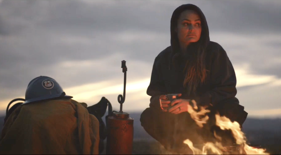
The person you see most in the film is Justine Gude, who was a squad boss on the Texas Canyon IHC. The crew is one of five hotshot crews on southern California’s Angeles National Forest. She goes the extra mile in all aspects to ensure she’s up to snuff to fight wildfires, and to make sure everyone survives each shift. Based on the footage in the film, no one gives Justine any more or any less crap than anyone else gets.
The narrator is Gabriel Kirkpatrick Mann, who also wrote, directed, and shot the film. The project took six years to complete. He finished shooting in 2020 and completed editing in 2022; the film has only recently been released for streaming.
“If I had only two years [to complete the film] it may have been more like Top Gun, more like rah rah stuff,” said Mann. As the movie turned out, it is haunting, intimate, wrenching, and absolutely gorgeous.
The film is unusual in that it is a documentary without interviews. A big part of that was because, when working with hotshots when you’re not a hotshot, it can be difficult to get them to open up. “They don’t want to be on camera. I was the fly on the wall shooting candid video.”
Screenshot from the movie Hotshot
“There were things they didn’t want to say on camera, so I was saying it for them. I was saying what they told me.” And it works well. Watching Hotshot is like an illustrated story: the visuals dovetail perfectly with what Mann is saying. The narration has a conversational tone and an easy pace.
Mann obviously did his homework too, which is evident in the segment on wildfire history. He shows and tells how wildfire has been shaping the natural world for many thousands of years and how Native Americans learned to follow nature’s example. But the balance went awry once immigrants started putting out every fire concurrent with spreading slash everywhere. And then, in more recent years, encouraging unnatural growth in the forests while the planet warmed. Hence our current Large Fire problem.
There is also a lovely segment about the increasing use of prescribed fire and large-scale burnouts. Mann calls it “painting with fire.”
The footage is excellent throughout, and is awash in fire whorls, ember showers, gigantic smoke columns, and waves of fire washing over roads, firelines — and occasionally firefighters. For lovers of stunning fire imagery, this film is unbeatable. But be aware that there are some scenes you may wish you could unsee. Mann’s treks through burned-over suburbs and rural communities tell a tale not seen on the evening news, but which firefighters see all too frequently. Animal lovers may want to fast-forward through these parts.
The shots are taken from the fireline, from the boots of those staring down the throat of Mother Nature in a rage. Then there are up-close-and-personal shots of airtankers flooding roads with retardant, helicopters carving through the smoke spilling water from buckets and belly tanks, dozers clanking through brushfields while carving line, and firefighters with hoses fighting a losing battle against a relentless fire front.
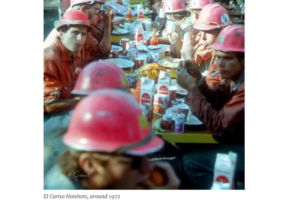
For those who’ve been southern California hotshots, watching Hotshots from the comfort of your lazboy may spawn a variety of neural responses. You get to enjoy seeing present-day hotshots doing the same stupid shit you did when you were on a crew — making bets on who could drink a carton of spoiled milk, snorting snuff before starting a line dig, watching a rookie puke after a hell-week highballing hike up a long, hot ridge. This is also, perhaps, a good movie for hotshot candidates to watch. Or not, particularly when they get to the part about the rotten pay federal firefighters (ahem, Forestry Technicians) receive, compared with firefighters from, say, Cal Fire or L.A. County.
For non-fire viewers, or rookies, there is some basic information delivered that is artfully delivered. What is fuel? Trees, fields of brush, houses, cars, washing machines. This is clearly summarized by the narrator and backed up in the visuals: Everything that can burn will burn.
And, oh yeah, pay attention to the wind, says the narrator, showing some rather alarming horizontal flammage, such as when the fire activity near to where they are cutting line starts getting dangerously frisky: “They take a bite, pull back, then take another bite, all day, all night,” says the narrator, while viewers see a crew digging hot line, then stepping back while helicopters spill water along the hot flank, enabling the crew to resume the dig.
Screenshot from the Hotshot movie by Gabriel Kirkpatrick Mann
Thank god there are hotshot crews to handle these debacles. As the narrator aptly puts it, a hotshot crew is “like a Swiss Army knife with beards.” They have everything that they need and nothing that they don’t.
Mann tried to get approval from the Forest Service to get embedded with Texas Canyon and was turned down. But he decided to do it anyway. He got his own PPE, got a press pass, and outfitted a Jeep for line duty. Then he participated with the crew in their pre-season readiness training. “I went through it all with them, the PT hikes, the safety training.” The experience helped him understand, on a personal level, the depth of dedication hotshots have, and he found it humbling. “I felt I was intruding on something sacred.”
Hotshot by Gabriel Kirkpatrick Mann
Even after he had finished shooting and editing the movie, he couldn’t stop running toward the smoke whenever he saw a column rising from the hills. “I was addicted, and I kept going back even after I was done with the movie.”
Watching the film can be somewhat addicting, too. To see Hotshot, go to hotshotmovie.com where you have the option to pay $4.99 to watch the movie all you want for 48 hours, or $13 to stream it anytime you want for the rest of your life.




 Michael Hill began this journey in the 1980s as an American wildland firefighter, and across his career worked as a hotshot and smokejumper. For many years Hill has been, and still is, deeply interested in Indonesia’s and Australia’s wildfires. He serves as an associate editor for