California sends firefighters into Mexico to battle wildfire near border

CAL FIRE engines cross border into Mexico
CAL FIRE engines cross the border into Mexico to assist firefighters in the suppression of a wildfire west of Tecate, Mexico. CAL FIRE photo.

The California Department of Forestry and Fire Protection (CAL FIRE) has mobilized a strike team of fire engines to cross the international border in order to help firefighters in Mexico. They will be assisting in the suppression of the Border 8 Fire that has burned 1,500 acres very close to the border just west of Tecate, Mexico 23 miles southeast of San Diego.

The fire is a threat to cross the border in an area of the United States with steep topography and limited access. Keeping it from crossing the border would be the preferred option, rather than having to suppress a much larger fire in difficult terrain on the U.S. side.

The fire has been spreading to the east, generally toward the city of Tecate which has a population of 102,000 in its metropolitan area.

Air tankers have been dropping retardant in a few selected locations north of the border off and on since the fire started August 14, including S2T and C-130 aircraft from bases at Ramona and Hemet, California.
Border Fire Mexico United States California
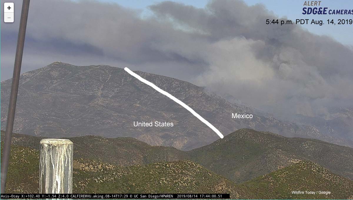
Photo from Otay Mountain showing the Border Fire at 5:44 p.m. PDT August 14, 2019, and the approximate location of the international border (white line).

CAL FIRE may decide to activate the unstaffed air tanker base at Brown Field Municipal Airport which is 1.6 miles north of the border and about 16 miles west of this fire. It is 31 miles south of the Ramona air tanker base and has a 7,972-foot runway which according to information from the USFS “provides ample length to meet safe takeoff requirements for the size and weight of a Next Generation Air Tanker with a full payload”. The runway at Ramona is too short to handle many of the large air tankers. The tanker base at Hemet, which also has a relatively short runway, is 80 miles north of the fire.

The fire can be seen via cameras here and here.

Border Fire threatens to burn from Mexico into U.S.

Border Fire Mexico United States California
Photo from Otay Mountain showing the Border Fire at 5:44 p.m. PDT August 14, 2019, and the approximate location of the international border (white line).

A large wildfire in Mexico west of Tecate is very close to the U.S. border and threatens to burn into California about 23 miles southeast of San Diego. It is spreading to the east, generally toward the city of Tecate which has a population of 102,000 in its metropolitan area.

The California Department of Forestry and Fire Protection, CAL FIRE, is monitoring the situation and has already started moving firefighting resources into the area, including aircraft.

Video from Channel 8 in San Diego showed air tankers, an S2 and a C-130 (T-134), making drops north of the border.

CAL FIRE may decide to activate the unstaffed air tanker base at Brown Field Municipal Airport which is 1.6 miles north of the border and about 16 miles west of this new fire. It is 31 miles south of the Ramona air tanker base and has a 7,972-foot runway which according to information from the USFS “provides ample length to meet safe takeoff requirements for the size and weight of a Next Generation Air Tanker with a full payload”. The runway at Ramona is too short to handle many of the large air tankers.

The fire can be seen via cameras here and here.

Border Fire Mexico United States California
A 3-D map view of the area, looking east from Otay Mountain. The yellow line is the international Border. The area is similar to that seen in the photo from Otay Mountain, at the top of the article.
Border Fire Mexico United States California
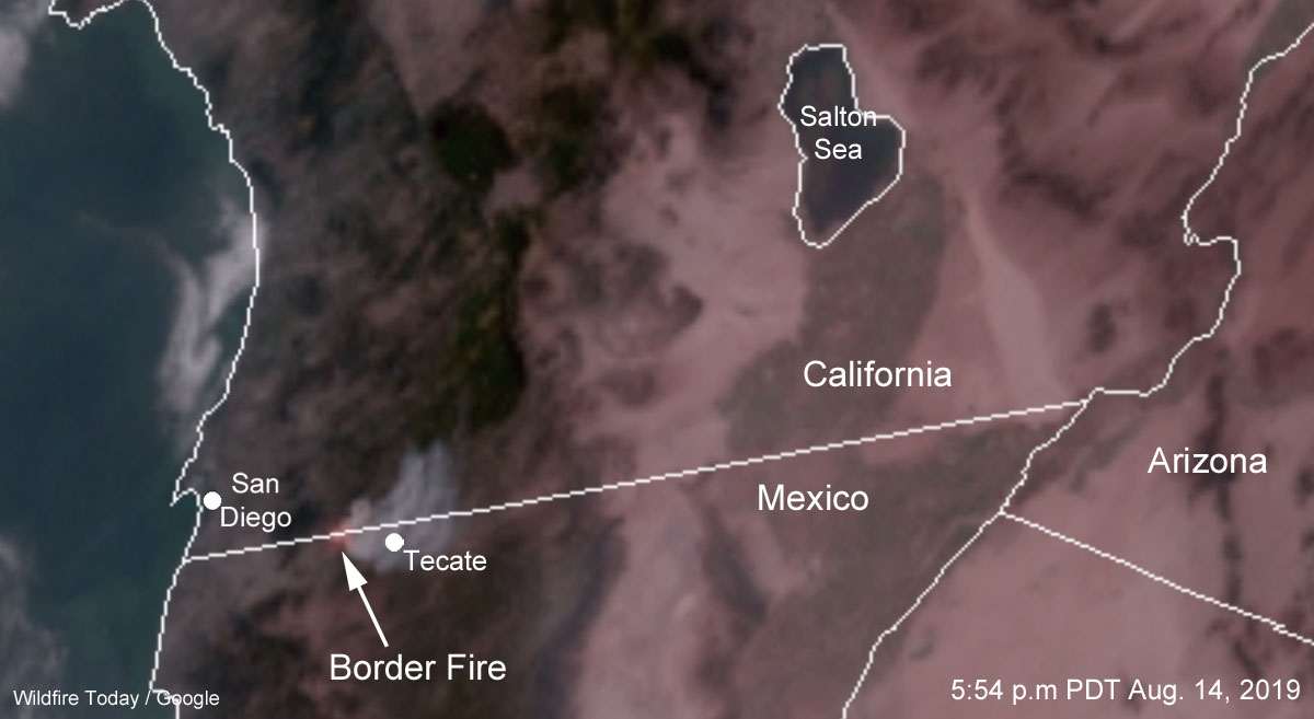
Satellite photo showing smoke from the Border Fire at 5:44 p.m. PDT August 14, 2019.

California: Border Fire forces evacuation of additional areas, including Lake Morena Village

(UPDATED at 8:15 a.m. PDT June 24, 2016)

map Border Fire
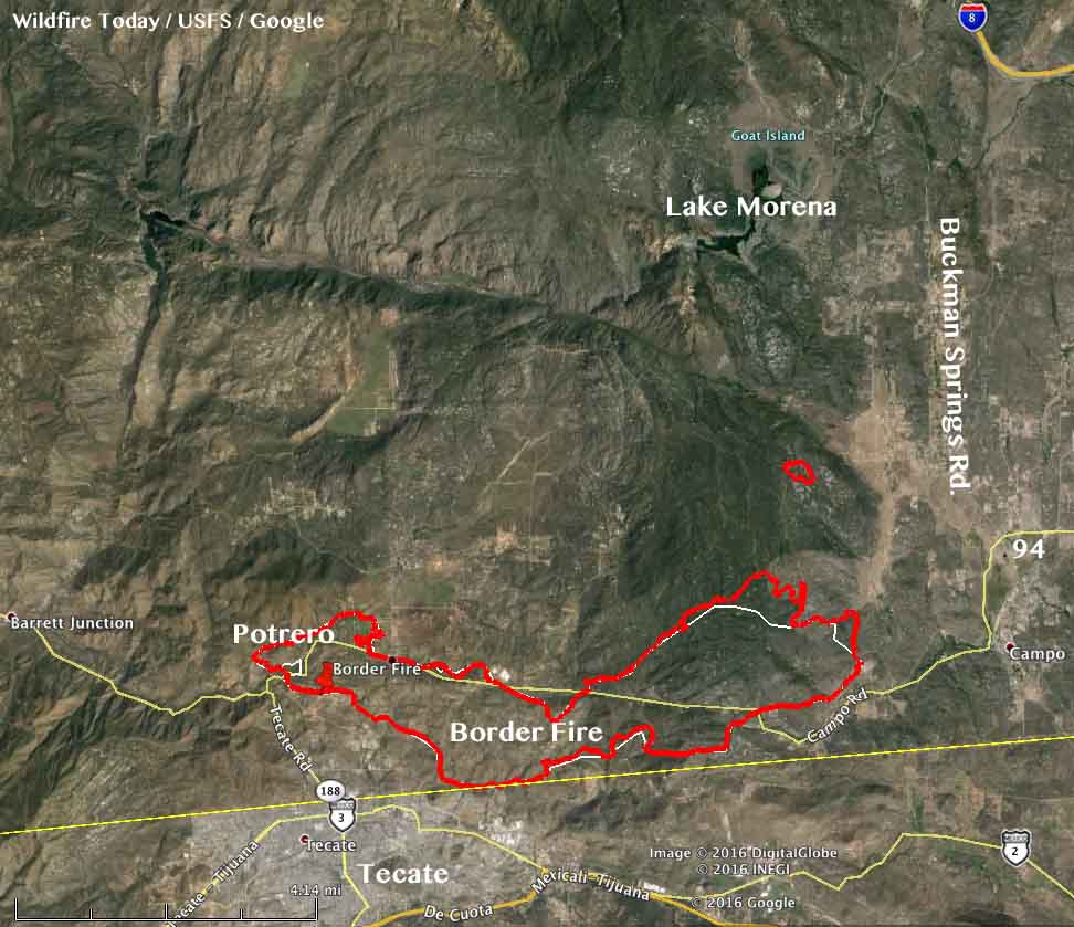
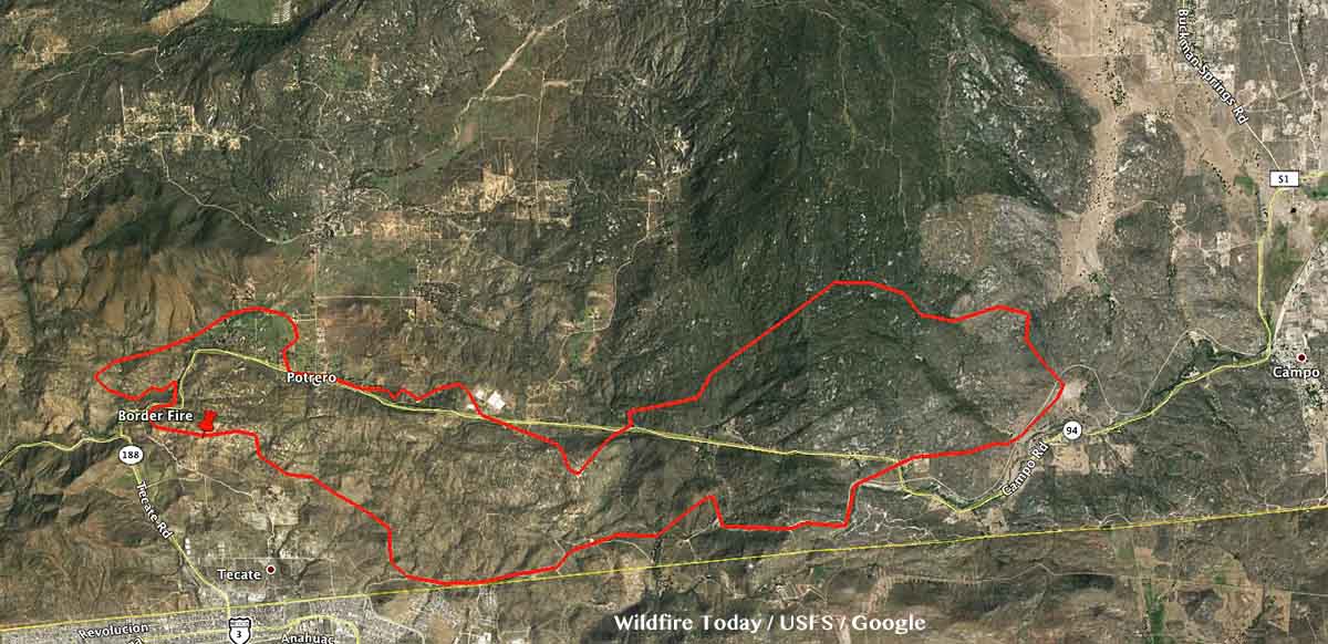
Perimeter of the Border Fire (in red) at approximately 9 p.m. June 23, 2016.The white line was the perimeter two days before. Click to enlarge.

The growth of the Border Fire east of Potrero, California has slowed in recent days. CAL FIRE reports that it has burned 7,483 acres.

****

(UPDATED at 7:20 a.m. PDT June 22, 2016)

map border fire
Map of the Border Fire at approximately 3 a.m. PDT, June 22, 2016. Click to enlarge.

The Border Fire at Potrero, California, 18 miles east of the greater San Diego area, continued to spread to the east on Tuesday, adding another 480 acres. CAL FIRE is reporting that it has burned a total of 6,500 acres, two residences, and 11 outbuildings.

A spot fire 1.2 miles northeast of the main fire had burned 40 acres as of early Wednesday morning.

Resources assigned to the fire include 1,604 personnel, 200 engines, 40 hand crews, 6 helicopters, 12 water tenders, and 7 dozers.

Highway 94 and the Pacific Crest Trail are closed.

****

CAL FIRE reported at 7 p.m. on June 21 the revised size of the Border Fire was 6,020 acres.

****

(UPDATED at 5:25 p.m. PDT June 21, 2016)

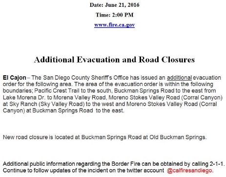
New evacuations were ordered for the Border Fire in San Diego County at 2 p.m on Tuesday June 21. It includes Lake Morena Village northwest of Campo, California.

Border Fire new evac

CAL FIRE reported that there are 1,484 personnel assigned, plus 158 engines, 32 hand crews, 6 helicopters, 12 water tenders, and 3 dozers.

The mandatory evacuations have been placed in parts of the city of Duarte and in the national monument still remain in effect.

****

(UPDATED at 6:10 a.m. PDT June 21, 2016)

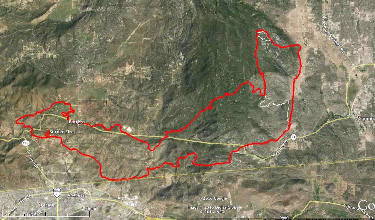
Border Fire perimeter map
Border Fire perimeter at 9 p.m. PDT June 20, 2016. Click to enlarge.

CAL FIRE’s latest estimate on the size of the Border Fire at Potrero, California was 7,500 acres late Monday afternoon. Our very rough analysis of Monday night’s mapping data puts it much closer to 6,000 acres … but it may eventually grow into the larger figure.

The fire has gone through or past several small communities with names like Dog Patch, and has come within two miles of Campo, which was the first evacuation shelter. When the fire grew closer to Campo, the shelter was moved to the rest area on Buckman Springs Road at Interstate 8, and was later relocated to El Cajon at the Los Coches Creek Middle School, 9669 Dunbar Lane.

According to CAL FIRE mandatory evacuations are still in effect for the communities of Potrero, Forest Gate, Star Ranch, Cowboy Ranch, Dog Patch, & Canyon City. Highway 94 remains closed. 

The number of structures destroyed remains at four outbuildings. There have been three minor injuries to firefighters.

Continue reading “California: Border Fire forces evacuation of additional areas, including Lake Morena Village”