California: Falls Fire

(UPDATE at 2:42 p.m. PDT, August 6, 2013)

Falls Fire
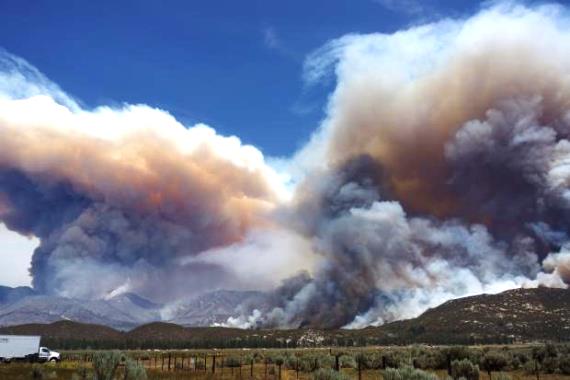
The Falls Fire burned close to many homes. August 6, 2013 photo by Marc Peebles

Information Officer Marc Peeples told us that the evacuations have been lifted for LakeLand Village and Rancho Capistrano. Decker Canyon remains under a mandatory evacuation order.

One of the factors that slowed the fire activity late in the day on Monday was the rising relative humidity. At 6:41 p.m. on Monday at the Temescal weather station 10 miles north of the fire it was 38 percent which is fairly high to sustain rapid fire spread in southern California brush. At 6:41 a.m. Tuesday it was 87 percent and fell to 49 percent by 9:41 a.m.

In spite of the high humidity, Mr. Peeples said there was beginning to be a little fire activity in some of the canyons on the fire Tuesday morning.

****

(UPDATE at 8:44 a.m. PDT, August 6, 2013)

DC-10  drop on Falls Fire, August 5, 2013
DC-10 drop on Falls Fire, August 5, 2013,, from KCAL video

The Southern California Geographic Area Coordination Center reported at 8:30 a.m. PDT that the fire has burned 1,416 acres and is zero percent contained. The fire continues to move south and east and has established itself in the San Mateo Wilderness, but is holding at the ridge lines. They said the it has potential to move further north, resulting in additional structure threat and could also move into Morrell and Decker Canyons. LakeLand Village, Rancho Capistrano and Decker Canyon remain under mandatory evacuation orders, according to the Coordination Center’s 8:30 a.m. report.

Marc Peeples, an Information Officer on the Incident Management Team assigned to the fire, said at 8:45 this morning that the fire is 5 % contained and is being fought by 265 personnel. Other resources on the fire include 6 helicopters, 6 fixed wing aircraft, 16 crews, and 45 engines.

The Cleveland National Forest has not updated InciWeb since about 7 p.m. Sunday and it also says the evacuations are in effect for Lakeland Village, Decker Canyon and Rancho Capistrano residents, in spite of a report from KCAL saying some of the evacuations had been lifted.

The report from KCAL said the Ortega Highway may remain closed for days or weeks, due to firefighters working along the highway, guard rails that have to be replaced, and power lines that were damaged.

The video also has some footage of Tanker 910, a DC-10, making some impressive retardant drops adjacent to houses.


Wakoski’s Incident Management Team was scheduled to assume command of the fire Tuesday morning.

The fire was reported at 10:06 a.m. Monday west of El Cariso Engine Station in the Cleveland National Forest.

****

(UPDATE at 9:25 p.m. PDT, August 5, 2013)

At 9:15 p.m. the Cleveland National Forest reported the fire had burned 1,500 acres. Mandatory evacuations for Lakeland Village, Decker Canyon and Rancho Capistrano residents. Ortega Highway is closed to non-residents. Closures are at Grand Ave in Lake Elsinore and Antionio Parkway in Orange County. The evacuation perimeter is for residences between Grand/Ortega Highway and Grand/Corydon on the west side of the lake.

Official information about evacuations can be found at InciWeb.

Excellent photos of the Falls Fire.

The videos below are from the Press-Enterprise.

****

Falls Fire photo
Falls Fire as seen from LA’s NBC 4 at 5:13 p.m. PDT, August 5, 2013, looking southeast. (click to enlarge)

(Originally published at 5:54 p.m. PDT, August 5, 2013; we will update this article as needed.)

A wildfire that started Monday morning in southern California between Lake Elsinore and San Juan Capistrano spread east almost four miles and is threatening homes in the Lakeland Village community on the west side of Lake Elsinore. In the photo above captured from television at 5:13 p.m. PDT, the fire had moved across the South Main Divide road and was burning downhill at a moderate rate of spread. It appeared to be approximately 500 to 1,000 feet west of the homes in the photo in Lakeland Village south of the Ortega Highway.

Falls Fire, near Ortega Hwy and Grand, August 5, 2013
Falls Fire, near Ortega Hwy and Grand, August 5, 2013. Photo by Ken.

As this was written at 5:54 p.m. PDT, the fire was even closer to the homes and can be seen occasionally on NBC 4’s live video feed. It was burning vigorously less than 200 feet from homes.

Several helicopters and air tankers, including a DC-10 Very Large Air Tanker, are assisting firefighters.

Referencing the map of the Falls Fire below, the fire has spread across the South Main Divide and is much closer to Lake Elsinore than shown in the heat data that was collected at 1:47 p.m. PDT today.
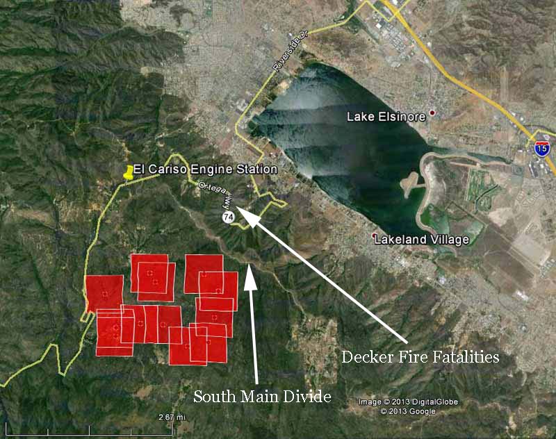
Map of Falls Fire at 1:47 p.m. PDT, August 5, 2013
Map of Falls Fire at 1:47 p.m. PDT, August 5, 2013, showing heat detected by a satellite. The red squares indicating heat can be as much as a mile in error. (click to enlarge)

The media is reporting the fire has burned 1,200 acres.

It is burning near the location of the 1959 Decker Fire (see the map above) which entrapped seven firefighters. Five of them lost their lives; three were members of the El Cariso Hotshot Crew. The east-facing slope above the lake is infamous for unusual wind patterns, which was a factor in the fatalities.
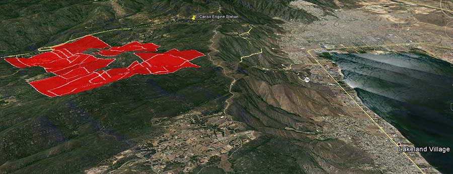
3-D Map of Falls Fire at 1:47 p.m. PDT, August 5, 2013
3-D Map of Falls Fire at 1:47 p.m. PDT, August 5, 2013, looking northwest. The red squared represent heat detected by a satellite; they can be as much as a mile in error. (click to enlarge)
DC-10 finishing drop on Falls Fire
DC-10 finishing a drop on the Falls Fire, August 5, 2013. Note from Bill: I examined the drop based on the known length of a DC-10, which is 180 feet, and calculated that this drop is approximately 1,620 feet long. The length of a drop from a P2V for coverage levels 4 to 10, ranges from 180 to 430 feet.

Wildfire arsonist convicted of murder, hijacks car then commits suicide

In a bizarre series of incidents, on August 3 a man committed suicide who had pleaded guilty to a second-degree murder charge for starting the 1997 Hemlock Fire in southern California which killed an aerial firefighter.

Cary Thomas Meeks admitting throwing an illegal firecracker into a grassy area of the San Bernardino National Forest in 1997 resulting in the 3,700-acre fire. In 1998 he received a sentence of three year’s probation for the crime. Since then he has been in and out of jail for other offenses.

Helicopter pilot Floyd Hiser was dropping water on the Hemlock Fire on July 6, 1997 when his helicopter lost power and crashed near Highland. He reportedly said “flame out” twice on the radio before his Bell 206 L-1 crashed. The National Transportation Safety Board said malfunctioning fuel-line valves caused the crash.

Mr. Meeks had a busy day on Saturday beginning with slashing the throat of a 67-year old man, who survived. U.S. Forest Service firefighters from the San Bernardino National Forest responded to that medical aid incident.

Mr. Meeks then carjacked a vehicle from a 73-year old man and led police officers on a chase at speeds up to 100 mph, with the vehicle’s owner in the car, who called 911 and described what was going on. Eventually the owner was let out of the vehicle, after which Mr. Meeks steered the car at high speed into a concrete bridge pillar without breaking. He died in the crash. He had previously told the vehicle’s owner he was going to kill himself.

Mr. Meeks had several other run-ins with law enforcement since starting the fire. The Riverside Press-Enterprise which always does an excellent job covering wildfires, has all of the details.


Thanks go out to Ken

California: Orleans and Salmon River fire complexes

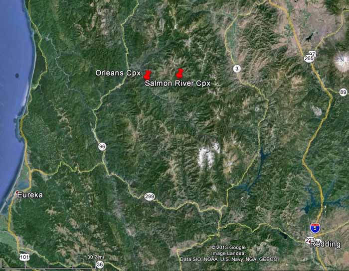
Map of Orleans and Salmon River Complexes of fires
Map of Orleans and Salmon River Complexes of fires (click to enlarge)

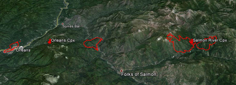
Two complexes of fires in northern California, shown on the maps, are seven miles apart but are on different national forests, which could be one reason they have not been combined into just one complex.

3-D Map of Salmon River and Orleans Complexes of fires August 3, 2013
3-D Map of Salmon River and Orleans Complexes of fires August 3, 2013 (click to enlarge)

Salmon River Complex 

The Salmon River Complex on the Klamath National Forest consists of at least two fires that as of early Sunday morning were about a tenth of a mile apart, burning 6 miles northeast of Forks of the Salmon, 2 miles northwest of Sawyers Bar, and 64 miles northwest of Redding. The Type 1 California Interagency Incident Management Team One assumed command of the Complex at 6 p.m. Saturday.

Orleans Complex 

The Orleans Complex comprises two fires on the Six Rivers National Forest. The Dance Fire is right at the community of Orleans and is burning on both sides of Highway 96. It started July 29 and is contained. The other is the Butler Fire 7 miles east of Orleans and about 49 miles northeast of Eureka. It was detected July 31, is listed at 3 percent containment, and has burned 1,463 acres. Northern California Interagency Team Two is managing the incident.

Salmon River Road, also known as Highway 93, is adjacent to three of these four fires and is closed.

Below is an update from the incident management team:

The fire reached the Morehouse Mine area, where structures are threatened. As of this morning, the fire lines are holding around those structures. The fire continues to burn mostly on the south side of the Salmon River in the area east of Butler Flat. Efforts to reach a spot fire on the north side of the river continue to be hampered by poor visibility and steep terrain. The fire was active around the perimeter yesterday and progressed across Lewis Creek (on the southern side) and into Grant Creek drainage (on the northeastern side). The fire is burning in the fire scars of the Hog Fire (1977). Difficult terrain, heavy vegetation, snags and poor access to the fire have continued to limit firefighting strategies. Crews are working today to open and utilize lines from the Somes Fire (2006).

Smoke issues

All of these fires are burning in an area that is infamous for long-duration fires subject to frequent inversions that trap wildfire smoke, sometimes creating air quality and health issues for sensitive residents. The incident management teams are referring residents to these websites for more information about the smoke:

On Saturday dense smoke limited the use of aircraft and the ability of fire managers to get an aerial view of the fires. A USFS fixed-wing aircraft using infrared equipment mapped the Salmon River Complex Saturday night.

Photos of Aspen Fire

Aspen Fire, July 27, 2013
Aspen Fire, July 27, 2013. Photo by Fire Behavior Analyst John Smith. (click to enlarge)

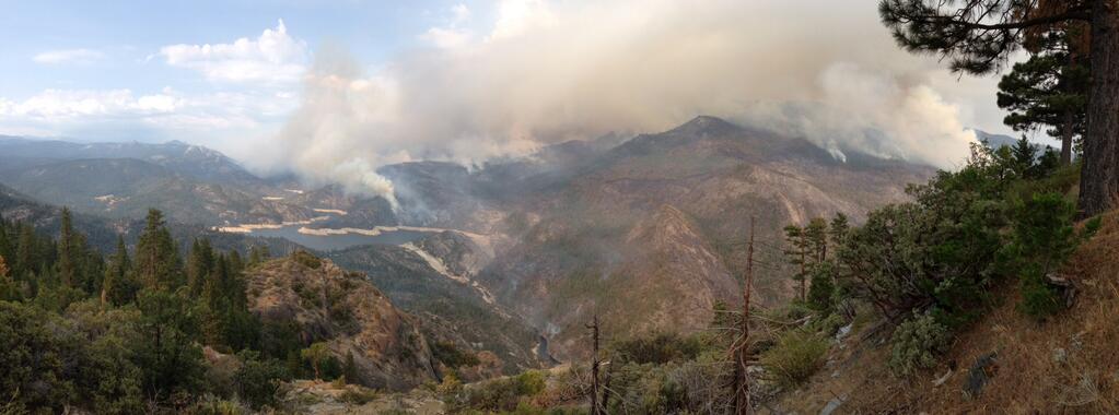
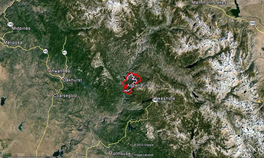
Even though we posted the excellent photo above of the Aspen Fire in our main article about the fire HERE, we wanted to place it here as well, in case you are not keeping up with that fire — which is in California 16 miles south of Yosemite National Park and 5 miles northwest of Huntington Lake. Click the photo to see a larger version. The photo, which we believe is looking toward the northeast, shows Mammoth Pool Reservoir and the steep terrain the firefighters are working in.

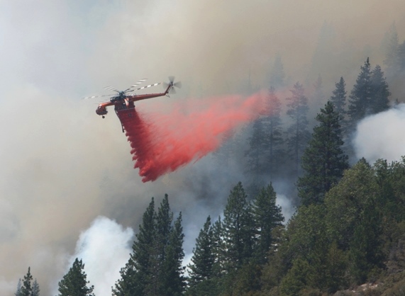
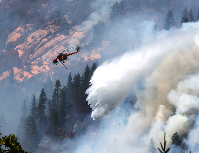
The photos below, of a Sikorsky helicopter dropping water and retardant, were also taken on the Aspen Fire. Bob Martinez, a Volunteer in Prevention Photographer for CAL FIRE/Fresno County Fire, took them from Stump Springs Road July 26, 2013.

Sikorsky helicopter dropping on Springs Fire, July 26, 2013 Sikorsky helicopter dropping on Springs Fire, July 26, 2013In 2010 and 2012 Mr. Martinez also sent us photos he took of military helicopters training for wildland fire season.


California: Aspen Fire

3-D Map Aspen Fire

(UPDATE at 7:05 a.m. PDT, July 30, 2013)

Map of Aspen Fire at 1 a.m. PDT, July 30, 2013

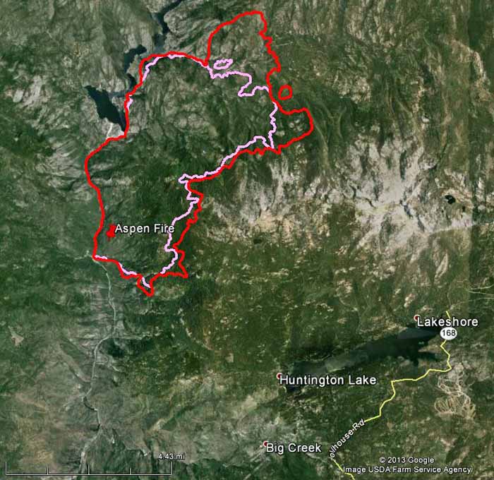
On the map of the Aspen Fire above, the red line is the perimeter at 1 a.m. July 30; the pink line is from about 24 hours before. On Monday the fire continued to spread on the south and east flanks, and moved over a mile on the north side.

Businesses remain open in the Shaver Lake, Huntington Lake, Lake Thomas Edison, Florence Lake and the Mono Hot Springs areas.

****

(UPDATE at 8:10 p.m. PDT, July 29, 2013)

Some of our web site visitors have told us the maps of the Aspen Fire on InciWeb are not very useful to them. So until that changes, we will at least occasionally post a map here that we hope fits the needs of the general public.

In the maps below, the red line is the fire perimeter at 10 p.m. PDT July 28, 2013. The pink line is the perimeter about two days before that.

Map of Aspen Fire at 10 p.m. PDT, July 28, 2013
Map of Aspen Fire at 10 p.m. PDT, July 28, 2013 (click to enlarge)
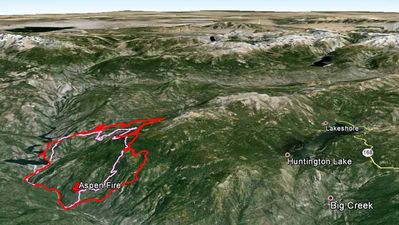
3-D Map of Aspen Fire, looking northeast at 10 p.m. PDT, July 28, 2013
3-D Map of the Aspen Fire, looking northeast at 10 p.m. PDT, July 28, 2013 (click to enlarge)

The fire has burned 11,000 acres. Monday, east winds promoted increased growth along the northern, eastern and southeastern perimeter of the fire. Helicopters worked the southern edge of the fire in the Aspen Creek drainage and other areas of heat. Fixed wing aircraft, including a Very Large Air Tanker (a DC-10) are pre-treating with retardant the Kaiser Creek area.

We have a photo of the DC-10, which is reloading at Santa Maria Air Tanker Base.

****

(UPDATE at 7:45 a.m. PDT, July 28, 2013)

Aspen Fire, July 27, 2013
Aspen Fire, July 27, 2013 Photo by Fire Behavior Analyst John Smith (click to enlarge)

Over the past two days fire activity has been increasing in the late afternoon on the Aspen Fire when the smoke inversion layer lifts. It is expected to dissipate earlier on Sunday. On Saturday the smoke kept aircraft grounded until 3 p.m.
Continue reading

Videos of the Mountain Fire

Our main article about the Mountain Fire in southern California has the details about the fire and is updated frequently, but here we have collected some video of the fire activity.

The first one is long, 39 minutes, but if you skip around you’ll find something that interests you. DC-10s can be seen dropping retardant at 10, 20, and 22 minutes. The video was shot on July 16 and 17 by “Lakeside Fire” at Garner Valley, Lake Hemet, Palm Springs, and the Hemet-Ryan Air Attack Base.

The next one, much shorter at 27 seconds, is a time lapse view of the fire on July 15, shot by Mike Sauder.

The next one is another time lapse and covers portions of four days, from noon on July 15 to about 8 a.m. on July 18. It is an animation of images taken every two minutes from a web camera on Toro Peak and was compiled by Hans-Werner Braun.

The next one, only 17 seconds long, was shot by the Riverside Press-Enterprise and shows the fire burning across a road on July 15.

The last one can’t be embedded here, but it has some interesting interviews about the fire.

California: Mountain Fire

Mountain Fire, as seen from Toro Peak

(UPDATE at 9:20 a.m. PDT, July 21, 2013)

Monsoonal storms brought heavy rain to the Mountain Fire west of Palm Springs early this morning. The weather station at the top of the Palm Springs Aerial Tramway just north of the fire measured 1.61 inches between 11 p.m. Saturday and 8:53 a.m. today. The Keenwild weather station 5 miles southwest of the fire had 0.23″ since midnight. A flash flood watch was issued for the fire area as well as the Riverside County Mountains, San Diego County mountains and San Diego County deserts. There is a 55 to 80 percent chance of more rain through 10 p.m. with additional accumulations of up to 0.60 inch.

This morning the incident management team said firefighters are taking advantage of the break in the weather:

With diminished fire activity, firefighters made great progress with line construction particularly along the East side towards Palm Springs. Although conditions were hazardous and some crews were taken off the line due to the severe weather, firefighters continue to fight the fire aggressively where possible. Today’s priority for fire operations is focused at the northernmost part of the fire with crews at the Palm Springs Aerial Tramway constructing direct hand line at the fire’s edge to reduce the threat to Idyllwild and surrounding communities.

The U.S. Forest Service has been using their new night flying helicopter and air attack ship on the fire, and proudly produced this graphic.

Night flying data, Mountain Fire

****

(UPDATE at 7:25 a.m. PDT, July 20, 2013)

3-D Map of Mountain fire, perimeter,
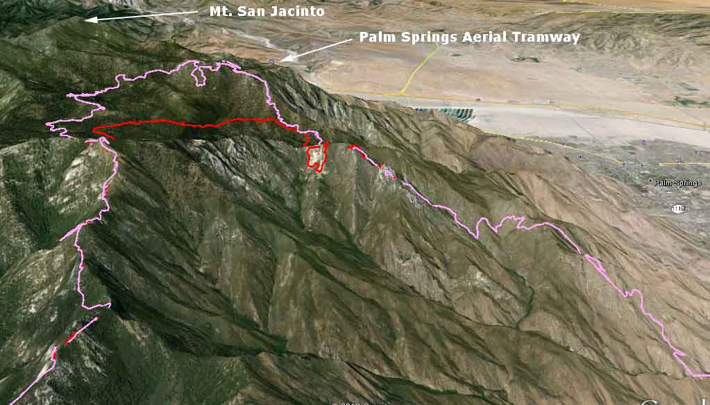
3-D Map of the north side of the Mountain fire, at 10 p.m., July 19, 2013, looking north. The pink line was the perimeter at 10 p.m. Friday, and the red line was 24 hours before that. (click to enlarge)

The Mountain Fire continued to spread to the north Friday, coming closer to the highest point in the area, Mt. San Jacinto, and within 0.7 mile of the Palm Springs Aerial Tramway. The 3-D map above which shows the north portion of the fire illustrates the very steep slopes the firefighters have as their work environment. The fire spread very slowly on the south side, while the east and west sides were relatively quiet Friday.

A major change in the weather is in the works, with the forecast for the higher elevations calling for much higher humidity and a 30 to 40 percent chance of showers over the next 48 hours. This should slow the fire’s spread and give firefighters a better opportunity to construct more direct fireline.

The incident management team has produced a map of the fire.

****

(UPDATE at 9:23 a.m. PDT, July 19, 2013)

Mountain Fire, from Hwy 74
Mountain Fire, from Hwy 74, July 17, 2013 USFS Photo by Sam Wu

The variable wind direction Thursday caused the fire to spread, as expected, in multiple directions. It continued to progress in the Tahquitz meadows area, but firefighters on the ground assisted by aircraft, including two military MAFFS C-130 air tankers from the California Air National Guard, held the fire at a ridge. The fire remains active on the north side and continues to threaten the community of Idyllwild, according to the Incident Management Team.

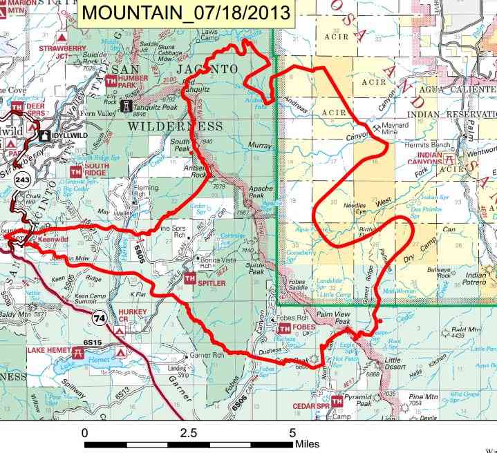
The IMTeam produced a very readable map, below. It was released at 6 a.m. July 18 and contains the fire perimeter as it was known late in the day on July 17.

Map of Mountain Fire
IMTeam map of Mountain Fire, July 18, 2013

We put together the following maps using data from various sources.

Map of Mountain fire July 19, 2013
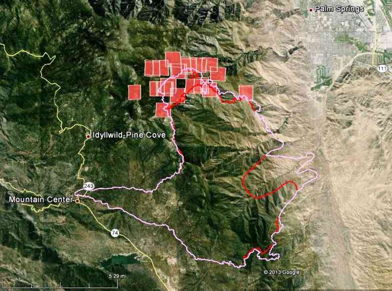
Map of Mountain fire. The white line is the perimeter at 9 p.m. PDT July 18. The red line is the perimeter 24 hours before that. The red squares represent heat detected by a satellite at 2 a.m. PDT July 19, indicating that the fire continued to spread to the north during the night. The apparent growth on the east side is most likely not new growth, but is probably a correction, showing movement of the fire several days earlier.  (click to enlarge)
Map of Mountain fire, July 19, 2013
3-D Map of the Mountain fire, looking toward the northwest. The white line is the perimeter at 9 p.m. PDT July 18. The red line is the perimeter 24 hours before that. The red squares represent heat detected by a satellite at 2 a.m. PDT July 19. (click to enlarge)

****

(UPDATE at 7:41 a.m. PDT, July 18, 2013)

We collected some interesting videos of the Mountain Fire HERE.

The maps below show the perimeter of the Mountain fire as it was mapped at 9 p.m. Wednesday.
Continue reading

Wildfire briefing, July 12, 2013

Congressional hearing about Wildfire and Forest Management

On Thursday the House Committee on Natural Resources held a hearing about wildland fire and forest management. You can watch a 2 hour and 15 minute video of it at C-SPAN. (Are there any volunteers who would like to watch it and give us a summary?)

Here is how it is described at C-SPAN:

“Wildfire and Forest Service officials testified on ways to reduce the risk of catastrophic wildfire. The hearing also focused on the increasing number and intensity of wildfires in the West and Southwest.

Representatives Doug Lamborn (R-CO), Scott Tipton (R-CO), Paul Gosar (R-AZ), and Ann Kirkpatrick (D-AZ) testified in the first panel.

Panel Two:

  • Jim Hubbard, Deputy Chief, State and Private Forestry, U.S. Forest Service, U.S. Department of Agriculture
  • James Douglas, Acting Director, office of Wildland Fire, Senior Adviser, Public Safety, Resource Protection and Emergency Services, U.S. Department of the Interior
  • Phil Rigdon, Deputy Director, Yakama Indian Nation Department of Natural Resources
  • Joe Duda, Deputy State Forester, Colorado State Forest Service, Colorado State University
  • Christopher Topik, Director, Restoring America’s Forestsm, North America Region
  • Chuck Roady, Vice President & General Manager, F.H. Stoltze Land & Lumber Company”

NIFC lowers Preparedness Level

The National Interagency Fire Center has lowered the national Preparedness Level from 3 to 2.

MAFFS sent home

By the end of the day the U.S. Forest Service will release the four Modular Airborne FireFighting System (MAFFS) C-130 air tankers being operated by the military. The last four remaining are from California and North Carolina.

Map of Chariot Fire

CAL FIRE, the agency responsible for suppressing the devastating wildfire that spread from the desert to the mountain community of Mt. Laguna east of San Diego, still has not released a current map of the fire showing that it burned significant acreage in the Cleveland National Forest and wiped out much of the Al Bahr Shrine Camp. Their last map is dated July 8. Approximately 149 structures were destroyed and 9 were damaged.

Smoke Map

Wildfire smoke map
Wildfire smoke map at 4:30 p.m. MDT July 12, 2013

The map below shows the distribution of smoke from fires in the United States and Canada as of 4:40 p.m. MDT, July 12, 2013.

California: Chariot Fire

Chariot Fire

(UPDATE July 15, 2013)

The Chariot fire is listed at 100 percent contained, so the map below could be the final one. A zoomable map is available HERE.

Map of Chariot fire, July 15, 2013

****

(UPDATE at 9:15 a.m. PDT July 10, 2013)

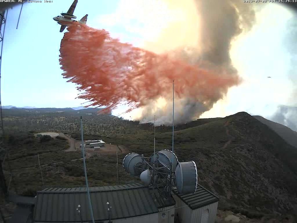
S-2T dropping near electronic site
S-2T dropping near electronic site on Mt Laguna at 3:29 pm July 8, 2013 HPWREN

The Chariot Fire not only burned a landmark-type lodge on Mt. Laguna east of San Diego, it also destroyed 120 structures, according to CAL FIRE, the agency attempting to suppress the fire. Initial reports by the San Diego Union that the lodge at the Sierra Club’s facility across the highway was destroyed were incorrect, but at least one structure there did burn.

Most of the structures, including the lodge built in 1925, were in the Al Bahr Shrine Camp a mile north of the US Forest Service’s Laguna Engine Station and about two miles north of the post office in the small community.

The fire started Saturday afternoon near the Butterfield Ranch in the Anza-Borrego Desert, 3.000 vertical feet below the community. Most of the damage was done Monday afternoon. CAL FIRE reports the fire has burned 7,055 acres and is 40 percent contained. The only map provided by CAL FIRE is dated July 8 and does not show the fire’s presence on Mt. Laguna.

Shriners International contributes funding to children’s hospitals, but most people know them as the organization that drives tiny cars performing maneuvers in parades.

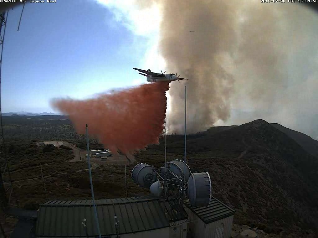
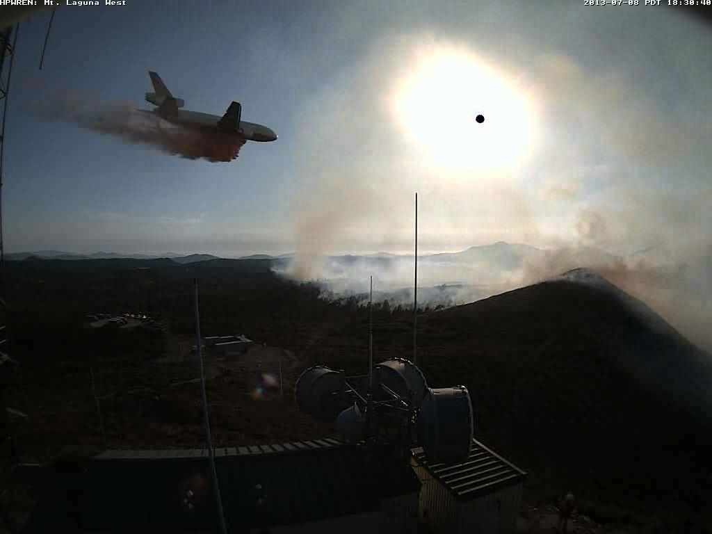
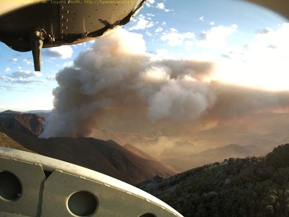
The web cameras operated by the University of California’s High Performance Wireless Research and Education Network (HPWREN) captured the aerial fire fight as air tankers dropped retardant to protect the electronic sites, including their own, on Mt. Laguna at the former Air Force base.

S-2T dropping near electronic site on Mt Laguna
S-2T dropping near electronic site on Mt Laguna at 3:39 pm July 8, 2013. HPWREN
DC-10 dropping near electronic site
DC-10 dropping near electronic site on Mt Laguna at 6:38 pm July 8, 2013 HPWREN

Thanks go out to the Lone Ranger for pointing out the HPWREN site that has 14 other photos of the air tankers working on Mt. Laguna.

****

(UPDATE at 11:18 p.m. PDT, July 8, 2013)

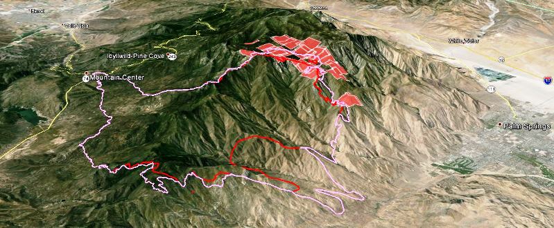
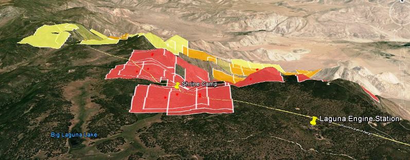
3-D Map of Chariot Fire 1:20 p.m. PT July 8, 2013
3-D Map of Chariot Fire 1:20 p.m. PT July 8, 2013. The squares represent heat detected by a satellite, with the red ones being the most current. The location of the squares can bee as much as a mile in error.

The San Diego Union is reporting that the Chariot Fire not only made it to the top of the slope, from the desert 3,000 vertical feet up to the Mt. Laguna area, but it crossed the Sunrise Highway and burned into the Cleveland National Forest. And, most importantly, it burned two landmark-type buildings on special use permits in the Forest — the large and very old lodges at the Sierra Club and the Al Bahr Shrine Camp on opposite sides of the highway, plus about six other buildings.

The fire crossed the Sunrise Highway and burned into at least one of the group campgrounds in the Laguna Campground complex adjacent to the Shrine Camp. A fire spokesperson said 120 residences were evacuated. The fire is burning about a mile north of the Laguna (or Camp Ole) engine station… one of my old stations on the Cleveland National Forest.

CAL FIRE reports the fire has burned 4,700 acres and is being fought by 1,383 personnel. It is about 50 miles east of San Diego.

The San Diego Union also reported, (incorrectly) “Loud booms could be heard as trees caught fire and their tops exploded.” The old “exploding trees” myth lives on.

****

(UPDATE at 3:42 p.m. PDT, July 8, 2013)

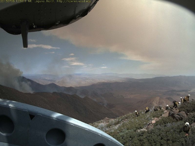
Kelly found this photo on the Mt. Laguna web cam that shows a crew in the foreground.

Chariot Fire at 12:34 p.m. July 8

****

(Originally published at 7:12 a.m. PDT, July 8, 2013) 

Chariot Fire
Chariot Fire at 6:10 a.m. PT, July 8, 2013

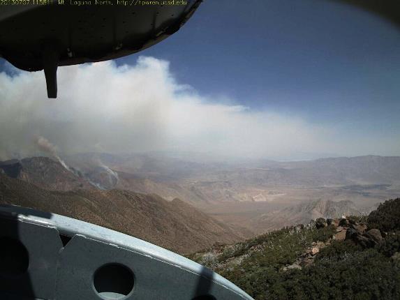
The Chariot Fire north of Mt. Laguna, California that is causing evacuations on the mountain can be watched in near-real time thanks to a web camera at the old Air Force Base at Mt. Laguna. The photo above was taken at 6:10 a.m. on Monday — the one below at 11:58 a.m. Sunday. Several campgrounds as well as the Al Bahr Shrine Camp have been evacuated.

Chariot Fire
Chariot Fire at 11:58 a.m. July 7, 2013

CAL FIRE said at 7:15 Sunday night the fire had burned 2,500 acres. The fire is burning on the desert slopes below Mt. Laguna, my old stomping grounds. There is a difference in elevation of about 3,000 feet from the desert floor to the forested area at the top. In the last 10 years or so there have been several fires in this general area so it is possible that it will burn into one or more of those and slow down considerably.

map of Chariot Fire near Mt. Laguna
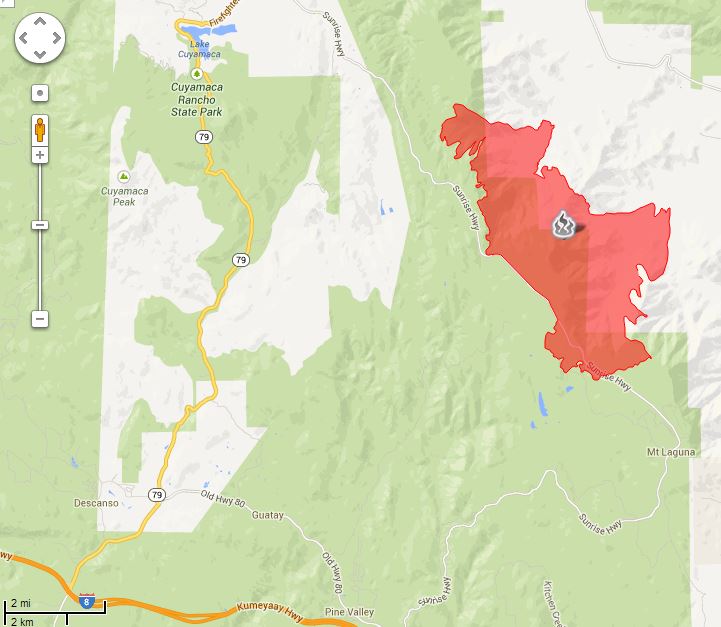
Map showing heat detected by a satellite on the Chariot Fire at 2:20 a.m. PT July 8, 2013. The icons representing heat can be as much as a mile in error.

The map of the Chariot Fire above shows heat detected by a satellite at 2:20 a.m. Monday.

The San Diego Union has some photos of firefighters from the U.S. Forest Service’s Descanso Engine Crew watching the fire from the top of the hill. The slopes below are far too steep on which to attack a rapidly moving fire.

CAL FIRE arrests Yosemite Lakes Park area arson suspects

Kenneth Alan Jackson
Kenneth Alan Jackson. Madera County Sheriffs Office photo.

After a rash of suspicious fires, CAL FIRE law enforcement officers Tuesday night arrested a Yosemite Lakes Park couple on suspicion of dozens of arson fires. Kenneth Alan Jackson, 40 and Allison Marie Waterman, 46, both of Coarsegold, were booked into the Madera County Jail for arson. Jackson is being charged with 31 counts of arson, resisting arrest, as well as attempted battery on a peace officer. Waterman was booked on a single charge of arson.

“The Yosemite Lakes Park community has been threatened by countless wildfires over the past several months that we believe were a result of arson,” said Chief Nancy Koerperich, CAL FIRE Unit Chief for the Madera-Mariposa-Merced Unit. “We appreciate the community’s support and assistance as we worked to track down these suspects.”


Thanks go out to Ken