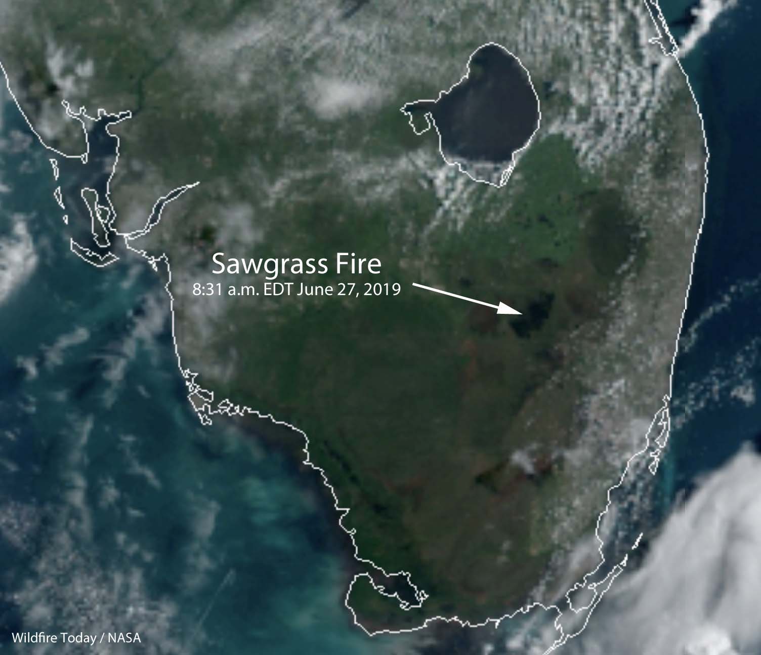
The catastrophe may have been an indirect effect of the COVID-19 pandemic. Over 7,300 unused rental cars were stored in a grassy field.
Continue readingExplosive target at gender reveal party turns into 10-acre wildfire
From CNN, April 4, 2020:
A gender reveal party in Florida went wrong and sparked a 10-acre fire, CNN affiliate WESH reported. Firefighters were called to a home in Brevard County, Florida, last weekend after reports that a blaze was possibly ignited by fireworks, fire officials said. But when they arrived, firefighters realized some explosives had been in the mix.
“We were informed that it was caused by a gender reveal using Tannerite and a weapon,” Brevard County Fire Rescue Chief Mark Schollmeyer told WESH. Tannerite is a highly explosive substance often used as a rifle target.
The county had been under a burn ban, including outdoor activities such as campfires, bonfires and trash burning, because of the dry conditions in the region. The order comes with a fine of up to $500. It’s unclear whether anyone faced a fine.
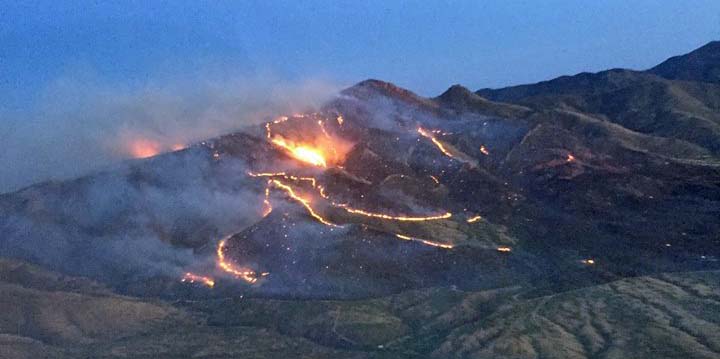
A gender reveal party in Arizona in 2017 ignited the 46,000-acre Sawmill Fire when an off-duty Border Patrol agent shot a Tannerite explosive target. The agent pleaded guilty and was ordered to make an initial payment of $100,000, then make monthly payments after that. According to the Arizona Daily Star and the Green Valley News, he agreed in court to pay $500 a month for the next 20 years, which adds up to $120,000, for a total of $220,000. He was also sentenced to 5 years of probation and agreed to participate in a public service announcement with the U.S. Forest Service concerning the cause of the Sawmill fire.
Exploding targets consist of two ingredients that when mixed by the end user explode when shot by a high-velocity projectile. After the ingredients are combined, the compound is illegal to transport and is classified as an explosive by the Bureau of Alcohol, Tobacco, Firearms, and Explosives. Exploding targets have caused many fires since they became more popular in recent years, have been banned in some areas, and caused the death of at least one person.
Over 3,500 rental cars destroyed by fire at Fort Myers Airport
The vehicles were stored in a grassy field
Continue readingWTREX provides prescribed fire training for women
Women-in-Fire Prescribed Fire Training Exchanges are supported by TNC, USFS, and DOI
Continue readingMiami has armored vehicle for high water, high winds, & active shooter incidents
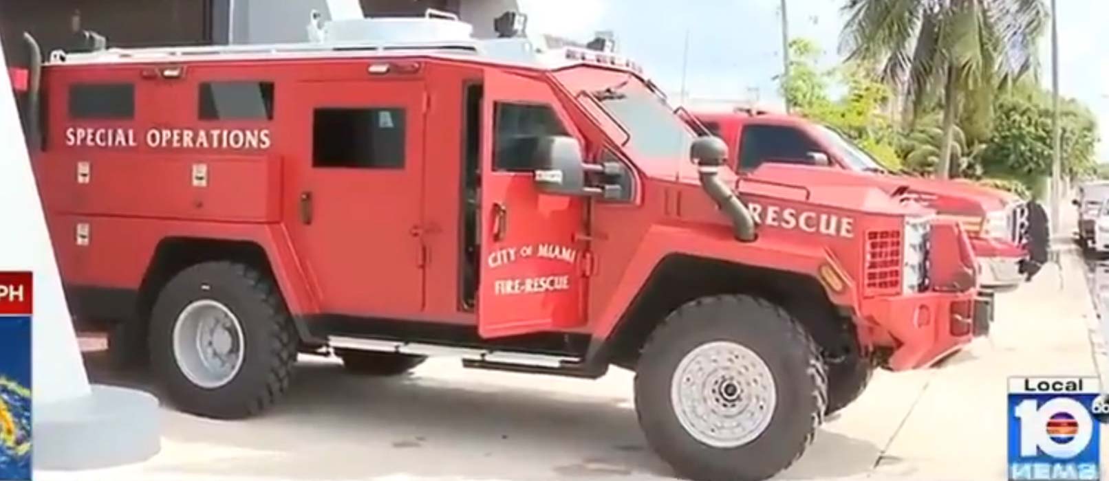
The Miami Fire Department has acquired an armored truck that can be used for incidents involving high winds, high water, and active shooters. Since we are seeing more of these types of emergencies it might be very useful.
The video lays out the details, including the body armor labeled “FIRE”.
Watch this vid. Introducing the #MedCat. @CityofMiami first ever high wind rescue vehicle is ready for #HurricaneDorian2019. @WPLGLocal10 @CBoomerVazquez @CityofMiamiFire pic.twitter.com/BsPE6KQuLK
— Ken Russell Miami (@kenrussellmiami) August 31, 2019


“You’ll get to carry fire”
Looking at the experience of prescribed fire
Continue readingBurn Boss: A History of Fire and People in Big Cypress National Preserve

Above: screenshot from the video below.
Big Cypress has released their second in a series of three films about prescribed fire in the south Florida Park, titled, Burn Boss: A History of Fire and People in Big Cypress.
Here is their description:
The job of the Burn Boss is difficult. Perhaps the toughest in all of professional conservation. To be the Boss of Fire, you must be willing to take responsibility for one of nature’s most powerful forces: Fire.
Jennifer Brown and Into Nature Films worked shoulder-to-shoulder with Big Cypress National Preserve to tell the history of the National Park Service’s most accomplished fire program. With beautiful cinematography, fascinating interviews, and tantalizing story, this film highlights the colorful people and places in the wild heart of south Florida, narrated and written by Rick Anderson, a descendent of Florida pioneers. Rick has dedicated his life to the use of fire for the land.
Last month the first film in the series was released, “Fire Swamp”, that explains the relationship between fire and the swamp.
Prescribed fire at St. Vincent NWR produces massive smoke column
#USFWS #StVincentNWR implemented a #rxfire yesterday. The operation went well and the burn is being monitored. @FFS_Leon @FFS_Chipola @NWSTallahassee @NFinFlorida Pic is during implementation. pic.twitter.com/AGszejaYwj
— USFWS Fire SE (@USFWSFireSE) August 9, 2019
The manager of the Twitter account for the U.S. Fish and Wildlife Service’s St. Vincent National Wildlife Refuge wanted to make it clear that the photo was taken during the implementation of the prescribed fire.
The refuge is in the Florida panhandle, southeast of Panama City. (map)
New film reveals the untold story of fire in a swamp
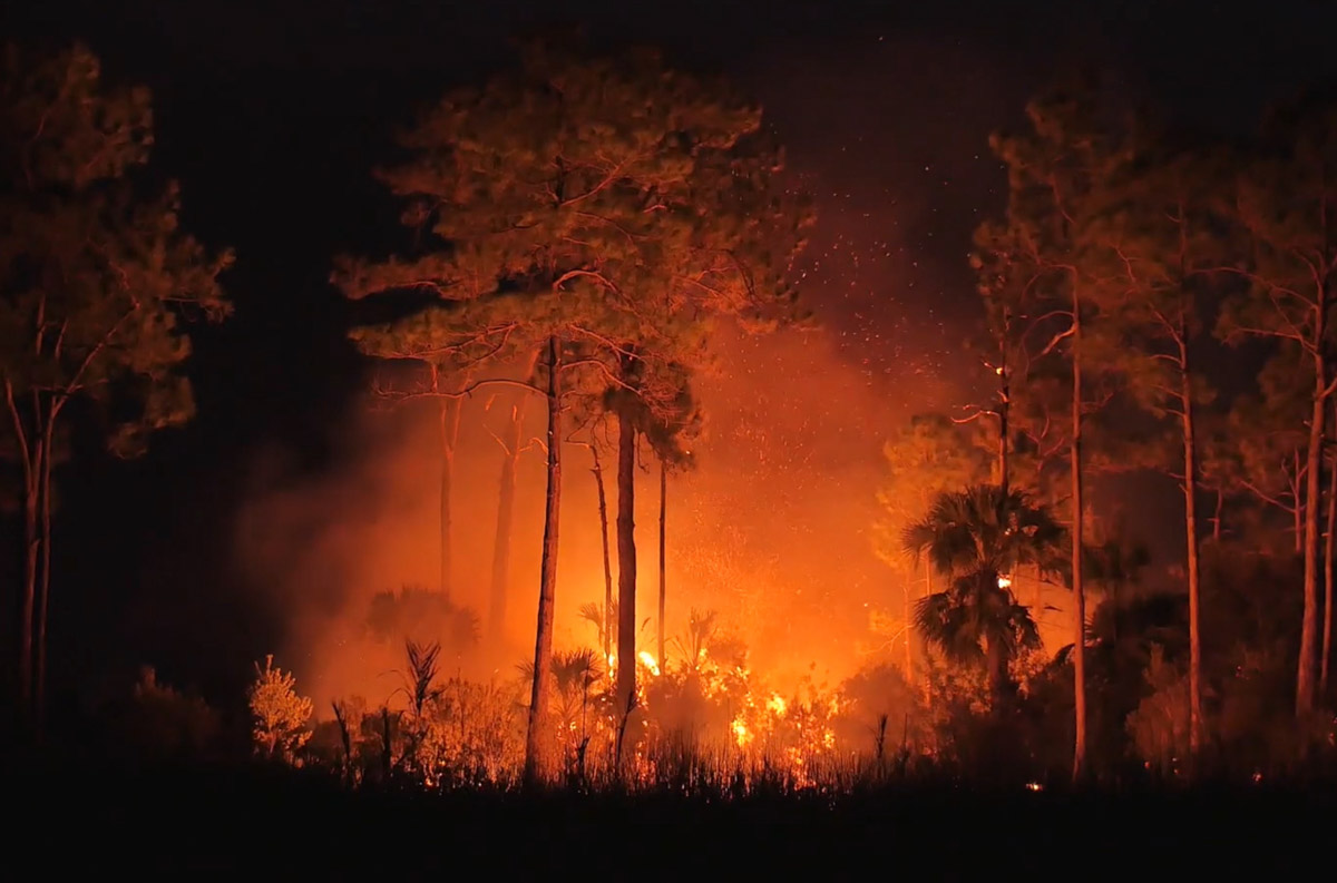
Much of Big Cypress National Preserve in south Florida is swampland. And like most areas with native vegetation it evolved with fire as a major component of the ecosystem.
Today the Preserve released a new film, “Fire Swamp,” that explains the relationship. Here is how they describe it:
‘Fire Swamp’ reveals the untold story of how fire burns in a swamp. Get a front row seat to fire flowing through our interwoven ecosystem of high and dry pinelands to cypress swamps with two National Park Service professionals who manage this dynamic ecosystem. Down here in the Big Cypress, the borders between fire, water, people, limestone, plants, and animals creates an exquisite mosaic of beauty.
Jen Brown, and recently with Rick Anderson, has been making films about fire in South Florida since at least 2012. Their company, IntoNatureFilms, has helped the land management agencies in the area interpret for the general public the value of public lands and inform them about how they are managed. More agencies around the country could learn from this approach.
Rain slows spread of 42,000-acre Sawgrass Fire in Florida
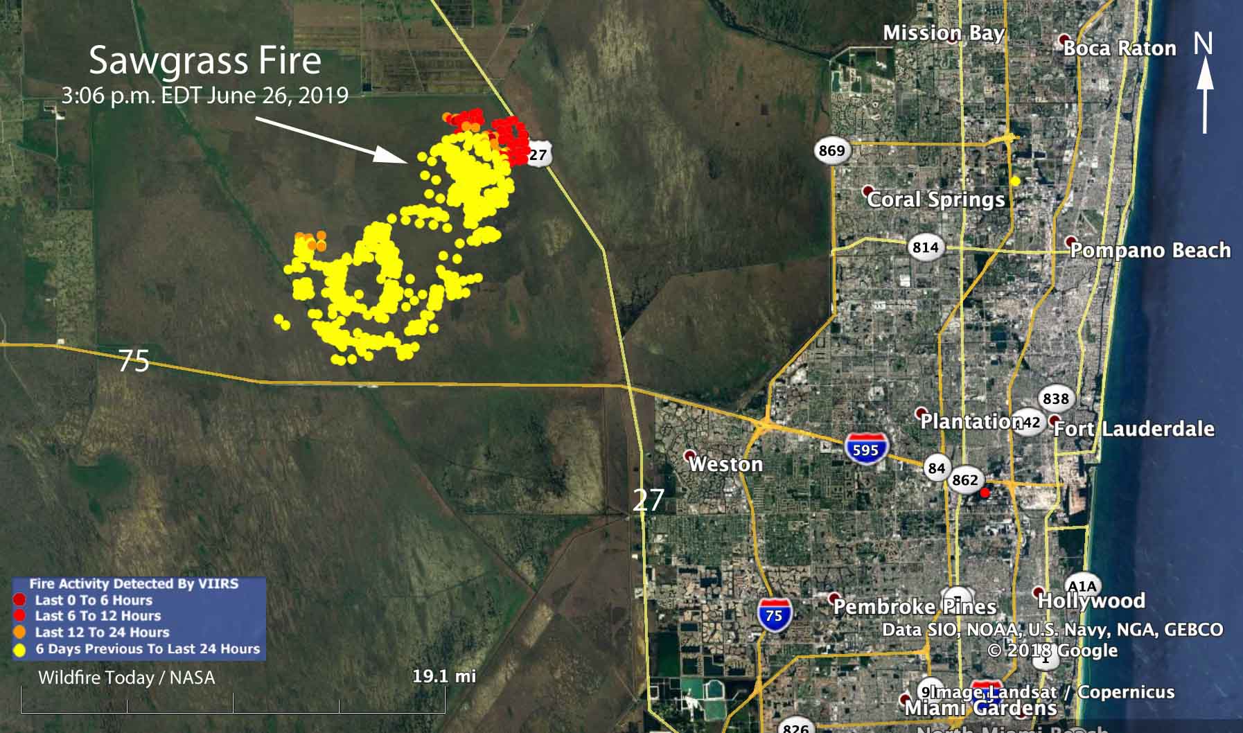
Rain off and on throughout the day on Wednesday accompanied by 97 percent relative humidity slowed the spread of the Sawgrass Fire in South Florida nine miles northwest of Weston.
Friday evening the Florida Forest Service mapped the fire at 42,000 acres. An aircraft will fly it again Thursday morning to get an updated size.
The winds Wednesday on the fire were variable, but were mostly out of the west and northwest, contrary to the forecast which predicted east or northeast winds which would have pushed the smoke away from the densely populated areas on the east side of south Florida.
As you can see on the map, the satellite detected little or no heat on the south and west sides of the fire during the Wednesday afternoon overflight. Clouds in the area prevented any later heat data from the satellite. The fire has approached State Highway 27 and the high voltage power lines on the west side of the road. This could be a result of natural spread due to the west and northwest wind, or possibly combined with a firing operation by the ten firefighters and the Type 5 Incident Commander assigned to the incident.
A weather station 15 miles northeast of the fire recorded 0.05 inch of rain Wednesday, but a couple of stations to the southwest received two or more inches, indicating thunderstorms moving through the area. There is only a 15 percent chance of rain on Thursday, but precipitation is much more likely during each of the following seven days.
If the forecast turns out to be accurate, the demise of the Sawgrass Fire seems likely in the next few days.