“You’ll get to carry fire”

Looking at the experience of prescribed fire

Prescribed fire Big Cypress National Preserve
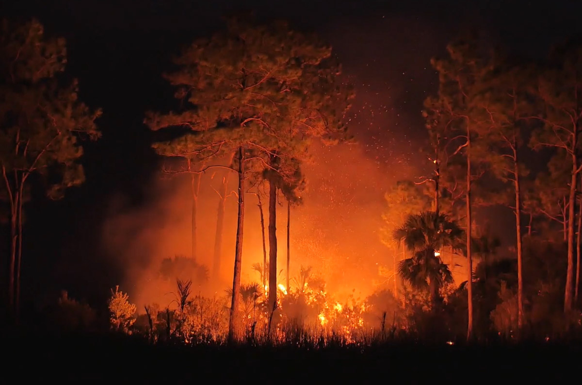
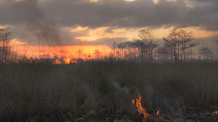
Prescribed fire at Big Cypress National Preserve video. Screenshot from NPS video below.

I assumed this third film in a series about prescribed fire at Big Cypress National Preserve in south Florida would be strictly that, prescribed fire. But it took an unexpected turn highlighting the unheralded and under-appreciated federal employees — firefighters — without whom there would be no fire management program in the National Park Service and several other agencies.

In the film there is no off screen narrator that drives that point, but instead there are interviews with two firefighters who obviously cherish the work they do. As a former firefighter, (is anyone ever a FORMER firefighter?) I could relate to the sentiment. They didn’t mention the money they make, which is a fraction of what they could make doing more, uh, normal work. But they conveyed the satisfaction in what they are accomplishing, both personally and for the natural resources.

“We’re here to manage the land and we have that responsibility as a human to do that.”
Megan Hurrell, Firefighter and Fire Effects Monitor at Big Cypress National Preserve

I don’t know if it was one of the producers’ objectives, but the film could serve as an effective recruitment tool.

“I went to my first fire and I knew right then. It’s kinda like when people say you meet the love of  your life it was kind of like that. It was — wow! That was good work, that was hard work. I’m filthy. I feel good about myself, I’m doing something that’s right. I’m comfortable with that and I’m in awe with it.”
Jay Thatcher, Burn Boss at Big Cypress National Preserve

When I was a Fire Management Officer and Burn Boss, occasionally a high-ranking person in the agency would attend a prescribed fire that was in progress. If they were near the action they wore personal protective equipment and I often put a drip torch in their hands and let them participate in ignition, under close supervision, of course. Sometimes it was difficult to get the drip torch back. They had a different perception of prescribed fire after that experience.

Recently a mom was encouraging her eight-year old son to serve in their church as an acolyte, with part of the duties being lighting candles at the alter. She told him, “You’ll get to carry fire,” then she looked at me and smiled.

For Megan and Jay in South Florida it’s in their job description. Sometimes wildland firefighters hear, “You’ll get paid in sunsets.” Well, that, and, you’ll get to carry fire.

Burn Boss: A History of Fire and People in Big Cypress National Preserve

Above: screenshot from the video below.

Big Cypress has released their second in a series of three films about prescribed fire in the south Florida Park, titled, Burn Boss: A History of Fire and People in Big Cypress.

Here is their description:

The job of the Burn Boss is difficult. Perhaps the toughest in all of professional conservation. To be the Boss of Fire, you must be willing to take responsibility for one of nature’s most powerful forces: Fire.

Jennifer Brown and Into Nature Films worked shoulder-to-shoulder with Big Cypress National Preserve to tell the history of the National Park Service’s most accomplished fire program. With beautiful cinematography, fascinating interviews, and tantalizing story, this film highlights the colorful people and places in the wild heart of south Florida, narrated and written by Rick Anderson, a descendent of Florida pioneers. Rick has dedicated his life to the use of fire for the land.

Last month the first film in the series was released, “Fire Swamp”, that  explains the relationship between fire and the swamp.

Prescribed fire at St. Vincent NWR produces massive smoke column

The manager of the Twitter account for the U.S. Fish and Wildlife Service’s St. Vincent National Wildlife Refuge wanted to make it clear that the photo was taken during the implementation of the prescribed fire.

The refuge is in the Florida panhandle, southeast of Panama City. (map)

New film reveals the untold story of fire in a swamp

film fire Big Cypress National Preserve
A screenshot from “Fire Swamp”

Much of Big Cypress National Preserve in south Florida is swampland. And like most areas with native vegetation it evolved with fire as a major component of the ecosystem.

Today the Preserve released a new film, “Fire Swamp,” that explains the relationship. Here is how they describe it:

‘Fire Swamp’ reveals the untold story of how fire burns in a swamp. Get a front row seat to fire flowing through our interwoven ecosystem of high and dry pinelands to cypress swamps with two National Park Service professionals who manage this dynamic ecosystem. Down here in the Big Cypress, the borders between fire, water, people, limestone, plants, and animals creates an exquisite mosaic of beauty.

Jen Brown, and recently with Rick Anderson, has been making films about fire in South Florida since at least 2012. Their company, IntoNatureFilms, has helped the land management agencies in the area interpret for the general public the value of public lands and inform them about how they are managed. More agencies around the country could learn from this approach.

Rain slows spread of 42,000-acre Sawgrass Fire in Florida

map Sawgrass Fire Florida
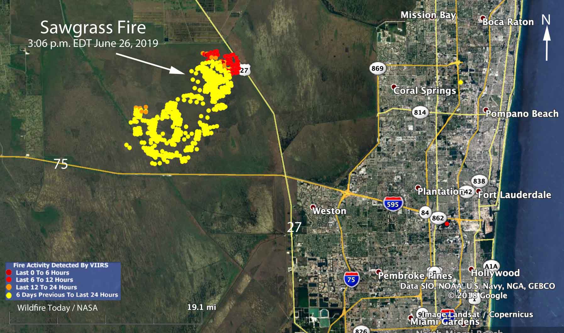
Map showing heat detected by a satellite over the Sawgrass Fire at 3:06 p.m. June 26, 2019. The red areas are the most recently burned.

Rain off and on throughout the day on Wednesday accompanied by 97 percent relative humidity slowed the spread of the Sawgrass Fire in South Florida nine miles northwest of Weston.

Friday evening the Florida Forest Service mapped the fire at 42,000 acres. An aircraft will fly it again Thursday morning to get an updated size.

The winds Wednesday on the fire were variable, but were mostly out of the west and northwest, contrary to the forecast which predicted east or northeast winds which would have pushed the smoke away from the densely populated areas on the east side of south Florida.

As you can see on the map, the satellite detected little or no heat on the south and west sides of the fire during the Wednesday afternoon overflight. Clouds in the area prevented any later heat data from the satellite. The fire has approached State Highway 27 and the high voltage power lines on the west side of the road. This could be a result of natural spread due to the west and northwest wind, or possibly combined with a firing operation by the ten firefighters and the Type 5 Incident Commander assigned to the incident.

A weather station 15 miles northeast of the fire recorded 0.05 inch of rain Wednesday, but a couple of stations to the southwest received two or more inches, indicating thunderstorms moving through the area. There is only a 15 percent chance of rain on Thursday, but precipitation is much more likely during each of the following seven days.

If the forecast turns out to be accurate, the demise of the Sawgrass Fire seems likely in the next few days.

Satellite photo Sawgrass Fire
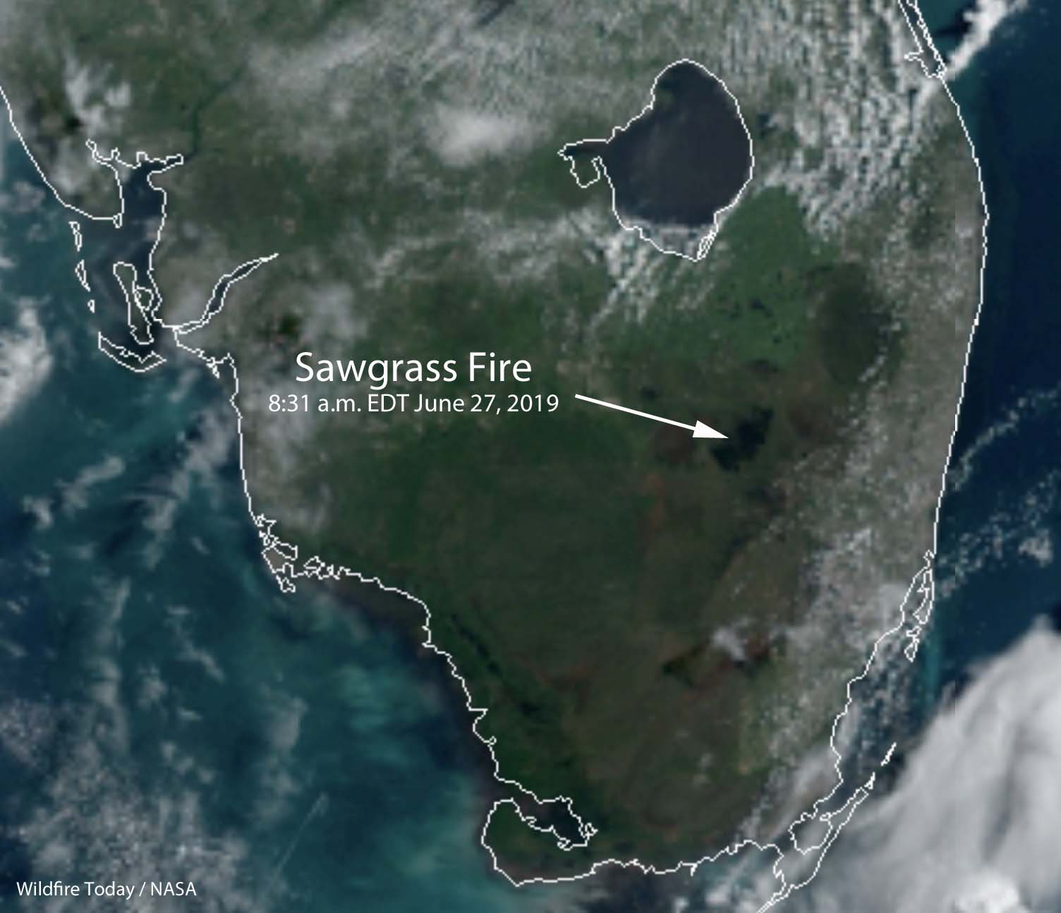
Satellite photo of South Florida at 8:31 a.m. EDT June 27. The area burned in the Sawgrass Fire is at the end of the arrow.

Sawgrass Fire in Florida briefly closes Interstate 75

The fire has burned 41,500 acres 9 miles northwest of Weston

Sawgrass Fire everglades Florida
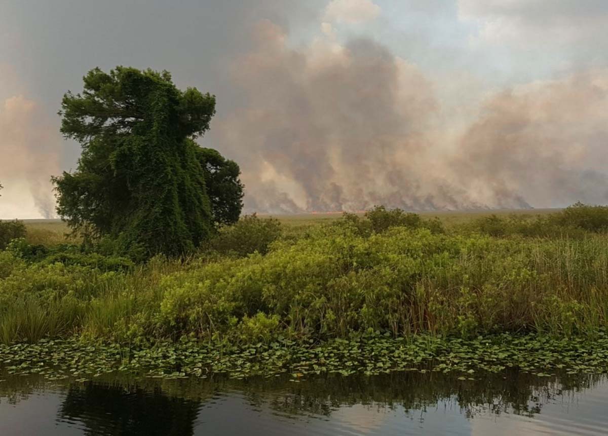
Sawgrass Fire. Photo by Florida Forest Service June 25, 2019.

(Originally published at 11:36 a.m. EDT June 25, 2019)

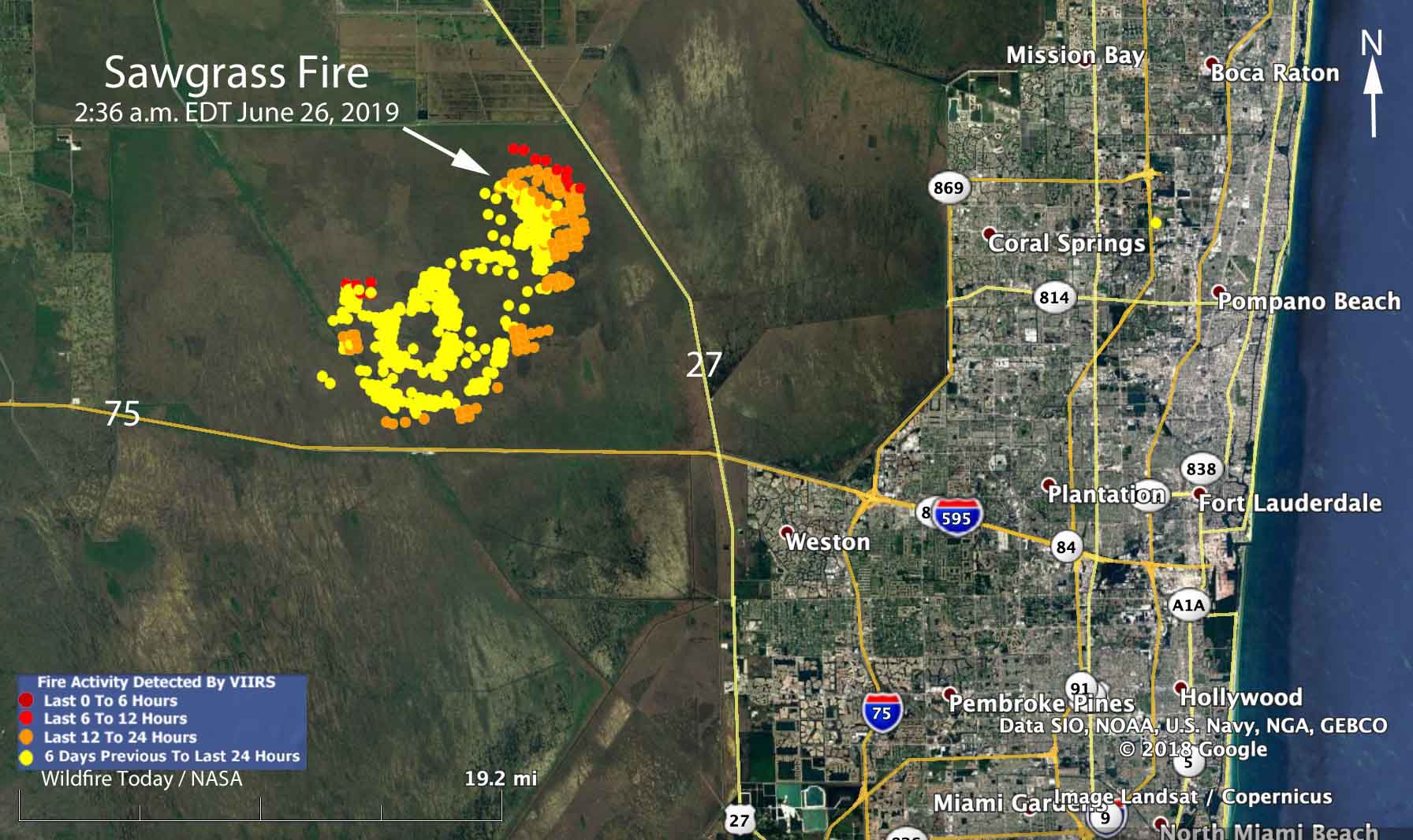
The Sawgrass Fire in the south Florida everglades required the closure of Interstate 75 for about 10 minutes Tuesday when smoke affected visibility on the highway. A light rain slowed the movement of the blaze and reduced the smoke, allowing the highway to reopen. As you can see in the map below, a satellite was still able to detect heat during a 2:36 a.m. overflight Wednesday.

map Sawgrass Fire everglades Florida
Map showing heat detected by a satellite over the Sawgrass Fire at 2:36 a.m. June 26, 2019. The red areas are the most recently burned.

Since the fire started from a lightning strike Sunday afternoon it has burned 33,500 acres of state-protected land as of Tuesday evening, according to the Florida Forest Service. The land in the area is managed by the South Florida Water Management District. (UPDATE at 2:05 p.m. EDT June 26, 2019: The Florida Forest Service has revised the estimated size to 41,500 acres.)

Four firefighters are assigned to the fire, led by a Type 5 Incident Commander.

The blaze is about one mile away from both Interstate 75 and State Highway 27. The objective is to keep the blaze within the 165,000-acre conservation area that is bordered by canals, said Scott Peterich, a spokesman with the Florida Forest Service’s Everglades District.

For the last couple of days the smoke has been moving to the northeast, somewhat sparing the community of Weston located 9 miles southeast of the fire. The forecast through Friday calls for east or northeast winds that will push the smoke away from the densely populated areas on the east side of south Florida. There is a 40 to 50 percent chance of rain Wednesday and Friday.

Check out the video of a drone flying through the fire:

Sawgrass Fire everglades Florida
Sawgrass Fire. Photo by Florida Forest Service June 24, 2019.