It had been a year since David Loveland retired as Fire Management Officer at Great Smoky Mountains National Park. On November 28, 2016 when the Chimney Tops 2 Fire burned from the park into Gatlinburg, he had been living in his home for 10 years. His goal had been to reduce the vegetation, the fuel, on the entire three acres to make it as fire resistant as possible.
When the fire approached the property between Pigeon Forge and Gatlinburg the clearing project was not complete, but the work he had done combined with his efforts as the fire burned around the structure meant he still had a place to live when the smoke finally cleared.
He tried to evacuate but the road was blocked by a tree that fell during the strong winds. He and his wife returned to the house and fought off the fire with a battery powered leaf blower and used a hose until the loss of power shut down the water system. His experience fighting fires in Yosemite National Park and other areas out west was in the back of his mind as he labored in the smoke.
…Homes dotting the top of the ridge were soon ablaze. Other residences below them were also on fire. Smoke was everywhere.
More problems. A tree limb fell over the power lines, knocking out electricity to the home and plunging the interior into darkness. The smoke detectors were going bonkers, adding to the overall chaos as Kathaleen Loveland raced about the home trying to get important items and documents together.
“I had a backup generator, but I had a problem with it that I didn’t know about until then,” David Loveland said. “I had only the water pressure that was left in the hose, and I needed that to protect the propane tank.”
That left Loveland with a leaf blower with three batteries, a hoe and a nearly powerless water hose. But, he had also prepared…
About 20 homes in Mr. Loveland’s neighborhood were destroyed. His was one of four that survived.
The fire continued to spread, killing 14 people, burning 2,013 homes and 53 commercial structures, and causing more than $500 million in damage.
Don Jacobs of the Knoxville News Sentinel has written a well researched article about the Chimney Tops 2 Fire that burned into Gatlinburg, Tennessee on November 28. The fire was monitored but not suppressed for five days until a predicted wind event pushed the fire into the city, killing 14 people, destroying 2,013 homes and 53 commercial structures, and causing more than $500 million in damage.
In addition to talking with Great Smoky Mountains National Park personnel in an attempt to determine what actions were taken on the fire, Mr. Jacobs interviewed four former wildland firefighters to gather information about how wildfires are typically managed.
Officials should have doused a 1.5-acre fire in the Great Smoky Mountains National Park days before high winds created a megafire that swept into Gatlinburg, former U.S. Forest Service firefighters said .
At the very least, said retired employees with almost 200 years of firefighting experience, officials in the National Park should have summoned every resource available when alerted Nov. 26 of the expected high winds.
“I’ve written for years that the best way to keep fires from becoming megafires is to attack them with overwhelming force, both on the ground and from the air,” said Bill Gabbert, who writes an online blog about wildland fires and aviation resources to battle wildland fires.
“People say that is very expensive, but it is not as expensive as losing 14 lives and $500 million in lost structures.”
Gabbert has written three articles on wildfiretoday.com about the Gatlinburg fires, providing technical data about fire conditions and aerial resources available to firefighters.
Four other former U.S. Forest Service firefighters agreed park officials didn’t pay attention to the severe drought, low humidity that provided a tinderbox for flames, available options to quell the slow-moving fire before winds made the flames uncontrollable and alarming weather forecasts.
Mr. Jacobs quoted the park’s Superintendent, Clay Jordan, as saying:
There was no way the fire could have been extinguished before the winds came.
The fire started on November 23, 2016. On November 27, two days before the fire burned into Gatlinburg killing 14 people, destroying 2,013 homes and 53 commercial structures, and causing more than $500 million in damage, there were three large air tankers parked at Chattanooga, Tennessee, 105 miles southwest of the fire; two RJ85’s and one C-130Q. But the air tankers were not used on the fire.
Air Tanker 131 (in the foreground) a C-130Q, and two RJ-85 air tankers, at Chattanooga, Tennessee November 27, 2016. Photo by Antonio More’.The only aircraft used before the fire burned into the city was a helicopter in the afternoon of November 27, which was replaced a few hours later by two other helicopters. They were refilling their water buckets at Fontana Lake. The 26-mile round trip to refill with water greatly reduced the amount of water delivered to the fire, compared to how much could have been dropped if a closer water source had been created or used.
Normally aviation resources do not put out a fire, but they can sometimes slow down the spread until ground resources can move in to construct direct fireline around the perimeter, removing the vegetation, or fuel, and preventing it from growing. But if firefighters are not allowed to directly access the fire’s edge due to a perceived safety issue, very large amounts of water or fire retardant can be applied from the air that in some cases can virtually put out a small fire. Or, pause the spread until rains arrive — like it did late in the day on November 28.
Another alternative to directly attacking a fire is to construct firelines some distance away, or use natural barriers, and intentionally burn out the vegetation between that line and the fire, stopping the spread. This was not done during the five days before the fire burned into Gatlinburg as the fire grew from 5 to 35 acres during that period.
Wind speeds
Strong winds can not only cause a fire to grow quickly, but they can also make the use of air tankers and helicopters impossible. Any retardant or water dropped can be blown far off target, making it ineffective. And, strong gusty winds can make it unsafe for aircraft flying low and slow over rough terrain.
There were times between November 23 and 28 when the wind speeds were too high to allow the use of aircraft.
Wind speeds at Cades Cove and Cove Mountain, November 23-29, 2016. .The data in the charts above, supplied by Great Smoky Mountains National Park, was recorded at Cades Cove 20 miles west of the fire, and Cove Mountain 8 miles northwest of the fire. It shows that the winds would have allowed the safe and effective use of aircraft during the daylight hours from early afternoon on November 24 through sundown on November 27. But they were not used except for the helicopters during the afternoon of November 27. The wind was far too strong on November 28 and 29 for aircraft.
Energy Release Component (ERC)
The ERC is calculated daily at Fire Weather Stations around the United States. It is a number related to the available energy (BTU) per unit area (square foot) within the flaming front at the head of a vegetation fire. Daily variations in ERC are due to changes in moisture content of the various fuels present, both live and dead.
Energy Release Component, Tennessee mountains.The average ERC for the Tennessee mountains in late November is 16 to 20. The 97th percentile is 40, meaning 97 percent of the time it is lower than that number. Since early September it had mostly been above the 90th percentile and was above the 97th percentile during much of November. The day the fire started the ERC was 41, and in the following days was higher, reaching 50 at one point which was the highest ever recorded on that date in the 23-year history of data from that weather station.
When the ERC is above average, and especially when it is higher than the 90th or 97th percentile, fires spread more quickly, burn deeper into the duff and organic material on the forest floor, and exhibit more resistance to control.
The ERC, along with other indicators, is often used as a planning tool to preposition firefighting resources, increasing their numbers in areas where large fires are expected. Days off for firefighters can be cancelled and prescribed fires postponed.
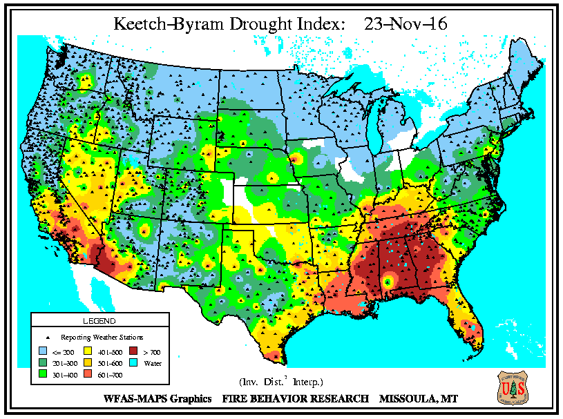
On December 5 we wrote about the Keetch-Byram Drought Index (KBDI), an indicator of drought and its effect on how wildfires burn. On November 23 when the fire was discovered the KBDI was very high, 599, Molly Schroer, a spokesperson for the fire’s Incident Management Team told us. For reference, 600 or above would indicate severe drought and increased wildfire occurrence. Intense, deep burning fires with significant downwind spotting should be expected under those conditions.
Many fire managers, when informed about a new fire under those KBDI and ERC conditions, would have attacked it immediately and aggressively with overwhelming force, from both the air and the ground.
Above: Structures damaged or destroyed in the Chimney Tops 2 Fire and other fires in the Gatlinburg, Tennessee area.
Fire suppression activities on the Chimney Tops 2 Fire at Gatlinburg, Tennessee are winding down as firefighters continue to increase their control of the 17,006-acre fire that burned into the nearby communities. The fire resulted in the deaths of 14 people and damaged or destroyed 2,460 structures.
The park opened several roads to the public on Friday including US 441, Newfound Gap Road from the Gatlinburg Entrance to Cherokee, NC, Little River Road, the Spur between Pigeon Forge and Gatlinburg, and the Gatlinburg Bypass.
On Saturday the Type 1 Incident Management Team was released and the South Atlantic Incident Management Team assumed command.
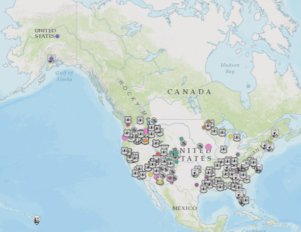
Map showing the home units of the personnel that have worked on the Chimney Tops 2 Fire in Tennessee. It only includes folks ordered through the Resource Ordering and Status System, but not local firefighters in the Gatlinburg area. The full, zoomable map can be seen here.
The number of firefighting resources has decreased and now includes 8 hand crews, 17 engines, 1 helicopter, and 1 water tender, for a total of 306 personnel.
Public meeting, uploaded by the Incident Management Team December 9, 2016.
This WBIR video explains the various systems for communicating emergency messages, such as evacuations, to the public, and why they did not work very well as the Chimney Tops 2 Fire burned into Gatlinburg, Tennessee last week.
There are multiple emergency alert systems but according to WBIR the one used by the National Weather Service can only push an emergency message to cell phones for one of the following situations: tornado, flash flooding, extreme wind, hurricane, typhoon, dust storm, or tsunami. Wildfire is not on the list, which seems, especially in retrospect after Gatlinburg, to be a serious oversight.
It is a good lesson that could be learned by communities at risk from wildfire and other emergencies.
Above: The Drought Monitor issued November 29 showed “Exceptional Drought”, the highest category, for the Gatlinburg area and large sections of Tennessee, Georgia, Alabama, North Carolina, and South Carolina.
On Monday, December 5, the Incident Management Team (IMT) on the Chimney Tops 2 Fire that burned from Great Smoky Mountains National Park (GRSM) into the Gatlinburg area reported that it has caused the deaths of 14 people. Over 130 sustained injuries, and 1,684 structures have been damaged or destroyed. Approximately 14,000 residents were originally forced to evacuate.
There are three broad categories of conditions that affect the way a wildfire burns: weather, fuels (vegetation), and topography. When the Chimney Tops 2 Fire burned into Gatlinburg on November 28, 2016 and destroyed those structures it was driven primarily by weather — specifically, very strong winds.
But the condition of the fuel was also important since it happened during what the National Weather Service (NWS) calls “exceptional drought” conditions. Much of the southeastern United States had been suffering extremely dry conditions for two to three months.
One indicator of drought and its effect on how wildfires burn is the Keetch-Byram Drought Index (KBDI). (The fire was in eastern Tennessee near the North Carolina border.)
We have asked for a standard KBDI graph usually used by fire managers showing the 2016 KBDI, the average KBDI by date, and the maximum recorded by date. When we receive it, we will add it to the article.
On November 23 when the fire was discovered the KBDI was 599, Molly Schroer, a spokesperson for the IMT told us. For reference, 600 or above would indicate severe drought and increased wildfire occurrence. Intense, deep burning fires with significant downwind spotting should be expected. A fire burning under those conditions would likely burn more intensely, have a rate of spread faster than normal, and have more resistance to control. Many fire managers in that situation would immediately attack emerging fires very aggressively with overwhelming force, that is, many firefighters on the ground assisted by numerous aircraft dropping water or fire retardant.
Ms. Schroer said she was not aware of any actual on-the-ground fire suppression efforts, other than perhaps some work on a distant indirect fireline, until Monday November 28, after the fire had grown large and crossed US Highway 141, the main road into the park. That is when it began moving rapidly toward Gatlinburg. Firefighting aircraft were not used until helicopters dropped water on the fire Sunday afternoon, November 27 four days after it started.
Wednesday, November 23, the day the fire started
At about 5:20 p.m. the fire was discovered near the top of a steep hill called Chimney Tops not far from where another fire occurred about a week before. GRSM firefighters spotted the new fire as they returned from responding to a report of a vehicle fire. The earlier fire on the hill was named “Chimney Tops” — hence the name “Chimney Tops 2” for the new blaze.
According to Ms. Schroer, firefighters walked up the Chimney Tops Trail to the top of the hill to size it up. But very little if any fire suppression activity occurred until Monday, November 28. The action taken by firefighters on Monday was defensive, to protect threatened structures at a nearby National Park Service picnic ground.
Investigators have determined that the fire was human-caused and are asking for information from anyone who has information about people or vehicles that were seen in the area that day. The Tip Line is 888-653-0009.
Narrowing it down to human-causes is easy for an investigator. It means they eliminated natural causes, such as lightning and volcano eruptions. The fire could have been accidental, or it may have been intentional.
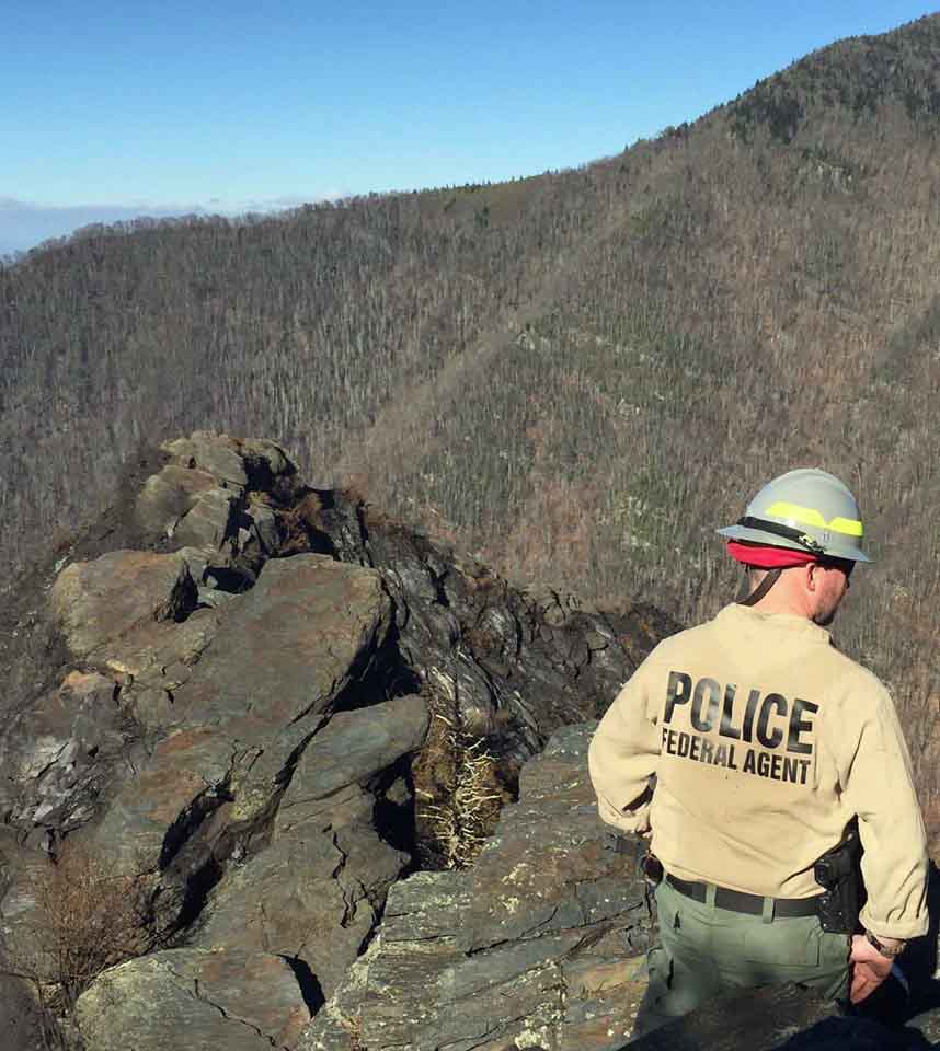
An investigator from the National Park Service’s Investigative Services Branch looks for evidence at Chimney Tops. NPS photo.
Above: Map showing the perimeter of the Chimney Tops 2 Fire at Gatlinburg, Tennessee as of 11 p.m. ET December 1, 2016.
(UPDATED at 4:12 p.m. ET, December 2, 2016)
Today for the first time since Gatlinburg was evacuated residents will be allowed into the city to access their property. They can enter the area between 10 a.m. and 5 p.m. today through December 6th.
According to CNN the number of confirmed fatalities has increased to 13:
Of the 13 who died, 12 were killed in the fires, and one person died of a heart attack after fleeing and being exposed to smoke, [Sevier County Mayor Larry] Waters and the county’s assistant medical examiner, Dr. Vincent Tolley, said.
The estimated number of structures destroyed officially remains at 700; it is likely that will change after the surveys are complete.
The Chimney Tops 2 Fire that burned into the city on November 29 has been mapped at 17,859 acres. Firefighting resources assigned to the fire include 17 hand crews, 31 engines, 6 helicopters, and 5 dozers for a total of 458 personnel.
Above: Thursday’s satellite photo shows no large quantities of smoke from wildfires in the southern states. NASA/Wildfire Today.
Thanks to the soaking rains over the last three days the satellite photo taken Thursday shows no large concentrations of smoke from wildfires in the southern states. Of course this photo was taken from hundreds of miles overhead and would not be capable of detecting smoking logs, stump holes, and the smouldering remains of burned structures at Gatlinburg, Tennessee.
And it does not mean the fires are out. Firefighters may still need to construct firelines around the perimeters of the fires and suppress still-burning materials that are near the fire’s edge.
The very dry soils and vegetation desiccated by the two-month drought will quickly soak up some of the precipitation making it less effective in suppressing a fire than it would have been if the weather had been closer to normal in recent months.
The Southern Area Coordination Center reported Thursday morning only two fires that were still spreading — the Chimney Tops 2 Fire at Gatlinburg, TN (+1,455 acres) and the Camp Branch Fire 9 miles west of Franklin, NC (+212 acres).
Chimney Tops 2 Fire at Gatlinburg
There are no major changes in the information provided by officials about the Chimney Tops 2 Fire. The estimated number of structures burned remains at 700 and they are still reporting 7 confirmed fatalities. The size is 17,108 acres.
A mandatory evacuation is still in effect for most of the City of Gatlinburg.
Great Smoky Mountains National Park is closed from the Gatlinburg entrance along Highway 441 to Smokemont, near Cherokee, North Carolina. Cades Cove and Oconoluftee Visitor Centers reopened Thursday.
The incident management team disclosed information about another fire they are managing east of the Chimney Tops 2 Fire. The name of this fire is unclear, but it is reported to be in the Cobbly Nob area.