9:58 a.m. PDT October 21, 2021

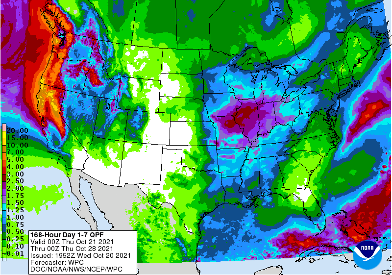
Forecasts are still being fine-tuned, but it appears likely that areas of Northern California, Oregon, and Washington will receive huge amounts of precipitation over the next seven days, with portions of Northern California getting more than 10 inches.
At least four waves of atmospheric rivers are barreling across the Pacific targeting the West Coast. The animated GIF below illustrates the progression of these “rivers.”

Predictions are subject to change, but the first band, beginning Thursday morning, will have the heaviest impacts in WA, OR, and northwest CA.
Sunday morning will bring another, centered in Central California.
The third wave will start to come through Tuesday, with the heaviest precipitation expected in Northern CA and OR.
The forecast could change over the next seven days, but the prediction is that another wave will primarily impact OR and WA on Thursday, Oct. 28.
With it already being the second half of October, it is likely that these atmospheric rivers will bring an end to the wildland fire season in Washington, Oregon, and Northern California. Most of Southern California south of Santa Barbara is expected to receive less than a half inch of precipitation, so if the rest of of the year there is warm, dry, and windy the area could still see more wildfire activity.
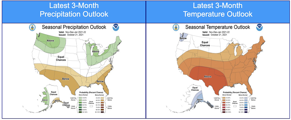
The three-month temperature and precipitation outlook issued today predicts November through January conditions in SoCal that will be warmer and drier than average. But if significant precipitation occurs in the next seven days, it would require some serious Santa Ana wind events to dry the soils and vegetation enough to enable large fires to occur.

