Beth Lund, Incident Commander on the Beaver Creek Fire

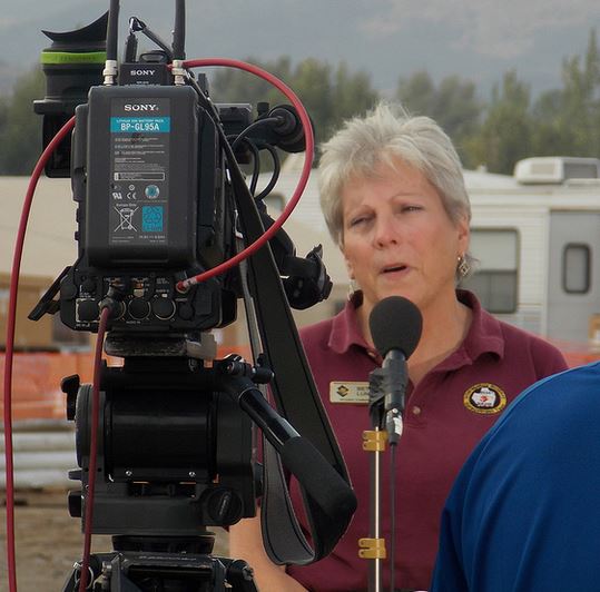
Beth Lund, Incident Commander
Beth Lund, Incident Commander. Incident Management Team photo.

Beth Lund is one of two female Incident Commanders on Type 1 Incident Management Teams, the largest and most capable teams that run large incidents. Jeanne Pincha-Tulley is the other.

Ms. Lund’s Type 1 Team has been managing the Beaver Creek Fire near Ketchum, Idaho which is one of the fires getting a lot of national media attention due to the number of acres burned, 111,000, and the movie stars homes that have been threatened by the fire. The Idaho Mountain Express has an article about her. Here is an excerpt:

In the modern world of firefighting, mavericks are discouraged, a strong and flexible mind excels and only quiet competence is rewarded.

It’s in this world that a 58-year-old woman, who is halfheartedly eyeing a retirement in which she will learn to quilt, has risen to become the face of fire news at its best and worst.

She is one of only two women in the already tiny national cadre of 16 U.S. Forest Service Type I incident commanders—the people who try to tame the most complicated wildland fires.

“My policy is to tell what I know and to tell the truth while being mindful that we don’t want people to hear it from the news first,” says Beaver Creek Fire Incident Command Leader Beth Lund.

She’s been the calm center in a relentless stream of media and public inquiry since arriving nearly two weeks ago to manage and expand the efforts to repel the fire that threatened the length of the Wood River Valley.

Even in the diciest moments as she bounces from gathering recon to live TV on demand, to fielding questions from strangers, with nearly every step she takes, she remains unflustered—even when she delivers unsavory news.

Traci Weaver and Beth Lund
Traci Weaver and Beth Lund accept a card from the Wood River community. Incident Management Team photo.
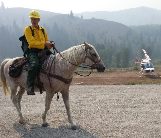
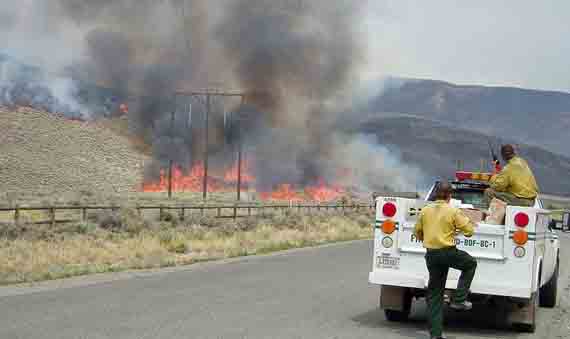
Burnout operation on the Beaver Creek Fire
Burnout operation on the Beaver Creek Fire. Incident Management Team photo.


Idaho: multiple fires east of Boise

(UPDATE at 10:50 a.m. MDT, August 19, 2013)

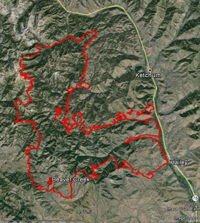
Map of Beaver Creek fire
Map of Beaver Creek Fire at 1 a.m. MDT, August 19, 2013

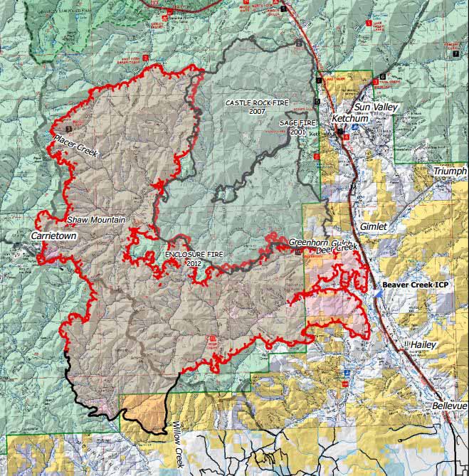
The Beaver Creek fire has not spread as much in the last two days as it did last week. This is due in part to the fire hitting the footprint of the 2007 Castle Rock Fire west of Ketchum, which can be seen on the map below posted on August 17.

The interior of the fire was active Sunday and there was some fire growth on the north and south ends of the fire. Red Flag conditions, including higher temperatures and wind gusts to 38 miles per hour, increased fire activity on the Beaver Creek Fire Sunday afternoon and evening. 1,150 firefighters working with 10 helicopters and 8 bulldozers expanded fire lines while large unburned areas within the fire lines and along the north and south edges of the fire sent columns of smoke 15,000 feet into the air. The fire is now 104,457 acres in size

The fire area is under a Fire Weather Watch on Monday.

Beaver Creek Fire
Beaver Creek Fire, old school and new school. InciWeb photo.

****

(UPDATE at 1:33 p.m. MDT, August 17, 2013)

Map of Beaver Creek fire at 2 am MDT, August 17, 2013
Map of Beaver Creek fire at 2 a.m. MDT, August 17, 2013 (click to enlarge)

Extreme fire behavior occurred on the Beaver Creek Fire again on Friday, prompting additional evacuations, preevacuation warnings and the ordering of additional resources. The fire was active in the Greenhorn Gulch, Deer Creek, Dollarhide, and Baker Creek areas. The Baker Creek head of the fire produced a massive pyrocumulous column, while fire whirls, torching trees, and crown fire were visible from Hailey and the Highway 75 corridor leading to Ketchum.

At least one home, a bunkhouse and five other structures have been destroyed. However, the exact number of structures destroyed or damaged on August 15 is unknown. At least one primary residence was destroyed and there was damage to several others. The bridge on FS road 227 which connects Ketchum and Fairfield was destroyed. The loss of multiple outbuildings is certain. One Remote Automatic Weather Station (RAWS) was also destroyed.


Continue reading “Idaho: multiple fires east of Boise”

Idaho’s Minidoka Complex keeps scoopers busy

Beth Lund’s Type 1 team members and local officials met last night with community members at Howells Opera House in Oakley to discuss the Minidoka Complex. The Times-News reported that fielded questions included a discussion of restoring burned grazing allotments and the timeframe for lifting imposed evacuations.

Lund said the team is optimistic they can contain the fires within a couple days. She said the recent rains will help with suppression efforts. The Cave Canyon Fire, the largest in the complex, has grown by more than 34,000 acres in a day. She said it’s made repeated downhill runs at night.

Scott Nannenga with the Minidoka Ranger District told ranchers that burned grazing allotments will be rested, but that the fire’s effects will have longterm benefits. Other area officials told the crowd that plans are under way for post-fire rehab.

Lund said decisions are pending for the dates that evacuated residents can return to their homes. “We don’t want to let you back and then have to take you back out again,” she said.

The team reported last night that evacuations and extreme fire runs have prompted their requests for critical resources.

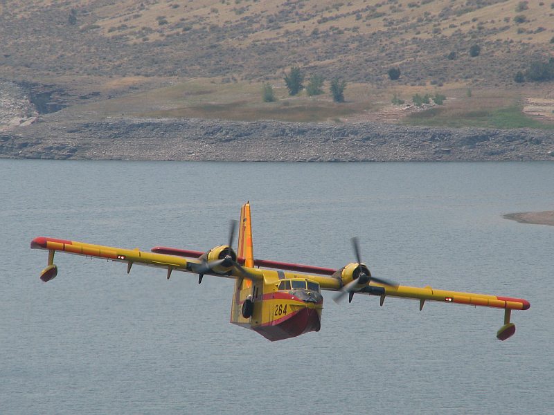
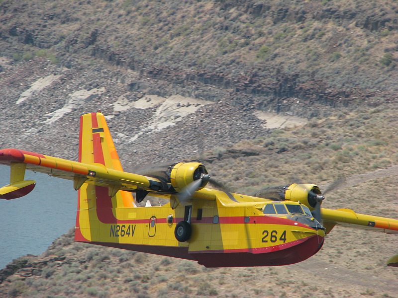
CL-215 on a run over Goose Creek Reservoir southwest of Oakley early afternoon on 08/11/2012.
One of Aero-Flite’s CL-215s on a run over Goose Creek Reservoir southwest of Oakley early afternoon on 08/11/2012. Photo © 2012 Jack Belk

Reservoirs both north and south of the fire were evaluated and approved for scooping runs by CL-215 aircraft, but that the lack of other ordered resources has resulted in fire growth in all directions. Containment objectives have been compromised by the lack of a Type 3 high performance helicopter.

CL-215 over Goose Creek Reservoir
One of Aero-Flite’s CL-215s on a run over Goose Creek Reservoir southwest of Oakley early afternoon on 08/11/2012. Photo © 2012 Jack Belk

The fires on the complex have burned with high intensity and have been extremely active, with running and torching in the conifer portions of the fires. Flamelengths have gone to 50 feet in some fuel types, with short-range spotting in all fuel types. Roads and natural barriers, fire managers said, can’t be relied upon to check the fire’s spread. The Cave Canyon Fire last night was at 80,012 acres, the Deer Hollow Fire was at 4,027 acres, the Eight Mile Fire was at 211 acres, and the Hot Well Fire was estimated at 8,056 acres.

Four CL-215s on the ramp at Kalispell 08/10/2012
Four CL-215s (two owned by Aero-Flite and two from the State of Minnesota operated by Aero-Flite) on the ramp 08/10 at Great Falls, Montana. The two Minnesota scoopers were headed for Moses Lake, and the Aero-Flite pair were en route to the Minidoka Complex. Photo © 2012 Tony Duprey