Range Fire at Orem, UT started from target shooting at police gun range

October 19, 2020   |   2:58 p.m. MDT

Range Fire
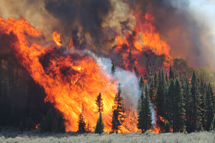
A DC-10 drops retardant on the Range Fire at Orem, Utah October 18, 2020. Photo by @bleewilliamson

Investigators have determined that the 3,450-acre Range Fire at Orem, Utah was started by target shooting at the police department’s gun range on the east side of the city. The police officer who was present is cooperating with investigators.

Range Fire origin

From the Incident Management Team, Monday, October 19, 2020:

“Fire activity on the Range Fire was minimal overnight, growth was significantly slowed by natural features. Firefighters completed a successful burn out operation last night to secure the southeast corner of the fire. Today, firefighters will be constructing hand line directly along the western perimeter of the fire. Crews will continue to mop up along the heel of the fire. Aircraft will assist ground resources by dropping water on hot spots as needed in areas where the terrain is too steep for firefighters to safely access.”

Resources assigned include 6 hand crews, 14 fire engines, and 6 helicopters for a total of 150 personnel. The estimated cost to date is $300,000.

Range Fire, Oct. 18, 2020 Orem Utah
Range Fire, Oct. 18, 2020. Photo by @tomigotchiii

Chaos on Interstate 15 as wildfire snarls traffic in Utah

Cottonwood Trail Fire
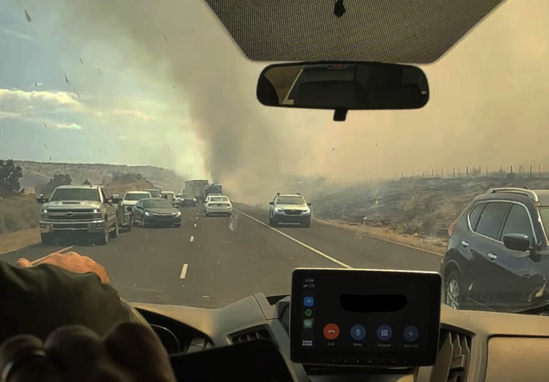
The view from inside a car trapped in a traffic jam caused by the Cottonwood Trail Fire. Screenshot from video by Griffin Hunt.

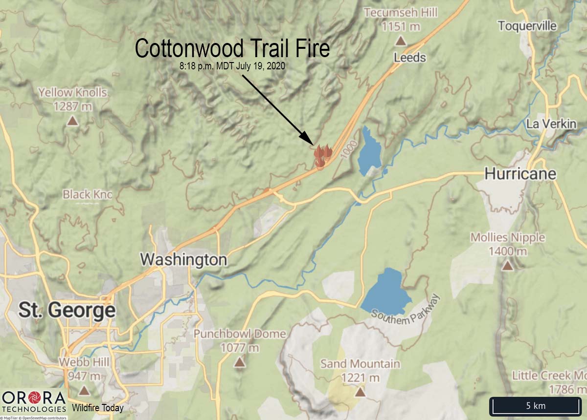
A wildfire that spread across Interstate 15 prompted evacuations and caused a massive traffic jam as motorists drove within feet of a rapidly spreading fire nine miles northeast of St George, Utah Sunday.

The Cottonwood Trail Fire started about 3 p.m. on the west side of the Interstate and burned across the four-lane divided highway blackening 3,000 acres before being stopped by firefighters on the ground and in the air. Resources assigned included three large air tankers, four helicopters, and 30 fire engines.

Cottonwood Trail Fire map
Map showing the location of the Cottonwood Trail Fire at 3:18 p.m. MDT July 19, 2020.

Both northbound and southbound lanes were eventually closed temporarily due to the fire, but perhaps a little too late. All evacuations have been lifted. A Type 3 Incident Management Team was slated to assume command of the fire Monday morning.

Videos showed traffic at times stopped or slowed to a crawl as the fire burned intensely near vehicles. Some were abandoned and the passengers rescued by others.

The video below by Griffin Hunt shows the chaos as vehicles inched past flames and became trapped in the traffic jam, with some turning around on Interstate 15. David Hunt posted the video, saying, “We were driving back from a wrestling tournament and got caught by fire. The other group that was with us had to abandon their vehicle and it burned to the ground. Here’s a video my son  took.”

Three large wildfires in southwest Utah

wildfires in southwest Utah
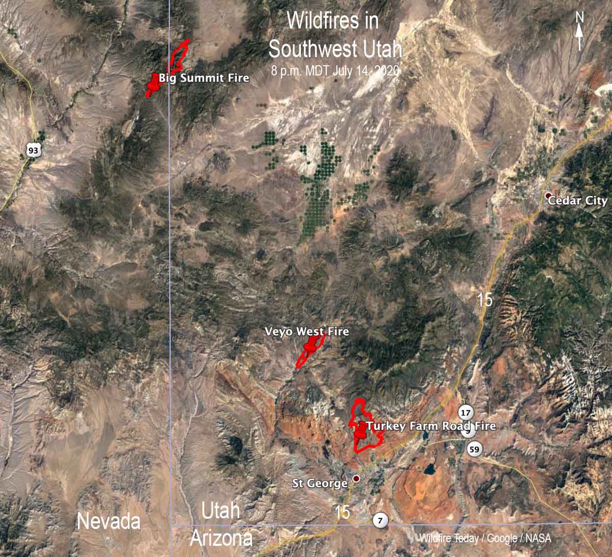
Fires in southwest Utah. Data from fixed wing mapping flights around 8 p.m. MDT July 14, 2020.

Three large wildfires are burning in southwest Utah.

At least one home has burned in the 2,618-acre Veyo West Fire which is very close to Veyo, Utah and 18 miles northwest of St George, Utah.

BAe-146 drops on the Turkey Farm Road Fire
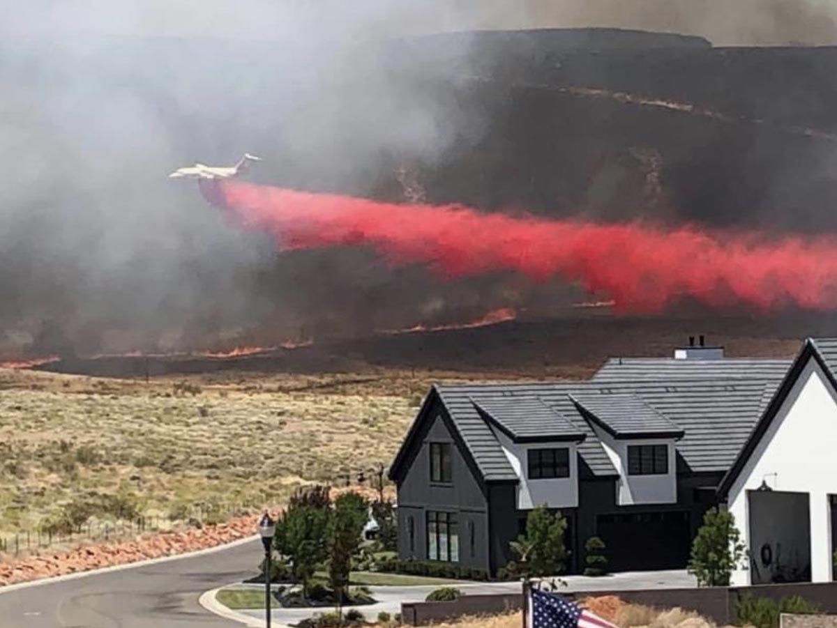
A BAe-146 air tanker drops on the Turkey Farm Road Fire. @UtahWildfire photo.

The Turkey Farm Road Fire was very active Tuesday and was mapped at 11,993 acres Tuesday night. A Type 2 Incident Management Team has been mobilized. The fire is 3 miles north of St George.

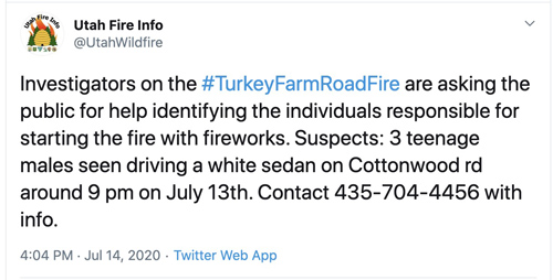
Law enforcement officials are asking for help in identifying the individuals who started the fire with fireworks.

Turkey Farm Road fire

The 4,000-acre Big Summit Fire started July 13 about 17 miles northeast of Panaca, Nevada and burned into Utah. It is 10 miles north of Modena, Utah and 61 miles northwest of St George, Utah. No structures have burned in either state.  Evacuations were in effect July 14.

Testing a new fire model during a crowning prescribed fire

research fire model wildfire

Above: Screenshot from the NASA video below about fire spread model research during a prescribed fire in Utah, June, 2019.

U.S. Forest Service scientists and others with the interagency Fire and Smoke Model Evaluation Experiment, or FASMEE, teamed up with the Fishlake National Forest to study a  prescribed fire from start to finish.

After months of planning and preparation, fire crews ignited more than 2,000 acres of Utah forest in an effort to consume living upper canopy vegetation and initiate growth of new vegetation. This June 2019 prescribed fire was designed to restore aspen ecosystems by removing conifer trees and stimulating the regrowth of aspen.

Researchers at the Pacific Northwest Research Station and Rocky Mountain Research Station, as well as other FASMEE participants, saw the fire as a unique opportunity for study.

During the event a fire model used for forecasting where and how a fire will move was put to the test. Adam Kochanski of the University of Utah used the opportunity to test the fire model known WRF-SFIRE.

WRF-SFIRE is a collaborative effort of NASA-funded teams from CU Denver, University of Utah, and Colorado State University. The project is led by Jan Mandel, Adam Kochanski and Kyle Hilburn.

The video below provides more details about the project and the test of the new fire model.

research fire model wildfire
Screenshot from the NASA video.

Couple cited for escaped campfire that started Gun Range Fire in Utah

Map Gun Range Fire
Map showing the approximate location of the Gun Range Fire using heat data from a satellite at 4:24 a.m. MDT August 30, 2019. The red line is the estimated perimeter.

A Utah couple has been cited by the U.S. Forest Service for having a campfire that escaped and started what became the 365-acre Gun Range Fire near Bountiful, Utah on August 30, 2019. The fire was named after the nearby Lions Club gun range.

KSL is reporting that the U.S. Attorney’s Office confirmed that Ashlyn Nelson and Jeremy Flores were issued a ticket for leaving a campfire without fully extinguishing it. Campfires, per se, were not illegal, but allowing it to escape and ignite a wildfire, of course, is.

The fire forced the evacuation of 400 homes and was fought by multiple hotshot crews, air tankers, and helicopters in addition to a large number of local firefighting resources.

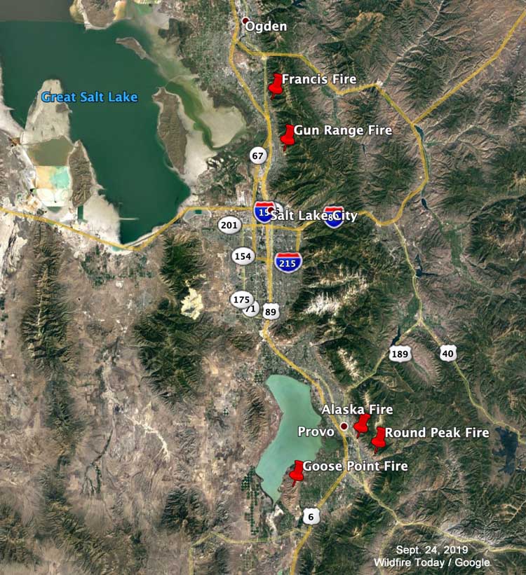
Other fires that have occurred recently in the greater Salt Lake City area since July 17, 2019:

fires salt lake city area utah
The map shows the locations of some of the wildfires that occurred in the greater Salt Lake City area between July 17 and September 16, 2019.

Videos of air tanker drops on the Francis Fire north of Salt Lake City

Monday afternoon the Francis Fire was burning on the slopes above Fruit Heights between Salt Lake City and Ogden, Utah. More information about the fire is a Wildfire Today, but below are videos of fixed wing activity on the fire.

Aircraft at the scene included, at least, an MD-87, a BAe-146 (Tanker 168), and multiple helicopters in addition to an air attack ship.

Update on the Fire and Smoke Model Evaluation Experiment

fire Manning Creek burn
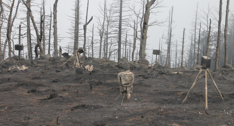
Manning Creek burn on June 20, 2019. (Photo by Roger Ottmar)

The Fire and Smoke Model Experiment (FASMEE) is a large, multi-agency effort funded by the Joint Fire Science Program and the U.S. Forest Service to identify and collect critical fuel, fire behavior, and other measurements that will be used to advance scientific understanding as well as operational and research modeling capabilities associated with wildland fire. The goal is to allow managers to increase the use of wildfire and prescribed fire.

On June 20, 2019, FASMEE completed data collection on Manning Creek, the first of two large, operational stand-replacement burns in a dense mixed conifer-aspen forest as part of FASMEE’s Phase 2 Southwest Campaign (Phase 1 was a planning phase and other campaigns are possible). The burn was conducted by the Richfield Ranger District located on the Fishlake National Forest in Utah. Over 40 scientists participated using ground sampling methods, drones carrying state of the art imagery and air quality sampling instrumentation, fire hardened video and still cameras, and LiDAR to collect a suite of data including fuel loading, fuel consumption, fire behavior, plume dynamics, and smoke data. Readers can view video and photographic imagery captured during the Manning Creek fire at https://fasmee.net/study-sites/manning-creek

Richfield Ranger District personnel will conduct a second stand replacement research fire this fall near Annabella Reservoir with over 120 scientists participating. In addition to the suite of instruments and sampling techniques deployed during the first research burn, two fixed wing aircraft including NASA/NOAA’s FIREX-AQ DC8 will be sampling plume smoke and heat release. Additional LiDAR and radar units have been acquired to better identify plume dynamics, with cameras and thermocouples added within the fire perimeter to capture data on soil heating and aspen regeneration.

fire Manning Creek burn
Manning Creek burn on June 20, 2019. (Photo by Brett Butler)
drone fire Manning Creek burn
A wildland firefighter flies a drone over the Manning Creek burn on June 20, 2019. (Photo by Adam Watts)