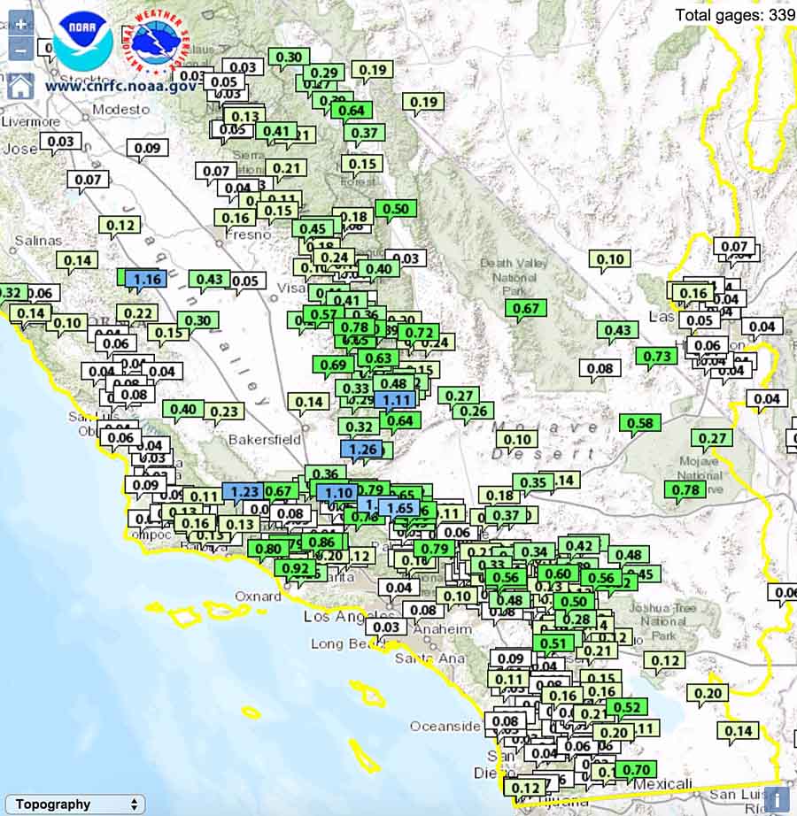
Massive amounts of rain in scattered locations and a general rain over much of the area over the past five days could pause the wildfire season in southern California.

Over an inch and a half of rain fell north of Los Angeles causing mud slides that closed 20 miles of Interstate 5 in the Tejon Pass/Grapevine area on Thursday and Friday. Over 200 vehicles on the highway were entrapped by the flowing debris. Some drivers sought refuge on the top of their cars, while in another area residents were rescued from the roofs of their houses.

The Los Angeles office of the National Weather Service warns that more flash flooding is possible in southern California today, Friday.
The multi-year drought and warnings of an above normal fall fire season in southern California in October had many fire officials on edge, and prompted the Los Angeles County Fire Department to double the number of scooping air tankers on contract from two to four.
The Wildland Fire Potential Outlook issued October 1 by the Predictive Services section at the National Interagency Fire Center predicted enhanced fire potential for southern California in October with “little if any precipitation”. Below is an excerpt:
Southern California: Above normal significant wildland fire potential will continue for the mountains and coastal areas of southern California in October, with the conditions trending toward normal in central California by the end of the month. Above normal fire potential will continue for the southern coastal areas into November before returning to normal by December.
Southern and central California will be dominated by high pressure during the first half of October, resulting in warm, to occasionally hot conditions throughout the region with periods of light to moderate offshore flow. Little if any precipitation is anticipated. There may be a trend towards cooler weather during the latter part of the month, but with the anticipated weather pattern, most of October will likely experience precipitation deficits.
The map below shows cumulative precipitation for the contiguous United States during the last seven days.


Ah the good old Grapevine…
Not surprising. actually gotsnowed on there years ago…
Turn out the lights…;)