After a fire or other incident occurs that had an unfavorable outcome, Wildland fire organizations typically conduct an investigation or review to cipher out lessons that can be learned. That of course can be extremely helpful and can reduce the number of similar accidents down the road. But looking at multiple incidents can uncover trends or themes that could be even more valuable.
The US Forest Service recently completed a “Metareview” of accidents and incidents, including fatality incidents in the agency over a 10-year period (2007-2016).
Five themes emerged:
Fatalities and injuries: Why are they continuing to occur?
Fiscal incentives: How does the current pay structure affect operational strategies and risk management?
Society: How do social and political pressures play into the wildland fire system?
Ecological soundness: How do ecological health and land management factors currently play into wildland fire decision making and strategy planning processes?
Communication/work environment: What do current successes and failures look like in the context of communication and the wildland fire work environment?
The seven-minute video below is an introduction to the effort.
The entire Metareview document can be downloaded as a .pdf, or you can peruse the individual chapters below.
One person who has reviewed much of the document described their impressions to Wildfire Today:
Basically the USFS is actually identifying a lot of their shortfalls and explains the policy issues they are having with conducting prescribed fires; describes that employee pay structures are unethical; describes why the current system by design is causing bad outcomes for employees both mentally and physically, and a lot more. Perhaps the most interesting part about this report is that there aren’t really any solutions offered.
The Forest Service views this metareview as one important step in their learning journey. This tool should be viewed in combination with other interagency wildfire safety products, such as the annual interagency National Wildfire Coordinating Group’s safety gram and the Lessons Learned Center’s annual “Incident Review Summary.”
This fall and winter, the Forest Service’s learning team will host webinars for the fire community to introduce the content and demonstrate how this learning tool can be used to transition from singular incident learning to ongoing, multi-format, iterative, shared learning.
Silver City Hotshots conduct firing operations along Hwy 518 west of Holman during night shift for the Calf Canyon Fire in New Mexico, 2022. Photo by Santa Fe National Forest.
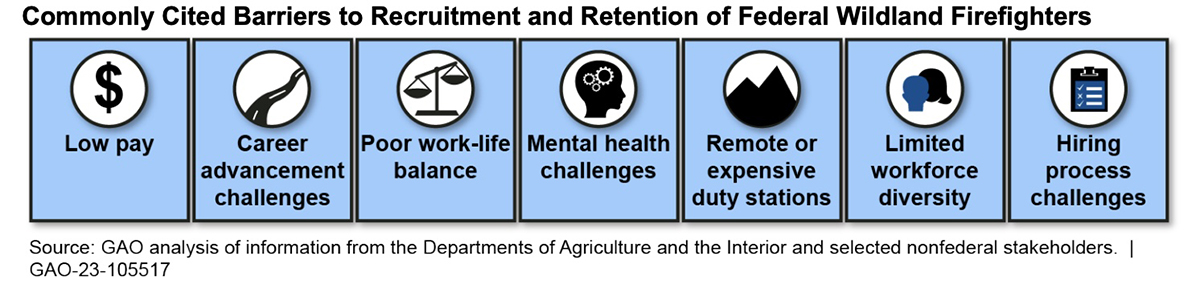
Today the Government Accountability Office released a report about the difficulties the federal agencies are having recruiting and retaining wildland firefighters.
Congress requested the report, but apparently did not ask for recommendations. The 41-page document identifies numerous issues that adversely affect recruitment and retention, most of which are already well known to the five agencies that employ wildland firefighters — Forest Service, Bureau of Land Management, National Park Service, Fish and Wildlife Service, and Bureau of Indian Affairs.
From the November 17, 2022 GAO report.
The report goes into detail about each of the major challenges, after receiving input from officials in the five agencies and a sample of 16 nonfederal stakeholders—including nongovernmental organizations representing active and retired federal firefighters and other organizations involved in firefighting issues, such as the National Association of State Foresters and the Western Governors’ Association.
Low pay was the most commonly cited barrier to recruiting and retaining federal wildland firefighters. Officials and all 16 stakeholders stated that the pay, which starts at $15 per hour for entry-level positions, is low. Officials and eight stakeholders also noted that the pay does not reflect the risk or physical demands of the work. Moreover, officials and stakeholders said that in some cases, firefighters can earn more at nonfederal firefighting entities or for less dangerous work in other fields, such as food service.
Some of the efforts being taken to improve hiring and retention are mentioned, including addressing pay, and offering slightly more time at home between fire assignments.
But much remains to be done, especially towards pay and a new Wildland Firefighter job series, which the five agencies have made very little progress developing.
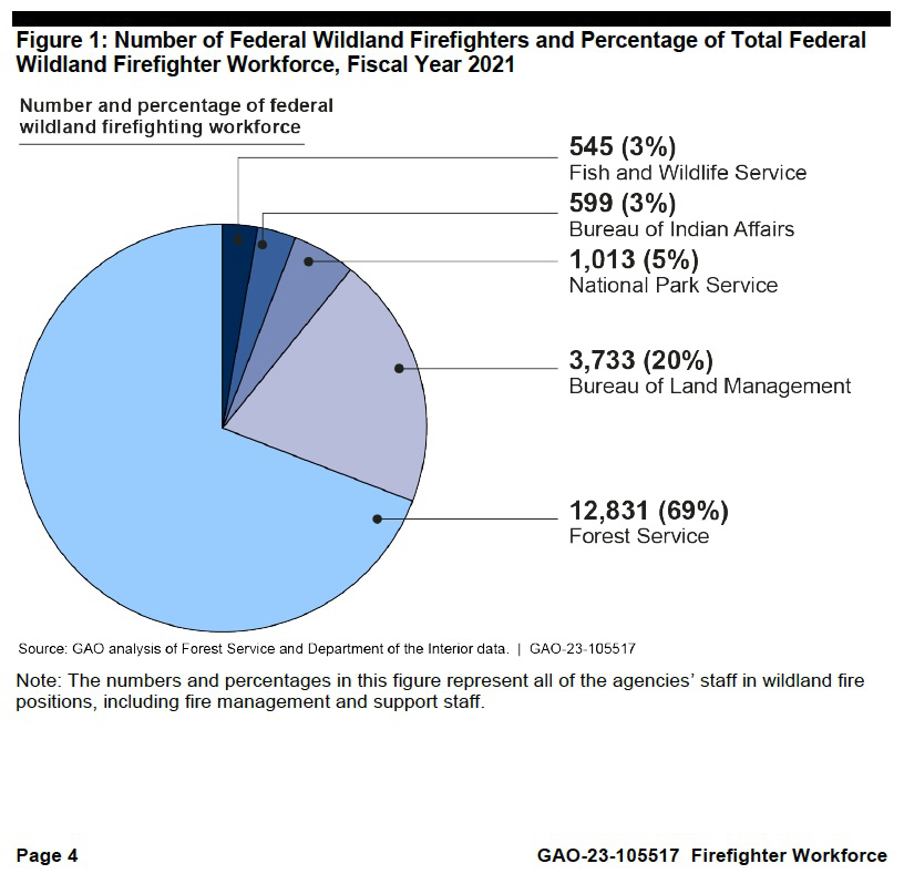
Number of federal wildland firefighters by agency, from Nov. 17, 2022 GAO report.
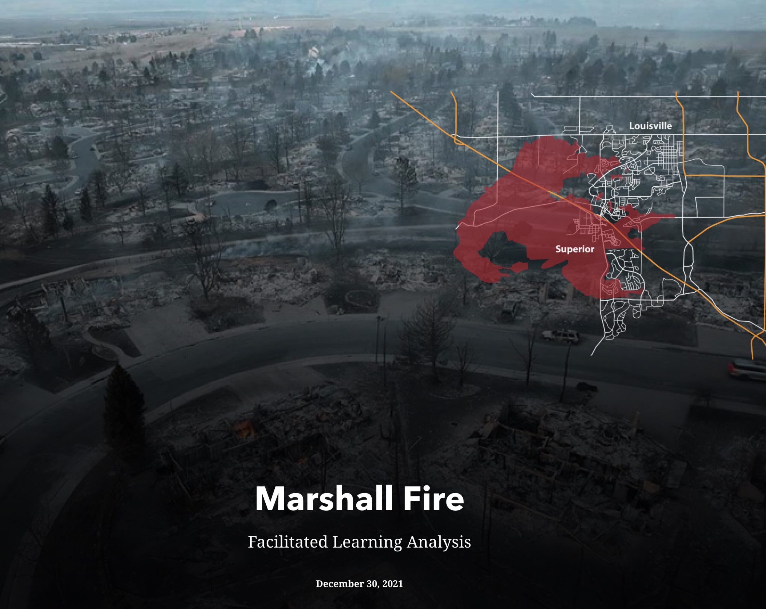
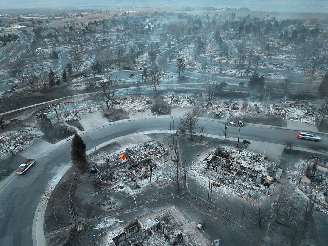
On the morning of December 30, 2021 the Marshal Fire ignited south of Boulder, Colorado. Pushed by winds gusting well over 40 mph, hurricane strength in some areas, it burned through subdivisions destroying 1,056 structures. By late the next day the winds had decreased and it was snowing on the 6,080-acre blaze.
At the request of the Colorado Division of Fire Prevention & Control a Facilitated Learning Analysis has been completed. The very lengthy and detailed document is in the Storymap format, which in this case includes many illustrations, photos, and maps.
Topics covered are weather, fuels, fire behavior, communication, ordering, evacuations, utilities, animal rescue, and hospital evacuation. It contains a wealth of information that could aid communities planning to prevent similar damage from inevitable wildfires, and manage them after they start.
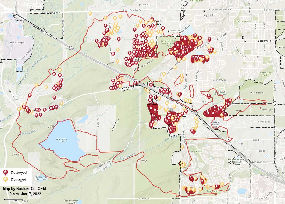
Map of structures damaged or destroyed during the Marshall Fire which started December 30, 2021 near Boulder, Colorado. Map accessed 10 a.m. MST January 7, 2021.
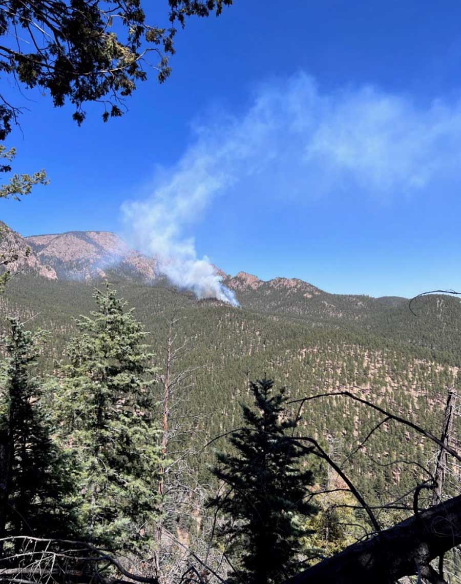
Test fire on the Las Dispensas prescribed fire on the Santa Fe National Forest in New Mexico, April 6, 2022. The prescribed fire later escaped, merged with another escaped prescribed fire, and burned more that 341,000 acres and 903 structures. USFS photo.
Forest Service Chief Randy Moore announced that the nearly four-month suspension on prescribed fires has been lifted after receiving the findings and recommendations provided by a National Review Team.
The suspension and review occurred after two prescribed fires on the Santa Fe National Forest in Northern New Mexico escaped in April, merged, and became the Calf Canyon – Hermits Peak wildfire that burned more than 341,000 acres and 903 structures. The area was later hit by flash floods which resulted in more damage. On September 18 the fire will transition from a Type 2 Incident Management Team to a Type 3 Team.
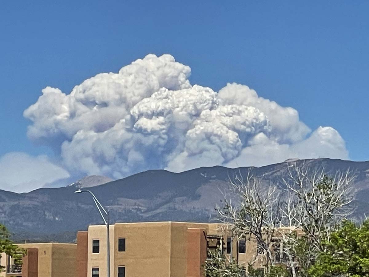
Calf Canyon – Hermits Peak Fire in northern New Mexico, May 10, 2022. Seen from Santa Fe. Photo by Allen Olson.
A report released by the Forest Service in June about the two escaped fires concluded the approved prescribed fire plan was followed for most but not all of the parameters. The people on the ground felt they were close to or within the prescription limits but fuel moistures were lower than realized and increased heavy fuel loading after fireline preparation contributed to increasing the risk of fire escape.
The National Review Team that evaluated the agency’s prescribed fire program produced a 107-page report which included seven recommendations. Chief Moore said in a statement, “I have decided to conditionally resume the Forest Service’s prescribed fire program nationwide with the requirement that all seven tactical recommendations identified are followed and implemented immediately by all Forest Service units across the country. These actions will ensure prescribed fire plans are up to date with the most recent science, that key factors and conditions are closely evaluated the day of a prescribed burn, and that decisionmakers are engaged in those burns in real time to determine whether a prescribed burn should be implemented.”
The seven recommendations in the report:
1. Each Forest Service unit will review all prescribed fire plans and associated complexity analyses to ensure they reflect current conditions, prior to implementation. Prescribed fire plans and complexity analyses will be implemented only after receiving an updated approval by a technical reviewer and being certified by the appropriate agency administrator that they accurately reflect current conditions.
2. Ignition authorization briefings will be standardized to ensure consistent communication and collective mutual understanding on key points.
3. Instead of providing a window of authorized time for a planned prescribed fire, agency administrators will authorize ignitions only for the Operational Period (24 hours) for the day of the burn. For prescribed fires requiring multi-day ignitions, agency administrators will authorize ignitions on each day. Agency administrators will document all elements required for ignition authorization.
4. Prior to ignition onsite, the burn boss will document whether all elements within the agency administrator’s authorization are still valid based on site conditions. The burn boss will also assess human factors, including the pressures, fatigue, and experience of the prescribed fire implementers.
5. Nationwide, approving agency administrators will be present on the unit for all high-complexity burns; unit line officers (or a line officer from another unit familiar with the burn unit) will be on unit for 30-40% of moderate complexity burns.
6. After the pause has been lifted, units will not resume their prescribed burning programs until forest supervisors go over the findings and recommendations in this review report with all employees involved in prescribed fire activities. Forest supervisors will certify that this has been done.
7. The Chief will designate a specific Forest Service point of contact at the national level to oversee and report on the implementation of these recommendations and on the progress made in carrying out other recommendations and considerations raised in this review report.
Chief Moore said two additional actions will occur by the end of this year:
Working with the interagency fire and research community and partners they will establish a Western Prescribed Fire Training curriculum to expand on the successes of the National Interagency Prescribed Fire Training Center headquartered in Tallahassee, Florida.
The Forest Service will identify a strategy, in collaboration with partners, for having crews that can be dedicated to hazardous fuels work and mobilized across the country to support the highest priority hazardous fuels reduction work.
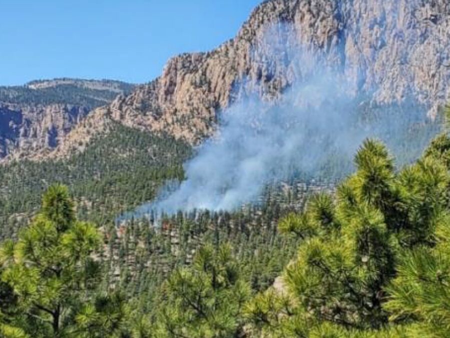
Las Dispensas prescribed fire, 1:07 p.m. MDT April 6, 2022. USFS photo.
An 80-page report (4.7Mb) released by the U.S. Forest Service concluded that the management of the prescribed fire that escaped and merged with another escaped prescribed fire to become the largest wildfire in the recorded history of New Mexico, generally followed the approved prescribed fire plan for most but not all of the parameters. The people on the ground felt they were close to or within the prescription limits but fuel moistures were lower than realized and increased heavy fuel loading after fireline preparation contributed to increasing the risk of fire escape.
The prescribed fire on the Santa Fe National Forest in northern New Mexico east of the city of Santa Fe was one of the units within the Gallinas Prescribed Fire Project Area. The first burning activity in early October of 2017, was the ignition of piles of debris left after forest thinning projects. Less than expected snow allowed the fire to spread away from the piles over the next three months. In late December they began to suppress the fire, and on January 18, 2018 it was converted to a wildfire. A Facilitated Learning Analysis found that“communication” and “prescribed fire preparation and risk” were two common themes.
In a continuation of that large multi-unit project, on April 6, 2022 at 11:34 a.m. firefighters ignited the test fire on the Las Dispensas prescribed fire, expected to be 150 acres. At 12:34 p.m. the test was considered successful and the project commenced.
Test fire on the Las Dispensas prescribed fire April 6, 2022. USFS photo.
The first small spot fire occurred at 1:35, which was controlled. At 2:26 a quarter-acre spot fire was caught.
Radio communication with some of the personnel was discovered to be a problem. It was later found that Bravo Holding was using a separate “crew net” and were not monitoring the planned frequency.
Ignition stopped a couple of times as spot fires were suppressed, but by about 4 p.m. when the relative humidity dropped to 10 percent there were at least a dozen spots. At 4:06 the Burn boss requested contingency resources and at 4:15 as groups of trees began torching all resources were pulled off the fire due to the increasing fire intensity. At 4:25 Dispatch reported that the contingency resources were physically located in Taos, New Mexico at the Fire Summit (an annual training exercise). Taos is approximately 70 miles from the prescribed fire.
At 4:38 Dispatch advised the Agency Administrator that the Burn Boss and the Fire Management Officer recommend it be declared a wildfire — about four hours after the primary ignition began. The Agency Administrator made the wildfire declaration and at 4:50 the incident was named the Hermits Peak wildfire.
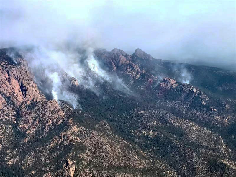
Hermits Peak Fire, April 8, 2022. USFS photo.
On April 22 the Hermits Peak Fire merged with the Calf Canyon Fire, another escaped prescribed fire on the Santa Fe National Forest. As of June 22 the blaze has burned more than 341,000 acres.
Weather
The prescription for broadcast burning required that the relative humidity be between 12 and 60 percent. The spot weather forecast issued by the National Weather Service at 8:53 a.m. on April 6 predicted the minimum RH would be between 9 and 13 percent, west winds 10 to 15 mph gusting to 25, and 54 to 58 degrees.
During the project on April 6 weather conditions were measured by a lookout once an hour using a hand-held Kestrel instrument. With that device the readings appeared to be within the prescription parameters except for the observations at 4 p.m. when it showed the RH had dropped to 10 percent.
From the report:
“Regarding temperature (dry bulb and wet bulb) and relative humidity, the observations recorded by the lookout showed a cooler and more moist bias when compared with other observations of weather and fire behavior on the site. Specifically, relative humidity readings taken from the Kestrel differed from what the relative humidity values should have been if calculated using the National Wildfire Coordinating Group standard tables for that elevation and the dry bulb and wet bulb observations. The relative humidity values recorded from the Kestrel provided values that are nearly 10 percent higher than those calculated.”
The recalculated RH at 4 p.m. was actually 6 percent, not 10 as shown on the Kestrel. One of the Firing Bosses also took readings and used the NWCG standard tables, which were similar to the recalculated values from the lookout’s Kestrel.
To summarize the weather, the forecast predicted the RH to be 9 to 13 percent, possibly below the prescribed 12 percent minimum, but it actually dropped as low as 6 percent, well below the prescription.
Fuels
Fine and heavy fuel loading increased in the years after the prescribed fire plan was developed, resulting from a combination of canopy opening from thinning (fine fuels) and fireline preparation (heavy fuels). This contributed to high fire intensity, torching, prolific spotting, and resistance to control.
The foliar fuel moistures were low and contributed to the transition from surface to crown fire. Fuel moisture samples taken from March 16 to April 3 showed a significant downward trend that contributed to the transition from surface to crown fire and increased spotting potential. Foliar moistures were listed to be sampled in the prescribed fire plan but were not part of the prescription.
The report’s conclusions, findings, and lessons learned
There was no nearby Remote Automated Weather Station (RAWS) in working order representative of conditions at the burn site. If available, the data could have improved situational awareness.
A thinning project in the burn area opened the canopy in some areas, allowing more sunlight which led to lower fuel moistures. Heavy ground fuels resulting from the construction of fireline for the burn project added to the fuel loading. This contributed to higher fire intensities, torching, spotting, and higher resistance-to-control.
Low live fuel moistures facilitated the transition from surface fire to torching and spotting outside the unit boundaries.
The prescribed fire plan mentioned that the Energy Release Component (ERC) which is an indication of the potential intensity of a fire, was to be monitored, but did not specify how the element would be used. On the date of the prescribed fire it was 37, far above average for the date which was 23. The highest ever recorded on that date was 41. Higher numbers indicate greater fire intensity.
There was an underestimation of the minimum holding and contingency resources needed. After numerous spot fires occurred, the Burn Boss requested the contingency resources, but they were 70 miles away.
A clear recognition and acknowledgment of long-term drought and climate factors versus short-term weather events would have led toward better situational awareness of the fire environment and could have resulted in more favorable outcomes.
The test fire was initiated in an area of the unit that was not representative of the rest of the unit. On several occasions, both before the burn was ignited and after the test fire was considered and accepted, some personnel felt that the dry conditions would result in difficult burning conditions and an increase in risk, but they accepted the assignment.
Consider requiring overhead, such as Firing Boss, Holding Boss and other staffed positions, to document support of the agreement with the Test Fire or the Go/No-Go decision.
Administrative boundaries limited the selection of potential control lines. The prescribed fire unit designation followed boundary lines from private property and other land designations, such as wilderness, and not necessarily advantageous fuels changes or topography.
Use the existing authority in the “Wyden Amendment” that allows managers of federal lands to spend funds to conduct treatments on adjacent non-federal lands to improve the viability of, and otherwise benefit, fish, wildlife, and other biotic resources.
District fire employees perceived pressure to “accomplish the mission,” which may have led to taking greater risk.
Records show the Prescribed Fire Burn Boss Type 2 (RXB2) performed as a fully qualified RXB2 at least 12 times since 2015.
Invest in education opportunities for continued learning in science and technology specific to fire behavior and fire environment. Consider workshops tailored for prescribed fire practitioners that address today’s challenges related to environmental and social conditions.
Prescribed fire programs and projects should invest in staffing, training, planning and other supporting resources commensurate with the priority and complexity of prescribed fire projects.
Consider Incident Management Teams when implementing complex prescribed fire projects.
Increase support for existing Burn Bosses by activating Planning Section functions when complexity warrants the additional capacity.
Establish an interagency training facility, such as the National Interagency Prescribed Fire Training Center, that would be located in the Western U.S. and focus on the additional complexities involved with western fuel treatments.
Learn from indigenous communities about cultural land management practices.
Invest in education opportunities for continued learning in science and technology specific to fire behavior and fire environment. Consider workshops tailored for prescribed fire practitioners that address today’s challenges related to environmental and social conditions.
And this from the report
“We ask them to make up ground on long-needed and far-behind proactive restoration work while barely allowing time to recover from a previously taxing wildland fire response and preparing to respond yet again. We ask them to restore fire process to ecosystems that have evolved to burn, but many of which are now primed for extreme fire behavior due to our own decisions to exclude or suppress fire in these areas.
“To accomplish this level and frequency of prescribed fire on the landscape, we must ensure that practitioners have access to the best science, technology and tools, and that they are confident and practiced in their usage. We need an approach to planning and implementing prescribed fire that’s as robust as our Incident Management Teams’ response to wildfire.”
The 10-year plan
The 10-year plan released in January by the Forest Service for prescribed fire and other fuel projects calls for tripling the number of acres treated on National Forest System Lands in the West and other Federal, State, Tribal, and private lands in the West, increasing from about 2.5 million acres a year to 7.5 million.
Our take
The report said, “District fire employees perceived pressure to accomplish the mission, which may have led to taking greater risk.”
If they feel pressure now, how will they feel when the number of acres treated needs to increase substantially? Will there be a corresponding escalation in Burn Bosses, Holding Bosses, full time prescribed fire planners, NEPA compliance capacity, crews, and weather windows?
Hermits Peak – Calf Canyon Fire, June 14, 2022. USFS.
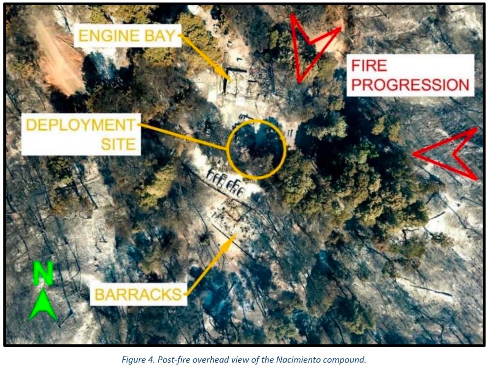
The Nacimiento guard station, two fire engines, several personal vehicles, and two dozers burned — there was one very serious injury
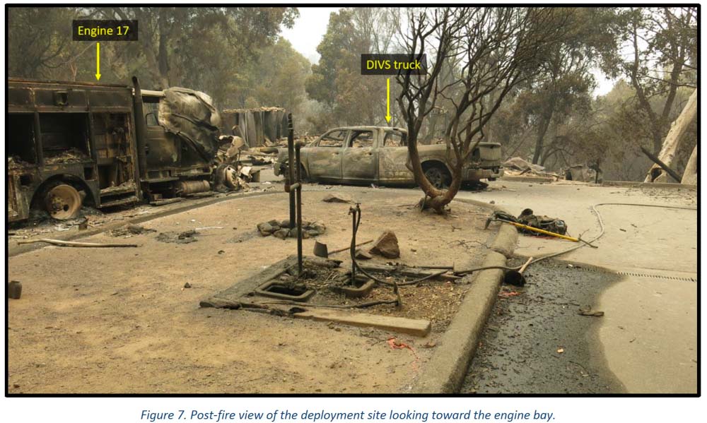
Dolan Fire deployment site. Engine & pickup. Image from the report
Several “learning reports” have been released by the U.S. Forest Service about the burnover and entrapment one and a half years ago of wildland firefighters at a remote fire station. It occurred on the Dolan Fire on the Los Padres National Forest in Southern California September 8, 2020. Fifteen firefighters deployed into only 13 fire shelters. Four firefighters were injured and three were hospitalized. One had very serious burns.
The Dolan Fire had been burning for weeks but there were about half a dozen other fires in California that were larger, some much larger such as the LNU Lightning Complex, SCU Lightning Complex, CZU August Lightning, and the August Complex.
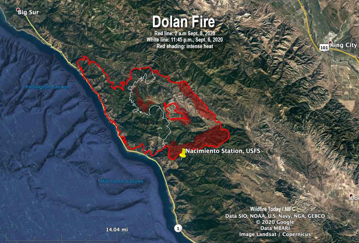
The Incident Management Team ran a modeling scenario on September 4 which showed that within the next 14 days the probability of the fire reaching the Nacimiento Guard Station was 60 to 80 percent with no delaying tactics. At that time the fire was 3.1 miles away.
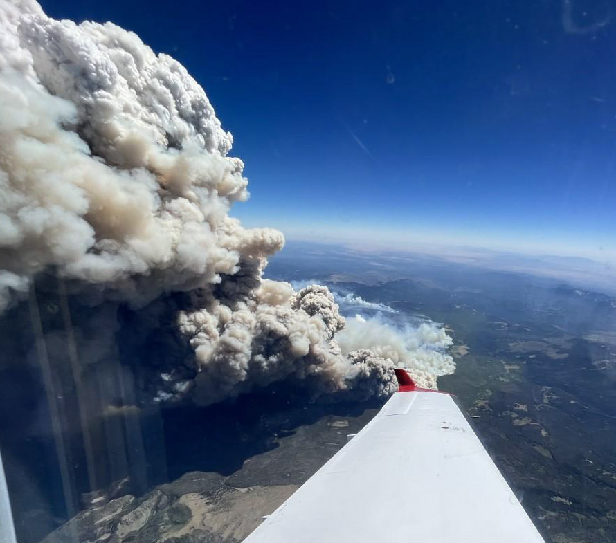
The night before the fire reached the station on Nacimiento-Fergusson Road 7 miles from the highway on the California coast, the fire ran for about three miles toward the station, burning 30,000 acres with spot fires three-quarters of a mile ahead. The map below based on infrared data shows the growth in the 26-hour period ending at 2 a.m. on Sept. 8. The fire hit the station between 7 and 8 a.m. on September 8.
Map of the Dolan Fire. The red line was the perimeter at 2 a.m. PDT September 8, 2020. The white line was the perimeter about 26 hours earlier. The red shaded areas indicate extreme heat.
When the fixed-wing aircraft mapped the fire five or six hours before the incident, it had burned about 74,000 acres, more than twice the size mapped the previous night. The sensors on the plane detected intense heat on the southern edge of the fire, 0.7 miles north of Nacimiento Station.
The fire personnel at the station during the burnover included two USFS engine crews, two dozers with operators, and the only Division supervisor working the night shift — due to a shortage of personnel. Other overhead at the fire may have been distracted as a newly established Incident Command Post had to be evacuated and relocated as the fire approached in the middle of the night.
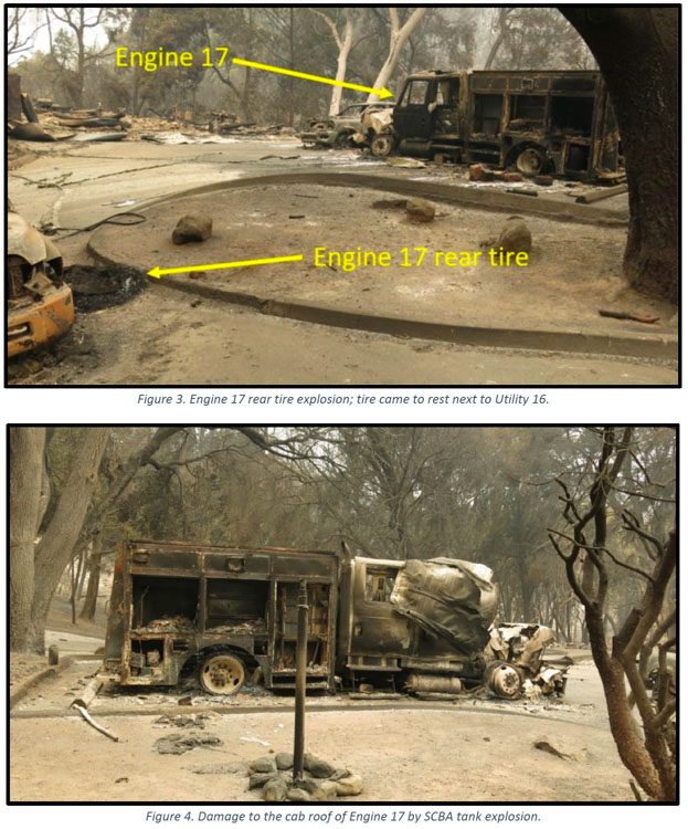
Dolan Fire deployment site. Engine 17. Image from the report.
Several of those involved at Nacimiento believed there was no way to defend the station even though a hand crew had cleared some vegetation, a hand line had been dug, and there were hose lays around the structures. With that work done and the fact that the station had survived other fires, some of the locals said they could protect the buildings and the personal belongings and vehicles of the fire personnel who lived there.
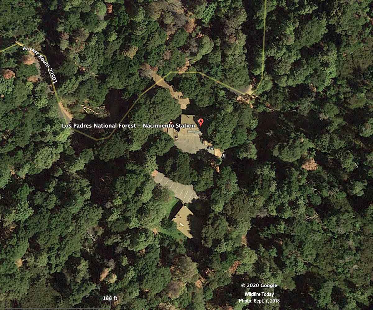
Below is an aerial photo of the Nacimiento Guard Station taken almost exactly two years before the burnover. It appeared in an article on Wildfire Today about the entrapment published September 11, 2020.
Nacimiento Station, satellite photo, September 7, 2018.
The photo below was taken after the burnover.
Dolan Fire deployment site, aerial photo. Image from the report.
This is the first paragraph in the Learning Review — Narrative:
Smoke is billowing out of the barracks and hot embers are raining down all around. Engine 16 is on fire. The engine bay is on fire. Marty can’t get his pack out of the burning engine, which means he can’t get to his fire shelter. He’s just standing there, and Rene can’t get his attention. She has her shelter out, ready to go. She hits him, but he just stands there. She hits him again, but he still just stands there. Marty is not ready to commit to the shelter; he’s thinking about potential dangers from the propane tanks around them, and that more needs to or could be done. Rene hits him again and pulls down on his shirt to get him down to the ground and into the fire shelter. Rene tucks the fire shelter around him and cinches it in tight under his arms and legs. She takes a quick look around and then climbs in under the shelter with him. Eleven other firefighters are deployed around them in the parking lot of the Nacimiento guard station. The heat inside the shelters was stifling. “I could feel the skin tightening on my face. Mucous was coming out of my nose and eyes, hanging off my chin. I felt like all the fluid was being roasted out of me. My throat was so sore I could barely drink my water.” Everyone is asking the same question: “How did we get here?”
“If we preach it, we should do it.”
The Organizational Learning Report has a section, Theme 3, pointing out that even though the Forest Service has “preached [to homeowners] FireWise concepts for decades” about how to reduce the chances of their houses burning as a wildfire approaches, too many of the agency’s own structures lack FireWise status. The report says, “If we preach it, we should do it. ”
We asked Kelly Martin for her thoughts about the reports on the Dolan Fire. She is the current president of Grassroots Wildland Firefighters and the retired Chief of Fire and Aviation for Yosemite National Park. She replied by text:
The biggest thing that comes to mind is our over confidence in what we deem ‘defendable’ until the time wedge becomes too small to make safe, proactive decisions. The oppressive personal/social pressure to protect treasured places puts us in an untenable situation to champion the notion, ‘not on my watch’ are we going to lose this place. The protection narrative gets repeated and reinforced by the majority who consider it ‘their home turf’ and unfortunately tend to dismiss many ‘outsiders’ objective perspectives on the situation that might help reduce the deep personal attachment to ‘home turf.’ Having ‘Outsiders’ become part of the decision making process can help enhance rational decision making.
Confirmation bias may have been a factor. The fire station survived previous fires, thus lulling us to previous events rather than fully appreciating the situation we now find ourselves in with excessive fuel buildup.
Also, I think the Wildfire Decision Support System (WFDSS) process and further high level local management and Incident Management Team analysis should have spotted this mindset trap early on.
Our Take
The disaster at the Dolan Fire is yet another example where knowing the real-time location of the fire may have made a difference. The Captain who ran the station and some other locals believed that they needed to protect the facility and insisted that they COULD. Others thought differently but were not assertive enough or didn’t have the authority to override that decision. They knew the fire was approaching. But would things have turned out differently with others who didn’t have emotional attachments to the buildings? Or who had real-time intelligence, and could “see” the locations of all resources as well as the entire fire — the very rapid rate of spread, the spot fires ¾ mile ahead, and the intensity? What if the Operations Section Chief, Branch Director, primary Safety Officer, or the Incident Commander had access to real-time video from a drone circling over the fire? Any one of those might have ordered the withdrawal of the engines, dozers, and 15 firefighters hours before they came close to death. They might have said, “Forget the damn structures. Think about the humans. Consider the physical and mental trauma those humans could suffer, perhaps for years.”
The decision to stay or go, in addition to human safety, should have also considered the dollar value of the personal belongings and vehicles of the employees who lived at Nacimiento. They were not evacuated days earlier even though the station was in a mandatory evacuation area. They trusted the Incident Management Team, the Forest overhead, and the Captains. How much will it cost those firefighters, on their meager salaries, to replace their personal vehicles and belongings? Then there is the cost to taxpayers of two engines, two dozers, and at least one pickup truck.
The technology has existed for years to provide real-time video of fires 24 hours a day. The John D. Dingell, Jr. Conservation, Management, and Recreation Act required that by September 12, 2019 the five federal land management agencies “develop consistent protocols and plans for the use on wildland fires of unmanned aircraft system technologies, including for the development of real-time maps of the location of wildland fires.”
While this technology has been demonstrated and used sparingly, such as the FIRIS program, real-time mapping is far from being used routinely.
The Dingell Act also mandated that the five federal land management agencies “jointly develop and operate a tracking system to remotely locate the positions of fire resources for use by wildland firefighters, including, at a minimum, any fire resources assigned to Federal type 1 wildland fire incident management teams,” due by March 12, 2021.
The Bureau of Land Management has installed hardware for Location Based Services (LBS), which are now operational on more than 700 wildland fire engines, crew transports, and support vehicles. Vehicle position and utilization data are visually displayed via a web-based portal or mobile device application. Ten months after it was required by Congress, the U.S. Forest Service has made very little progress on this mandate.
Some other government facilities are also not FireWise
It is not just the Forest Service with structures that do not all meet FireWise standards. When I was an area Fire Management Officer for the National Park Service, two of the parks for which I was responsible were threatened on different occasions by wildfires. Although the threat was low to moderate, I was able to convince the Park Superintendents that hazard reduction and thinning of the trees was necessary, now. It should have already been done, but seeing smoke in the air made it possible to make fast decisions and to get it accomplished very quickly. Up until then, removing any tree near park headquarters was a tough row to hoe. Neither fire spread into the parks, but the long-delayed and badly needed work got done. And I slept better.