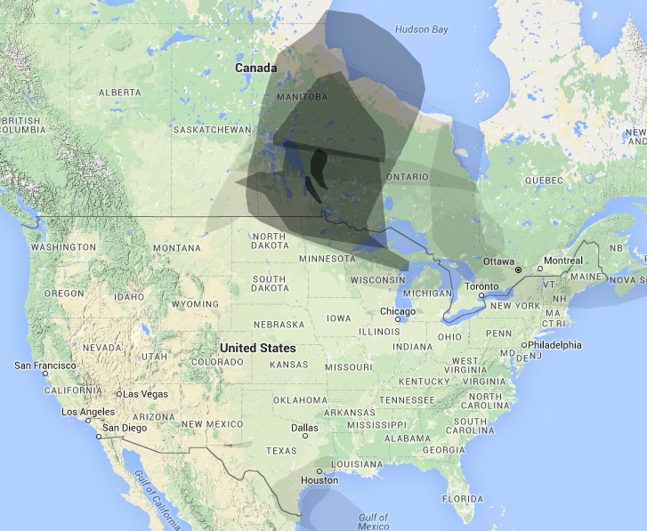
 Wildfire smoke Map 4 p.m. MDT May 10, 2016. WeatherUnderground.
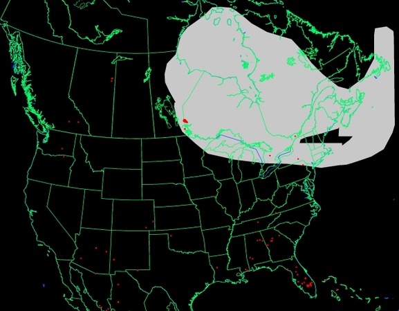
Smoke from the wildfires in Canada is now affecting the northern edge of the Great Lakes States and has moved into New England.
 Wildfire Smoke map, 3:11 p.m. MDT May 10, 2016. NOAA.
To see the most current smoke reports on Wildfire Today, visit the articles tagged “smoke” at https://wildfiretoday.com/tag/smoke/
Typos, let us know HERE, and specify which article. Please read the commenting rules before you post a comment.
Related
Author: Bill Gabbert
After working full time in wildland fire for 33 years, he continues to learn, and strives to be a Student of Fire.
View all posts by Bill Gabbert


