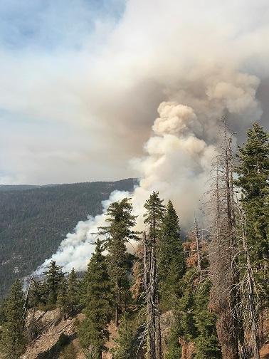
Firefighters battling South Fork Fire east of Wawona, California

Above: South Fork Fire. Inciweb.

(Originally published at 11:38 a.m. PDT August 15, 2017)

The main priority of firefighters battling the South Fork Fire in Yosemite National Park in California is protecting homes in the North Wawona community 1.7 miles west of the fire along the South Fork of the Merced River.

Not much information is available about the fire 56 hours after it was reported very early Sunday morning, but we know that it is burning above the river on steep, rocky slopes in a forested area with beetle-killed trees. While a fire burning through dead trees sounds scary, after the needles fall off, the trees burn with less intensity and rate of spread than a healthy forest.

According to the South Zone Coordination Center, voluntary evacuations are in effect for Wawona on the east side of Chilnaulna Falls Ridge.

Our very unofficial estimate based on satellite data from 3:43 a.m. PDT Tuesday puts it at approximately 2,000 acres. The last official figure from the Incident Management Team was 1,613 acres at 7 p.m. Monday.
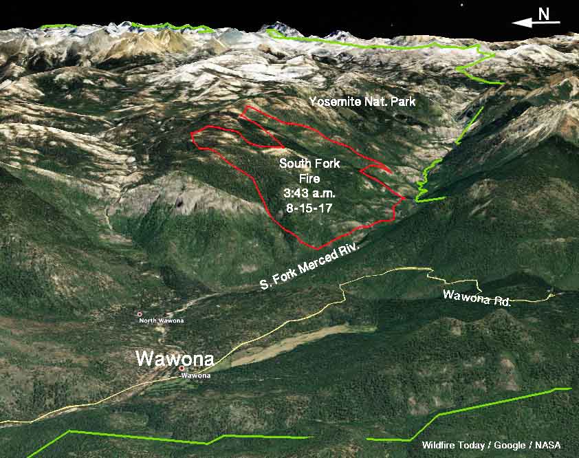
map South Fork Fire
3-D map of the South Fork Fire. Estimated perimeter (in red) based on satellite data from 3:43 a.m. PDT August 15, 2017.

Deron Mills’ Type 2 Incident Management Team is transitioning into the management structure of the fire today, Tuesday.

The weather forecast for the fire area for Tuesday calls for sunny skies, 75 to 80 degrees, relative humidity in the mid-30s, and very light winds on the slopes in the morning increasing to 10 mph on the ridgetops in the afternoon.

The South Fork Fire and others in California are contributing to unhealthy air quality in many areas.
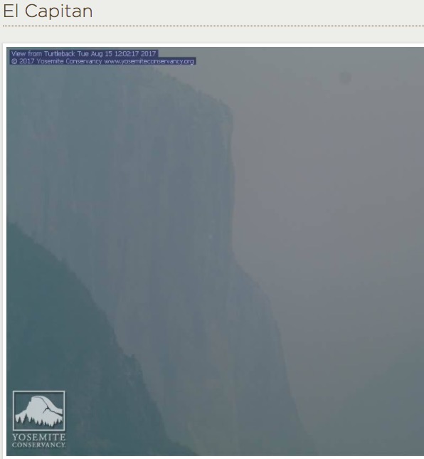
visibility in Yosemite National Park El Capitan
The visibility in Yosemite National Park at El Capitan, 12:02 p.m. PDT August 15, 2017.
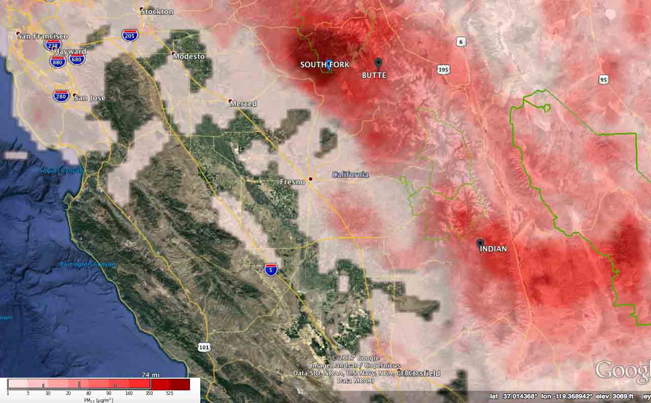
pm25 air quality california wildfire
The forecast for the maximum levels of wildfire particulate matter (PM 2.5) for August 15, 2017 in Central California. Experimental product by U.S. Forest Service/BlueSky.

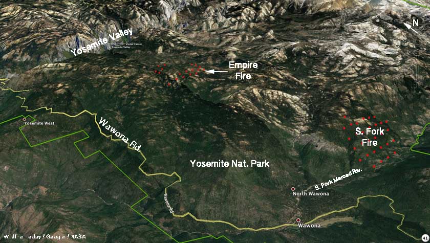
2 fires in Yosemite National Park, Empire and South Fork

Above: Satellite photo of the South Fork and Empire Fires in Yosemite National Park, August 14, 2017.

(Originally published at 3:40 a.m. PDT August 14, 2017)

Two large fires are burning in Yosemite National Park. The Empire Fire started two weeks ago and is being monitored but not completely suppressed. It has spread across 1,200 acres one mile south of Bridalveil Campground in Yosemite’s Wilderness.

The first report of the South Fork Fire came in at 2:30 a.m. Sunday, August 13 near the South Fork of the Merced River 2.6 miles east of Wawona.

South Fork Fire
South Fork Fire. Posted on InciWeb August 14, 2017.

It has burned approximately 1,000 acres. Smoke has prevented the use of air tankers at times, but there is a report that all three of the military MAFFS aircraft currently activated have dropped on the fire when the smoke has cleared.

A Type 2 Incident Management Team has been ordered.

South Fork Fire map empire
3-D map of the South Fork and Empire Fires in Yosemite National Park, August 14, 2017.

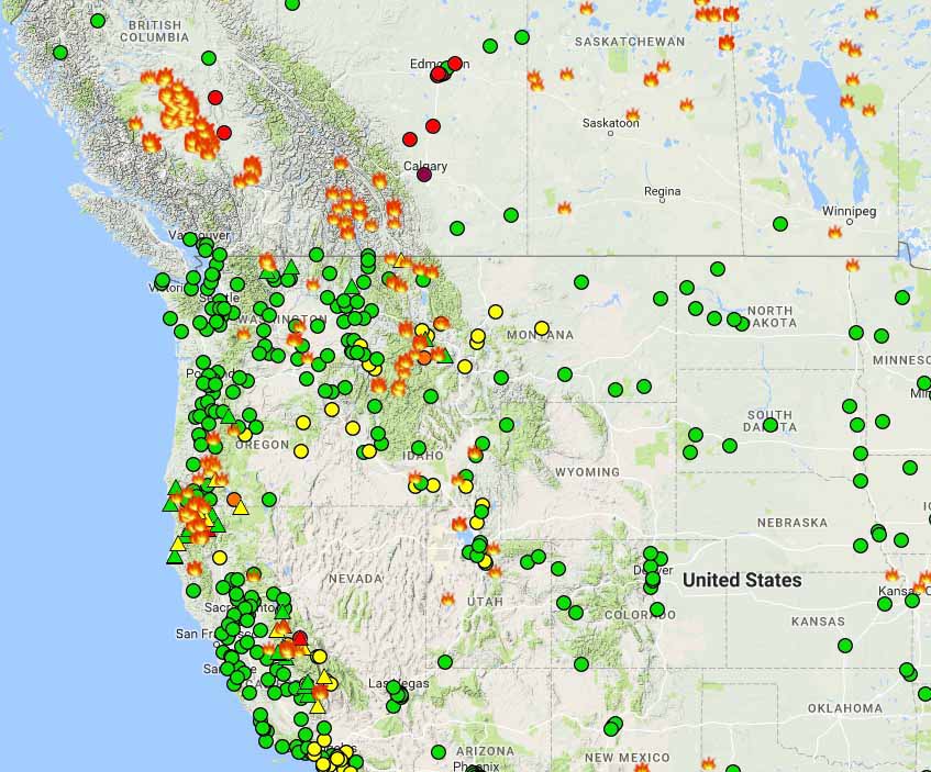
Wildfire smoke travels farther south into the United States

Wildfire smoke
Wildfire smoke at 1:20 a.m. MDT August 14, 2017. NOAA.

While sleeping with the windows open I woke up at 2 a.m. Monday morning with the strong smell of forest fire smoke in the house. I checked NOAA’s smoke map on my phone and sure enough there it was, in several shades of brown. Oddly, in spite of the strong smell, it is barely registering at the nearest air quality monitoring site.

Canadian smoke does not often drift this far south into the Black Hills of South Dakota in high enough concentrations to have a strong odor.

Wildfires air quality
Wildfires and air quality, at 2 a.m. MDT August 14, 2017

air quality legendBut it is much, much worse in some areas. I have friends that basically evacuated from Missoula at least temporarily because of the smoke, where Saturday the air was “very unhealthy”. And this morning in Calgary, Alberta the PM2.5 is 234, also “very unhealthy”.

And, thanks to the South Fork Fire that started Sunday 1.5 miles east of the community of Wawona in Yosemite National Park and the Empire Fire that has been burning in that area since August 1, it is “unhealthy” to breathe in Yosemite Valley where the PM2.5 is 154. The Empire Fire is not being suppressed so the smoky conditions could persist for an extended period of time. The South Fork Fire is a suppression fire.