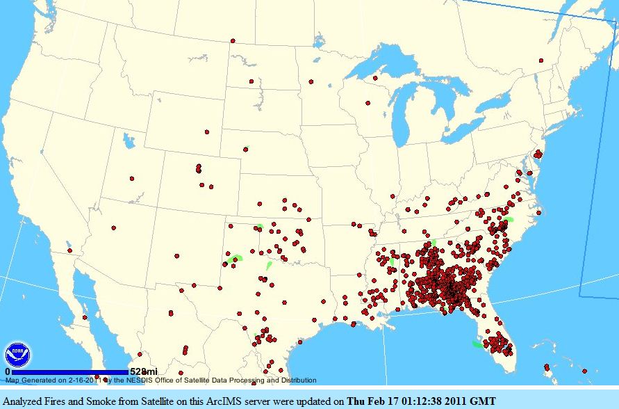
This map shows fires (in red) and smoke (in green) detected by satellites today. It looks like the folks in the southeast are busy. Click on the map to see a larger version.
Month: February 2011
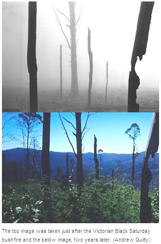
Australia’s Black Saturday fires: before and after photos
 I like to look at before and after pictures. One of the best examples is the book of photographs that compare the photos taken on General George Custer’s 1874 expedition through the Black Hills of South Dakota, with photos taken by Ernest Grafe and Paul Horsted and published in the book Exploring With Custer: The 1874 Black Hills Expedition in 2003. The differences in vegetation help to explain why we now have larger fires that are more difficult to control.
Andrew Quilty, a photographer on the other side of the world, has done something similar, but instead of waiting 129 years for the after pictures, he took photos immediately after the February, 2009 Black Saturday fires in Australia, and then again two years later. One is on the left, and others are HERE.
Thanks Dick
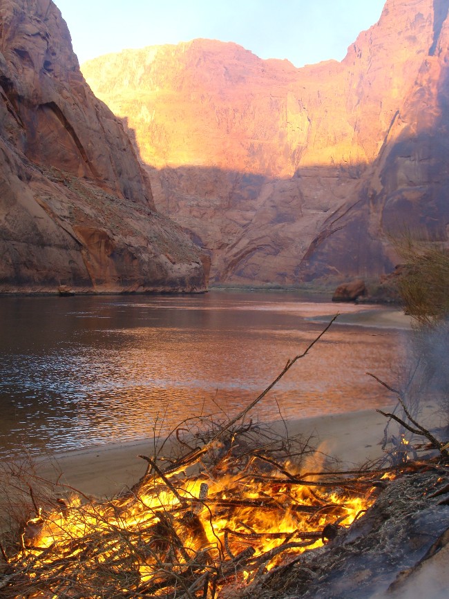
NPS photo contest, 1st place in the “Other” category
The above photo is another in the series of winners that we are highlighting from the 2010 National Park Service Fire and Aviation Photo Contest. This image was taken by Greg Bartin of Zion National Park, submitted by David Eaker of Zion, and took first place in the “Other” category. It was shot in Glen Canyon National Recreation Area and appears to show pile burning on the lake shore. It’s too bad the NPS web site does not have captions for the photos. Click on the photo to see a larger version.
NPS photo contest, 1st place in Structure Fire
The above photo is another in the series of winners that we are highlighting from the 2010 National Park Service Fire and Aviation Photo Contest. This image was taken by Joe Lachowski of Grand Teton National Park and took first place in the Structural Fire category. It was shot in Grand Canyon National Park. Click on the photo to see a larger version.
Wind of 114 mph breaks anemometer in Montana
The anemometer at the Choteau Airport in Montana recorded a wind gust of 114 mph on Saturday afternoon just before the instrument was destroyed by the wind. Other strong wind speeds in Montana on Saturday included gusts near 80 in Livingston and 90 near Nye.
It reminds me of when I was working on the response and recovery following Hurricane Andrew that struck south Florida in 1992. Andrew is the third most powerful hurricane to have made landfall in the United States, at least since the dawn of the 20th century. During the hurricane the anemometer at the Coastal Marine Automated Network (C-MAN) weather station at Fowey rocks recorded a peak gust of 169 mph just before it was destroyed by the wind. Another anemometer at the Kendall-Tamiami Executive Airport recorded a wind speed of an estimated 130 mph before it was also destroyed.
Here is an excerpt from Wikipedia about a third wind speed measurement during Hurricane Andrew:
The highest recorded surface gust, within Andrew’s northern eyewall, occurred at the home of a resident about a mile from the shoreline in Perrine, Florida. During the peak of the storm, a gust of 212 miles per hour (341 km/h) was observed before both the home and anemometer were destroyed. Subsequent wind-tunnel testing at Clemson University of the same type of anemometer revealed a 16.5% error. The observed value was officially corrected to be 177 miles per hour (285 km/h).

Thanks Dick
Evergreens’ Supertanker spotted on satellite photo

In checking out the location on Google Maps of a 50+ acre fire that was reported by the Southwest Coordination Center on their Twitter account, I thought I would cruise farther west and see what the “aircraft boneyard” at Pinal Airpark at Marana, Arizona looked like from a satellite.
I ran across Evergreen’s 747 “Supertanker” parked on the tarmac. This was not a surprise, because we reported back as far as October 17, 2008, that Evergreen had been conducting static tests on the ground at Pinal Airpark as well as drop tests over the nearby Black Mountains. When it was deployed to San Bernardino and Israel last year, it departed both times from Pinal Airpark.
Air tankers at other locations can also be seen on satellite photos, such as those at Neptune Aviation at Missoula, MT (imagery dated April 19, 2006), but since the aircraft are much smaller than a 747, they are not quite as noticeable. On the 747 photo, not only can you read the words “Evergreen Supertanker” on the fuselage, but you can almost read the tanker number “979” on the vertical stabilizer.


