Wyoming has a boatload of active wildfires. We have information on all of them below, but first here is a map of the northeast corner of the Oil Creek fire which is burning northwest of Newcastle, Wyoming. Firefighters are working on holding the north end of the fire at Skull Creek Road and Oil Creek Road. This fire perimeter was current as of 10:15 p.m. MT, July 4, 2012. The incident management team has been updating InciWeb on a regular basis, but when we posted this map it was more current than the map on InciWeb.
UPDATE: July 6, 2012: We posted an update on the Oil Creek fire HERE.
==============
The Wyoming State Forestry Division has created a site to provide fire information and have been updating it every day with. Here are some excerpts they posted Thursday morning:
===============================================================
Active Incidents – Wyoming
Ghost, Crook County, 10 miles W/SW of Sundance, Wyoming. Fire started on 7/3/12. The fire is estimated at 1,000+ acres. The fire is currently managed by a local Type III organization. Firefighters from Crook County, US Forest Service, and Wyoming State Forestry Division are on scene. The cause of the fire is unknown. The fire is 85 % contained.
Bear Cub, Buffalo District, Bridger Teton National Forest. The fire was reported on 7/3/12. The fire is estimated at 4,000 acres. The fire is within the wilderness boundary. There are no structures threatened. The cause of the fire is undetermined. For more information please see: Bear Cub
Ash Creek, Sheridan County, near Ranchester, WY and the Montana border. Fire started on 7/3/12. The fire is estimated at 200 acres. Local resources from Sheridan County are managing the incident. The cause of the fire is unknown.
Arapaho, Albany County, 60 miles North of Laramie, Wyoming. Fire started on 6/27/12. Estimated 93,505 acres, burning in timber. Suspected lightning caused. Over 300 homes and cabins have been evacuated, with a confirmed loss of approximately 30 structures. A Type 1 Incident Management Team is managing the incident. Cooperating Agencies: Albany County, Converse County, Platte County, USFS, State of Wyoming. 32% contained. For more information see Arapaho Fire
Squirrel – Albany County, 4 miles west/northwest of Woods Landing, 2 miles south/southeast of Lake Owen. Fire started 6/30/2012 in the Squirrel Creek drainage on the Medicine Bow National Forest, Laramie Ranger District; approx. 2 miles south/southeast of Lake Owen and 3 -4 miles west/northwest of Woods Landing, Wyoming. 10,169 acres. Mixed conifer and beetle killed timber in the Squirrel Creek drainage. Cause is unknown. The fire is being managed by a Type I IMT. Containment is estimated at 51%. Three outbuildings and one residence have been destroyed. No injuries.
The Albany County Sheriff’s Office has LIFTED the Evacuation Notice for areas east of Sheep Mountain to Harmony Lane, and south of Lake Hattie. Includes area northwest of Lake Hattie to Hwy 130. Road closures are in effect on Highway 230 from the Colorado State Line to Woods Landing. Pre-evacuation notices remain in effect for residents of Fox Park and Albany. A public meeting was held 7-3-12, and was well attended. Further information may be obtained by calling: (307) 746-2614. For more information see Squirrel Creek
Oil Creek, Fire in Weston County was reported on 6/29/2012. Located west of Newcastle. The fire moved aggressively into the night, but away from the Town of Newcastle. Has grown to an estimated 60,716+ acres on state, BLM and private lands. A type II incident management team has taken over management of the fire, 521 personnel. Aircraft: Five type 1, one type 2 and two type 3 helicopters are assigned. Equipment: 11 dozers, 6 water tenders and 49 assorted wild land and structural protection engines are on scene today. 40% containment. No Injuries.
Evacuations: Level 2 evacuations remain in place along Skull Creek Rd. (14), Elk Grove Trail (7), Ertman Rd. (6) and all residences within the fire perimeter. Level 1 evacuation remains in effect for Osage, Newcastle and along Hwy 16 between Newcastle and Osage. Trigger points have been identified in the event additional evacuations become necessary. Residents of Osage were allowed to go home 7-4-2012, but remain at Level 1 pre evacuation notice.
Fontenelle, NW of LaBarge, Lincoln and Sublette County. Kemmerer Ranger District of the Bridger-Teton National Forest, 17 miles west of Big Piney. The fire began started 6-24-12. The fire NF is burning in both Lincoln and Sublette Counties west of LaBarge and Big Piney. The fire is estimated at approximately 57,324 acres. A Great Basin Incident Management Team is managing the fire. There are some state sections in the area, including the section with the Denbury Helium Plant. 842 personnel, No structures are reported lost at this time. Containment is at 16%. More Information: InciWeb
Index Creek, Park County, Wyoming, 5 miles SE of Cooke City, MT. The fire is burning on the Shoshone National Forest and is estimated at 220 acres, burning in spruce/fir and logging slash. 45% contained. The fire was caused by a downed power line and was reported on June 26, 2012. For more information at InciWeb.


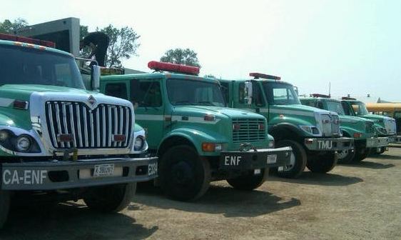
Glad to see some engines from the El Dorado National Forest!
Is there still an Area Command Team activated somewhere in the RMA?
We are very concerned about the possibility of the fire reaching Sweetwater Road 8 miles north of Newcastle. Any information is greatly appreciated as we are tuned in to your reports every minute!! Thank You & God bless!!
Drove from Spearfish to Newcastle afternoon of 4 July and saw heavy smoke plumes ascending from spots well to the west of Hwy 85 somewhat south of Four Corners. Also noted convoy of fire apparatus and two flatbeds hauling humongous dozers leaving the Newcastle Fire Camp and then heading west on Hwy 585–in the general direction of those plumes. Activity did NOT appear to be in vicinity of Sweetwater Road.
Thanks again Bill. Lots of great effort.
Weston County (Oil Creek fire) satellite imagery is being updated at http://www.westoncountywildfire.org.