(UPDATED at 11:08 a.m. MDT, August 30, 2014)

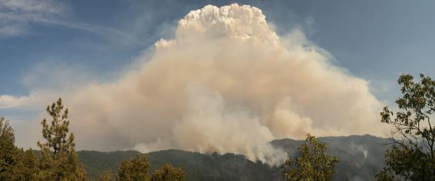
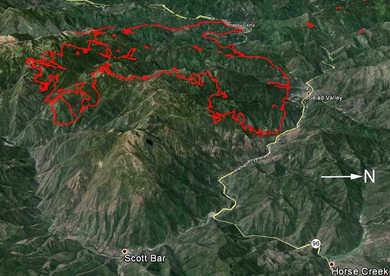
The growth of the Happy Camp Complex Fire on Friday was similar to the day before. Continued spread to the northeast added another 13,000 acres and brought the 57,722-acre fire to the banks of the Klamath River at the community of Seiad Valley. Exhibiting intense fire behavior it traveled north approximately three quarters of a mile up the Grider Creek drainage below a pyrocumulus cloud that formed above the large column of smoke.
The mandatory evacuations from Friday remain in effect. Communities that are threatened by the fire include Happy Camp, Elk Creek, Seiad Valley, Hamburg, Kelsey Creek and Scott Bar. Structure protection groups are placed in strategic locations to assist in protecting homes and property should the fire move into these areas.
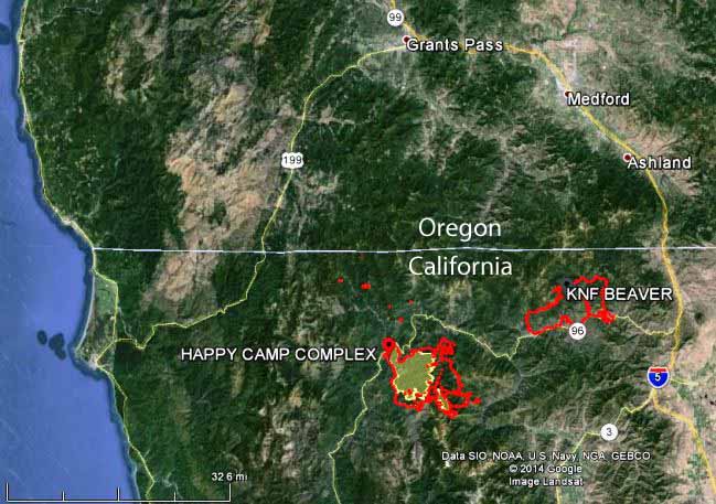
Click on the maps of the Happy Camp Complex below to see slightly larger versions.


****
(Originally published at 10:06 a.m. MDT, August 29, 2014)

The Happy Camp Complex of fires grew by 12,000 acres on Thursday, requiring additional mandatory evacuations in the Seiad Valley area, including:
- Scott Valley Road from Bridge Flat to the intersection of Hwy. 96.
- All areas south of Hwy. 96 between Scott River Road and Grider Creek.
- All areas south of Hwy. 96 from Seiad Valley down river to Kade Summit.
Other areas are under an evacuation advisory.
On Thursday the two largest and most active fires in the Complex, the Faulkstein and Frying Pan Fires, spread rapidly on the east side aided by long-range spotting. The fires grew together when an inversion broke, followed by a west wind that pushed the fire to the northeast. Burning embers were carried a mile and a half in front of the fire.
As you can see on the maps below, the fire is 38 miles southwest of Medford, Oregon and less than two miles from Seiad Valley, California on Highway 96.
Weather conditions are expected to be similar on Friday, which could lead to additional extensive fire growth during the day.

The map below zooms in on the Happy Camp Complex, which has advanced to within less than two miles of Seiad Valley on Highway 96. Click on the maps to see slightly larger versions.

We posted a map earlier on Friday showing the distribution of smoke created across California, Oregon, and Idaho by the Happy Camp Complex of fires.
