(UPDATED at 9:45 a.m. MT, June 17, 2015)

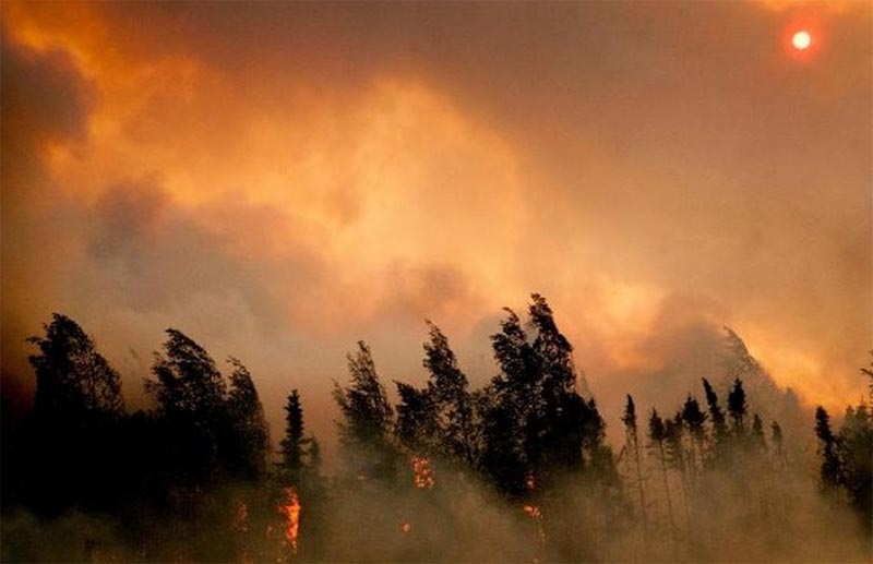
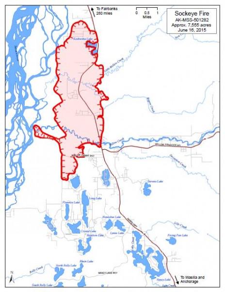
The Sockeye Fire north of Willow, Alaska, about 40 air miles north of Anchorage did not grow on Tuesday as much as it had on previous days, and is now estimated at 7,512 acres.
The Alaska Interagency Type 1 Incident Management Team, with Incident Commander Tom Kurth, assumed command of the fire at 7 a.m. Tuesday.
A total of 3,060 structures are considered threatened by the fire.

****
(ORIGINALLY published at 10:39 a.m. MT, June 15, 2015)

The Sockeye Fire, about 40 air miles north of Anchorage, Alaska, has forced evacuations near Willow. About 1,700 residences are in the designated evacuation area. More than 200 people signed in at evacuation centers on Sunday.
The fire is burning on both sides of the Parks Highway. It is moving south and has crossed Willow Creek at Mile 71.5, according to the Alaska Division of Forestry.
Matanuska-Susitna Borough officials were conducting an on-the-ground assessment early Monday to determine how much damage the fire had caused. Sunday evening the borough estimated that 10 to 15 structures had burned.
The area is under a Red Flag Warning on Monday for gusty winds and low humidity.
Below is information from InciWeb, published at 12:30 a.m. June 15:
****
“The fast-moving Sockeye Fire, burning along the Parks Highway in the Willow area, is now estimated at 6,500 acres. The evacuation area has been expanded to cover the area from Milepost 63 to 77, and from three miles east of the Parks Highway and west to the Susitna River.
The Parks Highway remains closed from Milepost 66 through 77. The Alaska Division of Forestry, Department of Transportation, and Alaska State Troopers are working together to reopen the highway as quickly as possible.
The fire was reported shortly after 1 p.m. Sunday and grew quickly. Due to continued hot, dry weather, extreme fire behavior is expected to continue Monday.
There is no estimate at this time of structures lost. Emergency managers and firefighters are focused on the evacuation and saving homes and, as yet, there has not been a damage assessment. Firefighters on the ground have been focused on protecting structures, while multiple aircraft from the Alaska Division of Forestry and Alaska Fire Service have been dropping water and retardant on the fire.
Additional firefighting resources have been ordered from the Lower 48, including 10 hotshot crews. The Alaska Type 2 Black Team is mobilizing and will assume control of the fire. The Matanuska-Susitna Borough has activated its Emergency Operations Center. Residents can get information about the evacuation at 907-861-8500.”
****
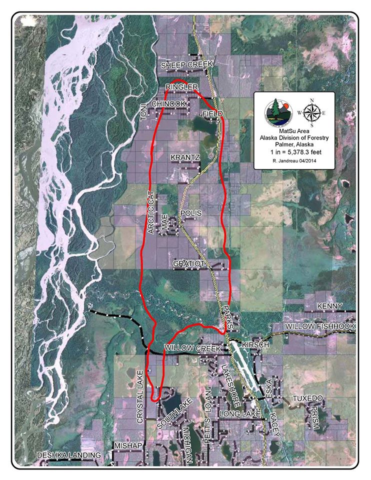
The map below, even though it has the date of 04/2014 in the legend box, was posted on June 15, 2015 and appears to have the current perimeter of the Sockeye Fire, in red. Click on it to see a larger version.

