(UPDATED at 7:40 a.m. PDT September 8, 2019)
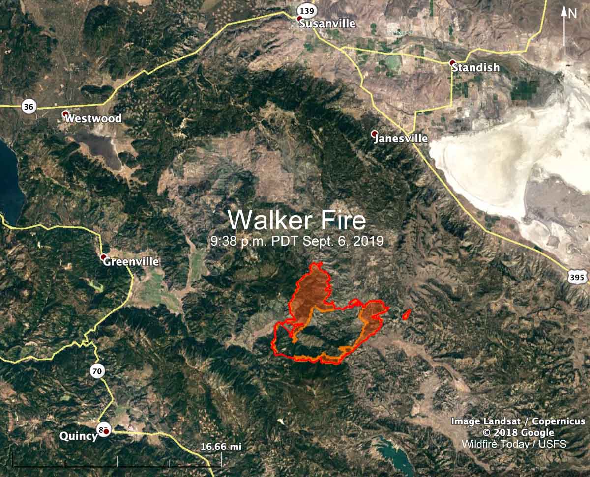
After being slowed earlier by cloud cover, the Walker Fire south of Susanville, California was very active late in the day Saturday, spreading toward the northeast in two large fingers 2 and 4.5 miles long, coming to within 5 miles of US Highway 395. Spot fires occurred more than half a mile ahead. The fire grew to the north up Wheeler’s Peak drainage and east around the Antelope Fire scar. Murdock Crossing is between the two large fingers, and now has fire to the west, south, and east. At 7:35 p.m. Saturday the fire was one mile south of Antelope Lake.
(Click here to see all articles about the Walker Fire on Wildfire Today, including the most recent.)
A mapping flight at 7:35 p.m. MDT Saturday found that the fire had burned 38,049 acres. It is 15 miles northeast of Quincy and 17 miles south of Susanville.
The Incident Management Team reports that during the period of reduced fire activity firefighters made progress on the south side, assisted by Very Large Air Tankers, water-scooping air tankers, conventional large air tankers, and dozers.

Resources assigned to the fire include 11 hand crews, 46 fire engines, and 6 helicopters for a total of 535 personnel.
The weather forecast for the Walker Fire area on Sunday calls for 67 degrees, relative humidity of 32 percent, clear skies, and winds out of the west-southwest at 8 to 13 mph gusting at 20 to 24.
(UPDATED at 8:43 a.m. PDT September 7, 2019)

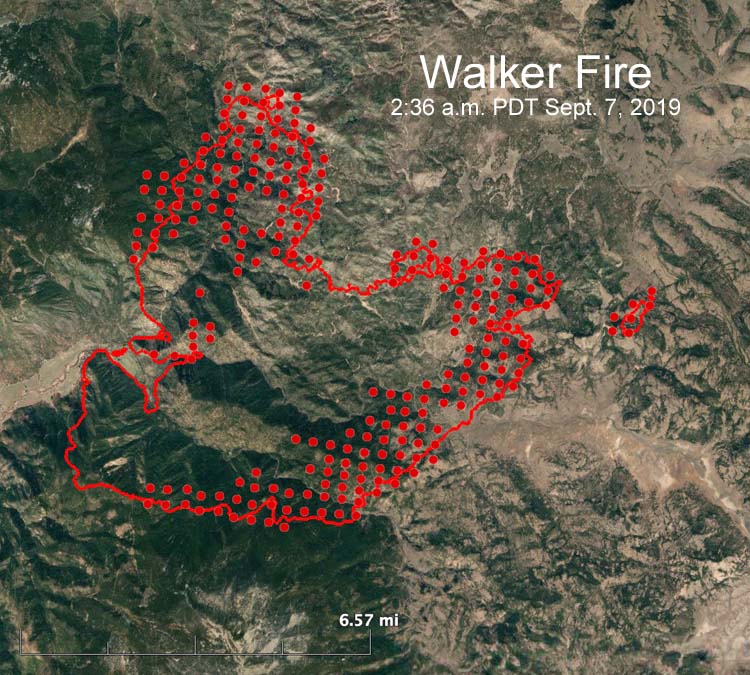
A mapping flight Friday night showed that the Walker Fire in Northern California had grown to 24,040 acres, an increase of about 6,000 acres since the last reported size of 17,912. The fire spread approximately 4 miles to the north and 6 miles to the east since noon on September 6. (see map above)
The fire is 15 miles northeast of Quincy and 21 miles south of Susanville.
The Plumas County Sheriff’s Office ordered mandatory evacuations for the Genesee Valley road corridor, the Ward Creek area, and the Flournoy Bridge area (through CodeRED).


Another year and no one knows how to put out a fire anymore. Streight streams are all they use , they don’t use fog
anymore, I even saw a ladder pipe on a aerial ladder being used on a wildland fire. Todays fire trucks are way to big,
you need to ladder the truck to pull a hose line, cant’t turn around on a city street and sure can’t take them off road.
The Crown Fire Coaches were all we needed. I have been watching fires in Utah, burning in light fuel in rolling
hills, good Cat country and no one working them, to dangerous. Hotshot crews all wearing back packs (extra weight
and clumsy to work in, WHY, we didn’t need them. Overburdened with fire shelters and nomex clothing. We wore jeans, cotton shirts and aluminum helmits, goggles and gloves were optional, you could feel the heat and know when to get out. you felt the stinging on your neck and know to look up, aluminum helmits were much lighter and didn’t melt. I’ve talked to a lot of “fire fighters” over the last few years and they don’t even know the
10 standard fire orders. Retired helitack foreman, LACoFd with 30 years experiance.