
Updated 8:36 p.m. PDT July 23, 2022
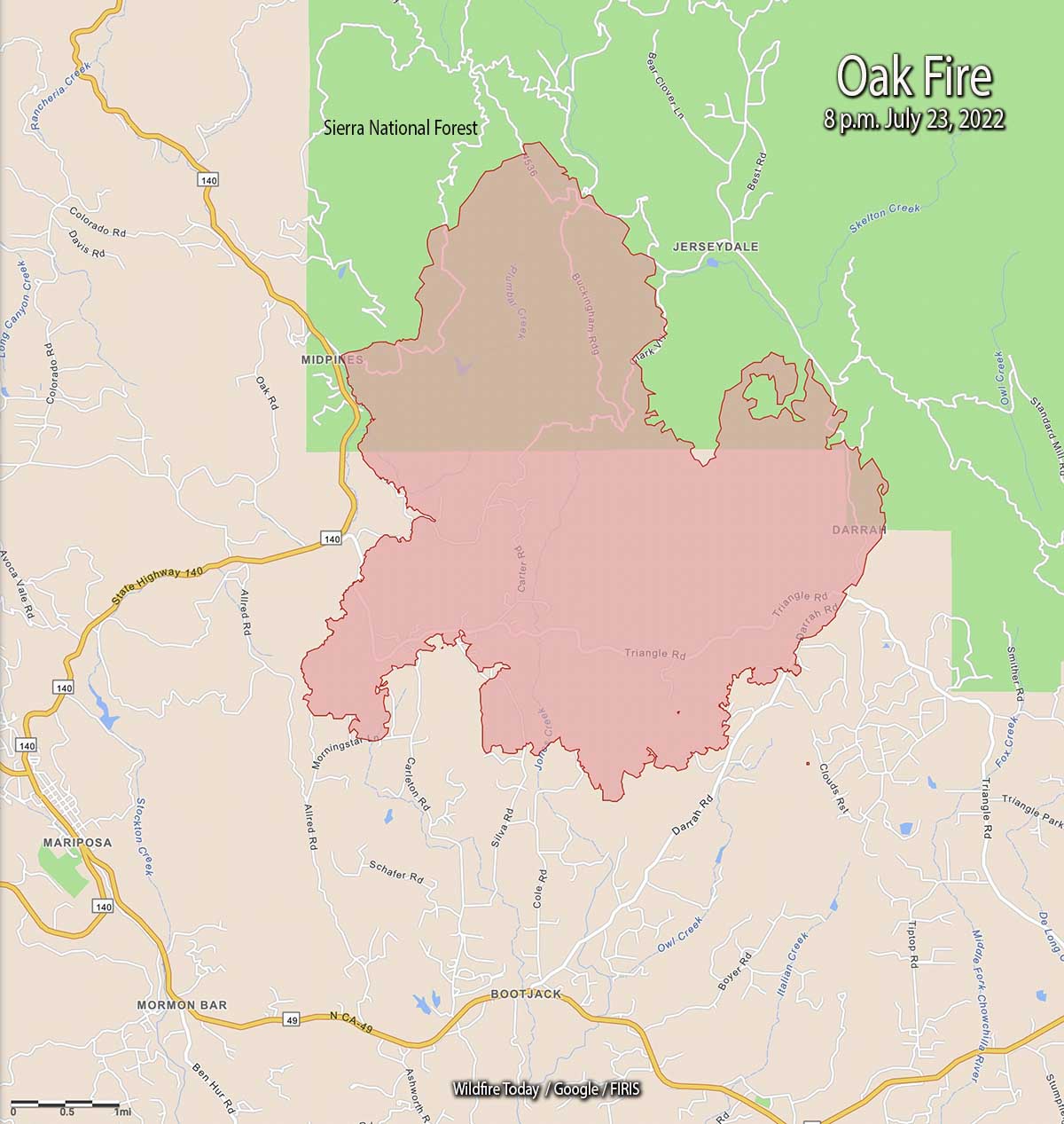
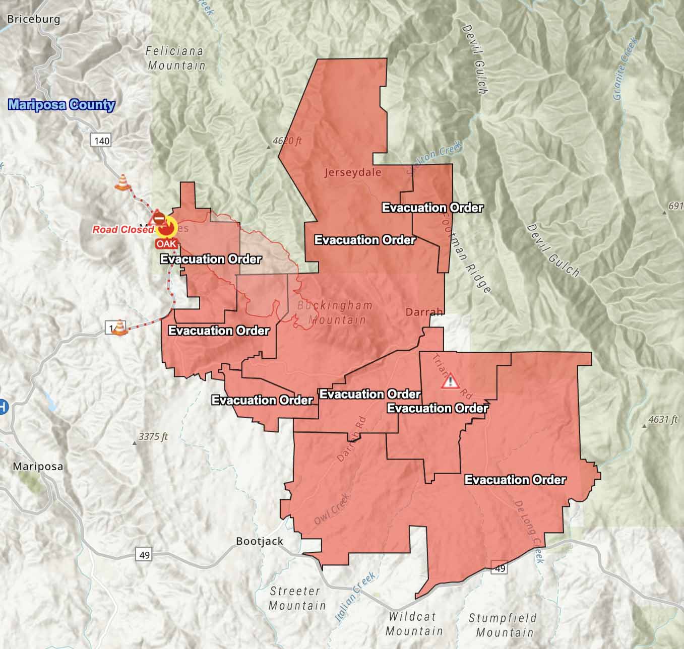
The Oak Fire has spread to the east quite significantly, crossing Jerseydale Road about two miles south of Jerseydale in the vicinity of Wild Dove Lane.
To see all articles on Wildfire Today about the Oak Fire, including the most recent, click HERE.
That puts it less than a mile west of the footprint of the very large Ferguson Fire which burned more than 96,000 acres in 2018. It was caused by a hot catalytic converter on a vehicle that parked in dry grass July 13, 2018 along Highway 140 near the Savage Trading Post.
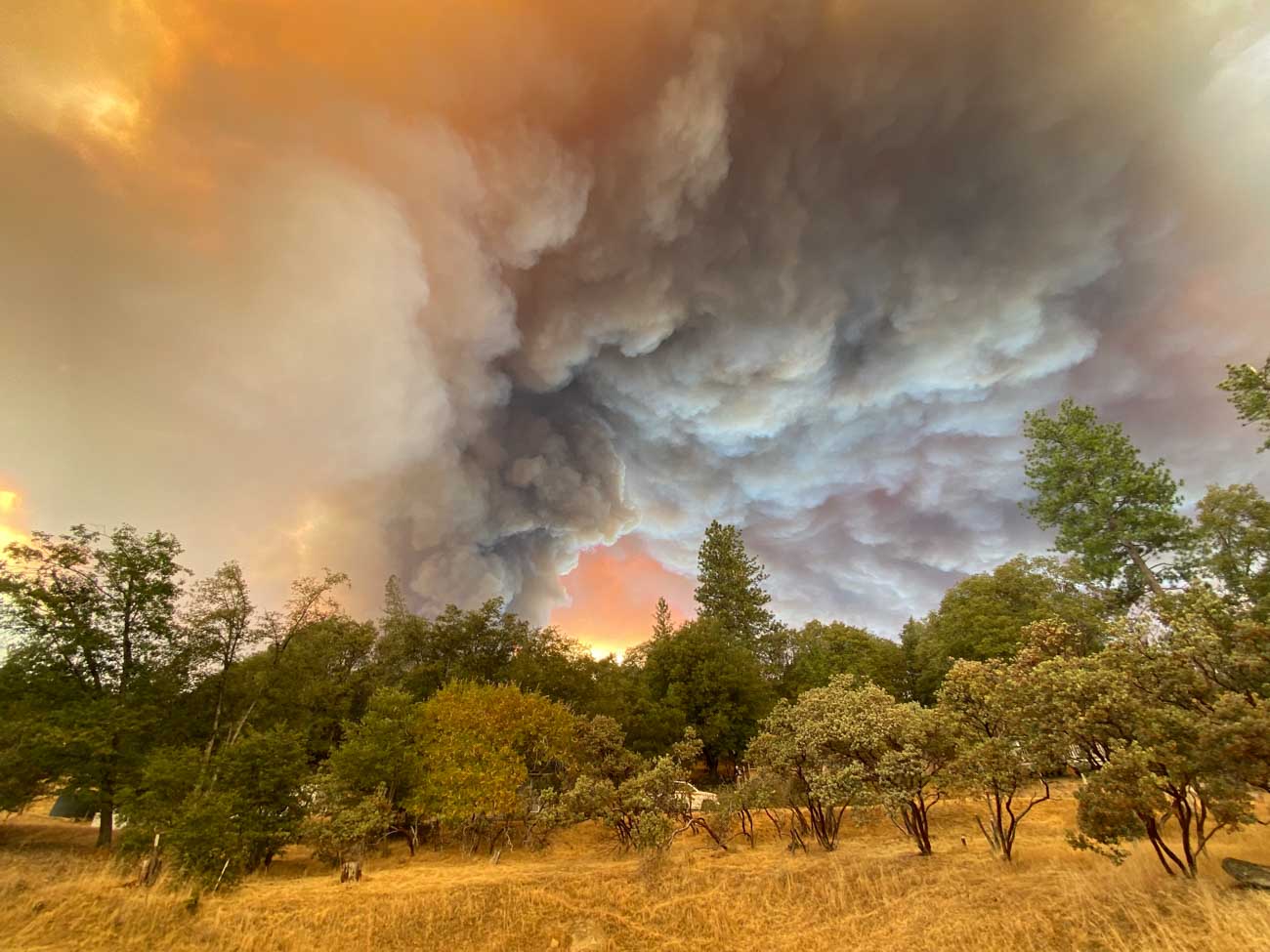
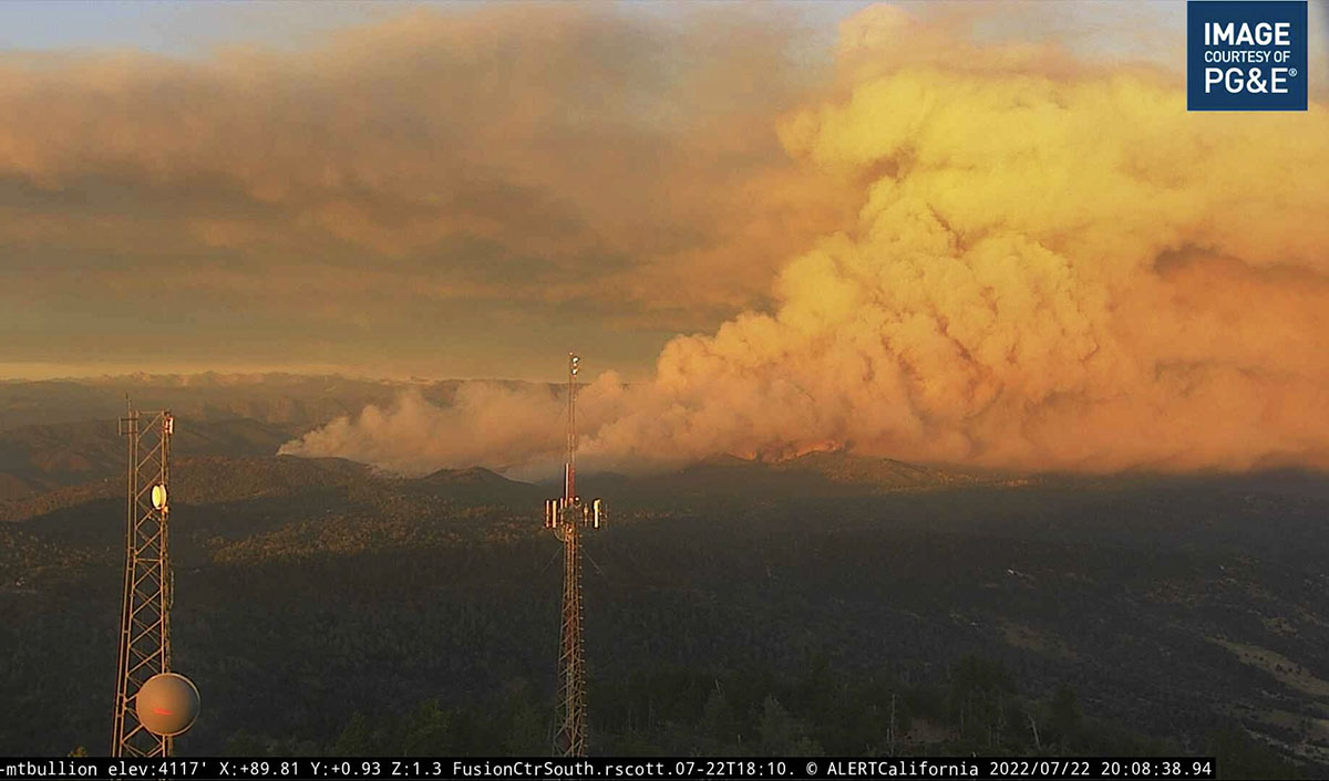
The Oak Fire is exhibiting extreme fire behavior, igniting spot fires far ahead of the main fire.
CAL FIRE announced that at 6:45 p.m. it had burned 11,900 acres.
Updated 5:00 p.m. PDT july 23, 2022
At approximately 4:20 p.m. Air Attack reported that the latest mapping of the Oak Fire showed had grown to 11,500 acres.
Updated 12:58 p.m. PDT July 23, 2022
At 11:15 a.m. Saturday the Oak Fire was mapped by Air Attack at 9,100 acres.
CAL FIRE confirms 10 structures have been destroyed. That number will likely increase.
Updated at 8:35 a.m. PDT July 23, 2022
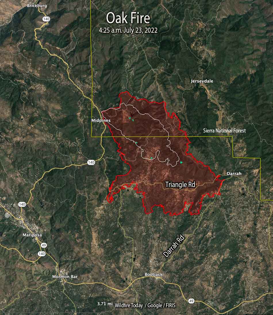
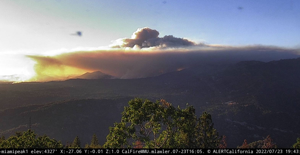
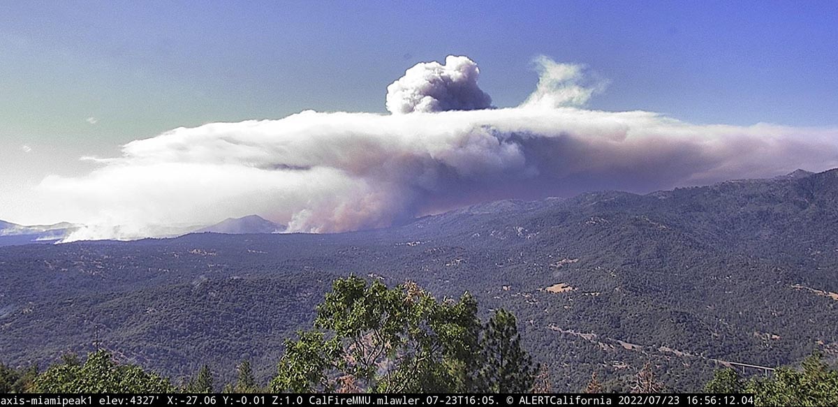
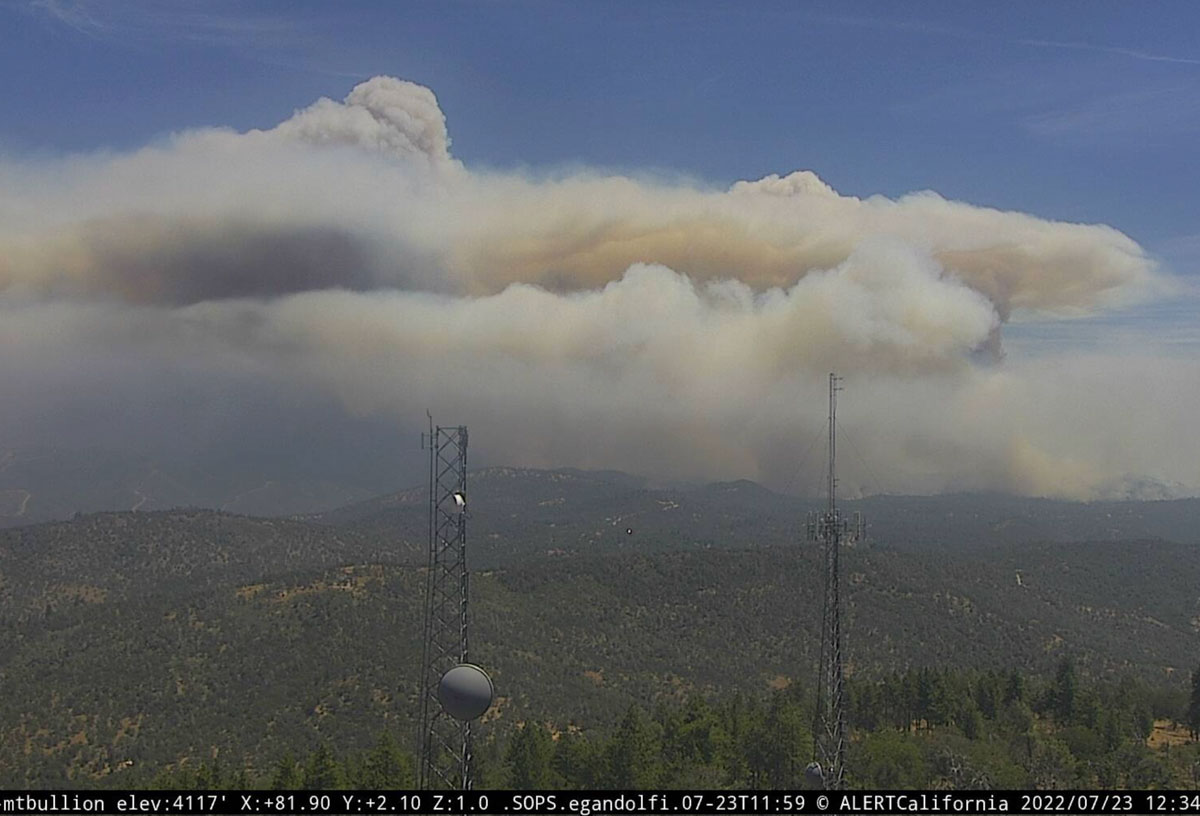
The Oak Fire at Midpines, California was active throughout much of Friday night, growing by about 2,200 acres between 10 p.m. and 4:25 a.m. Saturday when it was mapped by FIRIS at 6,555 acres. Half an hour after sunrise it was putting up two smoke columns that were quite some distance apart, with one of them creating enough energy to be capped by a pyrocumulus cloud.
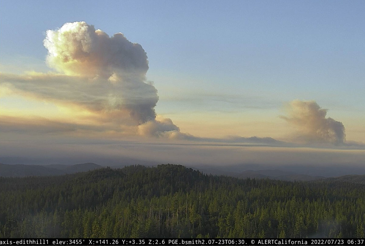
Just to be clear — wildfires normally lay down at night, providing an opportunity for firefighters to move in closer and put in direct fireline. It is not common for a fire to be burning so actively soon after dawn that it is creating multiple smoke columns, especially a pyrocumulus column.
The Mariposa County Sheriff has ordered evacuations as far south as Highway 49 and east to Jerseydale. Their map is available online. As we wrote earlier, this is a dangerous fire.
The Oak Fire is spreading rapidly. When it was mapped at 4:25 a.m. Saturday it had spread south across Triangle Road and reached Darrah Road. At that time it was about a half mile west of the community of Darrah. Firefighters were planning a burning operation between Triangle Road and Darrah Road west of the town.
Weather
The spot weather forecast for the area predicts hot and dry conditions to persist into next week. Winds will be generally light, except becoming gusty in the afternoons. On Saturday, mostly sunny skies, 90 to 94 degrees, 9 to 13 percent relative humidity, and 6 to 12 mph ridgetop winds from the south to southwest gusting to 20 mph in the afternoon. Saturday night will see poor humidity recovery, 26 to 31 percent, with very light winds. For Sunday, 10 to 14 percent RH with afternoon ridgetop winds out of the west at 4 to 8 mph.
10:36 p.m. PDT July 22, 2022
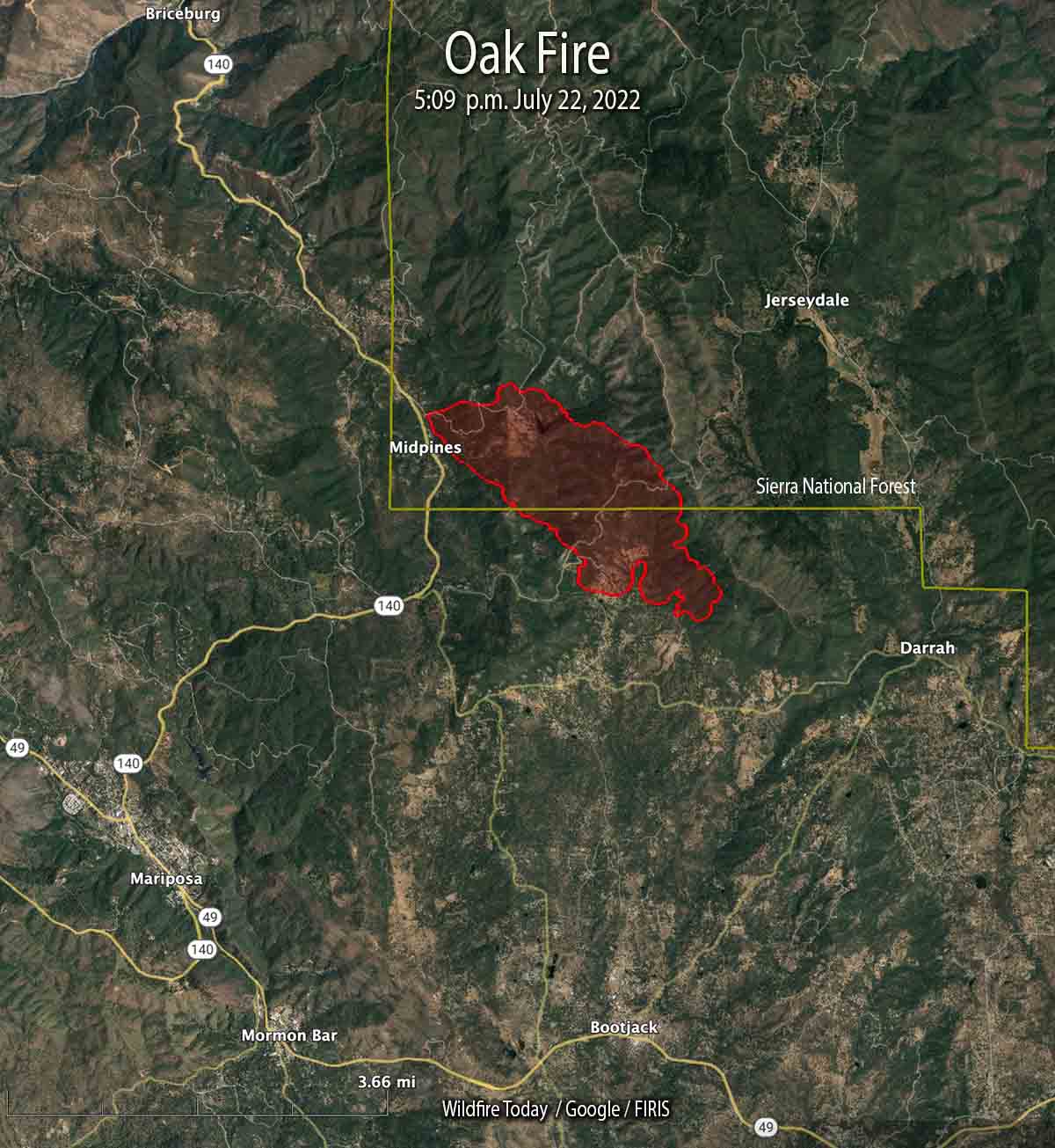
The Oak Fire that started Friday afternoon in Central California has been growing rapidly in Mariposa County. The County Sheriff has ordered evacuations for several areas east and southeast of Midpines. At 10 p.m. Friday it was about 4 miles northeast of Mariposa.
This is a dangerous fire. Residents should not hesitate to evacuate if there is any doubt about their safety.
At 5:09 p.m. it was mapped at 1,745 acres; at about 10 p.m. CAL FIRE reported it had grown to 4,350 acres.

To give folks an idea of what fire behavior can be in this area, when the Harlow Fire blew up it burned 20,000, acres in two hours. It was dubbed as the fastest burning fire in U.S. history for many years. The weather service felt that a mini jet stream had dropped causing this extreme behavior. An old ranger and Captain I worked for both said the ground actually shook when the convection column collapsed and the blow up occurred.
Thanks for this post, Bill. While I worked on the Sierra N.F. back in the day I did some work on the Mariposa R.D. out of Jerseydale. I was on the Harlow fire when it blew up and burned out a couple local small towns, I think Ahwahnee and NIppanahwasee, (sp.?) That country will be real tough to fight fire in. Again thanks for this and ALL your fire news.
Thanks as always for your post, Bill. We live in Jerseydale and were evacuated about two hours after this one began and I’ve never seen a fire travel so far – so quickly. The smoke was pretty amazing, and knowing how far the ignition point was FROM us, we were then astonished to see huge flames atop Buckingham Mountain as we left at about 5 PM yesterday.
Since then, it’s apparently moved to the south, away from our property – but we’ve heard reports of structures being lost or damaged, power lines down on Triangle Road (W) – and other events associated with this one. After the Ferguson Fire, this one is taking a similar path, though a little more westerly – through areas which weren’t burned in that last fire.
Thanks for your post, Bill –
Excellent reporting by W.F.T. and O.C. The Harlow Fire, 1961 started about ten air miles away, 44,000 acres. As mentioned, structures everywhere. The smoke column was highly visible over Yerington, Nevada. Thought the fire was off Highway 395?
Much of this area hasn’t burned in years. Lots of structures, narrow roads, heavy fuel loads, etc. . The air show this afternoon looked like they were hitting it with everything they could get in the air. As Bill said, this is a very dangerous fire with lots of potential. With all the structures in the area it’s going to be very difficult to do any firing out.