Originally published at 9:21 p.m. MT, October 9, 2012
(On October 10, 2012 we posted an update on the fire.)
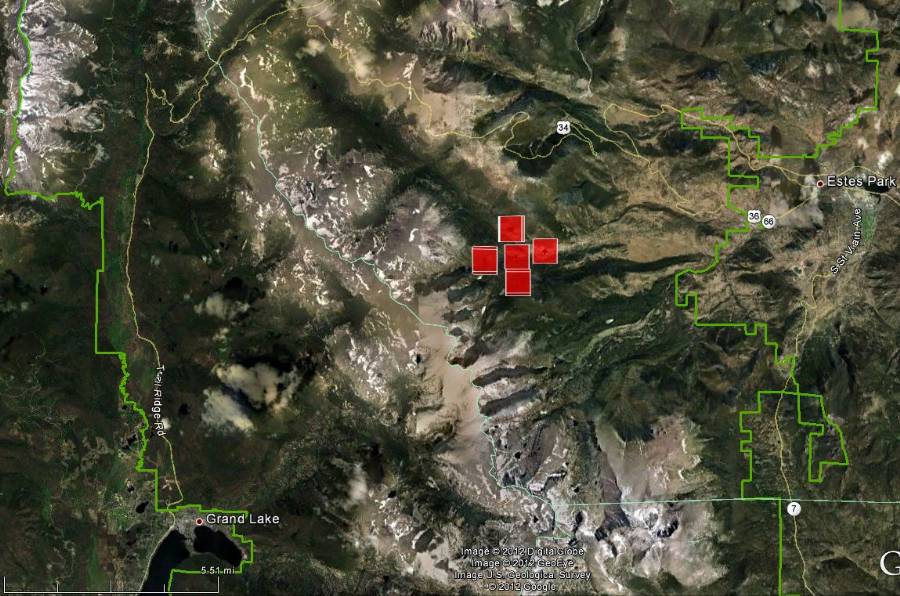
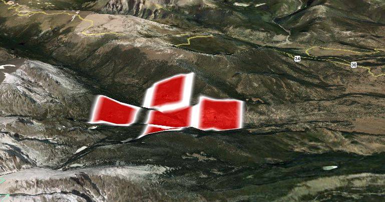
A new fire started in Rocky Mountain National Park Tuesday afternoon seven miles west of the town of Estes Park. Named the Fern Lake Fire, it is approximately 2 miles west of the Fern Lake Trailhead on the east side of the National Park. Click on the maps to see more details. The red squares on the maps represent heat detected by satellites.

At 5 p.m. the park reported the fire had burned approximately 300 acres. An air tanker and a heavy helicopter attempted to begin work on the fire late in the afternoon but were were foiled by turbulence and poor visibility.

Firefighters were only able to monitor the fire from a distance Tuesday afternoon due to steep, inaccessible terrain, so there will be no direct fire suppression Tuesday night. At least three hot shot crews and a strike team of engines are on order.
No evacuations for the Estes Park area have been ordered, but heavy smoke was a cause for concern for some of the residents. Tuesday night Bear Lake Road, Upper Beaver Meadows Road and Moraine Park Campground were closed. The campground was evacuated along with backcountry campsites and trails in the area of the fire. Trail Ridge Road, highway 34, remains open.
A fire information number has been set up with a recorded message and will be updated as conditions change. The number is 970-586-1381.
From some web cams in the Estes Park area viewers were able to see smoke created by the fire Tuesday afternoon, but not the fire itself.
Weather for the fire area
The weather forecast for the fire area leads one to believe that the fire has some potential on Wednesday. On Tuesday it was burning at approximately 8,000 to 10,000 feet in elevation and on Tuesday night the temperature there will drop below 32 degrees with a wind chill of around 22; not great conditions for firefighting — another good reason to hold off on sending firefighters to the scene until daylight. The wind during the night will be from the west at 6-10 mph, increasing on Wednesday to 10-15 mph with gusts up to 21 out of the west. This could lead to smoke over the Estes Park and Loveland areas. At the fire the temperature should reach 60 on Wednesday, while the relative humidity will bottom out at 25 percent. The cloud cover on Wednesday will be 20 to 40 percent.
There is a zero percent chance of precipitation until Friday, when the chance will be 10 percent in the morning, increasing to 41 percent in the afternoon, then gradually decreasing to 10 percent by Saturday night.
A weather station about 2 miles west of Estes Park recorded at 9:24 p.m. Tuesday night 32 degrees, 78 percent RH, with a 3 mph wind out of the north-northeast.
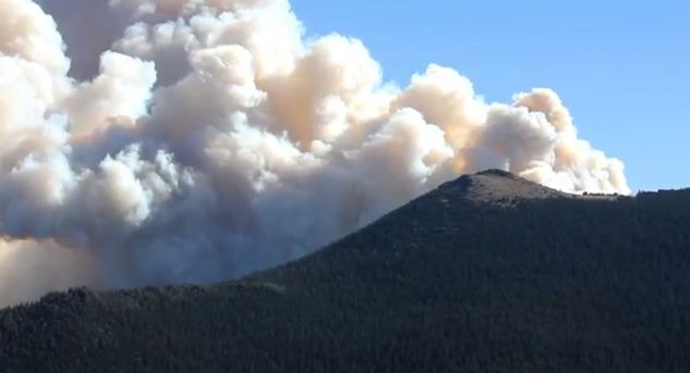
The video below shows an impressive amount of smoke created by the fire Tuesday afternoon.
On June 23 the Woodland Heights fire started which destroyed 22 residences and two outbuildings on the west side of Estes Park. That fire was over shadowed by the Waldo Canyon fire which started the same day and burned into Colorado Springs destroying 346 homes.

