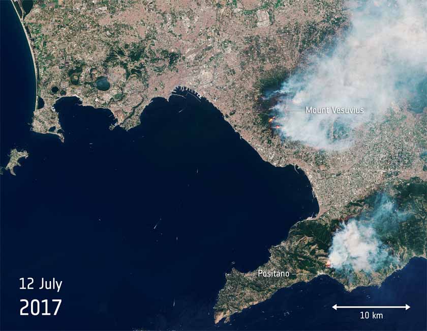
Above: Satellite photo from July 12, 2017 showing smoke from fires burning near Mount Vesuvius in Italy. The red dots represent heat from the fires. NASA.
(Originally published at 11:40 a.m. MDT July 13, 2017)
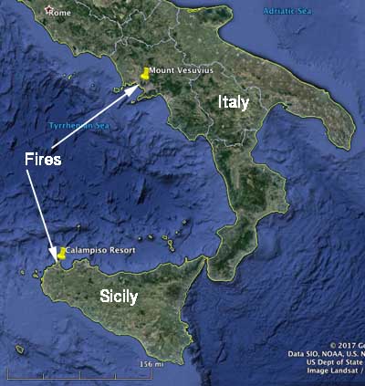
Two fires in Italy, one on the mainland and another on the island of Sicily, are in the news today.
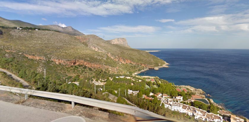
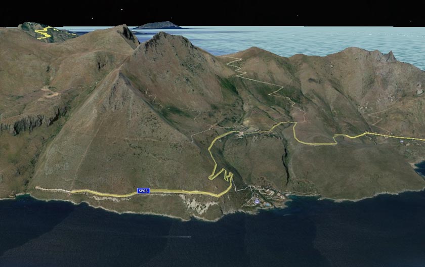
The fire on Sicily came very close to the Calampiso Resort 15 air miles northwest of Trapani and had authorities worried that tourists would be endangered by the fire directly, or trapped at the end of the dead end road leading to the community.
The Italian paper La Stampa quoted one evacuated tourist, Stella Belliotti, as saying: “We fled in swimwear and slippers. Our apartment was engulfed in flames. They were right above us. I took my daughter and I went to the beach. They made us go on the boats that go around Zingaro. First women and children, and then the others.”
1,000 tourists evacuated from Sicily village over fire https://t.co/F7U45OYddZ pic.twitter.com/Fw1FddtxyJ
— The Local Italy (@TheLocalItaly) July 13, 2017
Various reports say that 700 to 1,000 tourists were evacuated by boat from the Calampiso Resort and taken to San Vito Lo Capo 5 miles by boat to the northwest where the mayor, Matteo Rizzo, appealed on Facebook for residents to pick up the evacuees:
We need minibuses and cars to pick people up at the little port and take them to school buildings. Let’s all do something.
There were no reports of injuries.


Numerous wildfires have been burning on the mainland of Italy on the slopes of Mount Vesuvius and nearby the volcano. The huge plume of smoke led some to believe that Vesuvius was erupting again. The last time it erupted was in 1944, but it is most famous for the 79 AD eruption that destroyed Pompeii.
UPDATE: Huge fire on Mount #Vesuvius seen from Pompeii #Italy #Vesuvio pic.twitter.com/QNp77bC0J5
— Marco السلام (@meteorologo777) July 11, 2017


