(UPDATED at 3:06 p.m. MDT August 29, 2018)
(To see all of the articles on Wildfire Today about the Britania Mountain Fire, including the most recent, click HERE.)
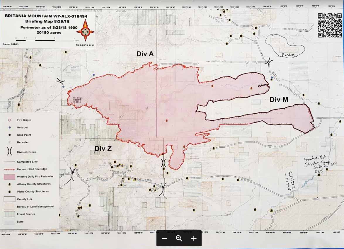
The incident management team on the Britania Mountain Fire 8 miles northeast of Wheatland, Wyoming has released a map of the fire:

Mandatory evacuations have been issued for Palmer canyon. The Red Cross set up an evacuation center in Wheatland at the Services for Seniors Annex, 809 16th St. They are asking those evacuating to call (307) 322-3279.
(UPDATED at 11:04 a.m. MDT August 29, 2018)
The Britania Mountain Fire 8 miles northwest of Wheatland, Wyoming has burned at least 20,180 acres and 16 structures according to information released by fire officials Wednesday morning. It is not clear how many of the structures are outbuildings or residences, or how current the data is. Very little official information has been released about the fire since it started on August 26.
On Tuesday the Britania Mountain Fire spread to the south into even more rugged terrain.
The area is under a Red Flag Warning through Thursday. The forecast calls for southwest winds of 15 to 25 with gusts to 35 mph and relative humidity of 10 to 15 percent in the afternoons on both days. This could spread the fire farther to the east and northeast if receptive fuels are available.

A Type 2 Incident Management Team with Incident Commander Shane Greer was scheduled to in-brief Wednesday morning at 8 a.m. Tuesday evening 259 personnel were assigned.
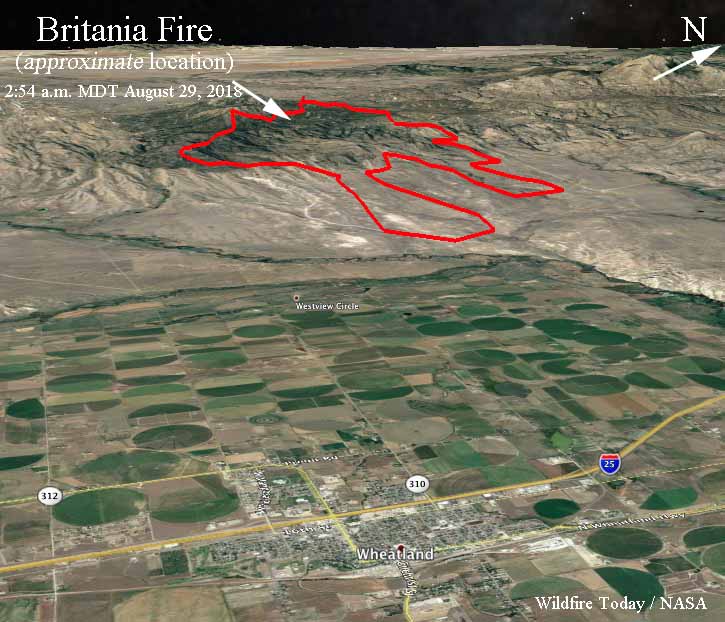
The maps below show the APPROXIMATE location of the Britania Mountain Fire. It is based on heat sensing data from a satellite at 2:54 a.m. MDT August 29 and a map created by fire personnel that used data from 7:46 p.m. August 27.

During the satellite overflight at 2:54 a.m. MDT Wednesday the only large heat sources detected were on the southern-most perimeter and the southwest side. At about 200 miles above the Earth smaller heat sources scattered across the fire can’t be “seen” by the sensors. On the map above the heat stretched across the south edge for 4 miles west of the County line (the green line) and one mile to the east. The fire spread further to the south in this area.

(Originally published at 11:30 a.m. MDT August 28, 2018)
The Britania Fire west of Wheatland, Wyoming has grown to approximately 18,800 acres. Shifting winds and rugged terrain are creating challenges for the 150 to 200 firefighters on scene, including one crew from Florida. More resources will be arriving today (Tuesday). The fire is approximately 8 to 12 miles west of Wheatland, Wyoming and 68 miles north of Cheyenne.
Some structures have burned, according to a spokesperson for the fire, including at least one residence. Exact numbers are difficult to determine as firefighters have not been able to access some areas because of the fire and the terrain.
It is burning on private land and the Medicine Bow National Forest.
There was some scattered light rain over parts of southeast Wyoming Monday night, but it is unknown if any occurred on the fire. Monday night the temperature at a weather station west of Wheatland got down to 48 degrees with a relative humidity of 81 percent. At 11 a.m. Tuesday the temperature had risen to 56 with 64 percent humidity. These conditions should slow the spread of the fire considerably.
A public meeting is scheduled for Tuesday night at 7:00 PM at the Platte County Fairgrounds.
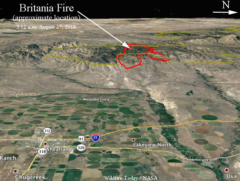
The maps below show the approximate location of the fire at 3:12 a.m. MDT August 27. Since that time it has almost doubled in size.


Where is the current fire boundary in relation to Van Ortwick Hill Road and the North Laramie river canyon, Johnson Mountain and Chimney Rock; and the fork in the road @ Fletcher Park road/Van Ortwick Hill Road as of 9:30 pm 8/30/18? Is the wind direction pushing the boundary towards/or away from this general area (previously burned during both the Arapaho and Cow Camp fires)? Is it burning on True’s Double 4 Ranch; Dry Laramie River canyon Homestead?