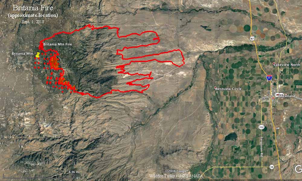
(Originally published at 7:34 a.m. MDT September 1, 2018)
The Britania Fire continues to spread on the west and southwest sides near the peak of Britania Mountain and areas south and southeast of the peak. The Incident Management team reports that it has burned 27,200 acres.
On Thursday firefighters were successful in constructing fireline to gain additional containment on the north side of the fire. On the eastern edge of the fire, crews mopped up and patrolled established containment line constructed over prior shifts.
(To see all of the articles on Wildfire Today about the Britania Mountain Fire, including the most recent, click HERE.)
The southeastern corner of the fire increased containment as crews were successful in constructing direct fireline in the lighter fuels as well as using roads as indirect firelines to conduct firing operations along Palmer Canyon Road. Firefighters used both fixed wing air resources and helicopters to support ground personnel in these efforts. On the southwest corner of the fire, crews identified roads that may be utilized as indirect firelines and began prepping those areas to conduct continued firing operations.
