
6:35 p.m. PDT Oct. 10, 2021
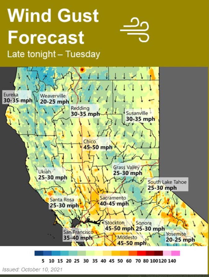
Much of California between Los Angeles and Redding will be under elevated fire danger or Red Flag Warnings Monday and Tuesday. Strong north winds are predicted to begin Sunday night, peak on Monday, and last through Tuesday. Temperatures will not be as high as is seen in typical Santa Ana wind events, but they will be higher than normal and relative humidities will be low.
In the North Bay, for example, winds will develop late Sunday evening from the north at 30 to 40 mph, and will be locally higher near favored gaps, canyons, and in the Valley. Minimum humidity will drop to 10 to 25 percent Monday and slightly lower on Tuesday. Overnight recovery will be 25 to 50 percent.
Any fires that develop could spread rapidly.
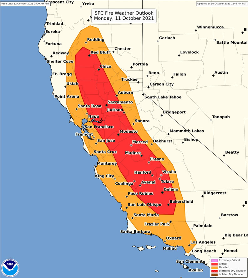
#RedFlagWarning in effect for central and northern California, from Shasta County down to Kern County from Sunday afternoon till Tuesday evening due to gusty winds and low humidity. This is #CriticalFireWeather so use caution outdoors. More tips: https://t.co/TRIM6OtIun pic.twitter.com/TxbtaBYKw4
— CAL FIRE (@CAL_FIRE) October 10, 2021
We will update this article on Monday Oct. 11 as this event develops.

Check out this WX forecasting site, the site is loaded with useful WX info.
https://www.ventusky.com/?p=38.12;-80.65;6&l=wind-850hpa