
6:10 p.m. PT, March 3, 2022
Firefighters are making good progress on the Jim Fire in the Cleveland National Forest in Southern California. On Thursday several air tankers and helicopters were assisting firefighters. There has been no mention of the fire spreading any more Thursday.
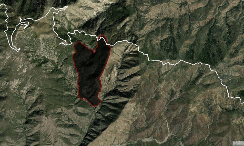
There has been no reported change in the size, and is still 553 acres.
The cause of the fire is officially still under investigation, but the Desert Sun reported that U.S. Marines were working with explosives in the general area about the time the fire broke out.
From the Sun:
Marine engineers from Camp Pendleton were in the area using explosives to demolish old dams, authorities said, as part of a long-running project to restore creek habitat for steelhead trout.
“There was a crew working in the area yesterday, but the fire is still under investigation,” said Nathan Judy, spokesperson for the Cleveland National Forest. “Forest Service law enforcement will be headed into that area to do the investigation.”
The video below from the FIRIS aircraft shows an air tanker dropping, and using infrared, the amount of heat remaining on the fire.
OCFA’s FIRIS Intel 12 on the Jim Incident showing retardant dropping on the Mike/Zulu Divisions. pic.twitter.com/7KBDccKmZO
— FIRIS (@FIRIS) March 3, 2022
8:58 a.m. PT, March 3, 2022
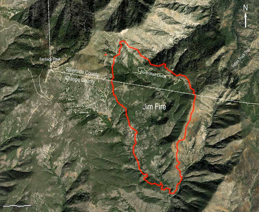
The Jim Fire that started near Holy Jim Canyon spread very little after the late afternoon on Wednesday. The Cleveland National Forest said Thursday morning it has burned 553 acres. Today crews will continue to build hand and dozer lines around the fire and utilize water-dropping helicopters to assist with any remaining hotspots. Air tankers will be on standby to respond if needed.
It began in Orange County in Southern California Wednesday morning and burned uphill and north across the North Main Divide Truck Trail and into Riverside County.
As you can see in the photo below the fire is fairly quiet Thursday morning, with some interior heat still present.

The thermal video below shows heat on the fire at 10:32 p.m. on Wednesday.
OCFA’s FIRIS Intel 12 showing a more detailed view at the head of the Jim Incident at 22:32 hours. pic.twitter.com/IkEwWf4ZYs
— FIRIS (@FIRIS) March 3, 2022
The photo of the Jim Fire below was taken Wednesday, a few hours after it was reported.

5:57 p.m. PT, March 2, 2022

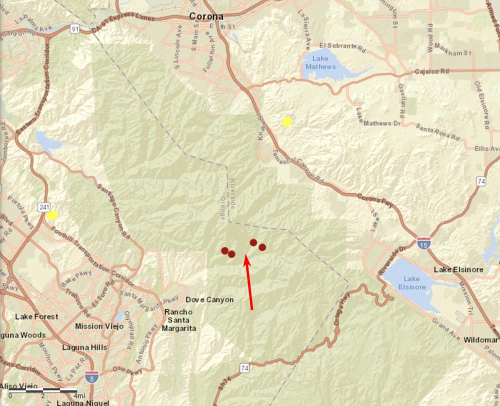
After the Jim Fire started at about 11:20 Wednesday morning near Trabuco Canyon in Southern California’s Orange County, it spread uphill to the North Main Divide road in the Cleveland National Forest. It created a significant column of smoke, especially for an early March fire, as it crossed the North Main and moved into Riverside County about half a mile east of Santiago Peak.
At 1:20 p.m. it was mapped at 290 acres; at about 2 p.m. the Cleveland NF said it had grown to approximately 400 acres, and at 3:30 it was still holding at that size. It was mapped again from the FIRIS aircraft at 4:24 p.m. and was 551 acres.
There is an unconfirmed report that two large air tankers were dispatched from Abilene, Texas to assist with this fire, an MD-87 and an RJ85. By 5:45 p.m. all air tankers had been released from the fire and a few helicopters were still on scene.


The forest district ranger Darrell Vance was in charge of the operation to blow up what remained of small creek dams. Hikers at Santiago peek reported one huge explosion taking place which could be several ignition points causing the fire to errupt. We have been waiting for years for Holly Jim and Trabuco trail to open only to have the ranger Darrell Vance help burn it down. Its high time for a new forest ranger now.
Hey Bill, that’s our old stomping grounds, the Main Divide TT, spent a lot of time on the divide, PT and project work.
An odd location for a start, I think I read or maybe saw something related to the military doing exercises in the area……who knows…..
Calif is again in for another barn burner of a fire season, however keep in mind the brush this time of year is still dormant, green up is still a little ways off…..but just the same it’s very dry…….
This is certainly not the first time LATS have been launched from Abilene to OSCC, mayyyyyyyybe it’s time to reposition one…or both????
That’s scary!!!