
Updated 8:55 a.m. PDT August 13, 2022
More accurate mapping on Friday found that the Leilani Fire on Hawaii’s Big Island was not as large as the earlier 25,000-acre estimate, and had instead burned 16,400 acres as of Friday afternoon. Fire officials said it was about two miles from Highway 190.
From BigIslandNow, August 12 at 3:41 p.m. HST:
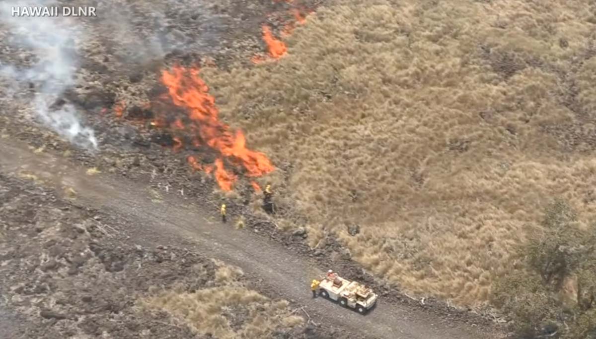
“The last two days the fire was mostly burning in invasive fountain grass. It’s the first plant that comes in after fire disturbance,” said Steve Bergfeld, the Hawaii Island Branch Manager for the Hawaii Department of Land and Natural Resources Division of Wildlife, and one of three incident commanders on the fire. “Unfortunately, the fire has moved into some dryland forest which has native ōhiʻa lehua and we are trying to keep flames away from this sensitive area.”
Seven contracted bulldozers left a fire command post this morning, leading the way into the fire area, where the heavy machines continued building wide fire lines. Five helicopters from the U.S. Army’s Pōhakuloa Training Area are conducting aerial water drops. It’s hoped this all-out assault on the Leilani fire will result in firefighters gaining the upper hand in the next few days.
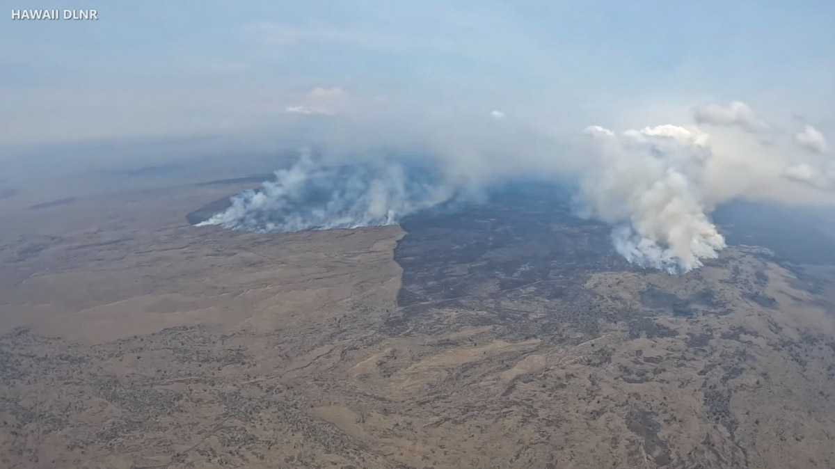
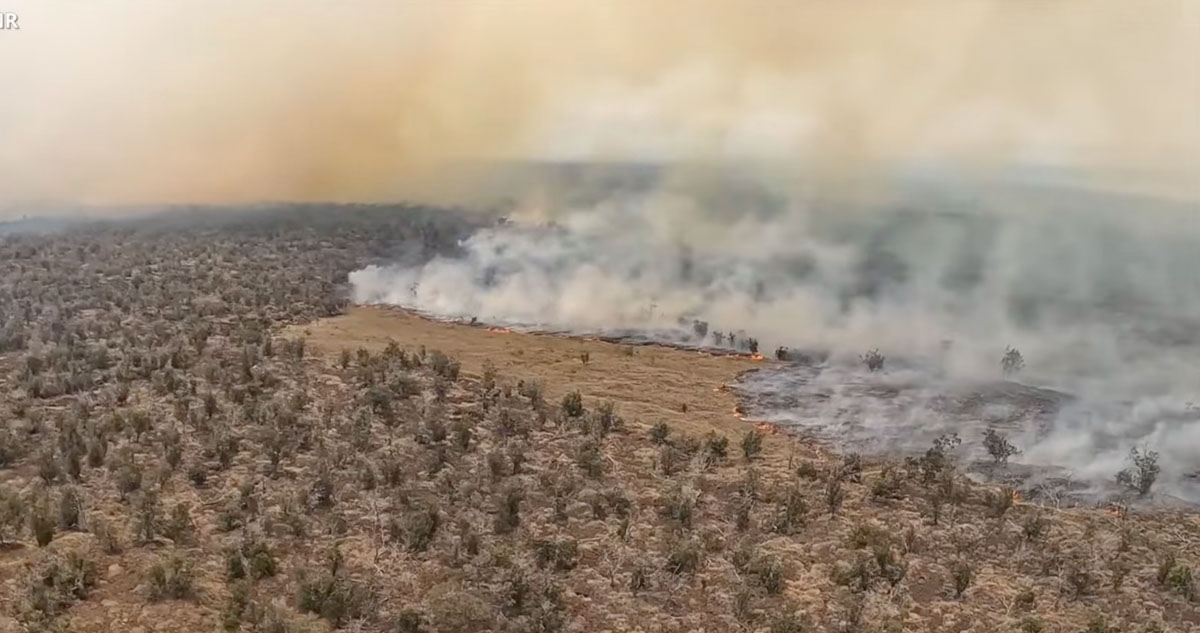
The video below was shot Friday August 12 by the Hawaii Department of Land and Natural Resources (DLNR).
The photos below are still images from DLNR videos.


12:01 p.m. PDT August 12, 2022
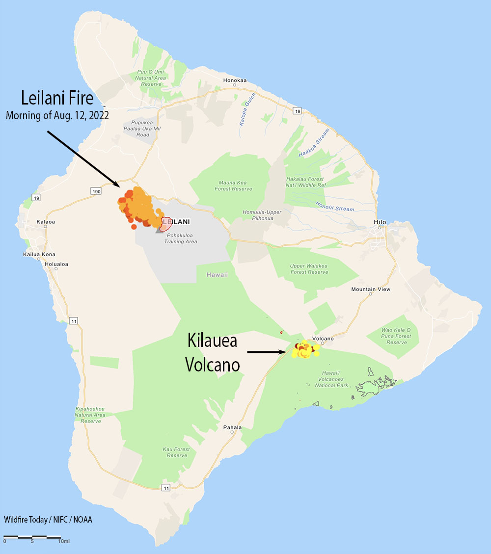
A fire in Hawaii that the Hawaii Department of Land and Natural Resources (DLNR) said has been burning for weeks has suddenly become much more active. The Leilani Fire started in the US Army’s Pohakuloa Training Area on the Big Island and was mapped July 22 at 2,362 acres. Recent strong winds and extremely dry conditions have helped it spring back to life and was reported Thursday evening to be 25,000 acres.
Satellite heat detections early Friday morning appeared to show it has advanced out of the Department of Defense training area and spread northwest onto state land, approaching the Daniel K. Inouye Highway (Highway 200). State officials said it was about a mile south of Hawaii Belt Road (Highway 190).
Officials with the DLNR said Thursday it was not threatening any homes but dry fuels and winds gusting up to 30 mph are making it difficult to contain the blaze. It is burning through brush and grass dessicated during the drought.
A spokesperson for the Army told The Associated Press that while there is active military training in the area, the cause of the fire remains under investigation.
“There are units up there training, I can’t confirm or deny if live fire was taking place,” said Michael O. Donnelly, chief of external communications for the U.S. Army Garrison Hawaii. “It’s business as usual, but the exact cause we don’t know.”

Pohakuloa, where the fire started is a toxic stew from more than 75 years of military bombing and shelling, including Depleted Uranium (radiation) weapons. DU metal when hit with high explosives turns into DU oxide particles that can be carried long distances in the smoke and wind. When inhaled, DU oxide particles can cause a wide variety of cancers. Why isn’t PTA ringed with air filter monitors to see what’s coming off the base? Why is this fire called the “Leilani” fire instead of the “Pohakuloa” fire?
A lot of wildlife will be displaced by this fire and make hazardous roads even more hazardous plus the smoke is making visibility bad on the recently built Hiway 2000. I wonder if the area the fire started at was part of the lands PTA leases from the state and is it a violation of that lease to not do a better job of extinguishing it. Does the military truly have no idea how the fire started, does training occur with no oversight and accountability.
Media says burning mostly in invasive fountain grass. Big enough now to use point protection and maybe holding at hwy 190. I’m sure they need someone that has many of the qualification on my red card to come over and help out.
The fire being on what locals call “the dry side” of the Big Island, vegetation growth comes slowly and is very valuable to wildlife, what little there is. To hear how few firefighter they have engaged make this appear to be a so-called “managed wildfire;” the tactic many of us are trying very hard to eliminate. It’s August and it’s hot and windy and that’s usual and always expected there.
You’re right. A lot of old timers want to take away more and more of what was a very natural thing, that is much needed in our forests. We need managed fires, and you’ll find the science follows that.