
Updated 5:36 a.m. PDT August 26, 2022
The East Fire in the Angeles National Forest northeast of Glendora has been relatively quiet since the spread was stopped Thursday evening. It was last mapped at approximately 147 acres.
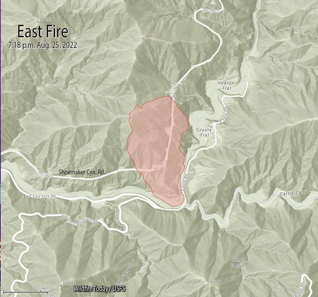
Updated at 6:18 p.m. PDT August 25, 2022

The spread of the East Fire northeast of Glendora, California has slowed and is mostly holding at the ridges, thanks to the efforts of the firefighters on the ground and in the air. At about 5 p.m. Air Attack estimated the size at approximately 135 acres with about two-thirds of the fire above Shoemaker Canyon Road and one-third below the road. However that size estimate could change.

At 5:45, in addition to helicopters, a lead plane, and air attack, there were two large air tankers over the fire, an MD-87 and an S-2T.
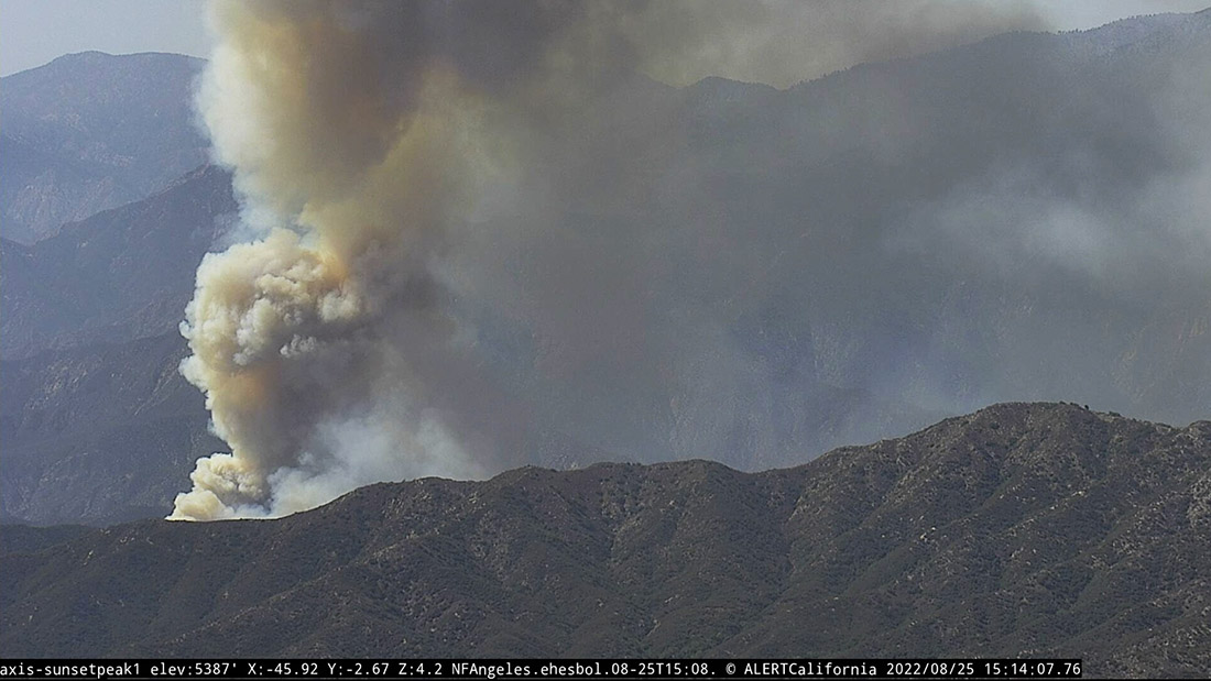
3:53 p.m. PDT August 25, 2022
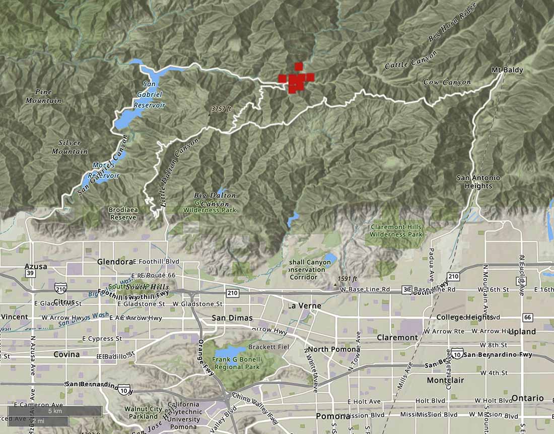
Thursday afternoon the East Fire started eight miles northeast of Glendora, California east of San Gabriel Reservoir near East Fork Road and Shoemaker Canyon Road.
It received a typical Southern California aggressive initial attack with hand crews, engines, helicopters, water tenders, and air tankers, including a DC-10 that was based nearby at San Bernardino.

At 3:29 p.m. the FIRIS aircraft mapped it at 73 acres.
OES Intel 24, Aug 25th on the #EastFire, ANF. Fire is mapped at 73 acres at 15:29 hours. Video to follow. pic.twitter.com/oRHY3hBgDa
— FIRIS (@FIRIS) August 25, 2022
The video below shows a US Forest Service engine and a hand crew having to be relocated as flames approached the turnout where it was parked.
#BREAKING: Flames get dangerously close to fire crews working the #EastFire in the Angeles National Forest. A Sky Crane quickly drops water behind them. @RoadSageLA reports from #Sky2. #CBSLA pic.twitter.com/l8D5iqwvTH
— Mike Rogers (@MikeRogersTV) August 25, 2022
We will update this article as more information becomes available.

Anyone know what fire department I would contact to possibly get permission to head up to east fork to see if I can recover some of my gold mining equipment I left there on the day of the fire??? I know the fire didnt reach where I left it. Been keeping an eye on all of the updates. Just got freaked out and went running for my car to get it out of there incase the fire closed off the road.
Angelus National Forest, San Gabriel River Ranger District
Excellent coverage of the East Fire. Those living in MT Baldy appreciate it.
Excellent reporting. Video was awesome