Wildfire burns about 250 acres on Santa Cruz Island

On Thursday 95 firefighters from California and Arizona were assigned to the fire.

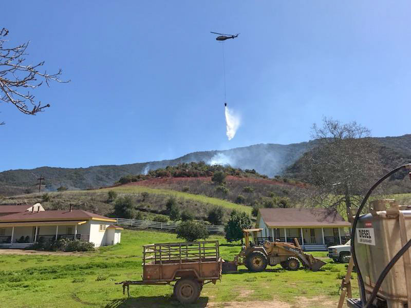
Above: Santa Cruz Fire, March 27, 2018. NPS photo.

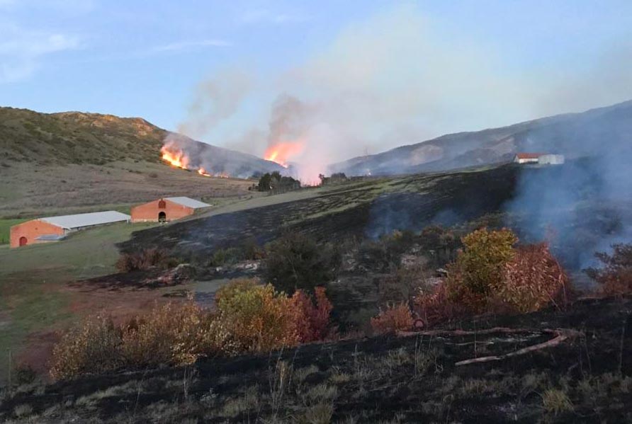
A wildfire that started Tuesday burned about 250 acres on Santa Cruz Island 20 miles off the coast southwest of Oxnard. The preliminary cause is a burn pile on Nature Conservancy land that escaped.

By Thursday firefighters slowed the spread assisted by lighter winds and a marine layer that brought higher humidities. Personnel, totaling 95, arrived from Santa Barbara County and the Los Padres, Sequoia, Sierra, and Tonto National Forests.

One small non-historic building burned in the fire.
Santa Cruz Island Fire
Santa Cruz Island Fire, March 28, 2018.

National Park Service spokesperson, Yvonne Menard, said air tankers, a mix of U.S. Forest Service contract aircraft and CAL FIRE S-2T’s, worked the fire — four on Tuesday and three on Wednesday along with at least one helicopter . The S-2T’s were dispatched from Paso Robles and the Forest Service aircraft came from Southern Arizona. They reloaded at Hemet Ryan, which is 155 miles southwest of the fire.

Santa Cruz Island, at 96 square miles, is the largest in the chain of eight California Channel Islands. The Nature Conservancy owns 76 percent of Santa Cruz Island and the National Park Service owns 24 percent. Together, they cooperatively manage the island as one ecological unit.
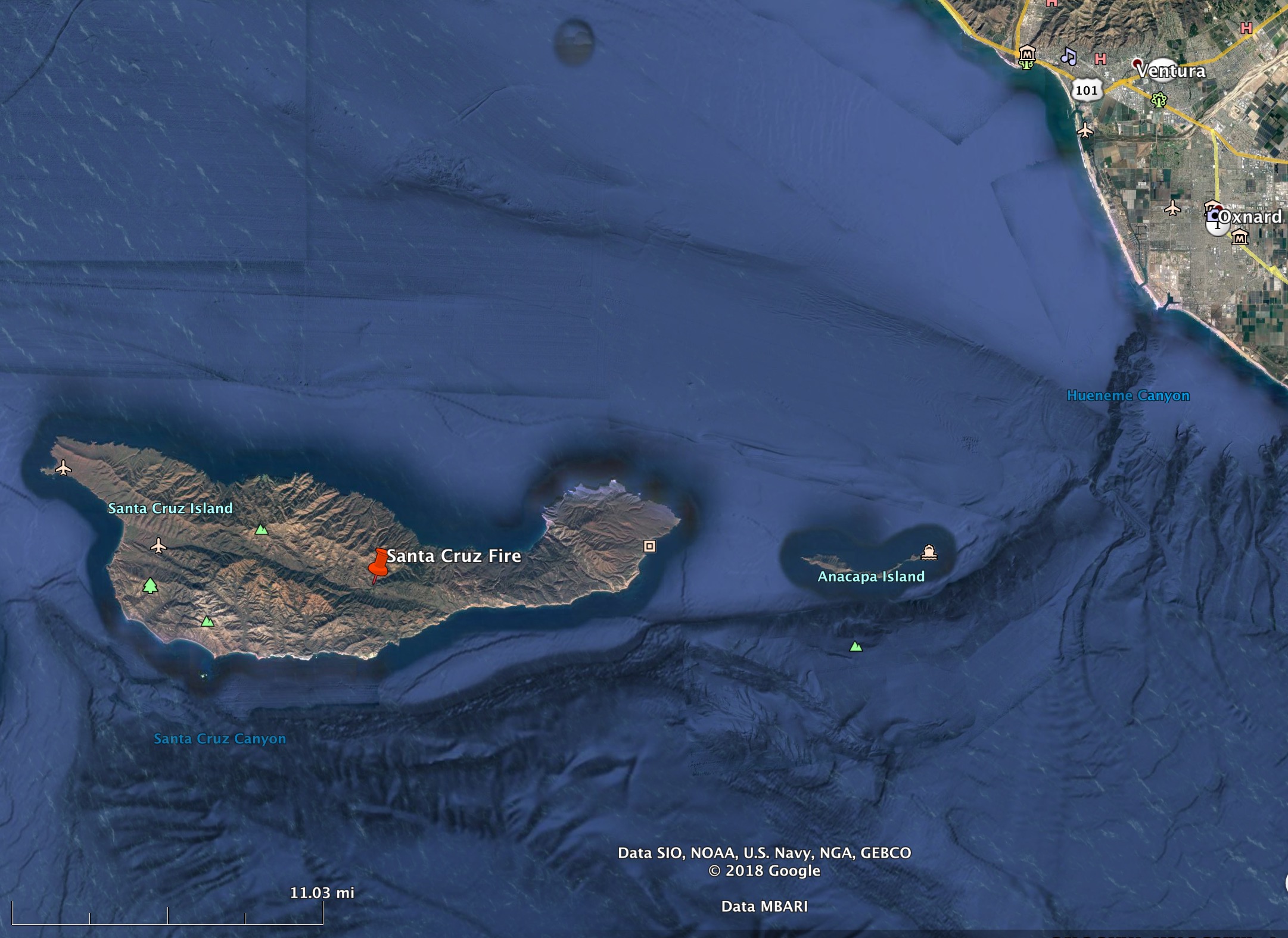
map Santa Cruz Island Fire
Map showing the location of the Santa Cruz Fire. Wildfire Today & Google Earth.
Santa Cruz Island Fire
Santa Cruz Island Fire, March 29, 2018. NPS Photo.
Santa Cruz Fire
Santa Cruz Island Fire, March 28, 2018. NPS photo.

Firefighting costs, 1985-2017

Above: Wildfire suppression costs for USFS and DOI adjusted for inflation. By Bean.

One of our regular readers, Bean, took the annual wildfire suppression costs for the U.S. Forest Service and the Department of the Interior and adjusted them for inflation using the Consumer Price Index.

“2017 was a record but there were other very expensive years”, Bean said. “Looks to me like there was an accounting methodology change from 1999 to 2000 or a big change in the way fires were fought. Pre 2000 costs are almost 2x lower than post 2000 costs. Other observation … from 2000 to 2016 there wasn’t much of a cost trend. Of course, if the USFS budget isn’t keeping pace with inflation,  things get to looking very bad as far as suppression cost as a % of their budget.”

Bean’s figures taking into account inflation can be compared to the unadjusted numbers.

Like Bean said, if the total budget for the Forest Service continues to be locked in at the same amount year after year, funding the fire organization at the 2015 10-year average is going to be very difficult. The ultimate fire funding fix would include, in addition to establishing in advance a special account for high-cost years, stop cutting (in real dollars) the total amount appropriated for the Forest Service.

Thanks and a tip of the hat go out to Bean.
Typos or errors, report them HERE.

Burn scars of the fire that burned into Tathra, NSW

(Originally published at 3:26 MDT March 27, 2018)

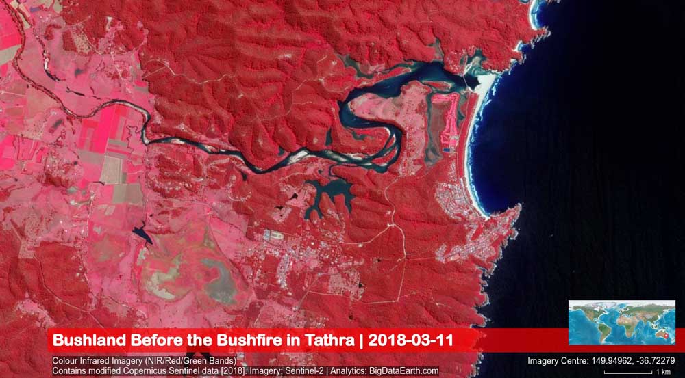
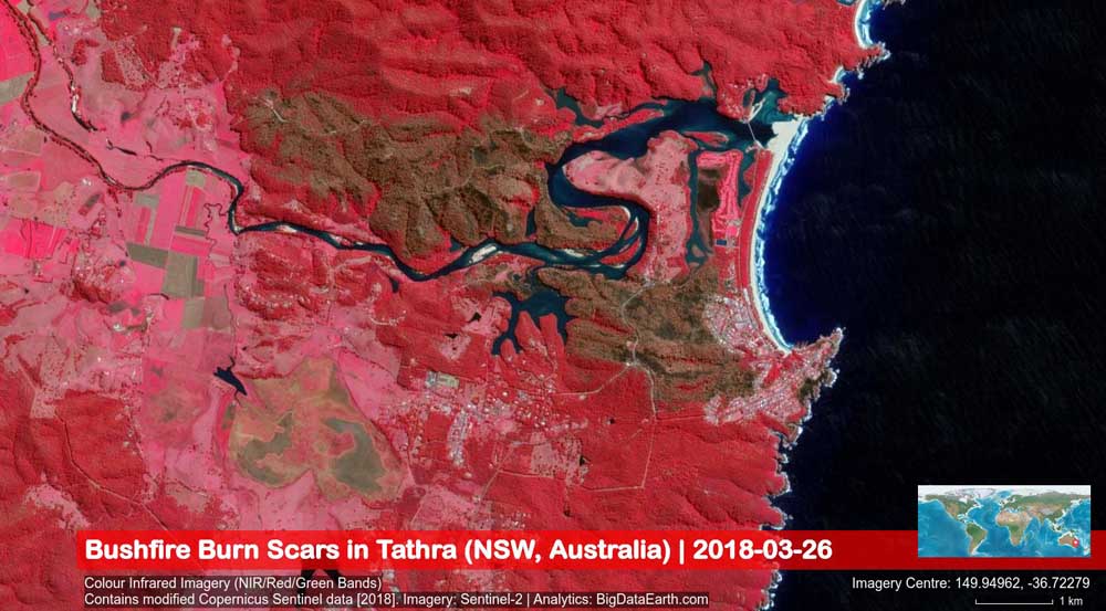
These satellite images show before and after photos of the March 18, 2018 bushfire that started southeast of Bega, NSW, Australia, and burned into Tathra, destroying at last count 69 homes.

The images were captured by the Sentinel-2 satellite system (March 26, 2018, 11:02 am local time) and were analyzed by BigDataEarth.com.

map tathra NSW wildfire homes destroyed
Map showing the area in New South Wales between Bega (on the left) and Tathra (on the coast on the right) before the fire.
map tathra New South Wales wildfire
Map showing the area in New South Wales between Bega (on the left) and Tathra (on the coast on the right) after the fire. The brown areas represent the burned area.

Visualizing increasing costs of wildfires

Firefighters in Oklahoma dealing with numerous wildfires

Posted on Categories Uncategorized

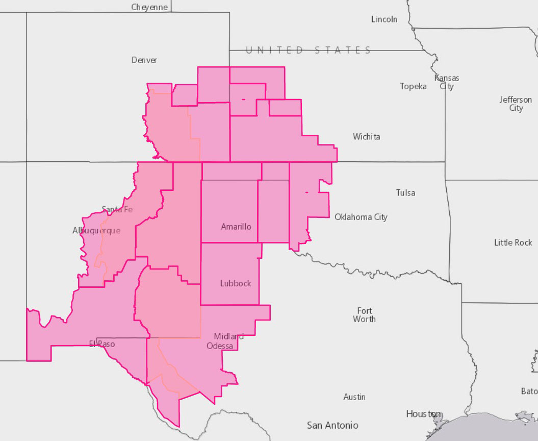
Oklahoma is one of six states under a Red Flag Warning for Friday.

(Originally published at 10:17 a.m. MDT March 23, 2018)

For the last week firefighters in Oklahoma have been busy attacking a rash of wildfires. Personnel have poured in to help from Mississippi, Kentucky, Louisiana, Alabama, and Georgia. One of the largest groups of resources came from Kentucky which mobilized eight engines, two dozers, and 23 personnel to help battle the fires.

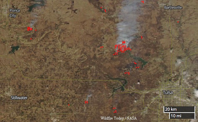
There are at least 42 fires in the state larger than 100 acres. The 10,816-acre Biggy Fire is one of several about 20 miles northwest of Tulsa.

Wildfires northwest Tulsa, Oklahoma map
Wildfires northwest of Tulsa, Oklahoma, March 22, 2018.

The Trentman Fire has burned 4,300 acres about 9 miles west of Bowring. At least six fires were burning Thursday in Okmulgee County. Officials said several were started intentionally.

On Friday the western side of Oklahoma was under a Red Flag Warning for low humidity and strong winds.

Red Flag Warnings enhanced wildfire danger
Red Flag Warnings for enhanced wildfire danger, March 23, 2018. Central Florida is also under a Red Flag Warning.