Fire and Rescue New South Wales acquires additional technolgy

Fire and Rescue New South Wales (FRNSW) recently introduced to the Australian public examples of a multi-million-dollar batch of new technological devices they have added to the firefighters’ tool box.

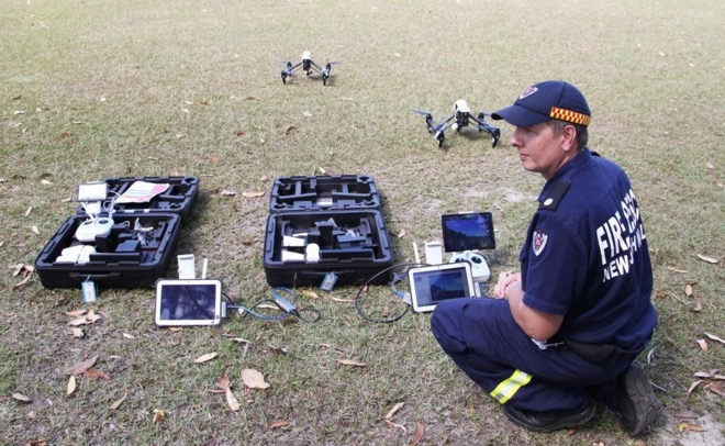
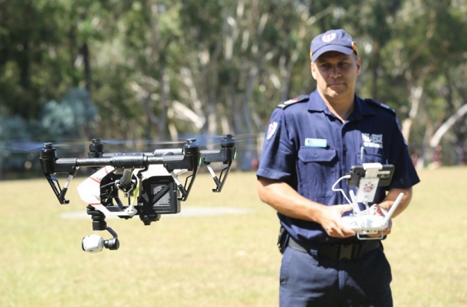
FRNSW drone

Drones are the latest weapon in the fight against fire, chemical spills and natural disasters, providing firefighters with real-time images of areas too dangerous to access and enabling rapid damage assessments. Two new drones are part of this new package, which also includes two custom-built mobile command centers and the installation of more than 180 mobile data terminals in fire trucks across NSW. FRNSW drone
Below is an excerpt from an article at Mashable:

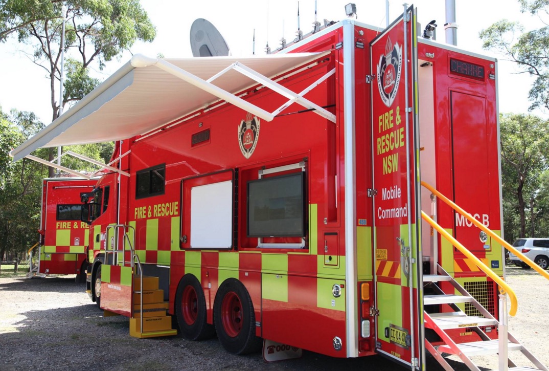
The two mobile command centres feature radio and video feeds, as well as communication services such as high-speed satellite and 4G. The mobile data terminals will give firefighters access to weather data and local hydrant, gas and electricity maps as they head to incidents.

The drones, paired with six trained firefighters to operate them, will give response crews a view of the emergency site from above, whether during a fire, flood or chemical spill.

“Each vehicle has high speed internet and a 100-meter Wi-Fi bubble which could be invaluable to communities cut off from technology following a catastrophic fire or storm event,” Fire and Rescue NSW Commissioner Greg Mullins said in the statement.

“This new technology improves the information available for first responders and will ensure that we remain a world class fire, rescue and hazmat service.”

FRNSW mobile command

On International Women’s Day: firefighters in Australia

On International Women’s Day, March 8, take a look at this video from down under that highlights the role of women, especially firefighters, in Parks Victoria.

Long range spotting on Mt. Bolton Fire in Australia

Looking at this tweet and the video, Nicholas McCarthy is saying embers from the Mt. Bolton Fire in Victoria, Australia caused a spot fire five kilometers (3.1 miles) away from the main fire.

Mr. McCarthy is working on the Bushfire Convective Plume Experiment based out of the University of Queensland studying extreme fire weather with portable radar.

On February 23 the researchers shot the following time-lapse video of the smoke plume from the Mt. Bolton Fire.

The fire was burning furiously while the video was being filmed, but in a day or two it ran out of heavy fuel and was corralled by firefighters.

Below is a photo showing shorter-range spotting on the Mt. Bolton Fire.

Mt Bolton Fire Victoria CFA
Mt Bolton Fire. Photo by Victoria Country Fire Authority.

Time-lapse video of the Mt. Bolton bushfire

On February 23 we posted information about researchers in Victoria, Australia who are studying extreme fire weather using portable radar as part of the Bushfire Convective Plume Experiment (BCPE) associated with the University of Queensland in Australia.

Below is a time-lapse video they recorded at the Mt. Bolton bushfire.

Spot fires at the Mt. Bolton Fire in Victoria

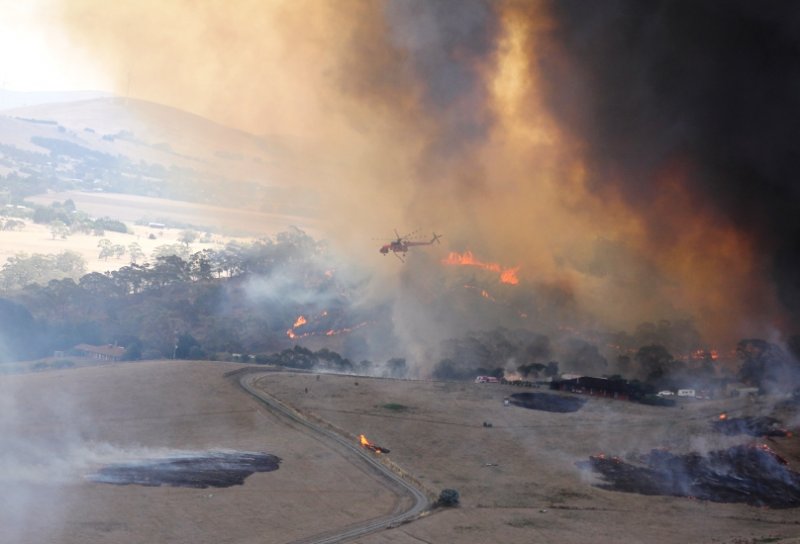
Above: an Aircrane helicopter battles spot fires on a bushfire near Mt. Bolton in Victoria, Australia. Photo provided by the Country Fire Authority.

On Tuesday we had some photos and information about smoke plume research going on at the fire near Mt. Bolton in Victoria, Australia. The Country Fire Authority recently distributed this photo. There’s a lot going in that picture. It looks like that Aircrane has its hands full. I wonder if it was able to pick up that spot fire across the road, but the structures on the right side were probably a higher priority.

Later the CFA said the fire had been contained. A satellite photo of the fire’s location showed that it was in a hilly forested area surrounded by treeless pastures  and agriculture fields.

Using radar to study smoke plumes

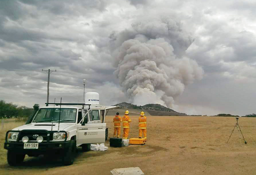
The researchers below are studying extreme fire weather using portable radar. This is part of the Bushfire Convective Plume Experiment (BCPE) associated with the University of Queensland in Australia.

Smoke plume research

More information about the smoke plume research.

Victoria’s Country Fire Authority distributed the image below earlier on Tuesday (U.S. time) — the photo is from the Bolton Fire, the same one being studied by the researchers above:

It’s been a big day for our emergency management family! 400+ incidents, including over 50 grass and scrub fires, 300+…

Posted by CFA (Country Fire Authority) on Tuesday, February 23, 2016

The photos below are also from the Bolton Fire. The CFA is saying the fire is now contained. A satellite photo of the fire’s location showed a hilly forested area surrounded by treeless pastures and other agriculture.

Photos from the front line…These photos were taken at the Mount Bolton fire earlier today by Waubra Fire Brigade…

Posted by CFA (Country Fire Authority) on Monday, February 22, 2016