Military C-130 aircraft and the 747 activated for Southern California Fires

MAFFS
File photo of MAFFS 1, based at Cheyenne, but is seen landing at Fresno, August 5, 2017. Photo by L.S. Braun.

This article first appeared on Fire Aviation.

(Originally published at 11:53 a.m. PST December 5, 2017)

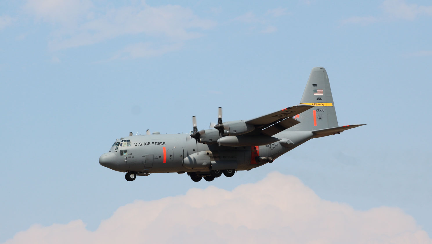
Two California National Guard C-130’s have been activated by the state’s Governor to assist with the wildfires in Southern California. Two large fires have burned a total of  49,000 acres since Monday afternoon — the Creek Fire at Ventura and the Thomas Fire near Sylmar.

A spokesperson for the 146th Airlift Wing said the aircraft have been activated, they are being prepared, and the Modular Airborne FireFighting Systems (MAFFS) are being installed, but they have not yet received the launch orders.

The MAFFS, which can be installed in a C-130 in a few hours, holds up to 3,000 gallons of retardant.

With the very strong Santa Ana winds currently blowing in Southern California, it remains to be seen if it will possible, safe, or effective to use fixed wing aircraft over the fires. Air tankers have to fly low and slow, and usually over rough terrain. Strong winds can make this unsafe and the retardant can also be blown far off the target.

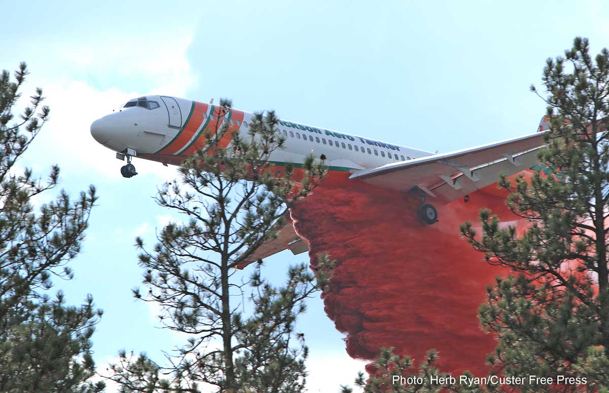
Very few air tankers on U.S. Forest Service contracts are still active this time of the year. Last Friday there were only four, all in southern California; two CL-415 scoopers and two MD-87’s.

The 747 SuperTanker has also been activated on a CAL FIRE Call When Needed contract and will fly from Marana, Arizona to McClellan near Sacramento today, arriving at about 3 or 4 p.m.

The scoopers are due to end their mandatory availability period on December 6, but it is possible they could be extended due to the current fire situation in southern California. In September the USFS cancelled the last four years of the 5-year contract for the scoopers. The cancellation was to take effect on December 6, 2017.

Beaver Fire, MD-87, T-103, South Dakota,
An MD-87, probably Tanker 103, drops on the Beaver Fire west of Wind Cave National Park September 13, 2017. Photo by Herb Ryan used with permission.

Very strong winds bring Red Flag Warnings to Southern California

wildfire red flag warning weather

(UPDATED at 1:43 p.m. PST December 5, 2017)

The National Weather Service has issued Red Flag Warnings for the coastal and mountain areas of southern California. Strong Santa Ana winds are expected through Thursday, with wind gusts between 60 and 80 mph. The winds will diminish in strength later this afternoon through Wednesday with gusts generally between 35 and 55 mph. However by Wednesday night and Thursday, the winds will increase yet again with gusts between 50 and 70 mph likely. As the Santa Ana winds continue, very dry conditions will persist with minimum relative humidity in the single digits and very poor overnight recoveries.

The Red Flag map was current as of 11 a.m. MST on Tuesday. Red Flag Warnings can change throughout the day as the National Weather Service offices around the country update and revise their forecasts.

Wind gusts speed southern california
Wind gusts during the hour ending at 1:41 p.m. PST December 5, 2017. Click to enlarge.

Creek Fire forces closure of 210 freeway in Los Angeles

The fire is north of the 210 near Sylmar and Kagel Canyon.

Map showing location Creek Fire Los Angeles
Map showing the location of the Creek Fire in Los Angeles.

(UPDATED at 1:02 p.m. PST December 5, 2017)

The Creek Fire has jumped across the 210 freeway and is now burning on both sides. Firefighters estimate it has blackened 11,000 acres.  The fire is being managed under Unified Command with the U.S. Forest Service, LA County and LA City.

The video below of the Creek Fire was posted by a Los Angeles County Fire Department helicopter pilot.

****

(Originally published at 11:55 a.m. PST December 5, 2017)

In addition to the 45,000-acre Thomas Fire at Ventura, another large fire is burning in Southern California.

The Creek Fire, near Sylmar and Kagel Canyon, has burned about 4,000 acres since it was reported at 3:42 a.m. Tuesday. It is on the north side of the 210 freeway which at 11 a.m. was closed between Interstate 5 on the west and Sunland Blvd. on the east.

Homes have burned in the Creek Fire but exactly how many is unknown.

According to the LA City Fire Department, the following mandatory evacuations are in effect:  “Kagel Canyon, Trailer park in Lopez Canyon, Arroyo St north of 210, Mobile home park top of Maclay, Pacoma Wash west of Sayre St, Eldridge/Sayre north”.

At 11 a.m. the resources assigned to the fire included 60 engines and 400 personnel.

Firefighters hope to be able to use fixed wing air tankers and helicopters to assist firefighters on the ground but the Santa Ana winds currently blowing at more than 20 mph could make that impossible. Weather stations near the fire are recording wind gusts at 19 to 40 mph with relative humidity in the low teens. The Santa Ana condition is expected to continue at least through Thursday.

A Nixle alert for the Creek Fire was sent out to the area shown below. The map does not show the location of the fire.

Nixle alert map Creek Fire
A Nixle alert was sent out to the areas shown on the map below. Click to enlarge.

Thomas Fire burns into Ventura, California

The fire has blackened about 45,000 acres and destroyed 150 structures.

The map above shows the approximate location of the Thomas Fire at 1:06 a.m. PST December 5, 2017 based on data from a satellite.

(UPDATED at 3:05 p.m. PST December 5, 2017)

Firefighters now estimate that the Thomas Fire which burned from Santa Paula to Ventura, California has now covered about 50,000 acres.

****

(Updated at 8:39 a.m. PST December 5, 2017. We will update this article on Tuesday as more information becomes available.)

The Thomas Fire has spread into the north side of Ventura, California, burning tens of thousands of acres. After it started Monday near Thomas Aquinas College very strong Santa Ana winds pushed it across Highway 150 close to Santa Paula and it then ran about 15 miles southwest to the edge of Ventura. About 27,000 people have been evacuated.

An update from Ventura County officials at 8 am Tuesday reported it had blackened 45,000 acres and destroyed about 150 structures. The areas of concern include Upper Ojai, Santa Paula, and Ventura.

The strong winds have made it impossible for fixed wing aircraft to fly low and slow near the ground as they have to do while dropping retardant or water. However early Tuesday morning helicopters were able to effectively work in some areas near Ventura. If the wind decreases Tuesday morning officials hope to have both types of aircraft available to assist firefighters on the ground.

Electrical outages have affected 260,000 homes and the lack of power at some water pumping facilities has left some fire hydrants dry.

Ventura County has more information about areas under evacuation orders.

(Articles on Wildfire Today about the Thomas Fire are tagged “Thomas Fire“)

Thomas Fire causes evacuations near Santa Paula, California

(UPDATED at 12:10 a.m. PST December 5, 2017)

map Thomas Fire
Map showing the very rough approximate location of the Thomas Fire northeast of Ventura, California, at 11:30 p.m. PST December 4, 2017. Click to enlarge.

****

(UPDATED at 11:31 p.m. PST December 4, 2017)

ABC7 is showing on their live video that the Thomas Fire has spread from Santa Paula, California southwest to the outskirts of Ventura. As of 10:40 p.m. PST the fire had reached Hall Canyon and Sexton Canyon Roads north of Ventura. It is moving toward Highway 33.

(For the most current information about the Thomas Fire, visit https://wildfiretoday.com/tag/thomas-fire/)

Anyone between Highways 150 and 33 or north of Foothill Road should be prepared to evacuate. Much of that area is already on fire.

The wind driven fire is launching burning embers very far ahead to the west and southwest that are starting spot fires ahead of the main fire which then grow quickly.

Our unofficial tracking shows that the fire is approximately 12 miles long. Many areas have lost electrical power, including portions of Santa Barbara.

Approximately 30 mobile homes off Wheeler Canyon Road north of Foothill Road have burned, according to ABC7.

Ventura County Fire Department estimates the Thomas Fire has burned about 10,000 acres.

****

(Originally published at 10:24 p.m. PST December 4, 2017. We will update this article as new information is available. )

A wind-driven wildfire is causing evacuations north of Santa Paula, California 8 to 10 miles northeast of Ventura. At 9:41 p.m. Monday Ventura County Fire Department officials said the fire was about 5,000 acres, and is spreading quickly. They expect it to reach the city of Ventura Monday night.


Multiple structures have burned,  but how many is unknown.

Santa Ana winds that are affecting much of the coastal and mountain areas of Southern California have pushed the fire at least five miles to the west across Highway 150 and at 9:30 p.m. PST had reached Wheeler Canyon Road where structures are reportedly burning. Portions of the fire have also reached Aliso Canyon Road.

Weather stations in the Santa Paula area recorded wind gusts of 17 to 28 mph out of the east with relative humidity of 7 to 16 percent.

We put together the following map which is very unofficial, based on live video from ABC7.

map Thomas Fire Santa Paula
General location of the Thomas Fire at 9:30 p.m. PST December 4, 2017. Wildfire Today. Click to enlarge.

The Ventura County website has details about evacuations, but occasionally the site is down, probably due to heavy web traffic.

radar smoke thomas fire wildfire
Radar image showing smoke from the Thomas Fire at 9:15 PST December 4, 2017.

The images below are screenshots from the ABC7 live video.

Thomas Fire
Thomas Fire at 10:04 p.m. PST December 4, 2017. KTLA.
Thomas Fire
Thomas Fire at 8:59 p.m. PST December 4, 2017. The road is Highway 150 north of Santa Paula. KTLA.

Strong winds and extreme wildfire danger predicted for Southern California this week

This Santa Ana wind event will likely be the strongest and longest duration one we have seen so far this fire season. Red Flag Warnings have been issued for Sunday night through Thursday.

Above: Red Flag Warnings issued for Southern California December 3, 2017.

(Originally published at 9:31 a.m. PST December 3, 2017)

The strongest Santa Ana wind event so far this fire season is in the forecast for the coastal and mountain areas of Southern California this week. The National Weather Service has issued Red Flag Warnings for Sunday night through Thursday for areas within the counties of Santa Barbara, San Bernardino, Riverside, and San Diego.

It is unusual for a Red Flag Warning to extend over parts of five days. And this one has the possibility of being extended for an additional one or two days into the weekend.

The exact timing and speeds will vary by location, but generally, powerful winds will begin Sunday night out of the north and on Monday will be from the northeast at 25 to 40 mph with gusts of 50 to 65, reaching 80 at some peaks and exposed areas.

The NWS forecast includes this statement:

If fire ignition occurs, there will be the potential for rapid spread of wildfire with extreme fire behavior that could lead to a threat to life and property.

The strong winds and low relative humidities (5 to 15 percent)  should continue at least through Thursday. Long range computer models are showing the possibility that the Santa Ana winds could persist into Friday or Saturday, which may require the extension of the Red Flag Warnings.

Wind Gusts Tuesday california santa winds wildfire