This NASA satellite photo of smoke from the wildfires in Southern California was captured and edited by Pierre Markuse. His description: “Mixed natural-NIR/SWIR with enhanced contrast and saturation. California wildfires #USA 5 December 2017”.
Tag: Creek Fire
Three large SoCal wildfires in one photo

The ABC7 helicopter crew was able to get all three large Southern California fires on one photo at 1:03 p.m. PST today. The nearest one is the 11,000-acre Creek Fire that has closed and crossed the 210 freeway near Sylmar. Next is the Rye Fire, which we have not yet written about. It has burned about 1,000 acres in Santa Clarita.
In the distance is the 45,000-acre Thomas Fire which has burned into Ventura.
Creek Fire forces closure of 210 freeway in Los Angeles
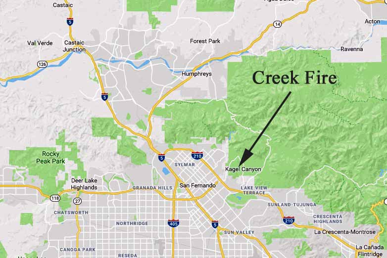
The fire is north of the 210 near Sylmar and Kagel Canyon.

(UPDATED at 1:02 p.m. PST December 5, 2017)
The Creek Fire has jumped across the 210 freeway and is now burning on both sides. Firefighters estimate it has blackened 11,000 acres. The fire is being managed under Unified Command with the U.S. Forest Service, LA County and LA City.
The video below of the Creek Fire was posted by a Los Angeles County Fire Department helicopter pilot.
Unbelievable conditions #CreekFire @LACoFDPIO #LAWind pic.twitter.com/QGnYV1vRwF
— Michael Dubron (@MichaelDubron) December 5, 2017
****
(Originally published at 11:55 a.m. PST December 5, 2017)
In addition to the 45,000-acre Thomas Fire at Ventura, another large fire is burning in Southern California.
The Creek Fire, near Sylmar and Kagel Canyon, has burned about 4,000 acres since it was reported at 3:42 a.m. Tuesday. It is on the north side of the 210 freeway which at 11 a.m. was closed between Interstate 5 on the west and Sunland Blvd. on the east.
Homes have burned in the Creek Fire but exactly how many is unknown.
According to the LA City Fire Department, the following mandatory evacuations are in effect: “Kagel Canyon, Trailer park in Lopez Canyon, Arroyo St north of 210, Mobile home park top of Maclay, Pacoma Wash west of Sayre St, Eldridge/Sayre north”.
At 11 a.m. the resources assigned to the fire included 60 engines and 400 personnel.
Firefighters hope to be able to use fixed wing air tankers and helicopters to assist firefighters on the ground but the Santa Ana winds currently blowing at more than 20 mph could make that impossible. Weather stations near the fire are recording wind gusts at 19 to 40 mph with relative humidity in the low teens. The Santa Ana condition is expected to continue at least through Thursday.
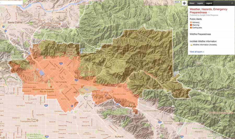
A Nixle alert for the Creek Fire was sent out to the area shown below. The map does not show the location of the fire.


