Fires force 500 to evacuate in South Africa

Muizenberg Fire in South Africa
Muizenberg Fire in South Africa Tuesday night. Photo by Clint Sutton.

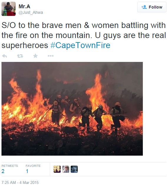
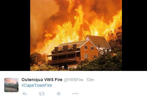
About 500 people were forced to evacuate as fires near Cape Town, South Africa burned for a fourth day on Wednesday. Firefighters said a small amount of rain did not have any significant effect on the 12,000-acre blaze that started on March 1. There are no reported fatalities, but 52 people from an old-age home had to be treated for smoke inhalation. Homes, offices, historic wine farms and a hotel lodge were damaged or destroyed.

An excerpt from an article at Blolomberg:

While some fires have been contained, they continue to burn in the Lakeside, Constantia Valley and Clovelly areas and are expected to take until the end of the week to extinguish, according to city officials and Working on Fire, the national fire management agency. Six helicopters and two planes dumped 2.2 million liters (580,000 gallons) of water in more than 2,000 drops, helping to stop the spread of flames in areas inaccessible to fire-fighting crews and their vehicles. Helicopters were grounded in the late afternoon on Wednesday due to strong wind and poor visibility.

An excerpt from an article at News24:

[Wednesday] morning, the City of Cape Town’s Fire Safety Division conducted a survey to determine exactly how many properties have been affected since the fire started in the early hours of Sunday 1 March 2015 above Boyes Drive in Muizenberg.

Staff have confirmed that 13 properties have been affected, including the Tintswalo Lodge at the foot of Chapman’s Peak. Three of the properties have been completely destroyed: two in Constantia and one in Noordhoek.

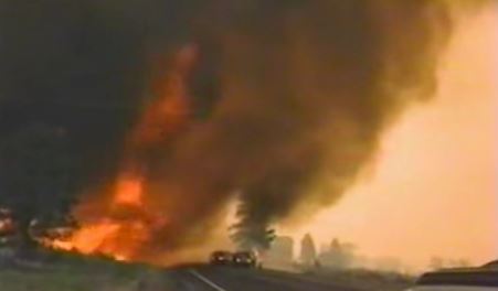
The video below shows a pretty cool fire whirl. I would not call it a “fire tornado”, or “firenado”, as some are. THIS is a firenado.
Cape Town Fires Cape Town Fires

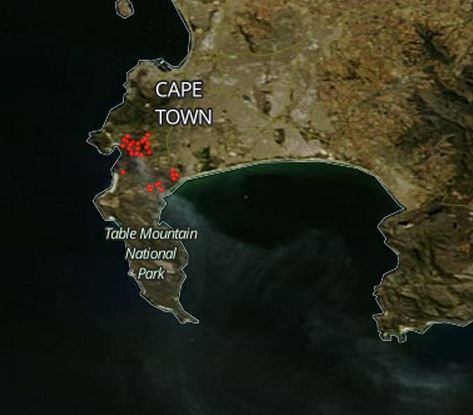
Map fires near Cape Town, South Africa
Map showing heat produced by wildfires near Cape Town, South Africa March 3, 2015

The six photos below were taken by Clint Sutton on Tuesday. Thanks Clint.

Continue reading “Fires force 500 to evacuate in South Africa”

Historic footage, firefighters caught in fire whirl

Fire whirl, 1989
Still image from the video below of firefighters being overrun by a large fire whirl in California in 1989.

You may have seen the footage in the video below, of firefighters being overrun in 1989 by a very large fire whirl or fire tornado (or firenado) in California. It is very impressive, and can be another reason why firefighters need to be on their toes and very situationally aware.

Thanks and a hat tip go out to Kent

A collection of reports of fire whirls and fire tornadoes

Fire whirl in Australia
Fire whirl in Australia, filmed by Chris Tangey

Fire tornadoes, firenadoes, or fire whirls have gotten a lot of notice in the press in the last week or so, primarily because several were filmed on the fires in San Diego County. The terms are being used rather loosely, but Rick McRae, a researcher in Australia, says a fire tornado is attached to the underside of a thunderstorm while a fire whirl remains attached to the ground.

Regardless, they are fascinating to watch.

Here are some links to reports we have had on Wildfire Today about the phenomenon:

And one of the best videos of a large fire whirl was shot by Chris Tangey of Alice Springs Film and Television while he was scouting locations near Curtin Springs station in Australia. We have more details about it at the link above, but it is embedded below for your viewing pleasure. 

Outback firenado-Australia from chris tangey on Vimeo.

Impressive fire whirl

I don’t think this meets the definition of a “firenado“, if there is a definition, but it is an impressive photo, regardless. Often, fire whirls are partially obscured by smoke and are difficult to photograph clearly.

The photo was posted on Instagram by Janae Copelin who happened to be driving by when a farmer was burning his field. She wrote:

A farmer burning off his field and as we stopped so I could take a picture the wind whipped up this fire twister #nofilter #firestorm #firetwister”.

She said it was the “coolest/scariest thing I’ve ever seen”.

Fire whirl full of tumbleweeds

This very impressive fire whirl was captured on video March 14 at the Rocky Mountain Arsenal near Denver, Colorado during a prescribed fire. The swirling wind swept up tumbleweeds, some of them burning, and created a problem for firefighters. It was posted on YouTube by Bellevue Wildfire.

 
Thanks and a hat tip go out to Jim, Steve, Tristan, and Andrew.

Video about 2003 fire tornado in Australia, and the results of the fire behavior research

Lee side slope fire behavior
Lee side slope fire behavior. A wind eddy on the lee slope can push the fire up the slope opposite the prevailing wind direction. At the ridge top, the fire can also move horizontally, 90 degrees off the main wind direction. Screen grab from the video.

In November, 2012 we wrote about some of the research that was conducted to study and document what can only be described as a fire tornado in Australia, a tornado-like event that can be generated by a wildfire. In recent years a new term has been coined — firenado — which seems appropriate.

It occurred near Chapman in the Australian Capitol Territories during the McIntyres Hut Fire January 18, 2003. After studying the event, Rick McRae of the ACT and others discovered that it traveled across 25 kilometers at 30 kph (19 mph), had horizontal winds of 250 kph (149 mph), and vertical winds of 150 kph (93 mph). Damage that occurred to trees and structures is much like what you would see after a tornado in Oklahoma.

Australia’s ABC TV produced an excellent video that goes surprisingly deeply into some of the scientific principles of this phenomenon, including fire behavior when a strong wind pushes a fire up a slope. This can result in spot fires at the bottom of the slope on the other side, the lee slope, which can be pushed rapidly up the lee slope by a wind eddy in the opposite direction of the prevailing wind (see the screen grab above from the video). They also documented how a fire at the top of the ridge can travel across the ridge at 90 degrees to the direction of the prevailing wind.

Knowledge about this kind of fire behavior is something that wildland firefighters should retain in their “slide file”, in the unfortunate event that they find themselves in danger of being entrapped and are considering using the lee side of a ridge as an escape route or a sheltering location.

Check out our November, 2012 article for more information about this 2003 event. The video below illustrates some of the findings developed by the fire researchers.

The information in the video can be even more interesting when considered along with the winds at the site of the Yarnell Hill Fire entrapment, as modeled by WindWizard. The image below is from page 79 of the Yarnell Hill Fire SAIT report. Click the image to see a slightly larger version.

Yarnell Hill Fire, wind vectors modeled using WindWizard