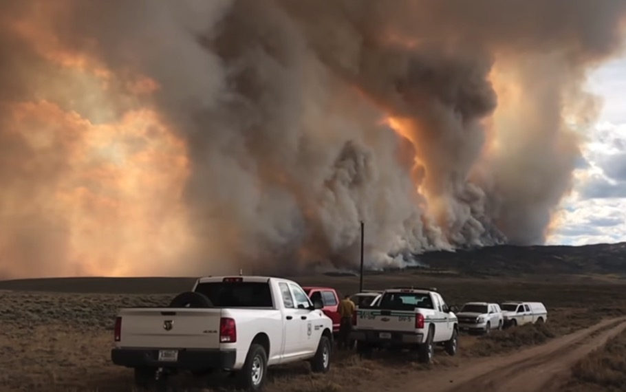
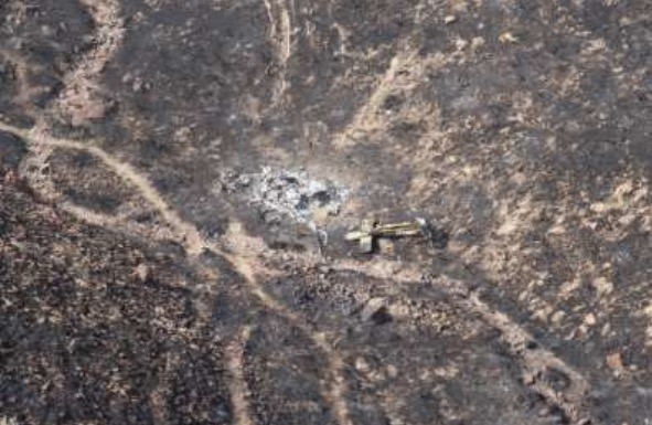
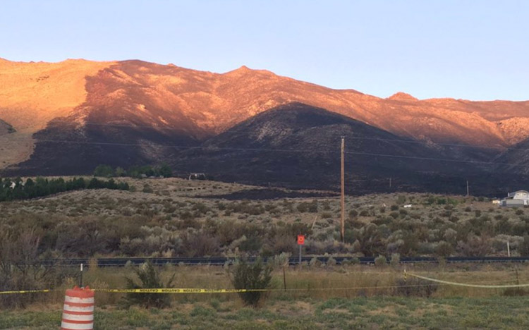
The sun rises on the Long Valley Fire, August 25, 2019. Photo by Truckee Meadows Fire Protection District .
(UPDATED at 9:42 a.m. PDT August 25, 2019)
At 8:37 a.m. PDT August 25 the Truckee Meadows Fire Protection District reported that the Long Valley Fire had been mapped at 2,438 acres and all evacuations had been lifted.
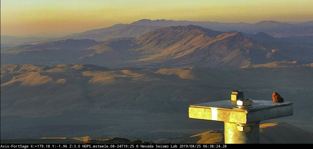
As the sun was rising Sunday morning the camera at Fort Sage looking south to the Long Valley Fire did not show any significant columns of smoke. The fire is north of Reno, Nevada between Highway 395 and Red Rock Road. (see map below)
The Long Valley Fire, looking south from the camera at Fort Sage at 6:38 a.m. PDT August 25, 2019.
The Truckee Meadows Fire Protection District reported at 7:10 p.m. PDT Saturday that one primary structure and multiple outbuildings burned. At 8:38 p.m. PDT the District said the fire had burned about 1,500 acres and “at least 50 to 75 homes have been impacted” by the fire.
The closure of Red Rock Road was lifted by 12:30 a.m. Sunday. Electrical power may still be shut off in some areas.
At 12:31 a.m. Sunday the evacuation order was still in effect.
The video below shows a Very Large Air Tanker, a DC-10, making a downhill retardant drop Saturday evening on the fire.
— Truckee Meadows Fire Protection District (@TMFPD) August 25, 2019
(Originally published at 6:49 p.m. PDT August 24, 2019)
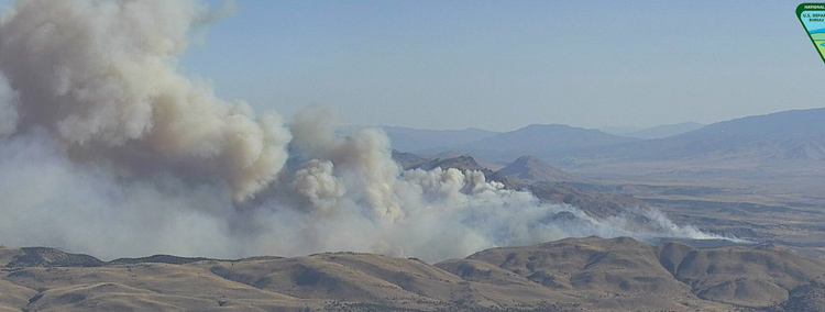
Long Valley Fire as seen from the camera at Fort Sage at 5:23 p.m PDT August 24, 2019.
The Long Valley Fire started Saturday afternoon north of Reno along Highway 395 about two miles south of the north end of Red Rock Road. Pushed by a strong wind it spread to the northeast toward Red Rock Road. The Truckee Meadows Fire Protection District is working to keep the fire west of the road.
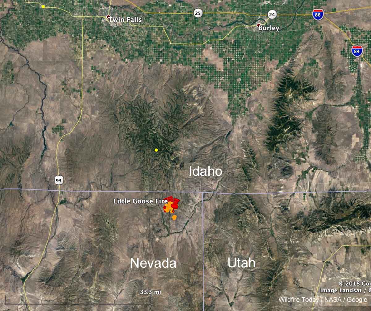
Map showing the location of the Little Goose Fire in Northeast Nevada at 1:36 p.m. MDT August 5, 2019.
A fire that was reported at 6:23 p.m. Sunday August 4 in the Northeast corner of Nevada has been burning vigorously on Monday. Heat detected by a satellite at 1:36 p.m. (see map above) showed it to be moving north and had spread to within a mile of the Nevada/Idaho border. In later satellite photos it appeared to have approached the border and was generating pyrocumulus clouds. By the time you read this there is a good chance it will have burned into Idaho.
The BLM reported at about 6 p.m. Monday that it was a full suppression fire and had burned 3,500 acres.
At various times it was called “Goose Fire” and “Little Goose Fire”. Just plain “Goose Fire” seemed to be winning out by late Monday afternoon.
As anticipated, fire plumes are becoming evident on satellite this afternoon. This one is the Goose or Little Goose right on the border of Nevada/Idaho. #idfire pic.twitter.com/sjdJICsq3x
— NWS Pocatello (@NWSPocatello) August 5, 2019
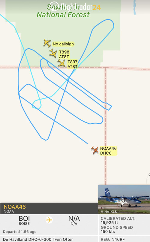
At about 4:40 p.m. MDT FlightRadar showed four single engine air tankers from Twin Falls and Tanker 911, a DC-10 from Pocatello, flying in the vicinity of the Goose Fire. A NOAA research Twin Otter also showed up, flying a grid pattern — NOAA46 (N46RF), that was most likely analyzing the atmosphere over the fire. NOAA has a fleet of nine aircraft that conduct airborne environmental data gathering missions. Later after the first NOAA Twin Otter departed, another NOAA Twin Otter was over the fire, NOAA48.
Map showing aircraft near the Little Goose Fire in Northeast Nevada at 5:37 p.m. PDT August 5, 2019. NOAA46 (N46RF)
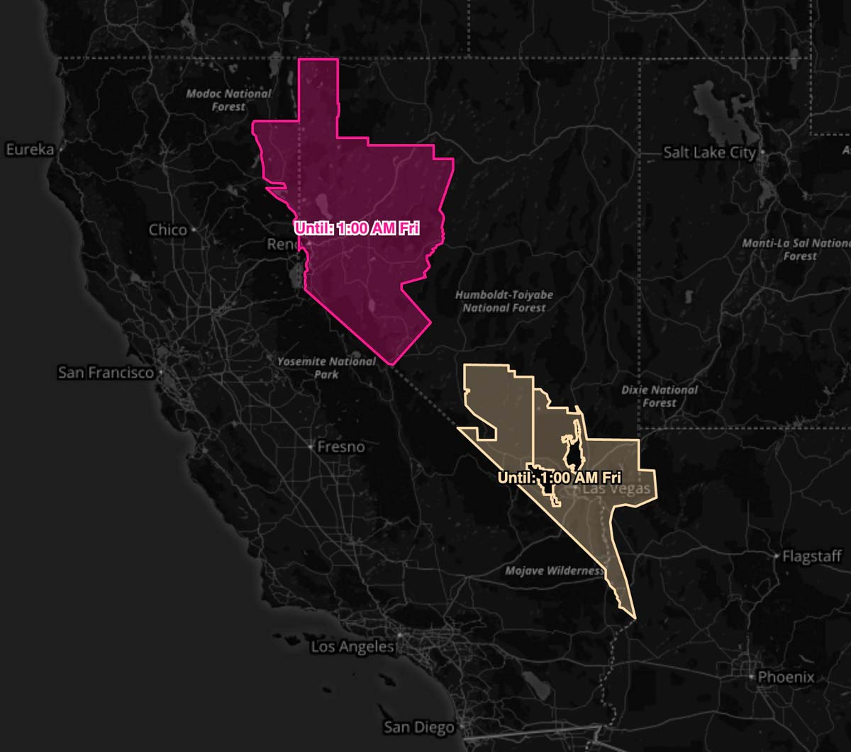
A Red Flag Warning is in effect for areas of Western Nevada and Northwest California from 11 a.m. Wednesday until 1 a.m. Friday. The forecast calls for southwest winds of 15 to 25 mph with gusts at 40 to 45 with relative humidity levels at 8 to 10 percent. A Fire Weather Watch is in effect for Southern Nevada for the same time frame and similar weather conditions.
(Red Flag Warnings can be modified throughout the day as NWS offices around the country update and revise their weather forecasts.)
(This article was first published at Fire Aviation.)
Left to right: Tanker 46, a second BAe-146, and Tanker 55 (a P2V) at the Minden Air Corp facility at the Minden, NV airport. Photo: Google Street View, April, 2015. Tanker 55 was damaged in 2012 when it landed with only partially lowered landing gear possibly due to a hydraulic system failure.
For more than 15 years Minden Air Corp has been working on the concept of transitioning from their Korean War vintage P2V air tankers to a jet, the BAe-146. They acquired two or three of them and had nearly completed their work on what was going to be Air Tanker 46 when they ran out of money. Problems with hydraulic systems led to landing gear failures on two P2Vs, T-48 and T-55, taking out Minden’s last two operational air tankers, which no doubt affected their incoming revenue stream. Thankfully there were no serious injuries reported in those two accidents, unlike the crash of the company’s T-99 on October 3, 2003 that killed the two pilots, Carl Dobeare, 54 and John Attardo, 51. A lookout staffing a fire tower saw that P2V fly into a cloud bank as it was preparing to land at San Bernardino. It did not emerge and shortly thereafter they saw what appeared to be smoke at the top of the cloud. The NTSB described it as “controlled flight into mountainous terrain”. The two pilots had a combined total of more than 15,000 flight hours.
In October AvGeek filmed a report about Minden Air Corp at the Minden Airport 45 miles south of Reno, Nevada.
Tim Cristy, Flight Operations for Minden, said in the video when explaining why the conversion of T-46 came to a stop, “We ran out of money. Well, the engineering got expensive as all get-out”.
We attempted to call Mr. Christy and Minden’s CEO, Len Parker, to get more information but the number we had used before no longer works.
The T-46 project had progressed to conducting a grid test, which involves dropping retardant over a grid of more than 3,000 cups on the ground. In the video Mr. Cristy said the test went well. We are not sure if the aircraft ever received a Supplemental Type Certificate from the FAA which is a major hurdle to overcome in addition to approval from the Interagency Airtanker Board. After that they would have had to deal with the bewildering and unpredictable Forest Service contracting system before they ever received a dime from their large monetary investment.
The retardant tank inside Minden’s T-46. Screenshot from the AvGeek video.
The video below, published June 17, 2014, shows T-46 making its first test drops of water and retardant.
Tanker 46, a second BAe-146, and Tanker 55 (a P2V) at the Minden Air Corp facility at the Minden, NV airport. Photo: Google, June, 2018.
Thanks and a tip of the hat go out to Brian. Typos or errors, report them HERE.
During a 90-day detail to Nevada this year Micah Booze recorded video which he put together in the finished product below. It appears that he had an active three months. The video shows some pretty fancy editing. Thanks Micah.
An overview of the crash site and the extraction point for the three victims. Photo from the report.
A report has been released for a helicopter crash in a very remote area of Nevada that started a fire, injured two passengers, and resulted in rescuers being burned over. It happened August 18, 2018 about 10 miles north of Battle Mountain.
One of the passengers called 911 on a cell phone at 1357:
We just got into a helicopter crash…three occupants, all of us are alive and managed to get out…started a big fire, fire is burning all around us right now…one of the guys hit his head pretty hard…you’re gonna have to get a helicopter, it’s the only way to get in here.
Adding to the complexity was the fact that several different agencies and organizations had various responsibilities: Lander County Dispatch, Battle Mountain Volunteer Fire Department, local EMS services, a medical helicopter, Elko Interagency Dispatch Center, and Central Nevada Interagency Dispatch Center.
As might be expected the complex communication chain between the victims and the actual emergency responders created some difficulties, including a delay in extracting the three personnel.
The Facilitated Learning Analysis does not speculate what caused the crash of the helicopter that was transporting two biologists on a chukar survey, but it started a fire, which was named Sheep Creek. The biologists and the pilot self-extracted, one of them with what appeared to be a serious head injury, and they all hiked up a steep slope to a flat bench where they awaited a helicopter. About two hours after the 911 call the three were evacuated from the scene by a firefighting helicopter that was on scene, and possibly also a medical helicopter. The report is not clear about this.
A closer view of the crash site. Photo from the report.
Meanwhile a volunteer fire department Type 4 engine that had responded in a search and rescue mode toward the crash site found that the condition of the road they were traveling on deteriorated from a 2-track road to a 4×4 trail, and finally ended. At that point the fire was closing in on their location. The rookie firefighter and the Fire Chief got out, and leaving their wildland fire personal protective gear in the truck, began to spray water around the vehicle.
From the report:
Within seconds, the fire was all around Pumper- 2. Both individuals were caught outside of the vehicle while trying to spray water. Neither had on their personal protective equipment (PPE) when the burnover occurred. The Chief stated, “We were in a rescue mission, so we had no PPE on.”
During the burnover, the firefighter jumped off the back of Pumper-2, started to run around the vehicle and then took refuge under Pumper-2. “I was burning and screaming and hunkered down underneath behind the rear tires.” After the burnover, the Chief yelled for the firefighter, whom he could not see anywhere. He eventually located the firefighter under Pumper-2.
After sustaining significant burns, both the Chief and firefighter got back into the vehicle, with the Chief driving, continuing down drainage. The fire was behind them as they continued driving through the black towards the bottom of the drainage. Pumper-2 drove through the bottom of the drainage over the rough terrain until getting stuck. Both individuals got out of the vehicle and proceeded to hike up the steep ridge until they got on top of the ridge to establish communications.
At 1646, Lander County Dispatch received a 911 call from the firefighter, who said he and the Chief had been burned. “We need help.” Dispatch was asking questions to establish a location, but the cell phone was breaking up. The firefighter said, “We might need a helicopter because we are on the ridge…in the black…wearing a red shirt and just uphill right of the engine.”
Suppression resources were actively engaged on the wildland fire during the burnover of the Pumper-2. The Incident Commander of the wildland fire was unaware that Pumper-2 was on the fire until well after the burnover occurred. The dispatch centers did not know the location of Pumper-2.
At 1745 the injured firefighters were located and extracted by the air medical and suppression helicopters to awaiting ground medical resources at Battle Mountain Airport. At about 1900, fixed-wing aircraft flew the injured firefighters to the University of Utah Burn Center in Salt Lake City, Utah.
The FLA points out a number of organizational and human issues that are worthy of consideration. One topic that was not thoroughly addressed in the report was the dispatchers and firefighting personnel at times did not know the exact location of the crash site or the victims, and were not aware that the engine was responding or it’s location following the injuries to the two firefighters.
Even when, eventually, the location of emergency responders will be able to be tracked on an incident, biologists and volunteer firefighters will probably be some of the last personnel to employ this capability on a routine basis.


 Problems with hydraulic systems led to landing gear failures on two P2Vs,