August ‘pyrotornado’ in Canada validated by researchers

A video that claimed to show a rarely-seen wildfire phenomenon went viral in August. Now, researchers have confirmed its legitimacy.

An “extensive investigation” led by researchers at Western University’s Northern Tornadoes Project in Ontario started after the video of a vortex above British Columbia’s Gun Lake was shared by numerous news outlets after it was recorded on August 18.

“The Northern Tornadoes Project has been investigating this event since that time — very carefully, given this was potentially the first fire-generated tornado that we have recorded,” researchers said.

Researchers first confirmed the location and date of the video, then had to determine whether the vortex shown in the video met the definition of a tornado. The project was able to determine the tornado’s validity through multiple visual indications from the recording, including the presence of a spray vortex at the base of the tornado, how the vortex formed and the position of the vortex over the fire, all of which matched the scientific research related to fire-generated tornadoes.

“Though the terminology in this area of science is still developing, it should be pointed out that this intense vortex was not a brief, fire-filled ‘fire whirl‘ but an actual tornado that is sometimes referred to as a pyrotornado,” the researchers said. “This is the first such fire-generated tornado recorded by [the Northern Tornadoes Project], and appears to be the most thoroughly documented fire-generated tornado so far in Canada.”

The researchers confirmed that, yes, the event is classified as a tornado. The full extent of the damage from the tornado isn’t yet known, but the project says evidence is trickling in slowly.

The pyrotornado isn’t the only one that’s been thoroughly studied. The “world’s first wildfire tornado” was captured on video in 2003 during a wildfire outside of Canberra, Australia. The fire destroyed 500 homes and killed four people. The damage was worsened when the pyrotornado emerged.

“The Canberra fire tornado of 2003 was rated an EF3 on the Enhanced Fujita Scale, with horizontal winds of 160 miles per hour, roughly equivalent to a Category 5 hurricane,” an article from Smithsonian Magazine reads. “As the first documented example of its kind, it was a milestone — another harbinger of 21st-century fire.”

A similar event was recorded during the 2018 Carr Fire in Redding, California, dubbed “the most destructive fire in National Park System history.” The fire destroyed 1,614 structures, killed seven people, and burned 229,651 acres. The fire also has a place in history for the pyrotornado it generated, which has since helped forecasters’ and scientists’ ability to identify future fire-generated tornadoes. NOAA researchers studied the pyrotornado, which had many similarities to the Gun Lake tornado.

“A key factor in the vortex formation was the development of a fire-generated ice-topped cloud (i.e., a pyrocumulonimbus), which reached as high as 12 km aloft,” NOAA said. “These observations will help forecasters and scientists identify, and potentially warn for, future destructive fire-generated vortices.”

A video that claimed to show a rarely-seen wildfire phenomenon went viral in August. Now, researchers have confirmed its legitimacy.

An “extensive investigation” led by researchers at Western University’s Northern Tornadoes Project in Ontario started after the video of a vortex above British Columbia’s Gun Lake was shared by numerous news outlets after it was recorded on August 18.
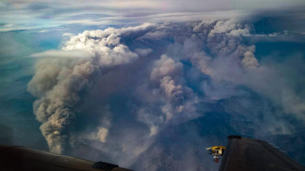
Researchers flying over wildfire detected 130 mph updrafts in smoke plume

And, downdrafts reaching 65 mph

Pioneer Fire
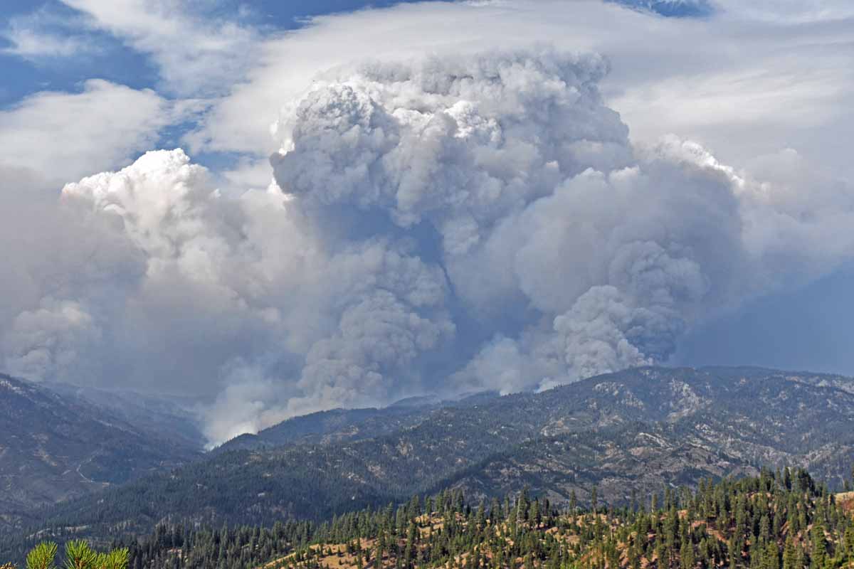
Smoke plume with pyrocumulus over the Pioneer Fire, posted on Inciweb August 29, 2016.

Researchers flying near smoke plumes over a large wildfire found extreme updrafts up to 130 mph and downdrafts reaching 65 mph. Operating radar and other sensing equipment in a small plane, one of the scientists was injured as the aircraft experienced a dramatic vertical displacement as it penetrated a 34-meters-per-second updraft in a plume over a flank of the 2016 Pioneer Fire in Idaho.

This is the first time the vertical velocity structure of a pyroconvective updraft has been viewed in such detail. The research showed that intense fires can produce updrafts that rival or exceed those in tornadic supercell thunderstorms.

An unexpected finding was that the updrafts strengthened with height above the surface, at least initially, challenging the assumption that they should decelerate with height.

The updrafts, the strongest ever documented, can be a hazard to aviation since they do not always show up on pilots’ weather avoidance radars, as discovered during a Qantas flight over a bush fire in Australia in January, 2020. Passengers experienced turbulence and darkness as the airliner entered the pyrocumulus cloud.

"There was one guy sort of swearing … I heard people down the front vomiting."

Another passenger said it was "the scariest flight" she had taken.
smoke plume research convection column pyrocumulus
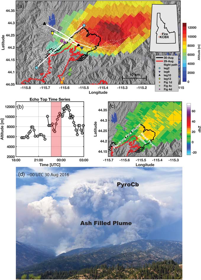
Overview of the PyroCb topped plume rising from the Pioneer Fire on 29 August 2016. (a) Map showing the fire perimeters, flight legs, locations of photos (triangle markers), terrain (hillshaded), and KCBX radar‐derived plume “echo top” heights (color shaded). (b) KCBX echo top time series showing rapid plume growth and the flight interval (red shaded). (c) Time mean KCBX radar reflectivity during the flight interval with head and flanking fire plumes annotated. (d) Photograph from the Boise National Forest at ~00 UTC 30 August 2016 showing the head fire plume and the transition from the ash‐filled lower plume to the pyroCb aloft. (from the research)

These findings are presented in a paper published September 9, 2020 written by B. Rodriguez, N. P. Lareau, D. E. Kingsmill, and C. B. Clements.

Convection column Pioneer Fire
Convection column with pyrocumulus over the Pioneer Fire, August 30, 2016. Photo by Nick Guy of the University of Wyoming.

Stunning photos of pyrocumulus clouds over the Claremont-Bear Fire

Northern California

Claremont-Bear Fire, Sept. 8 ,2020
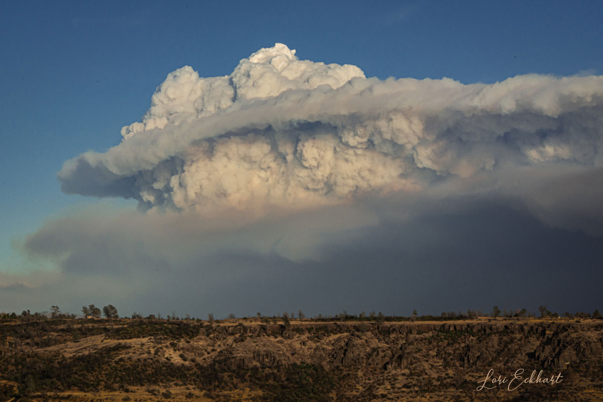
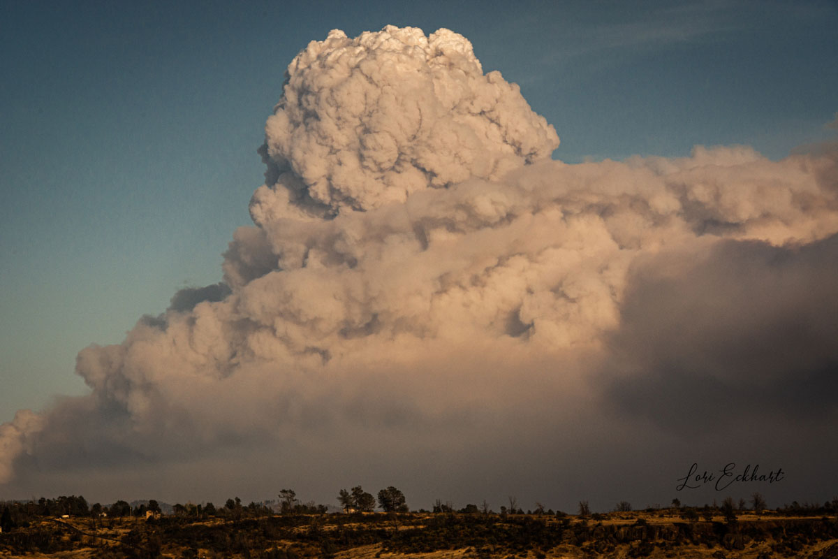
Claremont-Bear Fire, Sept. 8, 2020. By Lori Mallory Eckhart.

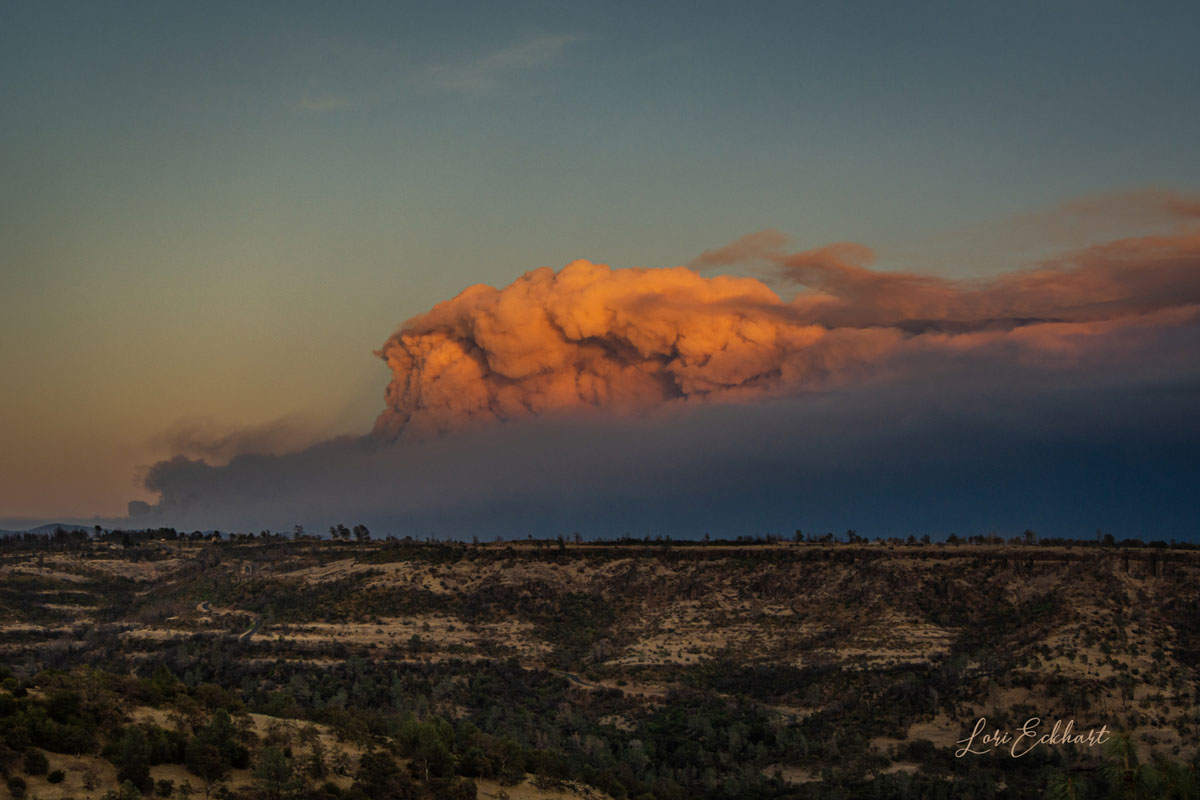
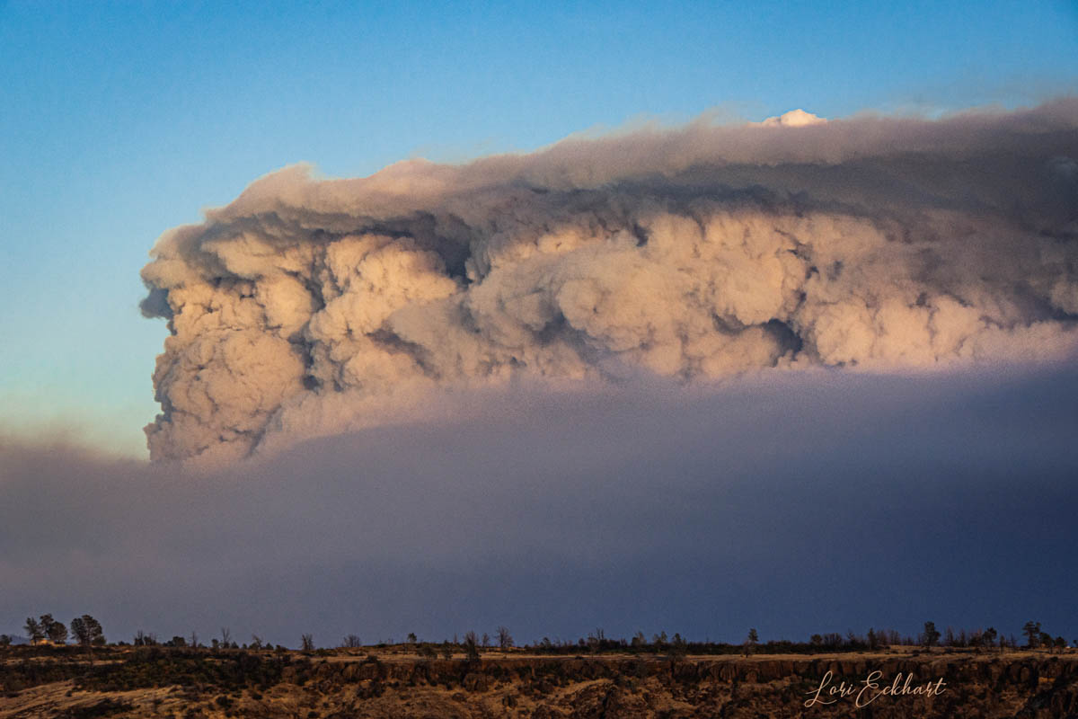
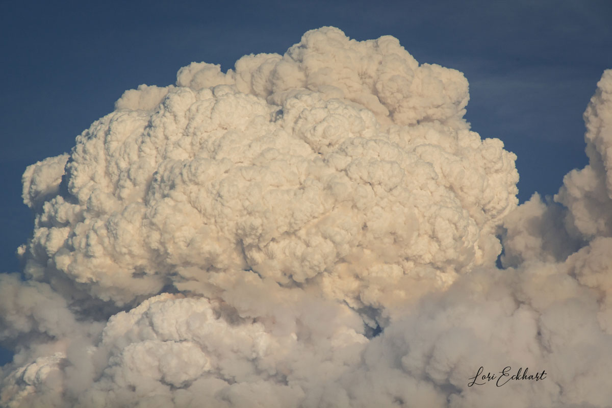
Lori Mallory Eckhart took these remarkable photos of the Claremont-Bear Fire September 8, 2020, the day it made a massive run west to Oroville, California increasing in size by more than 100,000 acres in 24 hours. The camera she used was a Nikon D7100 with an f/3.5-6.3  18-300 mm lens.

The Claremont and Bear Fires burned together and are now managed as part of the 252,000-acre North Complex organization.

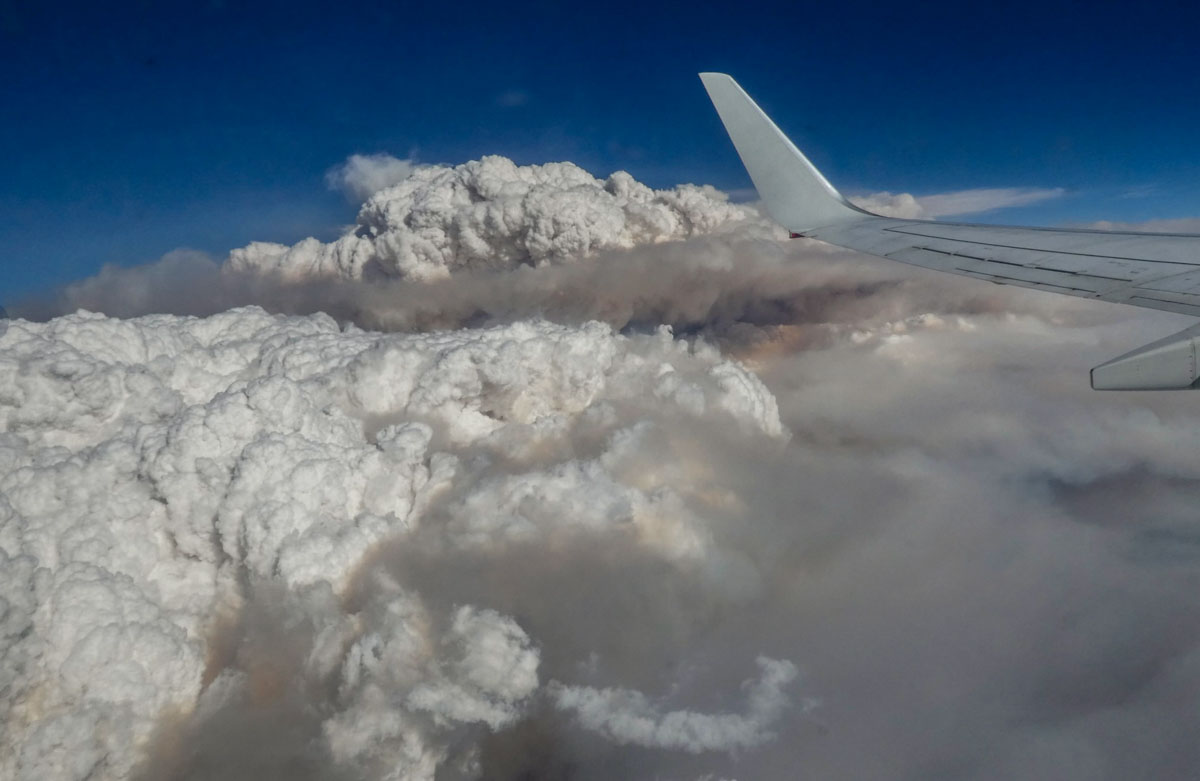
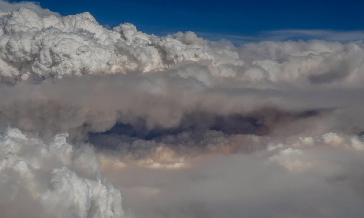
The white cloud above the smoke is a pyrocumulus cloud produced by the intense heating of the air over a fire. This induces convection, which causes the air mass to rise to a point of stability, where condensation occurs. If the fire is large enough, the cloud may continue to grow, becoming a cumulonimbus flammagenitus which may produce lightning and start another fire.

Claremont-Bear Fire, Sept. 8 ,2020
Claremont-Bear Fire, Sept. 8, 2020. By Lori Mallory Eckhart.
Claremont-Bear Fire, Sept. 8 ,2020
Claremont-Bear Fire, Sept. 8, 2020. By Lori Mallory Eckhart.
Claremont-Bear Fire, Sept. 8 ,2020
Claremont-Bear Fire, Sept. 8, 2020. By Lori Mallory Eckhart.
Claremont-Bear Fire, Sept. 8 ,2020
Claremont-Bear Fire, Sept. 8, 2020. By Lori Mallory Eckhart.

Stunning photos of pyrocumulus over fires in Australia

They were taken on a flight from Canberra to Melbourne

smoke pyrocumulus bushfires Australia
Photo of smoke from bushfires by Merrin Macleod on a flight from Canberra to Melbourne, posted January 4, 2020.

While on a flight from Canberra to Melbourne Merrin Macleod had an excellent view of pyrocumulus clouds over very active bushfires. She said on Twitter, “The country looks like ten or fifteen volcanoes have gone off.”

If the pilot had taken the most direct route to Melbourne they would have flown over many very active fires. The photos are used here with her permission.

Satellite photo smoke Australia fires
Satellite photo of smoke from fires in New South Wales and Victoria December 3, 2020. The red areas represent heat. NASA image processed by Wildfire Today.

Below is actual flight path for her 50-minute flight. About 16 minutes after takeoff the aircraft was 36,000 feet over the NSW/Victoria border.

flight path from Canberra to Melbourne
The actual flight path from Canberra to Melbourne. Flightaware.
smoke pyrocumulus bushfires Australia
Photo of smoke from bushfires by Merrin Macleod on a flight from Canberra to Melbourne, posted January 4, 2020.

A pyrocumulus cloud is produced by the intense heating of the air over a fire. This induces convection, which causes the air mass to rise to a point of stability, where condensation occurs. If the fire is large enough, the cloud may continue to grow, becoming a cumulonimbus flammagenitus which may produce lightning and start another fire.

smoke pyrocumulus bushfires Australia
Photo of smoke from bushfires by Merrin Macleod on a flight from Canberra to Melbourne, posted January 4, 2020.
smoke pyrocumulus bushfires Australia
Photo of smoke from bushfires by Merrin Macleod on a flight from Canberra to Melbourne, posted January 4, 2020.
smoke pyrocumulus bushfires Australia
Photo of smoke from bushfires by Merrin Macleod on a flight from Canberra to Melbourne, posted January 4, 2020.
smoke pyrocumulus bushfires Australia
Photo of smoke from bushfires by Merrin Macleod on a flight from Canberra to Melbourne, posted January 4, 2020.


More articles on Wildfire Today tagged “Pyrocumulus”.

Flying through a pyrocumulonimbus cloud

NASA Earth Observatory image Williams Flats Fire
NASA Earth Observatory image of the Williams Flats Fire by Joshua Stevens, using Landsat data from the U.S. Geological Survey.

(This article first appeared at earthobservatory.nasa.gov)

Atmospheric scientists regularly take note when satellites detect thunderheads rising above columns of wildfire smoke. These “fire clouds”—experts call them pyrocumulonimbus (pyroCb) or cumulonimbus flammagenitus—are caused when fires loft enough heat and moisture into the atmosphere to produce thunderstorms.

On August 8, 2019, a team of atmospheric scientists got an exceedingly rare look at these clouds as they were forming. NASA’s DC-8 flying laboratory passed directly through a large pyrocumulonimbus that day as it was rising from a fire in eastern Washington. The flight was part of a joint NOAA and NASA field campaign called FIREX-AQ. Scientists are studying the composition and chemistry of smoke to better understand its impact on air quality and climate.

Williams Flats Fire
August 8 photo by David Peterson (U.S. Naval Research Laboratory).

David Peterson, lead forecaster for FIREX-AQ, was in the cockpit of NASA’s DC-8. “The views were absolutely stunning,” said Peterson. “Very few photographs of large pyroCbs are available, especially from the air.”

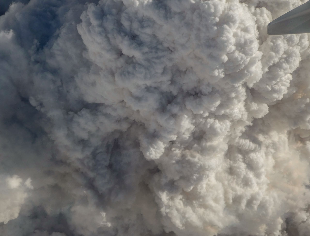
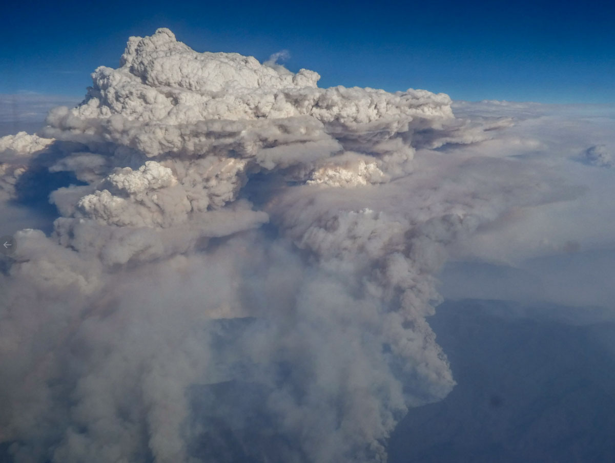
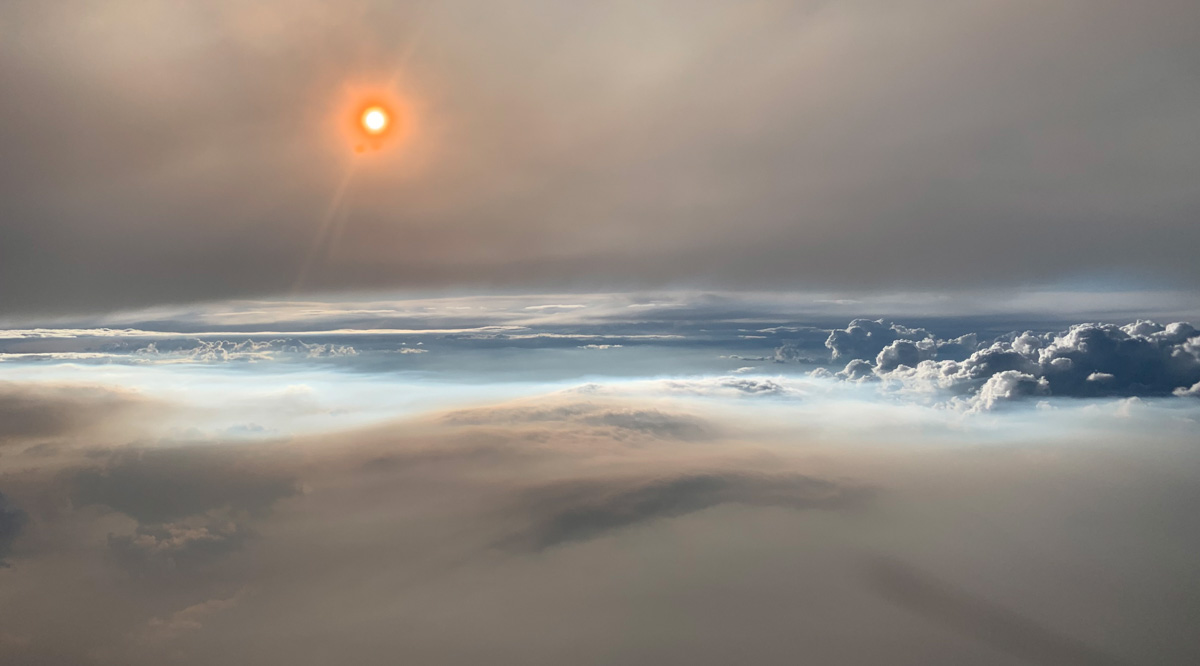
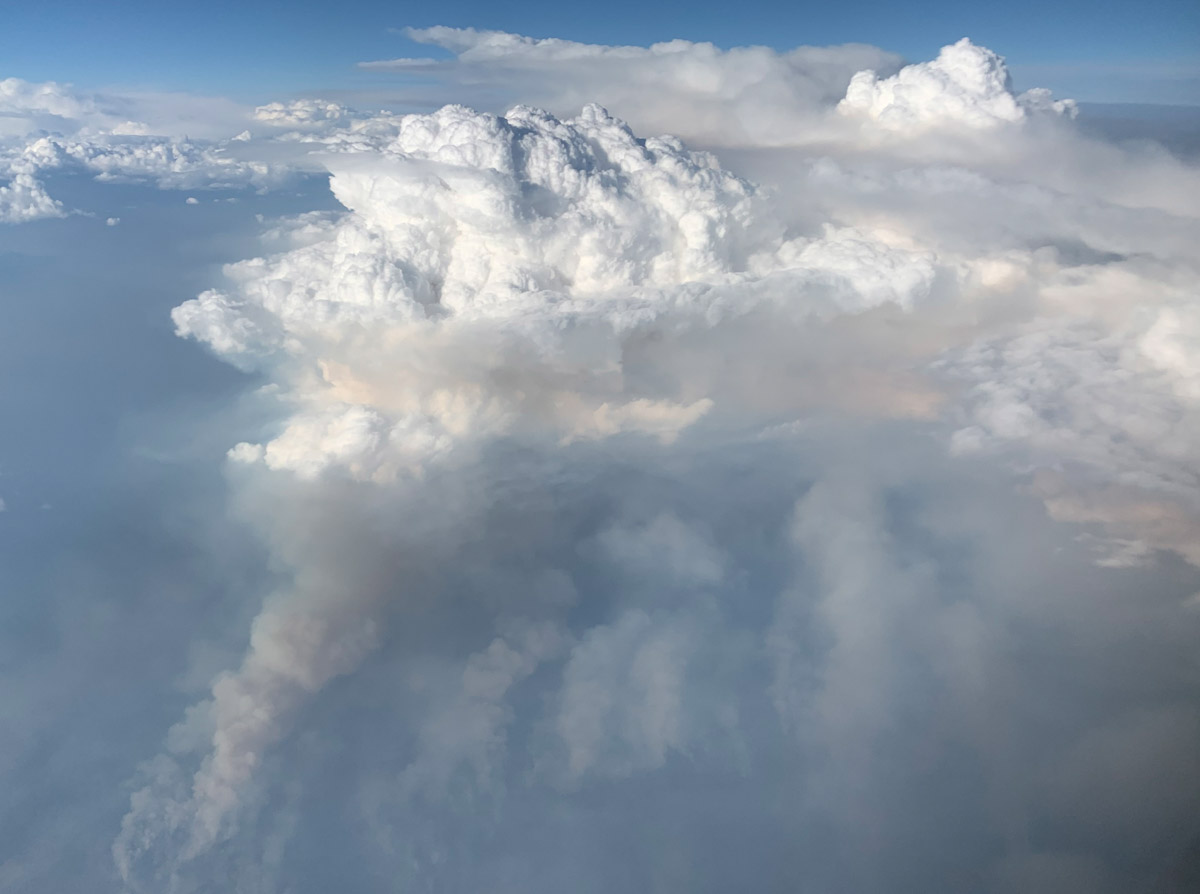
The photograph above, shot from roughly 30,000 feet (9 kilometers), shows the setting Sun shining through thick smoke at 8 p.m. Mountain Time. Particles in the smoke reflect light in ways that make the Sun appear orange. The photograph below shows the smoke plume (gray) that fed the pyrocumulonimbus cloud (white).

The flight was the most detailed sampling of a pyrocumulonimbus in history, explained Peterson. A second research aircraft flew over the plume a few hours earlier in the day, and mobile labs on the ground also made detailed measurements.

Williams Flats Fire
August 8 photo by David Peterson (U.S. Naval Research Laboratory).

“PyroCb are like large chimneys, transporting a large quantity of smoke into the lower stratosphere,” explained Peterson.

When smoke does reach the stratosphere, it tends to spread globally and remain high in the atmosphere for longer periods—months or even years—than smoke that stays in the lower troposphere. One recent study concluded that the largest fire clouds can even lift quantities of smoke aerosols into the lower stratosphere that are comparable to a moderate-sized volcanic eruption.

An early morning thunderstorm ignited the Williams Flats Fire on August 2, 2019. The Operational Land Imager (OLI) on Landsat 8 acquired a natural-color image of the blaze (at the top of the page) as it approached the north bank of the Columbia River on August 7, 2019. The image is natural color (OLI bands 4-3-2), overlaid with the infrared and shortwave infrared signature of actively burning fires.

Story by Adam Voiland of NASA Earth Observatory.

Goose Fire burning from Nevada toward Idaho

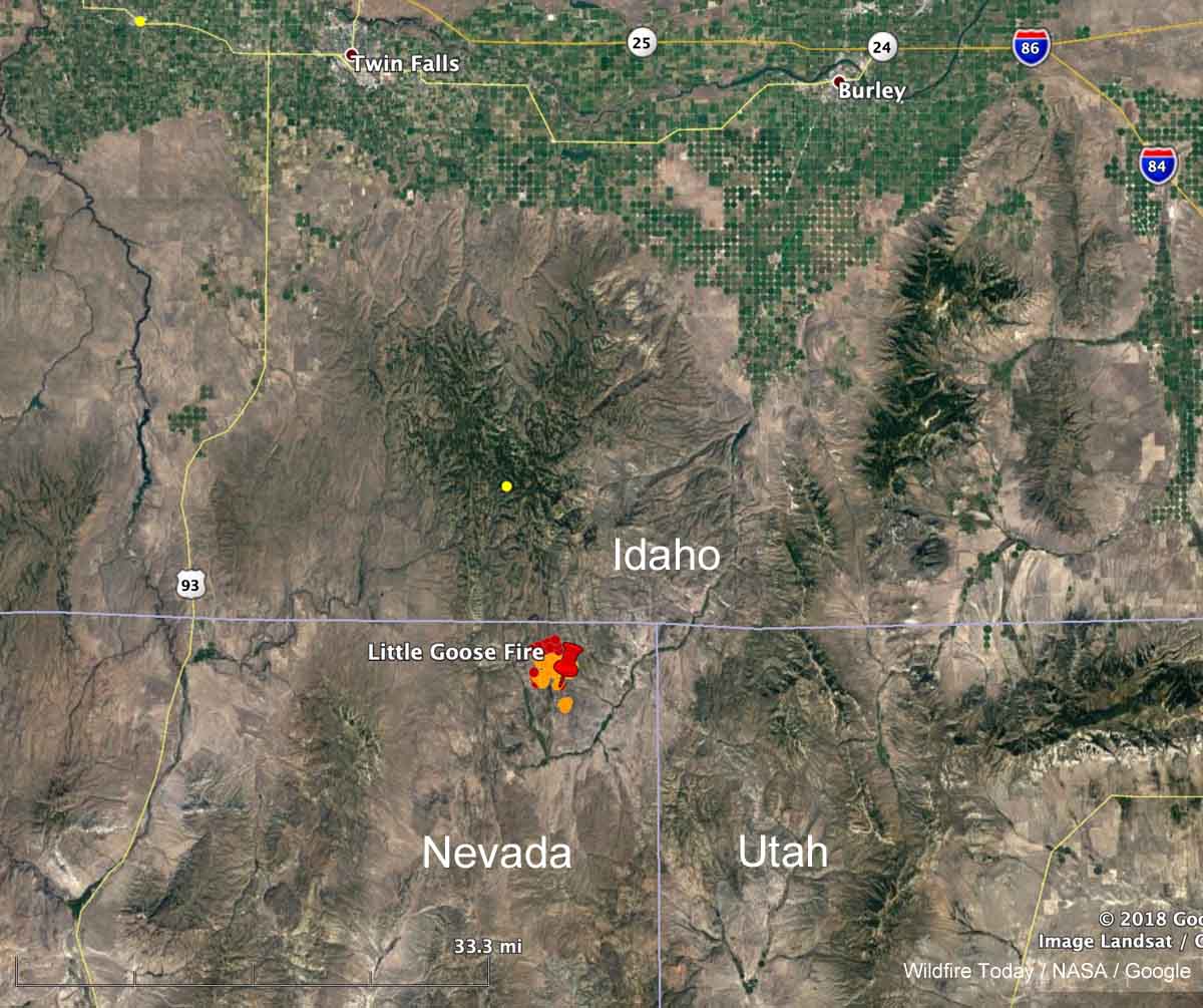
Little Goos Fire map
Map showing the location of the Little Goose Fire in Northeast Nevada at 1:36 p.m. MDT August 5, 2019.

A fire that was reported at 6:23 p.m. Sunday August 4 in the Northeast corner of Nevada has been burning vigorously on Monday. Heat detected by a satellite at 1:36 p.m. (see map above) showed it to be moving north and had spread to within a mile of the Nevada/Idaho border. In later satellite photos it appeared to have approached the border and was generating pyrocumulus clouds. By the time you read this there is a good chance it will have burned into Idaho.

The BLM reported at about 6 p.m. Monday that it was a full suppression fire and had burned 3,500 acres.

At various times it was called “Goose Fire” and “Little Goose Fire”. Just plain “Goose Fire” seemed to be winning out by late Monday afternoon.

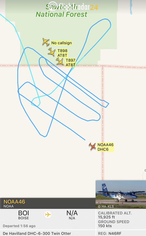
At about 4:40 p.m. MDT FlightRadar showed four single engine air tankers from Twin Falls and Tanker 911, a DC-10 from Pocatello, flying in the vicinity of the Goose Fire. A NOAA research Twin Otter also showed up, flying a grid pattern — NOAA46 (N46RF), that was most likely analyzing the atmosphere over the fire. NOAA has a fleet of nine aircraft that conduct airborne environmental data gathering missions. Later after the first NOAA Twin Otter departed, another NOAA Twin Otter was over the fire, NOAA48.

Little Goose Fire map aircraft
Map showing aircraft near the Little Goose Fire in Northeast Nevada at 5:37 p.m. PDT August 5, 2019. NOAA46 (N46RF)