Several wildfires pushed by very strong winds break out in Northern California and Western Nevada

Near Reno, Nevada and in California, Walker, Doyle, and Vinton

November 18, 2020   |    3:28 p.m. PT

We have found better satellite data for the location of the Mountain View Fire at Walker California, which confirms that as of 8:35 p.m. PT November 17 it had spread from Highway 395 northwest across the state line into Nevada.

Map of Mountain View Fire
Map of Mountain View Fire, showing heat detected by satellites as late as 8:35 p.m. PT Nov. 17, 2020.

At 3:10 p.m. PT Wednesday the weather conditions at Walker were 42 degrees, 80 percent relative humidity, with wind out of the southeast at 2 mph — conditions not conducive to rapid spread of a vegetation fire.


November 18, 2020   |    12:39 p.m. PST

California fires, November 18-19, 2020
California fires, Nov. 18-19, 2020

A number of wildfires broke out in Northeastern California and Western Nevada Tuesday as a cold front raced through the area.

Low humidity and very strong winds gusting at 40 to 60 mph caused the fires to spread rapidly to the northeast or east.

We will update this article as more information becomes available.

Pinehaven Fire

The Pinehaven Fire on the southwest side of Reno, Nevada started at 1 p.m. Tuesday southwest of McCarran Blvd. in the Caughlin Ranch area and crossed the road spreading to Cashill and Skyline Boulevards. It was pushed until 3 p.m. by 20 to 35 mph winds gusting at 40 to 60 mph from the west-southwest while the relative humidity was in the 20s.

Over a tenth of an inch of precipitation was recorded at weather stations Tuesday afternoon.

The fire destroyed five homes and damaged 15 others before the spread was stopped at 7 p.m. Tuesday. The entire area affected was about 1,200 acres but the fire spotted, leaving some areas unburned.

Pinehaven Fire burns home Reno Nevada
The Pinehaven Fire burns a home in theh Caughlin Ranch area of Reno, NV. Photo by Truckee Meadow Fire Protection District.

Laura 2 Fire

While the Pinehaven Fire was burning into Reno, the Laura 2 Fire started in the community of Doyle, California 38 air miles to the northwest near U.S. 395. In an update at about 11 a.m. Wednesday the Bureau of Land Management said it had burned 2,000 acres in Lassen County. Rain has slowed the spread. Officials estimate 20 structures have burned.
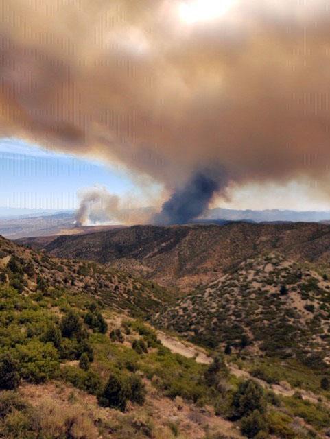
Mountain View Fire

Mountain View Fire
Mountain View Fire at 10:36 a.m. PST November 18, 2020.

The Mountain View Fire near Walker, California has burned 20,879 acres and resulted in one fatality, according to the Mono County Sheriff’s Office and the BLM. It started in the vicinity of Walker and was pushed by winds out of the west-southwest at 30 to 50 mph gusting at 60 to 78.

There are reports that dozens of structures burned.

The fire has spread into Douglas County, Nevada near the Lyon County line. On the map below, it is not certain that the red dots in Nevada are part of the Mountain View Fire. If it is, clouds may have blocked the view from the satellite between the two areas where heat is shown. Or, between satellite overflights light vegetation burned and cooled, leaving not enough heat to be detected. Precipitation that began at 1 a.m. Wednesday slowed the spread.

Mountain View Fire map
Map of the Mountain View Fire showing heat detected by a satellite as late as 2:24 a.m. PST November 18, 2020 (the red dots). It is not certain that the red dots in Nevada are part of the Mountain View Fire. If it is, clouds may have blocked the view from the satellite between the two areas where heat is shown. Or, between satellite overflights light vegetation burned and cooled, leaving not enough heat to be detected.
Mountain View Fire
Mountain View Fire November 17, 2020. Photo by by Mono County Sheriff’s Office.
Mountain View Fire
Mountain View Fire at 3:05 p.m. PT November 17, 2020.

Gulch Fire

The Plumas National Forest announced that the Gulch Fire burned about 150 acres near Vinton, California before it was contained at 5:30 p.m. Tuesday.

Two pilots killed in mid-air collision while battling wildfire in Nevada

UPDATED at 10:15 p.m. MDT July 30, 2020

Bishop Fire
Bishop Fire, from Ella Mountain Lookout July 29, 2020. InciWeb photo.

(This article was first published at FireAviation.com)

Two air tankers collided July 30 while working on the Bishop Fire in southeast Nevada.

The Air Tractor Single Engine Air Tankers, SEATs, were involved in a mid-air collision Thursday afternoon according to Federal Aviation Administration spokeswoman Claire Morville. There was one person on board each aircraft.

At 10 p.m. MDT July 30 a spokesperson for the Bureau of Land Management, Chris Hanefeld, confirmed that the collision occurred earlier in the day at about 12:55 p.m. He said both pilots were killed in the crash. Recovery operations are currently underway and initial notifications are still being made.

“We offer our sincere condolences to the families of the two pilots and to all those working with the BLM Nevada Ely District,” said BLM Nevada State Director Jon Raby.

map Bishop Fire
Map showing heat detected by satellites on the Bishop fire as late as 3 a.m. MDT July 30, 2020.

The Bishop fire, reported July 29, has burned 500 acres 14 miles south-southwest of Caliente, Nevada.

The accident occurred near the intersection of Kane Springs Road and Riggs Road, Ms. Morville said.

The fire is on land managed by the BLM. The two privately owned aircraft were under contract to the agency.

SEATs are small airplanes used to support wildland firefighters on the ground. They can deliver up to 800 gallons of fire retardant and operate in areas where larger airtankers cannot.

The names of the pilots have not been released.

Our sincere condolences go out to the pilots’ family, friends, and coworkers.

map Bishop Fire
Bishop Fire map. Data from 7:53 p.m. MDT July 29, 2020. BLM.

Thanks and a tip of the hat go out to Tom. Typos or errors, report them HERE.

Photos from the Cedar Fire, 15 miles south of Elko, Nevada

Originally published at 3 p.m. MDT July 22, 2020

Cedar Fire Elko Nevada July 20 wildfire
A firing operation on the Cedar Fire in Nevada, July 20, 2020. Photo: Mike McMillan/BLM Elko District.

The Cedar Fire 15 miles south of Elko, Nevada has burned 6,000 acres and Tuesday night was being fought by 8 hand crews, 10 fire engines, 2 helicopters, and various air tankers for a total of 258 personnel. Satellites have not detected any large heat sources on the fire for about 24 hours.

On this fire Sunday July 19 a CL-415EAF scooping air tanker was used for the first time on a fire.

Cedar Fire map

These photos were taken July 19-20, 2020 by Mike McMillan/BLM Elko District.

Cedar Fire Elko Nevada July 20 wildfire
A scooping air tanker on the Cedar Fire in Nevada, July 20, 2020. Photo: Mike McMillan/BLM Elko District.
Cedar Fire Elko Nevada July 19 wildfire
Firefighters hold a road on the Cedar Fire in Nevada, July 19, 2020. Photo: Mike McMillan/BLM Elko District.
Cedar Fire Elko Nevada July 20 wildfire
Two scooping air tankers on the Cedar Fire in Nevada, July 20, 2020. Photo: Mike McMillan/BLM Elko District.
Cedar Fire Elko Nevada July 20 wildfire
A dozer on the Cedar Fire in Nevada, July 20, 2020. Photo: Mike McMillan/BLM Elko District.
Cedar Fire Elko Nevada July 20 wildfire
Firefighters on the Cedar Fire in Nevada, July 20, 2020. Photo: Mike McMillan/BLM Elko District.

Three large wildfires in southwest Utah

Posted on Categories WildfireTags ,
wildfires in southwest Utah
Fires in southwest Utah. Data from fixed wing mapping flights around 8 p.m. MDT July 14, 2020.

Three large wildfires are burning in southwest Utah.

At least one home has burned in the 2,618-acre Veyo West Fire which is very close to Veyo, Utah and 18 miles northwest of St George, Utah.

BAe-146 drops on the Turkey Farm Road Fire
A BAe-146 air tanker drops on the Turkey Farm Road Fire. @UtahWildfire photo.

The Turkey Farm Road Fire was very active Tuesday and was mapped at 11,993 acres Tuesday night. A Type 2 Incident Management Team has been mobilized. The fire is 3 miles north of St George.

Law enforcement officials are asking for help in identifying the individuals who started the fire with fireworks.

Turkey Farm Road fire

The 4,000-acre Big Summit Fire started July 13 about 17 miles northeast of Panaca, Nevada and burned into Utah. It is 10 miles north of Modena, Utah and 61 miles northwest of St George, Utah. No structures have burned in either state.  Evacuations were in effect July 14.

Numbers Fire grows to over 18,000 acres south of Carson City, Nevada

Six miles southeast of Minden

(UPDATED at 12:02 p.m. MDT July 9, 2020)

Map of the Numbers Fire
Map of the Numbers Fire. The red line was the perimeter at 8 p.m. MDT July 8, 2020. The green line was the perimeter 24 hours earlier.

The spread of the Numbers Fire south of Carson City, Nevada slowed Wednesday, but a mapping flight at 8 p.m. MDT July 8 determined that it added an additional 1,025 acres to bring the total up to 18,321.

Information from the Incident Management Team Thursday, July 9:

“Great Basin Team 4, a Type 2 Incident Management Team, assumed command of the Numbers Fire this morning.

“[Thursday], crews are being flown to the upper ridgeline of the Pine Nut Mountains to limit fire spread over the ridge to the east and into Smith Valley.  Right now, this is the area of greatest concern for additional fire growth.  Helicopters will support these crews by dropping water from buckets and delivering supplies.

“Additional firefighting resources will continue to secure and patrol existing firelines and respond to any adjacent fire activity.  In some areas, where containment is certain, crews and equipment will begin to repair suppression actions.  This includes rehabilitation of ground moved by dozers to create fireline.”


(Revised at 8:10 a.m. MDT July 8, 2020)

Map of the Numbers Fire at 8 pm MDT July 7, 2020
3-D map of the Numbers Fire at 8 pm MDT July 7, 2020. Looking southeast.

The Numbers Fire 17 miles south of Carson City, Nevada burned 17,296 acres during the first 24 hours after being reported at 9:01 p.m. MDT July 6, 2020. A mapping flight at 8 p.m. July 7 showed that it had burned into the 2,323-acre Monarch Fire that started June 26, 2020.

A Type 2 Incident Management Team, Great Basin Team 4, is organizing the efforts of 11 hand crews, 38 fire engines, and 9 helicopters, for a total of 450 personnel. The fire behavior is described as extreme and threatens 350 residences.

(To see all articles on Wildfire Today about the Numbers Fire, including the most recent, click here.)

Numbers Fire map
Numbers Fire map, July 8 2020. The Numbers Fire has burned into the Monarch Fire that started June 26, 2020.

Wednesday afternoon firefighters on the Numbers Fire can expect sunny skies with no chance of rain, temperature around 80, relative humidity of 10 percent, and wind out of the northwest at 12 to 17 mph gusting to 25 — conditions similar to Tuesday.

Wednesday morning fire officials said evacuations had been lifted for Pine View Estates, Bodie Flat, Out our Way Area, Blue Bird, and Lena Way.

The two photos below were taken from the same camera at Ridge Tahoe. The first is from 2:40 p.m. June 7, and the second, 7:08 a.m. June 8.

Numbers Fire Nevada wildfire Carson City Minden
Numbers Fire, Ridge Tahoe cam at 2:40 p.m. June 7, 2020. Looking southeast.
Numbers Fire
The Numbers Fire as seen from Ridge Tahoe at 7:08 a.m. July 8, 2020. Looking southeast.

Evacuations southeast of Minden, NV for Numbers Fire

17 miles south of Carson City

(UPDATED at 9:22 p.m. MDT July 7, 2020)

Numbers Fire map Minden Nevada
Numbers Fire map, showing heat detected by a satellite as late as 3:48 p.m. MDT July 7, 2020.

On Tuesday afternoon the Numbers fire six miles southeast of Minden, Nevada spread an additional two miles to the east, pushed by strong winds. Our very unofficial estimate based on satellite data is that by 4 p.m. Tuesday it had burned approximately 12,000 acres.

(To see all articles on Wildfire Today about the Numbers Fire, including the most recent, click here.)


(Updated at 3 p.m. MDT July 7, 2020)

Numbers Fire Nevada wildfire Carson City Minden
Numbers Fire, Bald Mountain cam.

Residents directed to evacuate from the Numbers Fire are being directed to motels, rather than more conventional evacuation centers such as fairgrounds or sports facilities, due to the COVID-19 pandemic.

The fire has burned 7,500 acres 17 miles south of Carson City, Nevada and 6 miles southeast of Minden. The area is described as the Pine Nuts, in the Pine View area of Gardnerville.

Numbers Fire map
Numbers Fire map, showing heat detected by a satellite at 3:24 a.m. MDT July 7, 2020.

Fire officials said one “structure” has burned in addition to 10 outbuildings.

Tow ALERT Wildfire cameras have good views of the fire, Ridge Tahoe and Bald Mountain. The fire appears to be close to the latter camera.

Numbers Fire Nevada wildfire Carson City Minden
Numbers Fire, Ridge Tahoe cam.
Numbers Fire Nevada wildfire Carson City Minden
Numbers Fire, July 6, 2020. Photo by Tallac Hotshots.
Numbers Fire Nevada wildfire Carson City Minden
Numbers Fire, July 6, 2020. Photo by Tallac Hotshots.

Thanks and a tip of the hat go out to Dan. Typos or errors, report them HERE.