69 homes believed destroyed in New South Wales bushfire

Above: A fire burns structures in Tathra, New South Wales. Photo credit: NSW Rural Fire Service.

(Updated at 8:30 a.m. MDT March 19, 2018, US time)

At least 69 homes were destroyed and 39 damaged in the bushfire that spread into the coastal community of Tathra in New South Wales according to the Rural Fire Service.

As the fire ran into the town many residents took refuge on the beach, but very strong winds, smoke, and blowing sand convinced some to leave and head for the evacuation center in Bega.

The fire has burned approximately 1,200 hectares (2,965 acres).
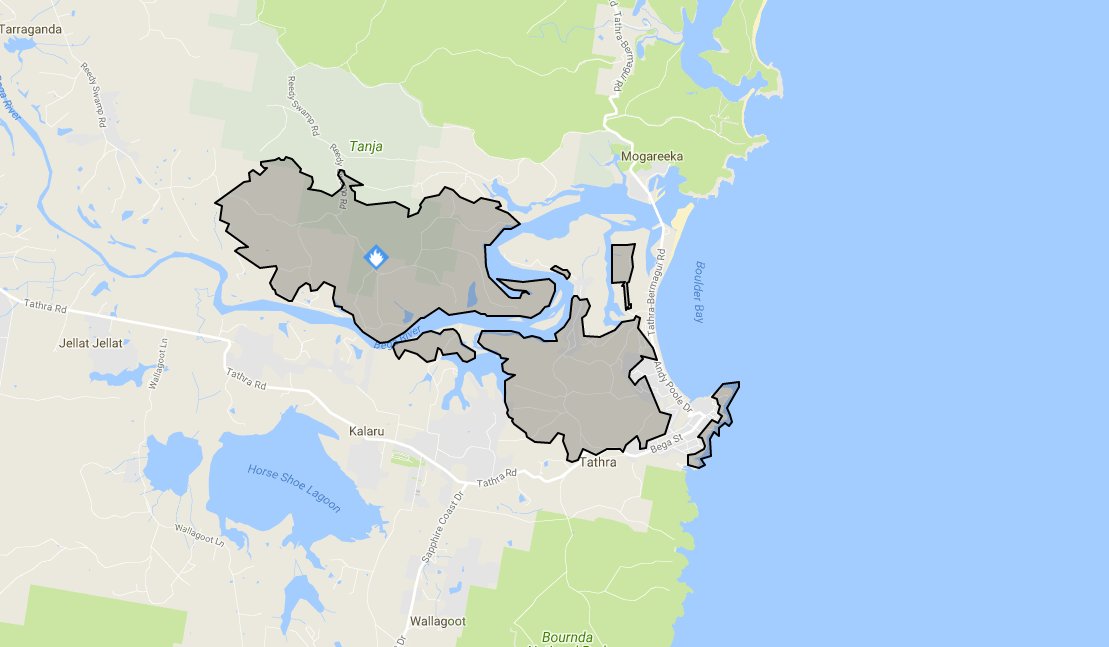
map fire tathra
Map of the fire near Tathra, New South Wales. NSW RFS.


(Originally published at 11:03 a.m. MDT March 18, 2018, US time)

A fire that started southeast of Bega, New South Wales has burned east to the Pacific coast destroying homes in its path. The official tally of the affected structures is not available but Campbell Fuller, communications director of the Insurance Council of Australia, said “We are hearing several dozen properties” burned.
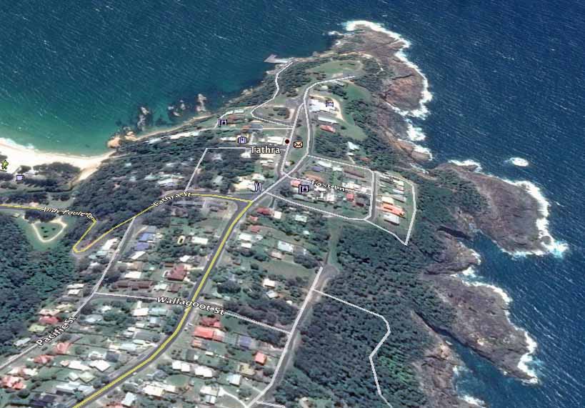
map bushfire Tathra new south wales
Google Earth file photo of the area in Tathra NSW affected by a bushfire. Compare this image to the one at the top of the article.

From the Daily Telegraph:

Earlier on Sunday night Bega Valley Shire Council mayor Kristy McBain said up to 35 homes had been lost and the concern was now about people stuck in Tathra as the roads in and out of the town were closed.

Many of the destroyed homes were in the small coastal community of Tathra, population 1,622. After the fire ran east for 5 miles (8 km) from the Bega area to the coast, jumping the Bega River, the wind shifted to come out of the south, slowing the spread. Officials advised residents to continue to monitor conditions and be prepared to enact their bush fire survival plan should the fire threaten again. The evacuation center is at Bega Showground.
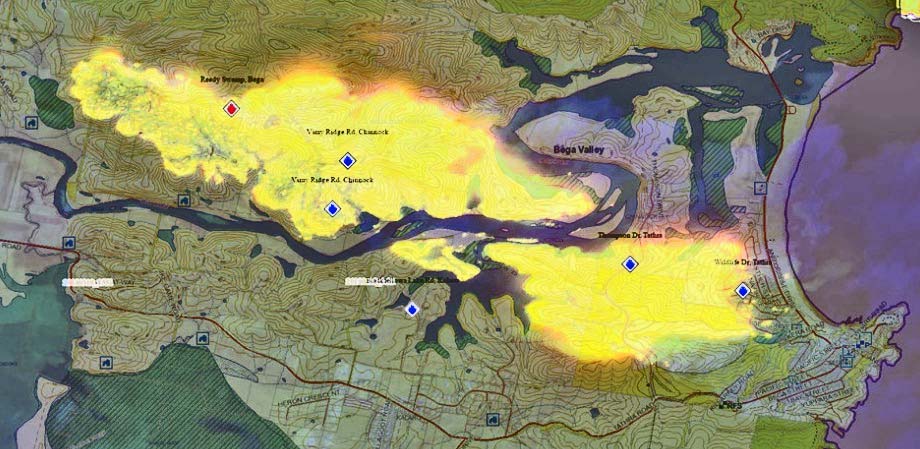
map bushfire Tathra new south wales
Map of the bushfire between Bega and Tathra NSW. Map by NSW RFS.

The NSW Rural Fire Service video below shows Air Tanker 390 making a drop in Tathra.

The latest size of the fire released by the Rural Fire service at 23:10 March 18 local time was 1,000 hectares (2,470 acres).

bushfire Tathra new south wales
Air Tanker 390 makes a retardant drop near structures in Tathra, NSW. Photo credit, NSW RFS.


Firefighters and aircraft are being kept busy in New South Wales

(This article was first published on Fire Aviation)

A post shared by Charlton Durie (@charltondurie) on

Click on the image above to start the video. Then, to see a second video, click on the arrow on the right side of the image.

Instagram user “charltondurie” grabbed this photo and video of Air Tanker 912, a DC-10, dropping retardant on a fire about 70 miles (110 km) southwest of Sydney in New South Wales, Australia that has burned 1,880 ha (4,645 acres) northeast of Taralga between Bannaby and Wombeyan Caves.

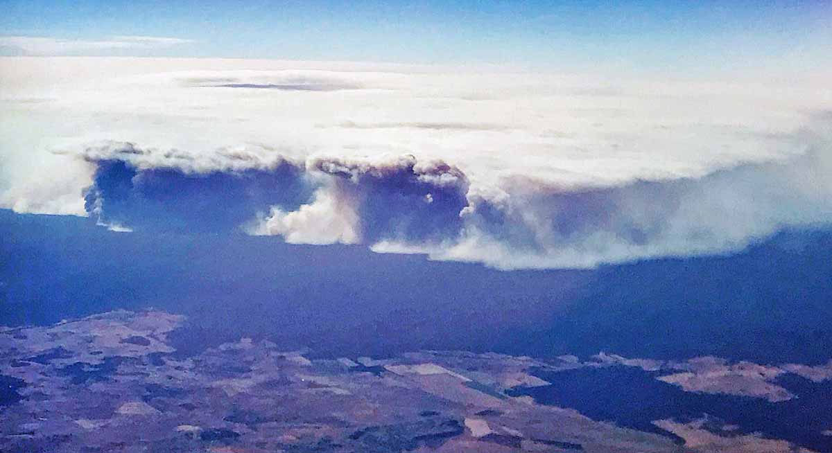
A huge fire in the Pilliga Forest between Coonabarabran and Narrabri has blackened over 57,880 hectares (143,000 acres).

Lightning ignited multiple fires across the Blue Mountains and Yengo National Parks in NSW Monday evening. There are two fires burning in remote areas to the north of the Great Western Highway in the Grose Valley, Blue Mountains National Park and an additional six fires south of the Great Western Highway and north of Warragamba Dam in the Blue Labyrinth, Blue Mountains National Park. The aircraft is named “Nancy Bird” after an Australian aviatrix.

There is also one fire in the Yengo National Park, east of the Putty Road in the Hawkesbury.

These lightning fires are burning in remote areas. NSW  Rural Fire Service and  National Parks and Wildlife Remote Area Firefighters have worked to establish and consolidate containment lines with the support of air tankers.

PIlliga Fire closes Newell Highway in New South Wales

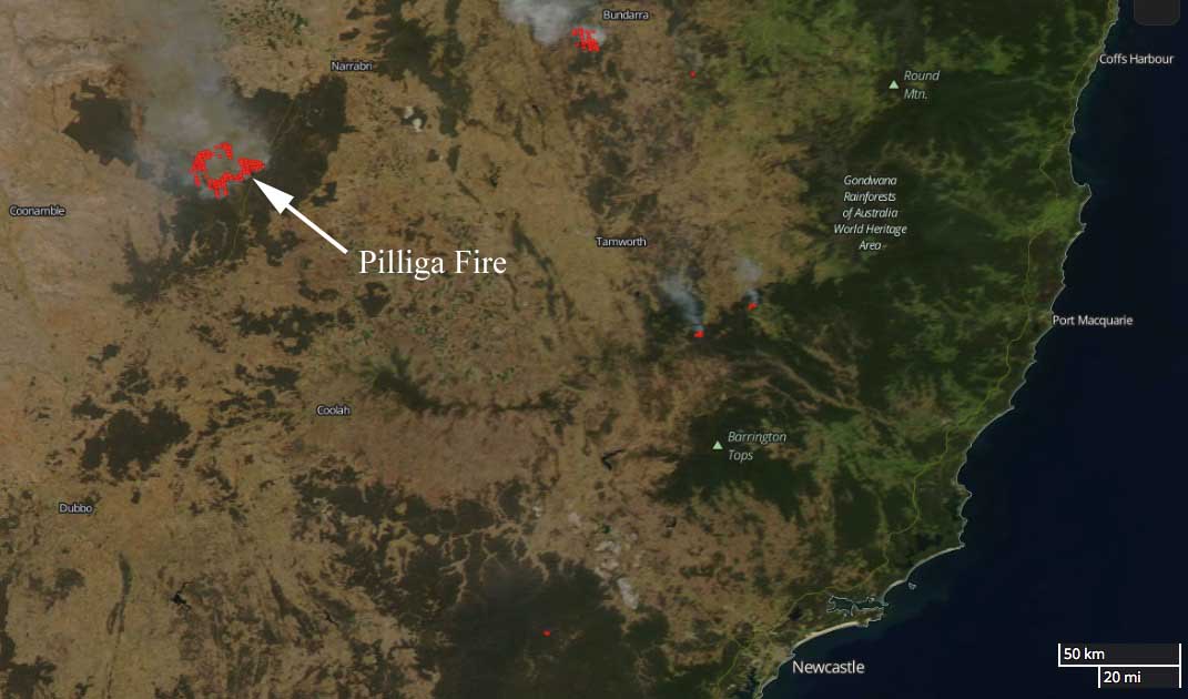
Above: The Pilliga Fire 60 km southwest of Narrabri, New South Wales, Australia. Modified Copernicus Sentinel satellite data  processed by Pierre Markuse.

(Originally published at 8:46 MST January 19, 2018)

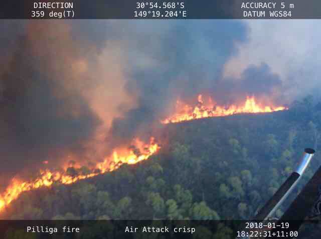
The Pilliga Fire in Australia between #Coonabarabran and #Narrabri has burned approximately 20,000 hectares (49,400 acres) in New South Wales, requiring the closure of the Newell Highway. The fire is burning near Dipper Road, Dandry, in the Pilliga Forest west of the highway.

Pilliga Fire New South Wales
Pilliga Fire 60 km southwest of Narrabri, New South Wales, Australia.

The Rural Fire Service reports that smoke is likely to drift across the Wee Waa, Gwabegar, and Baradine areas. There is, however, no current threat to homes.

Pilliga Fire New South Wales
Pilliga Fire 60 km southwest of Narrabri, New South Wales, Australia.

map Pilliga Fire New South Wales

Bushfire in NSW threatened communities north of Newcastle

On Saturday January 13 a bushfire near Masonite Road threatened the communities of Tomago, Williamtown, and Raymond Terrace 17 Km north of Newcastle, New South Wales, Australia.

(If you don’t see the video below shot from an air attack aircraft, click HERE.)

The weather changed, bringing a little precipitation after it had burned 1,381 hectares (3,412 acre), slowing the spread. For a while the Newcastle airport was closed due to visibility reduced by smoke.

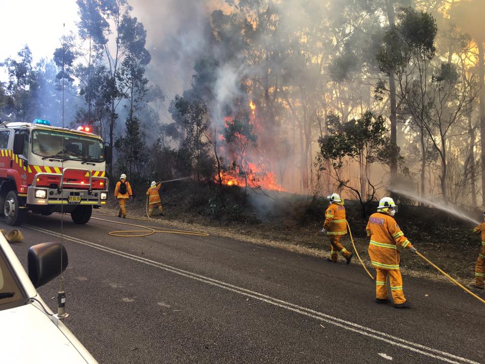
The fire was fought by 66 firefighters from the Rural Fire Service, Fire and Rescue, and the National Parks and Wildlife Service. They were assisted by helicopters and Air Tanker 912, a DC-10 that was recently renamed “Nancy Bird” in honor of an Australian aviatrix.

Bush fire season cranks up in Australia

NSW bush fire
A tough day for firefighters across New South Wales Wednesday with warm, dry and windy conditions. At 5:30 pm there were 94 bush and grass fires, with 38 uncontained. NSWRFS photo.

The bush fire season is heating up in New South Wales, Australia as they move into their Spring down under.

The video below was shot by a helicopter over a fire at Lakes Way at Tuncurry in New South Wales. It includes infrared and conventional images.

At the last report the fire had burned 1,700 hectares (4,201 acres) east of Nabiac and North of Tuncurry.

Currandoole Fire burns 6,000 acres near Tarago, NSW

Above: A helicopter flies over the Currandooley Fire near Tarago. New South Wales Rural Fire Service photo.

The Currandoole Fire has burned 6,054 acres (2,450 ha) and one structure in the Boro and Mount Fairy area south of Tarago, New South Wales.

On Tuesday a severe thunderstorm moved across the fire and dropped some rain, but not enough to extinguish the blaze. Firefighters will continue to strengthen containment lines Tuesday night ahead of challenging hot, dry and windy conditions predicted for Wednesday.

The DC-10 and RJ85 air tankers were dispatched and assisted firefighters on the ground.

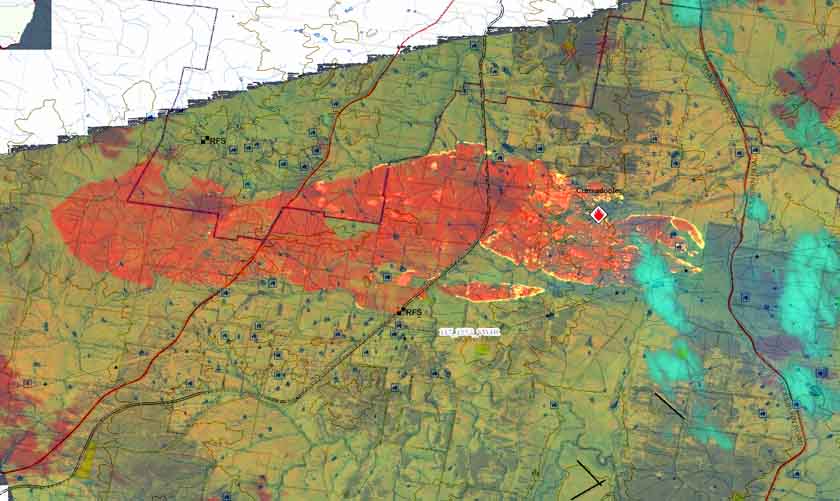
Currandooley Fire map
Map produced by an infrared line scanner of the Currandooley Fire near Tarago, New South Wales, Australia.