Wildfire smoke and Red Flag Warnings, September 10, 2016

wildfire smoke map
Distribution of smoke from wildfires, September 10, 2016. NOAA.

The National Weather Service has posted Red Flag Warnings or Fire Weather Watches for areas in Washington, Wyoming, Colorado, Nebraska, and South Dakota for today.

Red Flag Warnings

The Red Flag map was current as of 9:45 a.m. MDT on Saturday. Red Flag Warnings can change throughout the day as the National Weather Service offices around the country update and revise their forecasts and maps. For the most current data visit this NWS site. However, that site has not been properly displaying warning areas in recent days. This one may work better.

Click on the maps to see larger versions.

Fire weather outlook
Fire weather outlook for September 11, 2016

Red Flag Warnings, August 29, 2016

wildfire Red Flag Warnings August 29, 2016The National Weather Service has posted Red Flag Warnings or Fire Weather Watches for areas in Oregon, California, and Nevada.

The Red Flag map was current as of 8 a.m. MDT on Monday. Red Flag Warnings can change throughout the day as the National Weather Service offices around the country update and revise their forecasts and maps. For the most current data visit this NWS site.

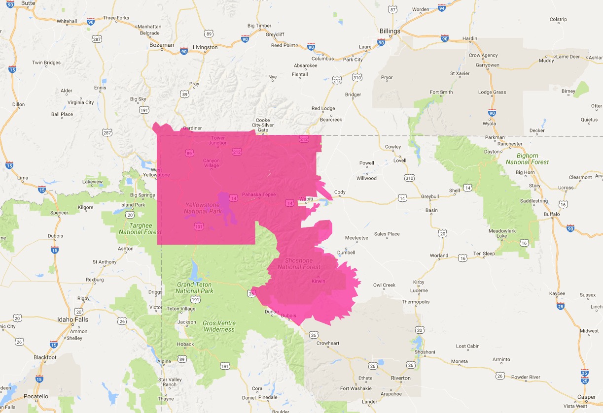
Red Flag Warning for Yellowstone National Park

wildfire Red Flag Warning August 28, 2016

National Weather Service forecasters have identified a Red Flag Warning for Yellowstone National Park and the Absaroka Mountains to the east. They designated the park boundary and the Wyoming/Montana state line as the edge of the extreme weather and fuel conditions on three sides. Apparently the national forests and the park on the north, west, and south sides of Yellowstone are not affected.

The Red Flag areas are confined to Fire Weather Zones 140 and 236. Zone 140 is Yellowstone NP, which has mostly straight lines on three sides. Zone 236 is the Absaroka Mountains.

This is the only area in the United States under a Red Flag Warning today.

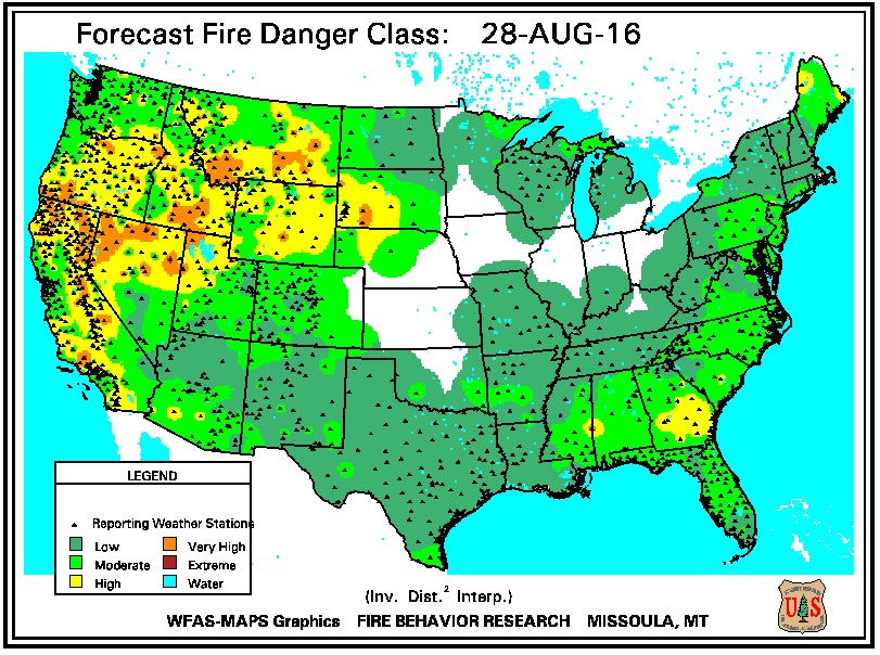
Meanwhile the U.S. Forest Service forecasts mostly Moderate to High fire danger for the same area.

Fire danger August 28, 2016

The Red Flag map was current as of 8:40 a.m. MDT on Sunday. Red Flag Warnings can change throughout the day as the National Weather Service offices around the country update and revise their forecasts and maps. For the most current data visit this NWS site.

Red Flag Warnings August 27, 2016

wildfire Red Flag warnings

The National Weather Service has posted Red Flag Warnings for areas in Washington, Oregon, Idaho, and Wyoming.

The Red Flag map was current as of 11:14 a.m. MDT on Saturday. Red Flag Warnings can change throughout the day as the National Weather Service offices around the country update and revise their forecasts and maps. For the most current data visit this NWS site.

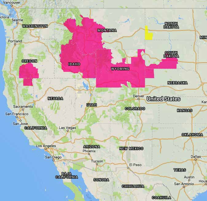
Red Flag Warnings, August 22, 2016

wildfire Red Flag Warning

The National Weather Service has posted Red Flag Warnings or Fire Weather Watches for areas in Oregon, California, Idaho, North Dakota, Montana, Wyoming, South Dakota, and Nebraska.

The Red Flag map was current as of 10:20 a.m. MDT on Monday. Red Flag Warnings can change throughout the day as the National Weather Service offices around the country update and revise their forecasts and maps. For the most current data visit this NWS site.

Red Flag Warnings, August 6, 2016

Above: Distribution of smoke from wildfires, 11 a.m. MDT August 6, 2016. Weatherunderground.

The National Weather Service has posted Red Flag Warnings or Fire Weather Watches for areas in Washington, Oregon, Idaho, Montana, Wyoming, and Utah.

wildfire Red Flag Warnings, August 6, 2016
Red Flag Warnings (red) and Fire Weather Watches (yellow), August 6, 2016

The Red Flag map was current as of 11:10 a.m. MDT on Saturday. Red Flag Warnings can change throughout the day as the National Weather Service offices around the country update and revise their forecasts and maps. For the most current data visit this NWS site.