Red Flag Warnings August 17, 2016

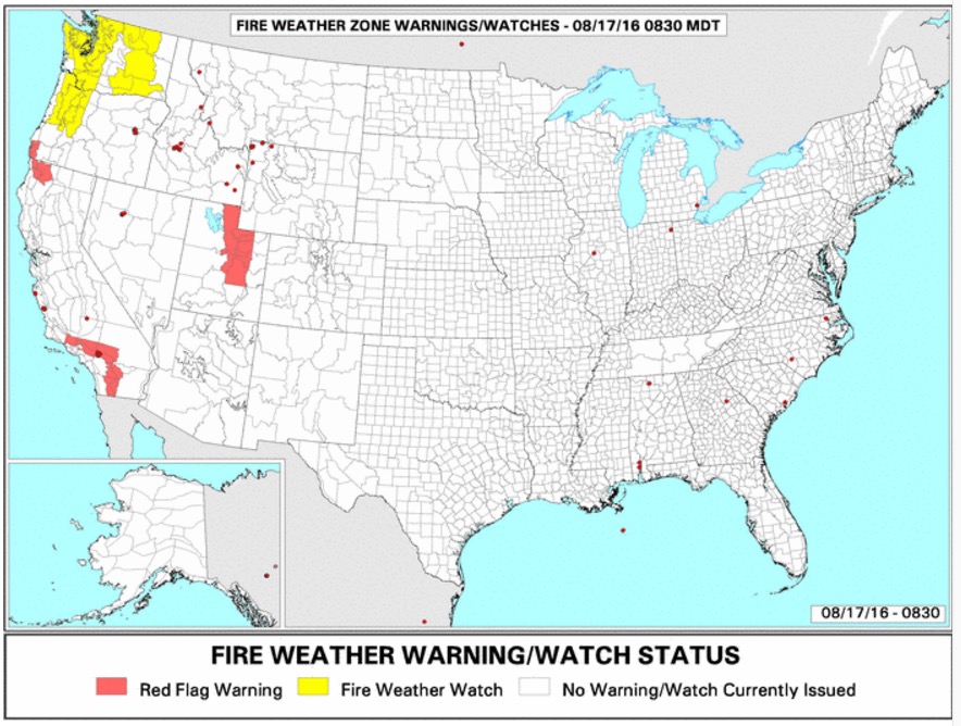
Red Flag Warnings August 17, 2016

The National Weather Service has posted Red Flag Warnings or Fire Weather Watches for areas in Washington, Oregon, California, and Utah.

The Red Flag map was current as of 8:40 a.m. MDT on Wednesday. Red Flag Warnings can change throughout the day as the National Weather Service offices around the country update and revise their forecasts and maps. For the most current data visit this NWS site.

Wildfire smoke and Red Flag Warnings, August 9, 2016

Map of smoke from wildfires
Map of smoke from wildfires, 9 a.m. MDT August 9, 2016. Weatherunderground.
wildfire smoke forecast
Experimental wildfire smoke forecast for 6 p.m. MDT August 9, 2016.
Red Flag Warnings wildfire
Red Flag Warnings, August 9, 2016.

The National Weather Service has posted Red Flag Warnings or Fire Weather Watches for areas in Idaho, Montana, Wyoming, and Utah.

The Red Flag map was current as of 9:10 a.m. MDT on Tuesday. Red Flag Warnings can change throughout the day as the National Weather Service offices around the country update and revise their forecasts and maps. For the most current data visit this NWS site.
Red Flag Warnings, August 6, 2016

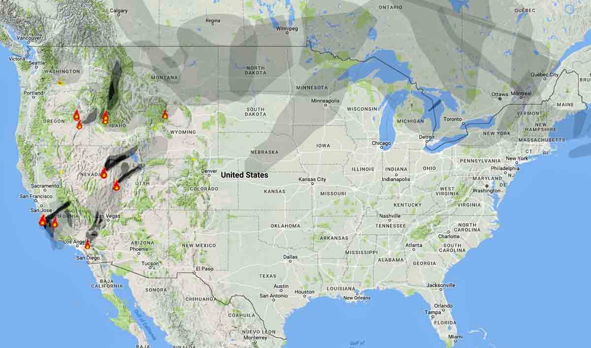
Above: Distribution of smoke from wildfires, 11 a.m. MDT August 6, 2016. Weatherunderground.

The National Weather Service has posted Red Flag Warnings or Fire Weather Watches for areas in Washington, Oregon, Idaho, Montana, Wyoming, and Utah.

wildfire Red Flag Warnings, August 6, 2016
Red Flag Warnings (red) and Fire Weather Watches (yellow), August 6, 2016

The Red Flag map was current as of 11:10 a.m. MDT on Saturday. Red Flag Warnings can change throughout the day as the National Weather Service offices around the country update and revise their forecasts and maps. For the most current data visit this NWS site.

Wildfire smoke and Red Flag Warnings, August 5, 2016

Above: Map showing the distribution of smoke from wildfires at 11:45 a.m. MDT August 5, 2016. Weatherunderground.

The National Weather Service has posted Red Flag Warnings for areas in Washington, Oregon, Idaho, and Utah.

Red Flag Warnings August 5, 2016

The Red Flag map was current as of 11:45 a.m. MDT on Friday. Red Flag Warnings can change throughout the day as the National Weather Service offices around the country update and revise their forecasts and maps. For the most current data visit this NWS site.

Wildfire smoke map and Red Flag Warnings, August 3, 2016

Above: Wildfire smoke map August 3, 2016. Weatherunderground.

The National Weather Service has posted Red Flag Warnings for areas in Montana, Wyoming, and South Dakota.

The Red Flag map was current as of 10:40 a.m. MDT on Wednesday. Red Flag Warnings can change throughout the day as the National Weather Service offices around the country update and revise their forecasts and maps. For the most current data visit this NWS site.

wildfire Red Flag Warnings, August 3, 2016

Wildfire smoke map and Red Flag Warnings

map wildfire smoke
Map showing the distribution of smoke from wildfires, 6 a.m. MDT, August 2, 2016.

Smoke from wildfires in the western United States continues to affect the northwest and the northern great plains.

The National Weather Service has posted Red Flag Warnings for areas in Washington, Oregon, California, Nevada, Idaho, Montana, Utah, Wyoming and South Dakota.

The Red Flag map was current as of 8 a.m. MDT on Tuesday. Red Flag Warnings can change throughout the day as the National Weather Service offices around the country update and revise their forecasts and maps. For the most current data visit this NWS site.

wildfire Red Flag Warnings August 2, 2016
Red Flag Warnings August 2, 2016