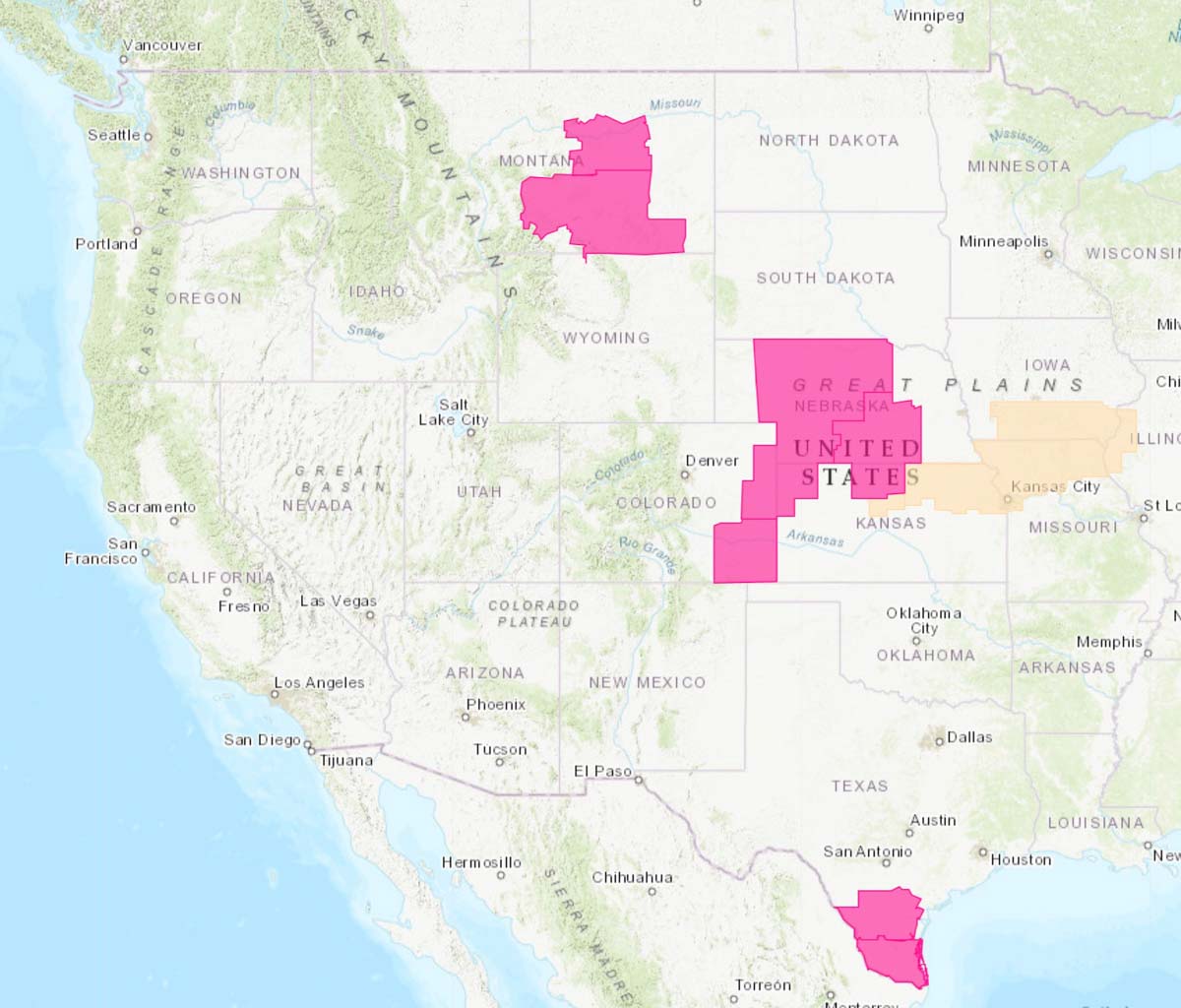
The National Weather Service has issued Red Flag Warnings due to low humidity and gusty winds in areas of Colorado, Montana, and North Dakota for Sunday. Most of the warnings expire Wednesday evening.
In southwest Colorado similar conditions could persist into Monday .
(Red Flag Warnings can be modified throughout the day as NWS offices around the country update and revise their weather forecasts.)
The National Weather Service has issued Red Flag Warnings due to low humidity and strong winds in areas of Nebraska, Kansas, Colorado, Oklahoma, Texas, and New Mexico. Most of the warnings expire Wednesday evening.
(Red Flag Warnings can be modified throughout the day as NWS offices around the country update and revise their weather forecasts.)
The National Weather Service has issued Red Flag Warnings due to low humidity and strong winds in areas of Montana, Colorado, Kansas, Nebraska, and Texas. Most of the warnings expire Wednesday evening except for those in western and north central Nebraska which are in effect until Thursday evening.
(Red Flag Warnings can be modified throughout the day as NWS offices around the country update and revise their weather forecasts.)
The fire weather in southern California for Tuesday night through Thursday, October 29-31, is predicted to be the most severe so far this year. Wind gusts of 50 to 70 mph are possible in the mountains and foothills and relative humidity could drop into the single digits.
In areas of northern California a Red Flag Warning will be in effect from 8 a.m. PDT Tuesday until 4 p.m. PDT Wednesday. The wind is expected to be out of the north or northeast at 15 to 35 mph with gusts of 35 to 60 mph, locally higher in canyons and exposed ridges.
(Red Flag Warnings can be modified throughout the day as NWS offices around the country update and revise their weather forecasts.)
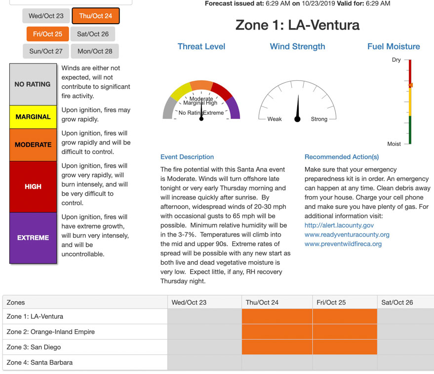
The fire threat for four areas in southern California on October 24 and 25 is described as “Moderate”. This example is for the Los Angeles and Ventura areas, showing Threat Level, Wind Strength, and Fuel Moisture on Thursday October 24.
A wildland fire danger forecasting tool called the Santa Ana Wildfire Threat Index (SAWTI) is categorizing the fire threat from the strong winds predicted for Thursday and Friday of this week in southern California as “Moderate”. This includes Los Angeles, Ventura, Orange County, Inland Empire, and San Diego. The Santa Barbara area is shown as “no rating” for this week. Most other tools for predicting fire danger would use a stronger adjective for the predicted conditions.
The SAWTI uses a predictive model that includes wind strength, dead fuel moisture, live fuel moisture, atmospheric moisture, and the greenness of annual grasses to create a daily threat assessment of the fuel conditions across Southern California. The output is then compared to climatological data and historical fire occurrence to establish the index rating. It does not assess conditions in the central or northern part of the state.
The SAWTI is a product of the US Forest Service and Predictive Services, according to the website dedicated to the tool. The site does not specify which of the numerous Predictive Services and Forest Service offices are involved.
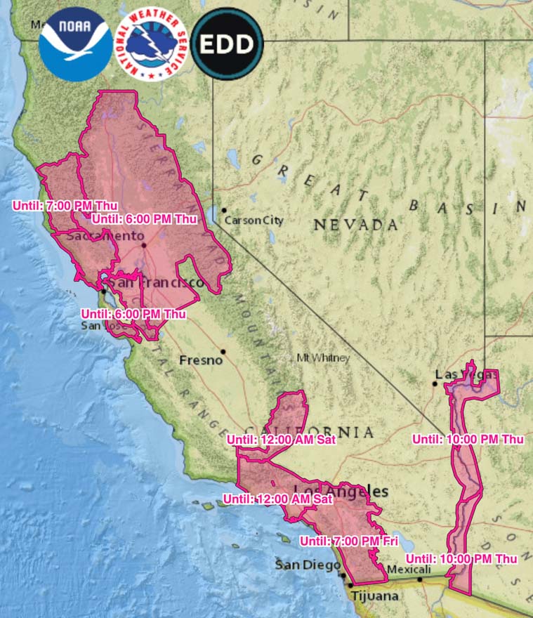
Red Flag Warnings, produced at 6:30 a.m. PDT October 23, 2019. Times are CDT.
For northern California the forecast on Thursday and Friday is for north to northeast winds of 15 to 30 mph gusting at 35 to 45 with humidity in the teens. For southern California: northeast winds of 20 to 40 gusting up to 65 with humidity in the single digits. These predicted numbers vary depending on the exact location.
(Red Flag Warnings can be modified throughout the day as NWS offices around the country update and revise their weather forecasts.)