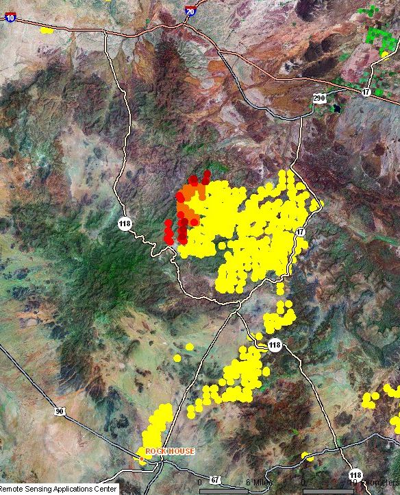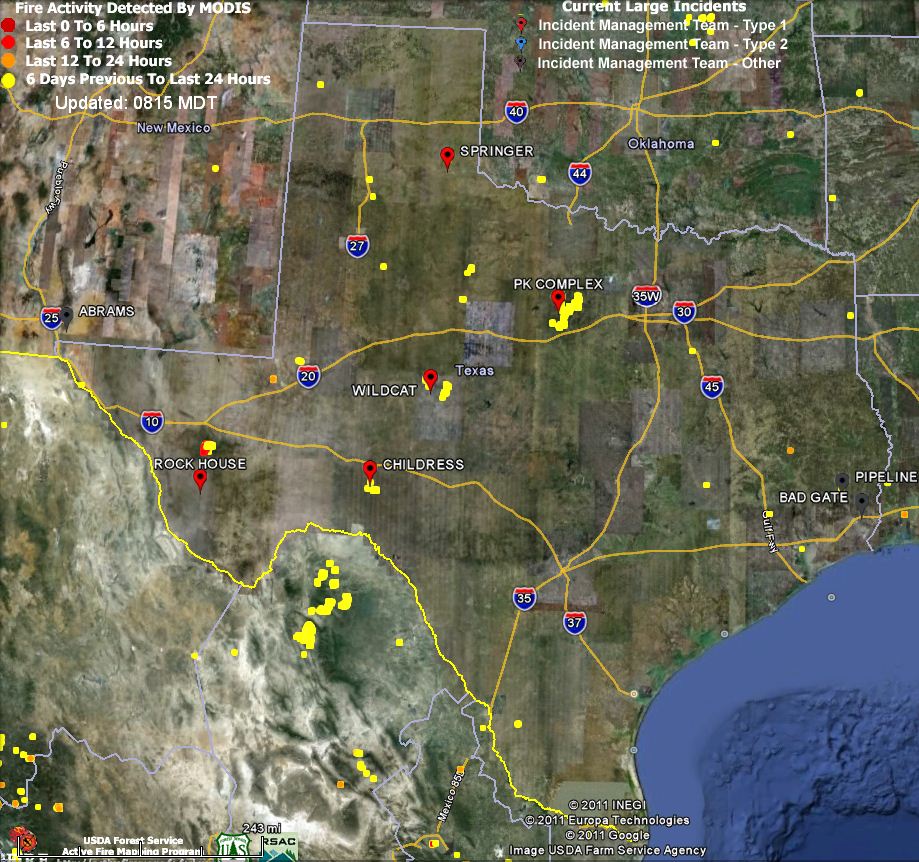
The Rock House fire started on April 9 and is still adding to it’s 207,000 acres in southwest Texas. The map above shows, in red and orange, the heat detected by satellites within the last 24 hours. The yellow areas previously burned.
Much of the recent heat and additional acres on the northwest side northwest of Fort Davis, may be due to a planned burnout operation that is likely to continue for several days, weather permitting. According to a report on InciWeb from April 22:
Over the next few days, firefighters may begin burning out an area in the NW area of the Rock House fire, between the fire and roads. These roads are further back from the fire, and will allow firefighters to safely and indirectly attack it as it comes out of the canyon lands.
The following was posted on InciWeb Sunday morning, which appears to indicate that the Rock House fire was very active:
Due to concerns for public and firefighter safety, as well as a lack of reliable communications, firefighters have backed out of the Davis Mountains’ steep canyons to gentler terrain. Dozers cannot be used on the steep terrain; and, aerial resources have been ineffective. Structure-protection assessments are ongoing. Yesterday firefighters conducted burn-out operations near the McDonald Observatory in anticipation of predicted strong north winds (gusts up to 60 mph) early in the week. The observatory hosted a public meeting last night to provide information to residents on the fire situation.
Today firefighters will focus on aerial operations, structure protection and evacuation plans. A Red Flag Warning is in effect today with temperatures in the 80s.
On Saturday the relative humidity in the area of the Rock House fire was in the single digits. That is expected to continue on Sunday with the issuance of a Red Flag Warning for 20-25 mph westerly winds with gusts up to 40 mph and the humidity again at 7 percent. The temperature will max out at 90 degrees. The Red Flag Warning is in effect from noon CDT until Sunday evening. Another Red Flag Warning is forecast from noon Monday until 9 p.m. on Tuesday.

As you can see in the above map, the satellites did not find any large amounts of heat over the last 24 hours in any other fires in Texas (other than the Rock House fire) or the fires 30-40 miles south of the border in Mexico that the 747 and Martin Mars very large air tankers are working on.
Here is a list of the top 10 large fires listed on the National Situation Report today:

