Above: Smoke from the Roosters Comb Fire was captured in a photo by the (non-operational) GOES-16 satellite at 7:30 p.m. MDT July 10, 2017.
(Originally published at 7:20 a.m. MDT July 11, 2017)
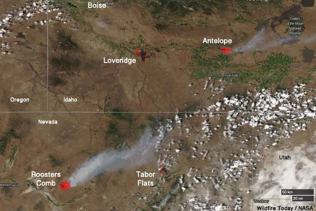
Four wildfires in northeast Nevada and southern Idaho are large enough that satellites are able, in some cases, to see the smoke and the blackened burned areas. These photos were taken late in the afternoon on Monday July 10.
The one putting up the most smoke Monday was the Roosters Comb Fire which as of Monday evening had burned approximately 25,000 acres in Nevada 17 miles northeast of Battle Mountain. It was reported at 9 p.m. Sunday July 9. The fire is spreading rapidly through grass, sagebrush, and pinyon-juniper.

Farther to the east in Nevada is the Tabor Flats Fire 27 miles northeast of Elko close to Interstate 80. The reported size of this fire is also 25,000 acres. The fire behavior in the tall grass is described as “extreme, running, flanking, wind driven runs”.
In Idaho the Loveridge Fire has burned over 38,000 acres 18 miles south of Mountain Home. It was shown as contained in the Tuesday morning national situation report. The heat detected by the satellite in that area (shown as red dots) could either be from the Loveridge Fire or a new fire in the same area.
The Antelope Fire at Shoshone, Idaho just south of Interstate 84 has covered 29,500 acres. It is exhibiting extreme fire behavior with wind-driven runs.

