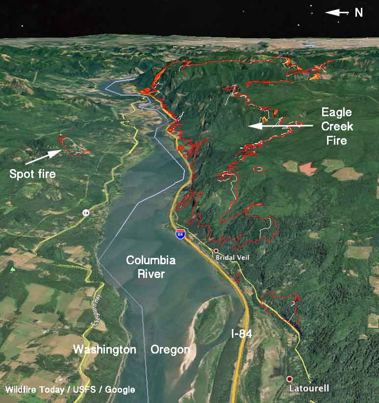
On the map above, the red line was the perimeter of the Eagle Creek Fire at 2:15 a.m. PDT September 7, 2017. The white line was the perimeter about 24 hours before.
(Originally published at 9:06 am PDT September 7, 2017)
The Eagle Creek Fire that is believed to have been started by a teenager playing with fireworks, continued to spread Wednesday but more slowly than in previous days, adding another 2,453 acres mostly on the south and northeast sides. The spot fire across the Columbia River in Washington has expanded to 209 acres.
The main fire is 11 miles east of Gresham.
Interstate 84 is still closed. The Oregon Department of Transportation said Wednesday that there are nearly 2,000 trees that are in danger of falling into the highway.
Snow plows are being used to push fallen trees off the Historic Columbia River Highway, which is also closed “for an undetermined amount of time”, the DOT said.
We’re using plows to clear downed trees on the Historic Columbia River Highway so fire crews can continue to fight #EagleCreekFire pic.twitter.com/qGbEhWTLYc
— Oregon DOT (@OregonDOT) September 6, 2017
The weather forecast indicates that the air quality should improve in the Portland area over the next few days. The prediction is for a “moderate” Air Quality Index for Thursday and Friday of this week. The forecast also calls for a chance of rain off and on over the next couple of days.


Historic Columbia River Highway will remain closed for an undetermined amount of time due to #EagleCreekFire #OneontaTunnel pic.twitter.com/dTcC8z4TGv
— Oregon DOT (@OregonDOT) September 6, 2017

