
Updated at 9:54 a.m. CDT June 25, 2022
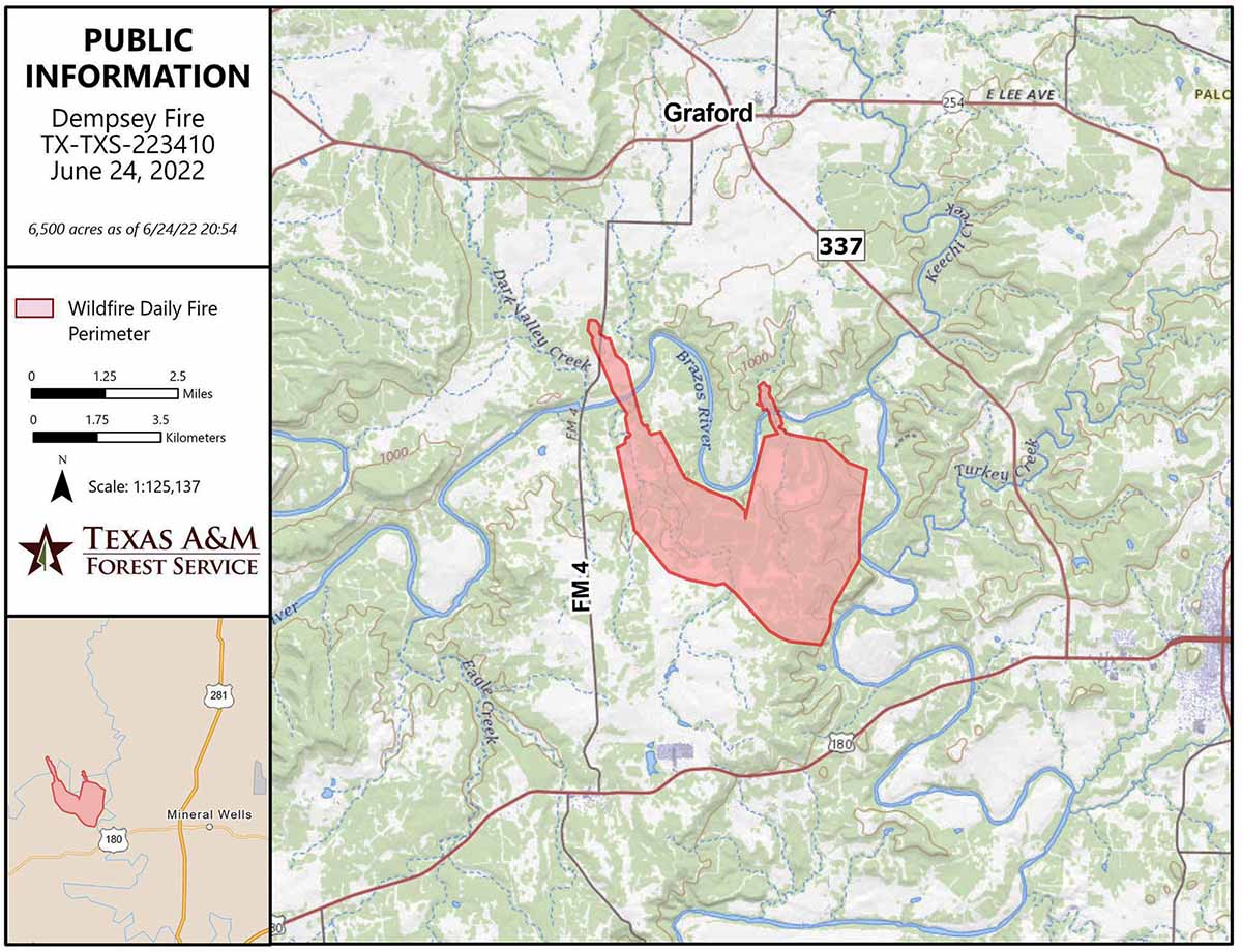
The Dempsey Fire showed extreme activity well into Friday night and only slowed down when when high humidity set in early Saturday morning. The fire jumped FM Road 4 and Fortune Bend Road, and crossed the Brazos River in multiple places.
To see all articles on Wildfire Today about the Dempsey Fire, including the most recent, click HERE.
Additional dozer and engine crews have arrived on scene and began constructing and holding line early Saturday morning. Helicopters and air tankers are expected to be available to assist firefighters.
At 9 a.m. Saturday the Texas Forest Service was still saying the size is 6,500 acres. That could change with updated mapping.
An updated spot weather forecast from the NWS for Saturday calls for clear skies, 105 degrees, 19 percent relative humidity, and winds out of the south at 5 to 9 mph.
10:35 p.m. CDT June 24, 2022
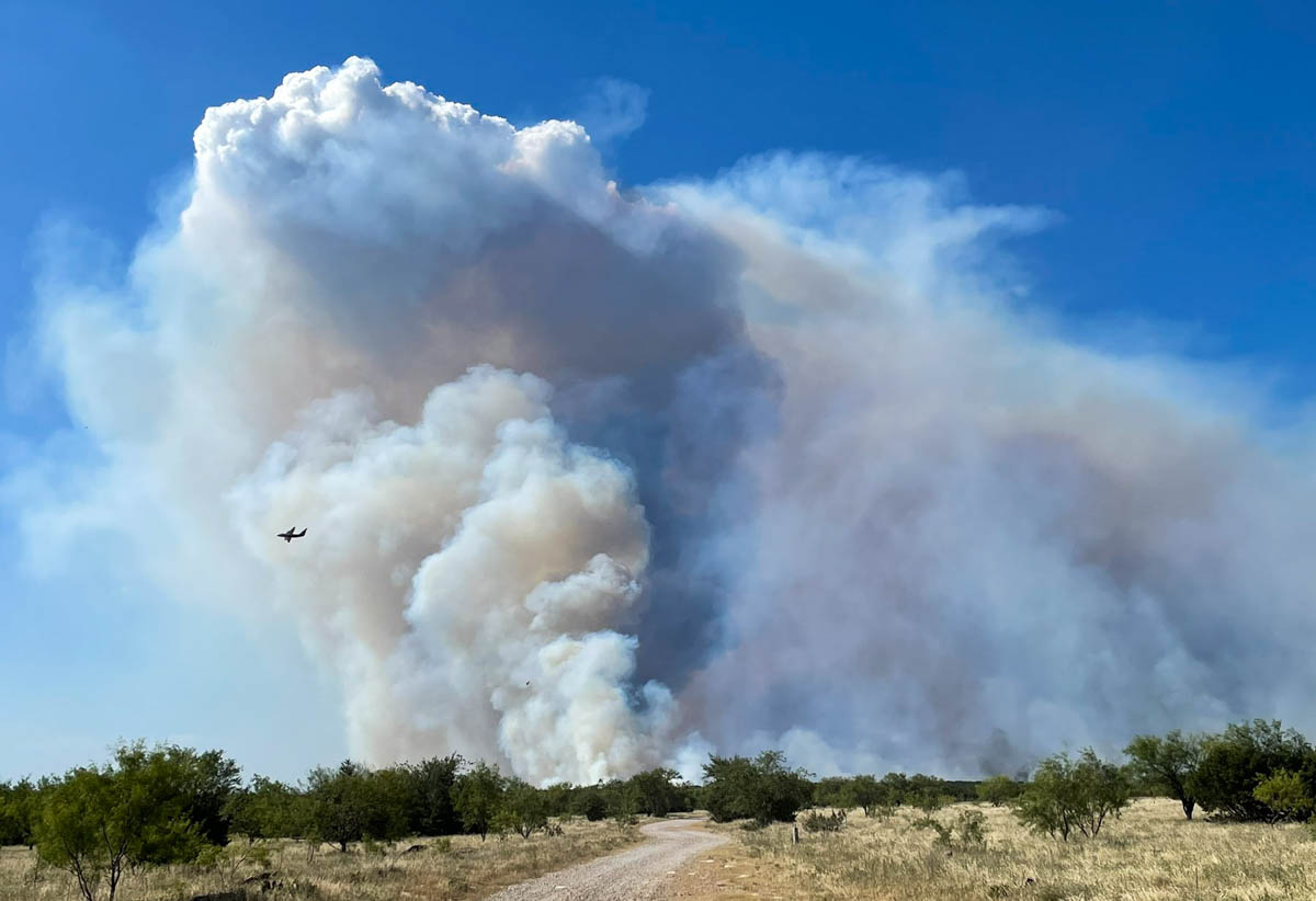
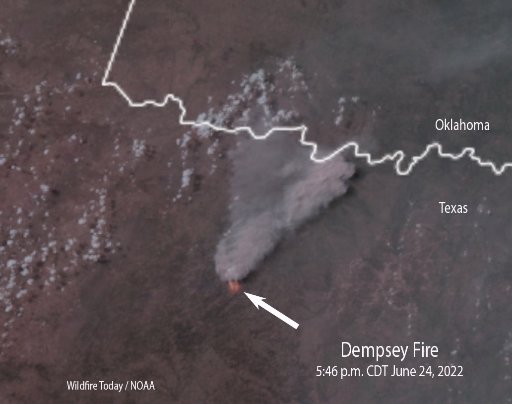
The Dempsey Fire 6 miles west of Mineral Wells, Texas was extremely active Friday afternoon, growing to approximately 6,500 acres as the temperature soared to 106 degrees. The Texas Forest Service reported it ran to the north and northwest, jumping the Brazos River and FM Road.

Engines have been engaged in structure protection as dozers construct line along the flanks of the fire. Aircraft are assisting firefighters by cooling the head and flanks, slowing the rate of spread and buying time for the ground crews. Evacuations are in effect south of Grassy Ridge Road.

After 2 p.m. Friday the wind at the Mineral Wells Airport was out of the south and southeast at 10 to 18 mph gusting at 20 to 30 while the relative humidity was 17 percent. The spot weather forecast for Friday night calls for 7 to 12 mph winds out of the south and southeast with the humidity rising to 50 percent by dawn. On Saturday the wind will be from the south at 10 to 15 mph with 18 percent relative humidity and a high temperature of 105. These weather conditions will favor the continued spread of the fire to the north and northwest .


Thank you! to all the brave and loving men and women who put themselves in harms way to protect us and our property here in the great state of Texas! Amen and Amen!
Be fruitful and multiply. Genesis 1:28.
Due to recent events, I will no longer assist with a fire in Texas. I dissent.
HEARD!
I will no longer consider going to TAMU for fire ecology.
What so ever.
I also dissent.
We were evacuated from Rocker B Ranch in Barnhart, Friday evening. Has the fire reached Rocker B Ranch?
I am confused by the question. Barnhart? As in SW of San Angelo?