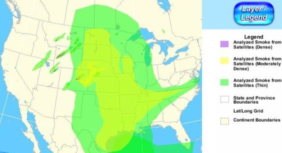
Smoke maps, June 26, 2012

Smoke map, wildfires, 8:18 p.m. MT, June 26, 2012

The map indicates the distribution of smoke generated by wildfires, as of 8:18 p.m. MT, June 26, 2012. Many fires in Utah, Nevada, Montana, Wyoming, and Colorado are putting up massive amounts of smoke.

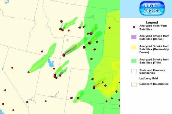
Below is a zoomed in version of some of the western states, created at 8:48 p.m. MT, June 26, 2012:

Smoke map, 8:48 pm MT, June 26, 2012

Typos, let us know HERE, and specify which article. Please read the commenting rules before you post a comment.

Author: Bill Gabbert

After working full time in wildland fire for 33 years, he continues to learn, and strives to be a Student of Fire.