(UPDATE at 9:55 a.m. MT, June 9, 2013)
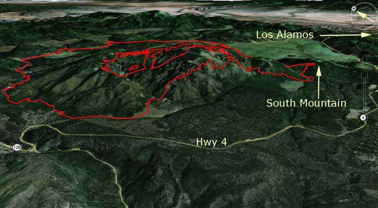
The map of the Thompson Ridge Fire above shows the perimeter at about 2 a.m. Sunday. The most recent fire spread was on the southeast side onto South Mountain, within about a mile of Highway 4.
The fire has grown to 20,687 acres and is listed at 40 percent containment. Firefighters have been completing firelines and burning out in the interior for the last couple of days. Saturday just before sunset they were firing out along a road on the southeast side, removing fuel between a planned line and the fire edge, when the fire spotted across the road and became established on the north side of South Mountain.
The plans now are to prepare for and then burn out between the southeast side of the fire and Highway 4.
Effective 6 a.m. today, June 9, 2013, New Mexico Highway 4 will be closed at the junction of State Route 126 to the junction of State Route 501. Residents in and around Sierra los Pinos are permitted entrance and exit along Highway 4 south to Jemez Springs. No traffic will be allowed to travel along Highway 4 east of Forest Road 10. Residents must show their identification to gain re-entry. There are no additional evacuations at this time. Evacuations remain in effect for Thompson Ridge, Rancho de la Cueva, and Elk Valley.
****
(UPDATE at 1 a.m. MT, June 9, 2013)
The Thompson Ridge Fire posted this “Urgent Update” at about 6 p.m. MT, June 8:
During burning operations this evening, the fire spotted across the fireline on the southeast side and established on South Mountain. Fire personnel are on scene evaluating containment options. Further updates as information becomes available.
Effective 0600 Sunday, June 9, 2013, New Mexico Highway 4 will be closed at the junction of State Route 126 to the junction of State Route 501.
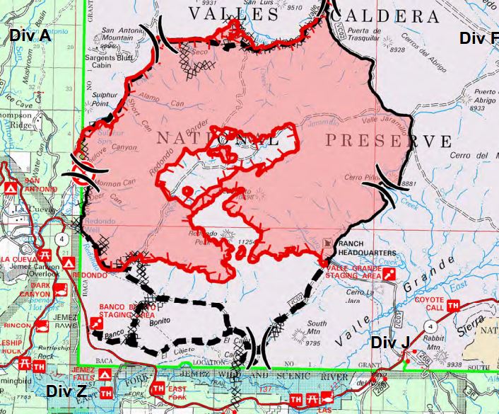
On the map of the Thompson Ridge Fire below, (created before the expansion onto South Mountain) the firefighters were most likely burning to remove fuel between the fire (the red area) and the black dashed line on the southeast side of the fire when it spread onto South Mountain, between the black dashed line and Highway 4.
The DC-10 air tanker and possibly other air tankers were dropping retardant on the Thompson Ridge fire Saturday afternoon, probably in the South Mountain area..
****
(UPDATE at 11:50 a.m. MT, June 8, 2013)
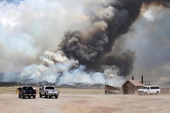
Even though the Thompson Ridge Fire 12 miles west of Los Alamos, New Mexico has been slowed in recent days by cooler, more humid weather, it still added about 4,000 acres Friday, bringing the total up to 18,527. A spokesperson for the fire said it was due to a previously unburned island of fuel in the interior of the perimeter burning out Friday. Firefighters spent the day yesterday mopping up and widening the containment line on the western edge of the fire near the adjoining communities.
Firelines will be tested Saturday — a Red Flag Warning has been issued, valid from 1:00 pm through 7:00 pm, for sustained northwesterly winds of 15-20 mph, with gusts up to 30 mph.
An article in the Los Alamos Monitor describes an incident that occurred Tuesday that must have resulted in some tense moments for firefighters. Here is an excerpt:
Crews talk of saving Caldera Historic District
Tuesday night was a rough one on the Valles Caldera. Fire crews were having a fairly easy time fending off the flames when the unexpected happened. The smoke plume from the Thompson Ridge Fire suddenly collapsed, sending a storm of high winds and fire toward the Valles Caldera Historic District.
“It has all that energy that’s going straight up,” said Lindsay McElfresh, a structural and group trainee for the U.S. Forest Service. “But then, it starts to lose all that energy when it begins to cool down, and it will just fall.”
But all that energy has to go somewhere, and Tuesday night into the wee hours of Wednesday morning it was headed straight for the historic district, which included the historic Baca Ranch, located between a slope populated with old growth forest and the Valle Grande, which is mainly a vast meadow of dry, yellow grass.
It was quite a battle, according to firefighter Vas Naiker, an engine captain with the Valles Caldera crew. Luckily, they had some backup systems in place.
“The (DC-10 Tanker) had already done a drop, but the fire had gotten around it,” he said. “When it came around the corner, we activated the defense systems…”
Below is information about the Tres Lagunas Fire, Friday’s reports about the two fires, and a progression map of the Thompson Ridge fire, updated Friday night.
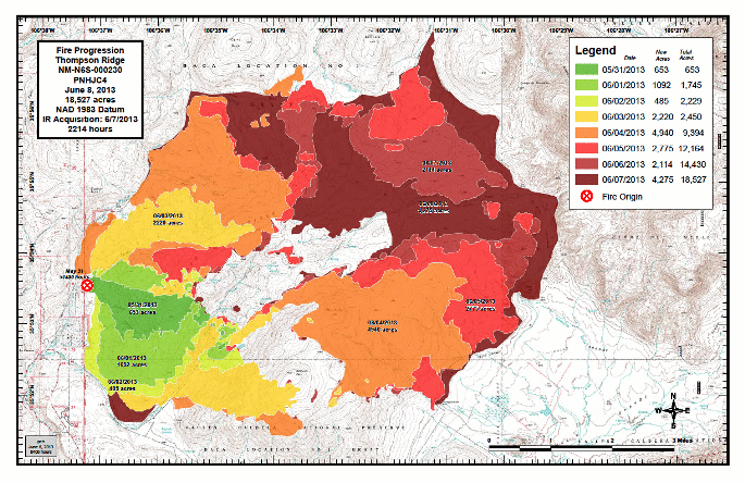
Unfortunately, while there are numerous excellent photos of the Thompson Ridge fire on InciWeb, none of them have dates, descriptions, or the names of the photographers.
There is not much change in the 10,040-acre Tres Lagunas Fire 10 miles north of Pecos, New Mexico, according to InciWeb:
Good progress was made Friday on hand and dozer lines. Lines were constructed to tie in remaining active fire areas which include the northwest corner of Holy Ghost Canyon. Firefighters completed firelines around the spot fires in Holy Ghost and the cluster of spot fires on the east side of the fire. Mop-up will continue Saturday in north, south, and southeast areas. Potential burnouts to establish a solid fire perimeter may be conducted west of Forest Road 92. An assessment will be conducted today for this action. The burnout operation (if needed) is a strategy for the protection of the Gallinas watershed.
****
Two large fires in northern New Mexico, each over 10,000 acres, have been slowed by moist air moving into the area.
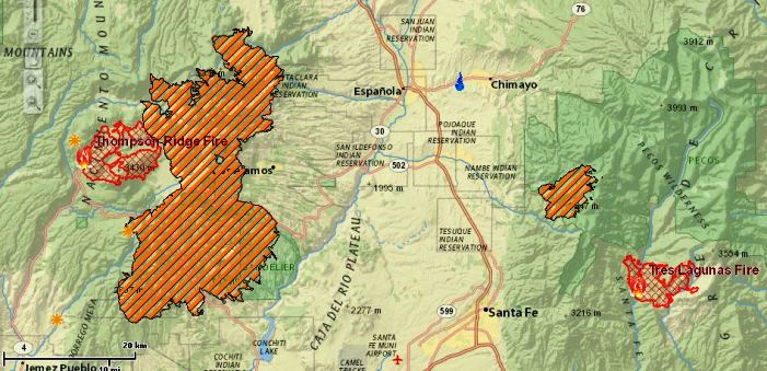
The Thompson Ridge Fire has blackened 14,430 acres within the Valles Caldera National Preserve about 12 miles west of Los Alamos. Firefighters have been taking advantage of the favorable weather to construct firelines and mopup near the Preserve’s headquarters. On Friday they conducted firing operations across high ridges on the northeast side of the fire.
The Preserve draws thousands of visitors each year and serves as the backdrop for the opening scene of A&E Network’s television series “Longmire”.
The other fire in the area is the Tres Lagunas Fire, 10 miles north of Pecos, New Mexico. Today firefighters are using bulldozers and hand crews to construct firelines to tie in the remaining active portions of the fire, which includes the northwest corner of Holy Ghost Canyon.
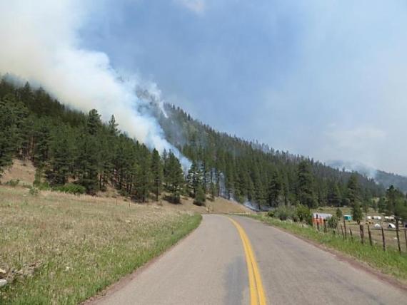
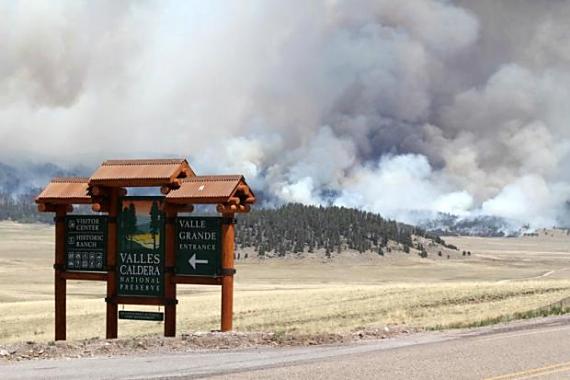
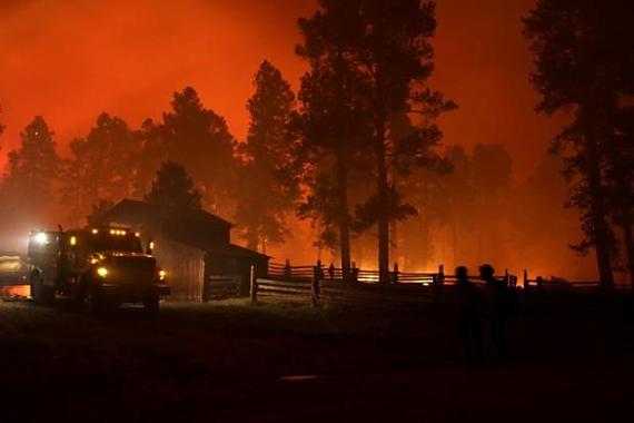
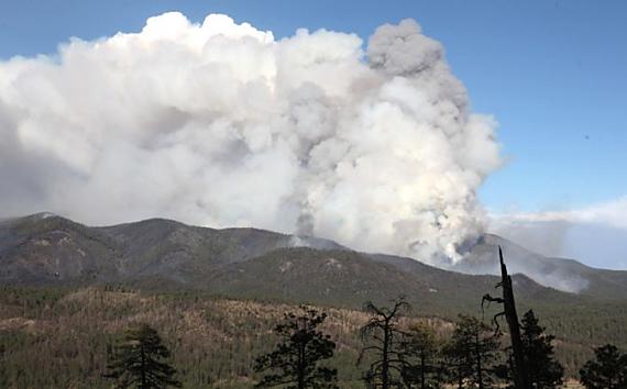
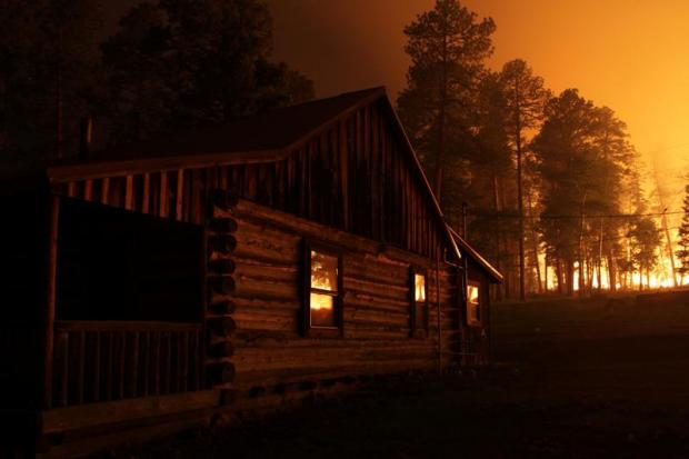
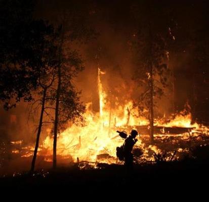
The last two photos below were taken at the Thompson Ridge fire.

Having a paved road somewhere off in the distance surely reduces ultimate risk. It is THE stopping point when there is ample time to pretreat the paved corridor. I’m certain there is pride involved when, “we are going to burn out this place and, stop that.” It’s a great learning and training ground when you know there is the “ultimate barrier” somewhere beyond and there are very few, if any, dwellings between. I can’t help but think that upper eschelon fire fighting is not just a rush as it is for the groundpounder but also a “cross your fingers and tight-toothed grinning adventure”. What do you have to lose? Your job? Kudos to you guys for being comfortably(?) ensconced in a very awkward place.
Lone Ranger