(UPDATED at 8:30 a.m. PDT, September 10, 2013)
The spread of the Morgan Fire in Mt. Diablo State Park 18 miles east of Berkeley, California slowed late in the day on Monday. More accurate mapping resulted in a decrease in acreage, from 3,718 to 3,243 acres by Tuesday morning. The incident commander is calling it 45 percent contained, up from 20 percent on Monday.
KTVU has an interesting timelapse video of the fire.
****

(UPDATED at 4:57 p.m. PDT, September 9, 2013)
The Morgan Fire east of the San Francisco Bay area has grown to 3,718 acres, and the Incident Commander is calling it 20 percent contained.
****
(Originally published at 12:33 p.m. PDT, September 9, 2013)
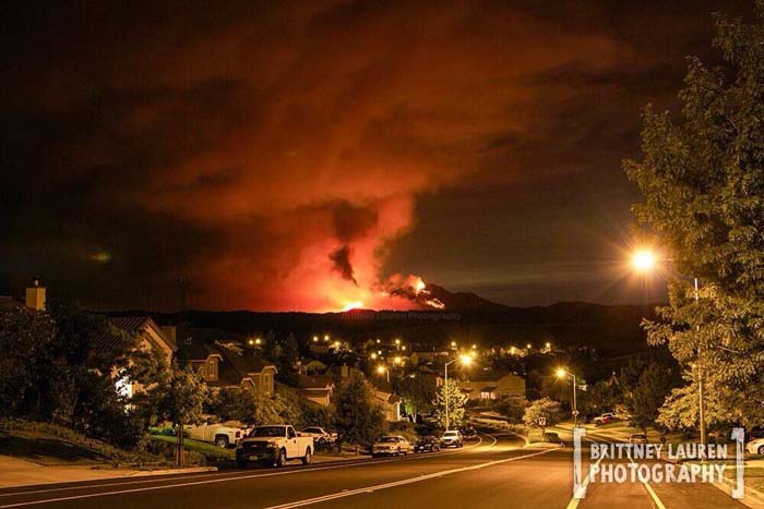
The Morgan Fire is burning in Mt. Diablo State Park 18 miles east of Berkeley, California (see the map below). It started Sunday at 1 p.m. and burned actively all night. The fire is currently threatening PG&E electrical transmission lines, communications infrastructure on Mt. Diablo, and historical buildings at the summit of Mt. Diablo. At 11:30 a.m. on Monday CAL FIRE said it had burned 1,500 acres.

Mandatory evacuations have been ordered for Oak Hill Lane, Curry Canyon, Curry Lane, Curry Point, Trail Ride Road, East Trail Road, Russelman Park Road, Upper Trail Road and Lower Trail Road.
The fire is being fought by 705 personnel, 85 engines, 30 hand crews, and 11 dozers.

These sites occasionally have live video feeds of the fire: KTVU, Dropcam, ABC7news, and NBC Bay Area. And there’s a web cam that needs to be refreshed to see the latest images: Mt. Diablo Cam.

Fuel reduction, worked with a company that rents goats for elimination vegetation fuel loadings. Very impressive results. Poison oak gone, rattlesnakes no where to be found, trees trimmed up about six feet, amble supply of fertilizer to amend soil.
Yes, and they wipe out poison ivy and blackberries as well!
Bummer about the blackberries…
Heh, depends where you live. We love blackberries, but they can take over the world!
I was a kid during 1977 fire. My horse and I watched as crews battled that fire, actually my horse rather than me, he hung out with fire trucks at corner of Morgan Territory Rd and Marsh Creek. This fire seems to be way worse already. Yes, there is more fuel because of dry weather, but is always dry this time of year. I really though want to congratulate the State of CA in their wisdom in discontinuing having cattle graze through BLM on Mt. Diablo. The cattle that used to be there ate the grasses in the canyons that are not accsesable to tractors etc, but oh my gosh, they poop on trails that apparently people cannot step over. Wow. I am so glad that now there is a huge amount of feul to make a really pretty FIRE ALL OVER MT. DIABLO!! Cheers to the policy makers in Sacramento!!
Bring on the goats! Easier to hop their droppings!
Please resist the temptation to criticize tactics you may see in a photograph, which is like looking through a soda straw without being able to see the big picture. More information about this concept can be found here.
Ha ha thanks Cap. That was what I wanted to say but figured I’d be lambasted by the other readers for it.
Here is some shortwave IR satellite imagery showing the fire “hot spots”, from the beginning of the fire through the overnight hours: http://cimss.ssec.wisc.edu/goes/blog/archives/13829