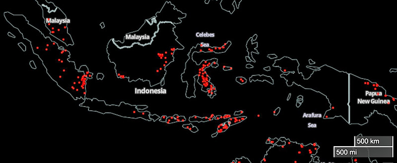
 The red areas represent heat detected by a satellite over Indonesia on November 5, 2015. NASA.
The map shows heat from wildfires detected by the MODIS satellite over Indonesia on November 5, 2015.
Yesterday we wrote about the United States sending some fire equipment to Indonesia, where massive wildfires are burning across the 3,100-mile length of the country creating very serious air quality issues. Visibility in some cities has been reduced to about 100 feet.
Typos, let us know HERE, and specify which article. Please read the commenting rules before you post a comment.
Related
Author: Bill Gabbert
After working full time in wildland fire for 33 years, he continues to learn, and strives to be a Student of Fire.
View all posts by Bill Gabbert

